Why flights don't make sense on a Flat Earth

ฝัง
- เผยแพร่เมื่อ 5 มี.ค. 2024
- *Minor correction - when talking about stall speeds I gave a figure of 250knots, a few people have pointed out this is indicated airspeed rather than true airspeed, the true stall airspeed is actually more than 400knots which makes Jeran's claim even more impossible
Flat Earthers claim plane routes make more sense on Flat Earth than a globe ... lets put that to the test
PATREON: / davemckeegan
Please consider supporting the channel by making purchases through my Amazon affiliates: geni.us/Affiliate
This video was sponsored by Brilliant
-----------------------------------------------------------------------
Music by Bensound.com
-----------------------------------------------------------------------
#globe #science #flatearth #flights #flightroutes - วิทยาศาสตร์และเทคโนโลยี


Pilot here. Why are they assuming that only airliners make these flights? Corporate/private aircraft fly these routes as well. No computer is telling us to speed up or slow down.
Don't you know? _Everyone_ is on it, _except_ for a small group of flat earthers on YT 🙂
@@Jan_StrzeleckiEven with our worse enemies, they agree with our lie. For some reason. Yeah that must be the answer.
Flerf's will probably just claim you still have to listen to ATC instructions, and that following the actual shortest path will get you incarcerated or something like that.
Bluewater shipping and sailing also use great arcs.
Just admit that you are in on it Kevin.
If you aren't in on it then obviously someone has planted a chip in you that controls you.
So who funded all that? NASA of course.
All those years of not flying rockets to the imaginary moon, they just photoshopped images and did surgery on pilots.
😂
Now I want to become a Hat Earther, it seems far more stylish.
Best internet comment ever!
But would you be a Bowler Hat Earther, or a Panama Hat Earther? Then again, there is also the Tam O' Shanter, the Beret, Deerstalker, Fedora, Fez, Boater, Beanie, Top Hat, Pork Pie, Derby, Bearskin, etc, etc!
@@JabbaticWimple earth for the win!
"The Earth is hat!"
"Don't you mean..."
"I know what I said!"
@@JabbaticHas to be Pork Pie, telling porkies and all that 😉 ("pork pie" being rhyming slang for "lie")
As a Cartographer i have to correct you. The map used by timeanddate is not a mercator projection, but a equirectangular projection or plate carée.
You wouldnt be able to properly wrap a mercator projection around a sphere in photoshop. Plate carée are exactly 2:1, which is the same ratio for equator-meridian, while a mercator projection is infinitely high.
I once was flying to Boston from DC and we took off like 45 minutes late, but caught a massive tailwind and touched down on time. Literally cut the flight time in half.
And the pilot was SO EXCITED he kept talking about how it was the fastest he'd ever flown, upper 600s mph.
The jet stream will make planes fly faster.
jetstreams can be fuckin crazy lol
Do you think there's a tailwind that could get that airspeed up around 1500mph forr those southern hemisphere flights? Lol
Dave: ".... useful tools in Photoshop" 0:16
Flat Earthers: " Aha. Photoshop! It's all fake!"
flerfs are just morons
Dave: Proves he's faking it with Photoshop ON VIDEO 🤣🤣🤣
@@sarumano884 manipulation to convert a flat projection of a 3D object into the prior object (create pre-image by inverting operation(s)) is not the same as fabrication
@@fuery.sarcasam
@@Kitsisuri Thank you 😊
Even easier you can use a globe and a piece of string that you run between the two destinations.
And he has a globe sitting right behind him. 😀
I can use any desk globe and a tape measure to tell you any distance between any two points on earth and it will match reality, every time for every distance. I often ask flerfs to bring me a scaled flat world map that I can use to achieve this same basic function, but after more than two years of asking, they still haven't presented it.
Check your Googles for actual distance across countries like Canada or Australia, then compare it to maps on a big screen TV.
You will quickly learn the official measurements of country size, don't match what Google show you.
This video is sh1t. He doesn't quantify any evidence of anything, other than his next video.
I will never forget my first day in the sixth grade. A kid said he went to Korea over the summer and that the plane went close to Alaska coming back to Seattle. The teacher said that was strange because, while pointing at the Mercator projection map, it shouldn't have gone close to it. I raised my hand and said I could explain and traced out a short path on the globe from Seoul to Seattle which went over the Aleutian Islands right south of Alaska. I felt so smart on my first day of sixth grade!
Then the teacher ignored what I had just done, went back to her Mercator projection map and said, "They went there probably because of the winds from the jet stream."
@@scottlarson1548 And this is where flerfers come from.
To any flatties who think intercontinental southern hemisphere flights don't exist: check out yesterday's LATAM flight LA800 from Sydney to Santiago via Auckland. Were all those ambulance people who met that flight at Auckland, the injured and hospitalised, all paid actors?
Another example
NY to Tokyo Direct flight time: 14h30m
Chile to Sydney Direct flight time: 14h30m
Drawing a direct line from the first 2 and second 2 destinations (on a FE map) shows that the flight path from NY to Tokyo is HALF than that of the other. Yet the flight time is the same
Hmmmmmmm ?
No 1 is 11300 the other is 10800, that is not half
@@wadecooley5138 you didn't read what i said properly did you?
I think I'm gonna give my vote of confidence to actual pilots, like Wolfie6020 or Kelsey from 74 Gear, rather than to a bunch of flerfs who simply parrot each other from their basements.
Edit please …”from their mum’s basements”
No rush.
Also remember Petter from Mentour Pilot!
@@kernicterus1233rude
@@kernicterus1233I’m guessing most of them got kicked out of their parents’ house for spewing such nonsense😂
@@LSA30 Like CC Chris from New York Westchester County got kicked out of his wife's house.
I'm working on my pilot's license right now, and older cheaper GA aircraft usually do not have much in the way of computers in them. You have to do fuel burn calculations by hand based on how far you've flown and how the winds are blowing. You can then estimate how much fuel your plane is burning at a certain RPM. This is crucial in order to make sure you don't run out of fuel while flying, most older planes do not have a fuel flow indicator, and yes they do have fuel tank gauges, they never seem to accurately show your fuel levels. If the maps were distorted and inaccurate, we wouldn't be able to predict fuel burn correctly and you'd have a ton of pilots running out of fuel mid-flight on cross country flights, and it would be especially prevalent in Australia.
I've never been on a plane and you've unlocked a new fear for me.
@@robertbjork1989 they're probably talking about small general aviation aircraft like Cessena 172 older models. Aircrafts now have more reliable tech. Newer C172s with Garmin 1000 have digital fuel flow indicator and what not.
In simple terms, it is good for a pilot to learn all the skills, and it is fun.
You don't have to worry.
I am also working on my pilot's license right now, my first attempt did not go well as I put he picture in the wrong corner and almost go caught. :)
Seriously, that is awesome that you are getting it if you have not gotten it yet best of luck to you.
@@claytoncourtney1309 Written test is done, hours are done, just have to do the practical.
@@singhamaninder5836 Most of the planes in my price range are pre-172. Piper tripacers, erco ercoupes.
I’ve been a commercial pilot for over thirty years and have methodically debunked several flatlands including Brian, Flatzoid and others.
They not only lack the intellect to grasp these relatively simple concepts but they also don’t want to know.
I miss the days when there were flerfs that claimed to be pilots.
I used to get out my old PPL books and ask them simple questions from it.
Not once did I get an answer.
Good times.
Flat earthers hardly ever watch debunk videos cos they "KNOW" the world is flat, so they don't have to watch debunk videos. Their flat earth is circular! 😅
'Oh, well they just fly at different speeds to get there when expected.' Wow, hope they washed that response after pulling it right out of their ass.
It’s all witless does.
he makes it very clear he's never looked into how planes stay in the air.
@@5peciesunkn0wn It's not even that. It's the jump in logic from 'you ever take off late but land on time?' to 'they just decide how long the flight should take and fly the plane to match.' As if all planes are secretly capable of flying twice as fast and as far as they are 'supposed to' but they all hold back just to keep the globe lie going.
What kills me is that the Pastor actually said he got to his destinations on time when the plane left late. Im calling BS. In my many decades on earth, Ive probably had a dozen or so flights that left late … and they arrived late … connecting flights be damned. NOT ONCE did the pilots just decide to fly super fast to make up lost time. The airlines (as always) were basically like “go eat sand, we move at our own pace”.
@@InertiaCreeps if it's ten minutes late, they can make it up as Dave showed. Half an hour or more though? No way.
With the upcoming Solar eclipse in the US in april we can expect a fresh new batch of "this proves the flat earth".
Just bear in mind that in 2017 they said the Moon is 70 miles wide because that was the size of the umbra. Now it's will be about 120 miles wide. That should be interesting...
Well obviously the men in the moon have been farting lots recently, due to eating too many moon beans. The inflated moon will shrink again one day, when the fart pressure is vented to move the moon into its new florbit above the flerf.
The moon moves up and down and makes the shadow bigger due to angular size... how does the moon do it? It just does. Like the water just finds it's level. Or things just fall down. They just do, dude. Trust me.
Yeah, the flerfs will argue about the size of the moon's shadow based on the area of totality during a solar eclipse. There's photos out there showing the moon's shadow on the earth and the size of it backs up the heliocentric model.
despite the fact there's nothing in the sky that would allow the sun and moon to cross each other's paths in any location but a few random straight, constant solar eclipses around the ice wall if they're circling above a flat earth lol.
@@MrFreakHeavy That's like the flerf who was arguing about gravity and was asked why things fal DOWN instead of UP. His answer< "Duh! Down is down!"
Hi, pilot here. What we do to save time is like you said ask for shortcuts from ATC, at least in my airline we fly with a low cost index so that means slower climb and especially slower speed during descent. What we can do is increase the speed in descent which combined with the shortcuts can sometimes make up around 10 to 20 minutes. But that's only if we get all the shortcuts we ask for which doesn't happen at peak times but basically always happens at off peak times.
As someone who worked 13 years in the Australian Airline industry, with the majority of that in airline network planning, I just shake my head at some of the claims over the shape of Australia, the shape of the earth, and how aircraft are scheduled and operated in general.
Before I moved into route network development, I did reporting both internally and for legislative requirements externally. Part of this was reporting how many "seat kilometers" we flew, which was the agreed distance between 2 airports multiplied by the number of seats you flew between them.
The Department of Transport and Communications (DoHC) at the time used to publish a book each year, which had the lat/long of every airport and the complete formula global for great circle distance (it varies on hemisphere). The lat/long was published because it did change occasionally. For example, when Sydney built its third runway, the centre of the airport moved SSE by just over a KM. The formula I had built into a spreadsheet, as well as the lat/long positions, and entering any 2 would give me the great circle distance (allowing for hemisphere) between these 2, and that was the industry-agreed distance.
This was not only used for reporting, but also for planning, which would also include aircraft type, payload, waypoints, expected departure and arrival patterns (SIDS and STARS), expected out and in taxi times and winds aloft predictions (seasonal). This was used to calculate a) if the route was possible with the equipment type, and b) how much fuel was required (or if it was going to be payload restricted).
If I haven't bored everyone enough, the final point is on ETOPS (Extended Range Twin Engine Operations). Australia is one of the only countries in the world where there is so much distance between airports that specific ETOPS requirements need to be met even on domestic routes. For example, back in the 1990's, one carrier had a fleet of 25 B737-300's, but only 8 were certified to fly between Melbourne and Perth direct. The direct track takes you out over the Great Australian Bight, which was too far south of Adelaide and Kalgoorlie in case of emergency. Flerfs will pick flights out that hug the coast and say "see, eRf iS pHLaT", when in fact it is likely an aircraft that is not or run out of ETOPS certification has conducted the service.
As a 22 year old aviation lover from Adelaide, i highly appreciate your comment and the huge amount of info you just typed out. I don't know very much, probably just what some would call the very basics (different models/ which companies use what brand and model and a little bit more). I only went on my first plane ride last year from YPAD to YBBN (some fancy letters for those in the know 😂) and also went on a joy ride over the Barossa Valley in a tiny plane which I believe is used for flight training, however, i got to take controls for a little bit and fly it (once we had gotten to cruising alt. which was only 3000ft) Did a couple turns, couple small dives and climbs and just having the controls in my hands in general. So that was an amazing experience.
After my flight i fell in love with planes even more and wanted to fly again ASAP.. booked another trip up to Brisbane with my GF at the time.. but we split up like a month before the flight so i was super devo but that's just life 😂
@@Ranganation Using ICAO codes I see 😉. I have been an "avnerd" all my life, and was fortunate enough to fly around and see quite a bit. I got to sit up the front in the "jump seat" several times, which is just behind the pilot. My first time was a stormy B767-200 landing into Sydney on 16L. A couple of things I noticed in that ride - 1) the first time you fly into a cumulonimbus doing 270knts, your instinct is to duck and pull back from the windscreen (whilst the pilot and 1st officer laugh hysterically), 2) 16L at YSSY does not look as long on approach as you would like it to be, and 3) pilots like to hand fly approaches when they have good visual on the runway regardless of weather, even if that means fighting the aircraft all the way in. I also got to sit in the right hand seat of a Cessna Caravan out of Kununurra to fly over Lake Argyle, the Bungle Bungles and many other amazing sites in the outback.
Keep following your dreams!
why dont we see a curve at 157 miles high mr PILOT, who dont understand s at maths apparently. Tghere is no way we shouldnt see a curve at that altitude .
@@Frenchy78ify so please, when have you been at that altitude to see if a curve is visible or not, or alternately, have you got video or photographic footage using a rectilinear lens that shows the horizon? There are literally hours of video from the ISS which is in orbit just over 400km above earth's surface that clearly shows curvature.
Now before you question someone else's education you should at least be able to write a simple paragraph at a grade 3 level without so many spelling and grammatical errors wouldn't you think?
@@bowks1o_o669 cry me a river, have you been in space ? Funny that like its rhe only proof lmao
The usual flat earth flight path strategy of
1. pick a projection of the globe map
2. Search for a flight whose path makes sense on your chosen projection
3. profit while ignoring all the other flights which don't make sense on your chosen projection.
We can easily rest this argument. Find me one international pilot that believes the earth is flat. 😂
@@Supremax67Also, give us a name so we can check the FAA database. Cause many flerfs will just say “a pilot agrees with me” but won’t say who the pilot is or their credentials. I will say though, you might be waiting a while. They are probably as common as flat earther surveyors.
@@adoramay9410That's the classic proof surrogate. It's one of their favorite thing to pull.
@@adoramay9410 Yup. And the pilot will almost always be conveniently reluctant to give their name out of fear or "retaliation". Because what's more important than maintaining their worldview is maintaining the conspiracy theory that makes their worldview relevant and super-ultra-special.
I can show you a hundred flat earth maps that will show flight paths that fit every single flight timetable on Earth. Of course, they all conflict with each other..
*Flat Earthers:*
A group of people who suffer from an array of psychological issues; chief among which is Cognitive Distortion and Identity Protective Cognition. There are certain markers that preclude those who fall for cult’s schemes and tactics for example. These markers overlap when dealing with unfounded conspiracy theorists and those that deny facts due to their feelings. Often times it deals with not feeling special or chronic low self esteem/raging insecurities mixed with deep-seated trust issues, likely brought on by trauma, and an insatiable need to feel important; what would make someone feel more important than thinking they know better than most of the educated people on Earth and scientific consensus. It’s a desperate ploy and vicious cycle of needing to feel important and a sense they belong.
I tend to use an argument that may be cruel if this is the case...I ask flerfs, why would NASA bother to lie? If the Earth was flat, they'd just say it was. Why go to a bunch of extra effort to make up a globe, when it makes no difference to them. They do their job and it would be the same either way. I wonder if flerfs might have a real hard time thinking about that, maybe I should not use that anymore (as it makes them feel less "special and important")…I honestly don't want to mess with anybody's sense of self or mental balance. I was just trying to get somebody to explain to me why the government would even bother to lie, what good would it do them? What advantage does it give them? Now I feel bad.
@@gl15col I wouldn’t feel bad personally. Remember, it’s people like them that spread demonstrably false and dangerous disinformation during the pand3mic that caused very real harm to very real people. I don’t personally care if I hurt someone’s feelings by correcting or challenging them if they are in fact wrong. I don’t go out of my way to do it (unless instigated to do so - like they insulted me first or was just acting like an &sshat) but if the truth hurts their feelings, as far as I’m concerned, that’s on them.
I very much appreciate your take and wanting to not upset people though. It’s quite admirable honestly. ❤️
Nah, Flat Earthers know we're living on a globe, they just do this flat Earth stuff as a grift.
There are many TH-camrs doing dumb video to make a living.
@@backalleycqc4790 I agree, in some respect. But unfortunately, the people these grifters are grifting actually believe the grift…
@@DemonDrummer Yup, that I agree with.
A flat earther saying stupid stuff? I am shocked.
You’re correct! They usually say *really* stupid stuff!!
Flat earth saved my life. If i had been a globber during the PLANDEMIC, I would have trusted their pseudoscience vaccines as a covidiot animal bending over for more toxic vaccines 😢. Viva Eric Dubai. The Greeks knew earth was a non rotating flat earth in the center of the whole universe with repeated cycles into infinity. Sun is local performing the analemma and moving at 1 degree every 72 years around the zodiac. Check out the antikithera mechanism AKA flat earth working model ❤Most importantly, who started the spinning ball lost in a vacuum conspiracy?
th-cam.com/video/Rg4JzlsUMCA/w-d-xo.htmlsi=EX4Pw_pyERUAZ8SU
A Flat Earther saying dishonest stuff? I am utterly electrified.
Yes but he said it like Sam Elliott
Well, you would be wouldn't you. Remind me what it's like in la la land.
As an Aussie, I've driven both those routes. When I drove to Darwin I set my cruise control to 100km/h, when I drove to Perth I set it to 250km/h just so they'd take the same time..... because that's apparently how airlines do it....
Explaining that to SA police could be interesting.
So you are the Nightrider? th-cam.com/video/hsmyIrbSG2s/w-d-xo.html
Wait... could it be, that Mad Max played on a flat earth, where fuel economy collapsed because of the global conspiracy?
If the earth were flat wouldn't it be daylight or dark everywhere all the time?
Yup.
Professor Dave made a diagram on a flat earth map to show just how absurd day and night patterns get.
yes. So they claim the sun acts like a spotlight lol. Which goes to show they're even dumber than the ancient people of our planet who's myths all show the sun going *under* the flat earth since that's the only way a sunrise and sunset can function.
so way back when i was in school there was always someone in class that no matter how the teacher explained the lesson , someone just didnt understand it. the whole flat earth movement is made up of the people who just cant understand and no amount of explaining is ever going to change that.
I think this is a little different. Sometimes people just don't understand the person explaining. With flat earthers they actually do lack comprehension skills. But if you put me and my grandmother in the same room ugh. Neither one of us are dumb but we confuse each other way too often. It's beyond frustrating.
This reminds me of my father, when I was young and starting to do Algebra.
When I said that 1/2 x 1/2 equals 1/4 he would reply, "In theory yes, but in practice it equals one".
It's just a generation gap thing :(
They both can't and don't want to understand
No amount of evidence will convince an idiot
@@rysacroftMy father was an engineer and so was I. It's not a generation gap thing. Half of half an apple, in practice, does not equal an apple.
Pilot here, most modern aircraft do not vary their speed, we fly at the most economical flight level and speed and as your article explained the most we can make up is about 5/10 minutes at a cost of about a tonne of fuel, now here’s the thing, we don’t carry a spare tonne of fuel just for laughs, if we need extra fuel at the planning stage we can carry it but the problem with delays is that you don’t necessarily know that we have one until we get going by which time it’s a little late to add fuel. In short, we tell folk that we will try to make up time but in reality it doesn’t really happen. Cheers.
It won’t help. You’re part of the conspiracy, you’re in on it, you learn all the things to say in those special secret flight school sessions, you’re owned by NASA!!!
Also as the plane burns the fuel the flight level goes up.
As I think about it, their "planes can fly at different speeds" and "computers calculate the flying time" claims don't make any sense, especially when made together.
Why would the computer impose a slower speed on the north-south route in Australia than for the east-west route? That's just weird to even suggest.
You mean it doesn't happen often. It does happen. Engineers often give a time estimate on a repair and the pilots can respond accordingly. I have called for the fuel truck to add extra fuel at the pilots' request.
@@DavidVerch that is correct, the most efficient flight level depends largely on aircraft weight, however wind and temperature will also play a part. For example tomorrow I will be flying from LHR to LAS about a 9 and a half hour flight, my initial cruise level will be about FL340 but by the time we cross into US airspace we will be at FL380/400.
Faulty
Logic and
Extremely
Religious
Faith
Yes, that is one way to describe the belief that Earth is flat and motionless.
Faulty
Assumption
Idiocy &
Large amounts of
Upsetting
Researcher
Exempting
Or Failure for short haha
I really hate how people get into the weeds discussing the details of these conspiracy theories without ever forcing the conspiracy theorist to explain specifically WHY every pilot, every scientist, every medical professional and every person working for every government on the planet are all spending infinite resources to convince us the Earth is a different shape than it really is.
because they never explain that and when you try to force them, they either get mad or run away
They deliberately get into the weeds because it’s easier to get away with lying and ignores all the glaring issues with flat earth.
its so obvious flat earth is a distraction from hollow earth and stuff like base 211
I'm struggling to find anything that does make sense on a flat earth 🤷
Flat Earthers according to other Flat Earthers is probably the only thing
Distances in a true north/south direction are the ONLY thing accurate on the preferred flat earth map.
@@sendintheclowns7305 That's the trouble isn't it? They might be able to explain one thing if they limit the situations it is applied in, but when it comes to adding additional aspects of reality that we experience their reasoning crashes hard against reality.
Meanwhile, they want to replace current scientific understanding about the universe with a big "nuh-uh" and I don't know any company (that doesn't make money catering to the conspiracy minded) that would replace what they use based on the scientific understanding with the flat earth lack thereof.
Fighting military robot pingeons ofcourse
@sendintheclowns7305 not over any kind of distance.
Something I don't think Flat Earthers understand. Every 4 years there is a sailing race around Antarctica. Sail boats. It is called the Vindee Globe. Think they can explain that away?
Well, they need to demonstrate a Solo yacht averaging 12-15 knots an hour, every hour of every day for 92 days. Because that is what it would take to match the record set by Lisa Blair on the Flat Earth... In reality, Lisa averaged just over 6 knots.
They come up with something. It will be stupid, but they’ll give it a go nonetheless.
It's just all part of the big lie, obviously. 'Out of sight, out of mind' is how flerf coping mechanisms work.
@@tysondog843 it's much much harder than that. The Vendee Globe website gives the positions of every yacht several times a day during the race, including while sailing around Antartica, so you can plot these on the Gleason map and work out average speeds between positions. You'll find some yachts are sustaining average speeds of as much as 60 knots by that map. Oops.
@@tysondog843 Which way it turn? On a flat erf you need to steer away from the Antarctica to go around it.
land travel has been around for 5,000 years - sea travel has been around for 5,000 years - air travel is a recent event - the distance between continents & the basic shape of continents has been PROVEN to be 1000% accurate !! ... and yet ... "flat earthers" use a map that's 00.00% accurate ?? .... NOW THAT'S FUNNY !!
When it comes to Australia, you can just drop the 2 flight paths, use the 2 railroads. Perth - Sydney and Darwin - Adelade and use roads to connect where needed.
If you are using the 2 flight paths over Australia you can use Flight Tracker and get their speed.
I'm guessing they'll say the train computers control the speeds too.
Don't even need to worry about speed. The tracks are a measured length. The tracks had to be ordered and made to standard lengths. Flerfs just now need to show that what was ordered and made was done in vast quantities for a FE distance on Australia.
I heard a flat earth argue we'd feel wind resistance. And I thought yeah it's called wind
Lol
I think that your flerf was thinking that we'd be feeling a constant wind from the Earth's movement through space and/or rotation. I've seen others make a similarly stupid argument before.
Apparently those flat-earthers think that a moving Earth would feel like sticking your head out of a car windows as it drives down the freeway. Apparently it never occurs to them that the Earth moving is more analogous to a car driving along a perfectly smooth road with the windows rolled up.
When you switch on your fan, you successfully experienced wind resistance! Congrats!
@@George89999 That sounds really dumb because there's no wind in space. There's hardly any particles in space so they're just dumb. It's more analogous to being in a car with the windows closed. You don't feel a thing when you're already moving.
@@apocalypseap Agreed, and that's why I made that same analogy myself.
However the flat-earth believers (as opposed to the grifters, trolls, and Poes so know better) tend to not understand that. They seem to think that if they can feel wind with the car window down that the whole Earth should feel a similar effect as it moves through airless space. Their position makes absolutely no sense to anyone trying to be objective on the subject, but then again they aren't really trying to be objective.
Flerfs still won't understand this. They have no depth perception.
That and “those dots are too small” 😂
Or how about: “if those dots were flying on the side of your ball earth the way you show, they would fall off” to the floor of whatever magic room they think their magic cow patty earth is in.
It’s as you said, no depth.
In perception or logic.
its the ability to think in 3d they arent good at
@@perry92964”in 3D” is redundant to the sentence
Flerfs wont understand anything, they're either too egotistical to accept they might be wrong for once, or just uneducated
Navigation is and always has been fatal to the FE cult.
I mean, a simple stick is fatal to FE, so...
"Let's use a flat 2D projection with known distortions to 'disprove' a 3D globe"
And they don't even realise why that gets laughed at.
They literally just disprove one flat earth model.
And no modern flat earther will provide an actual flat map, because each flat earth map is only useful for one specific argument. Every flat map can be debunked by many methods, while on an actual globe, every single situation just makes sense.
Even among flerfs, Terry ain’t the sharpest tool in the shed.
He once posted a video claiming a fishing boat in the Bass Strait was turned back by a naval ship because it was too close to the 60 thparallel. I commented saying he doesn’t know how to read a map and that the Bass Straight is between Australia and Tasmania, a place where people live. He deleted the video.
I love how FOT tried to debunk a globe Earth by using a flat map. The complete lack of self-awareness is both hilarious and sad.
not sad, just moronic
I’ve been a pilot and there idiots that think they know about flight is hilarious and insulting at the same time.
“Not only do we not know that the earth is a globe, we also don’t understand basic physics when dealing with aeronautics.”🤦♂️
It’s not just you, don’t worry. Flat earthers don’t understand basic physics when dealing with anything.
FWIW: I worked in Aviation maintenance for many years {both military & civilian contractor}.
I was an enlisted aircrewman in the US Coast Guard.
I was also a student pilot and soloed at the end of 1979, but due to lack of $$$ I never got my PPL.
I mention all that to justify saying I totally agree with you.
@@Allan_aka_RocKITEmanhell, i was just a groundpounder cav scout, and even i know, a lot of our tech only works on a globe. not to take away from the pilot-specific stuff at subject here, but no form of navigation we use over long distances can work on a flat earth, only a globe. not on land, not at sea, and not in the air.
Even as a humble former Technical Author and Illustrator for aerospace companies, I saw enough to know that aircraft wouldn't be capable of the acrobatics the flat earth larpers claim they can do.
as a New Zealander, I can see the dome from my house
The amount of resources we waste in trying to explain to flerfs that the earth is not flat is actually ridiculous...why are yall even entertaining them ... nothing they say makes sense even if you try to make it sensible for them they'll just stick to their flerf mindset 🤦🏾♂️
Anyone could rent a car and measure the height and width of Australia. If it’s not really 2.5 times wider than it is tall, then the flat earth map they are using is clearly wrong.
They will not do this.
Of course, long distance truck drivers do this all the time - for their living.
That's just what Big Odometer wants you to believe.
Best part about South Hemisphere flight.
There is a TH-camr called Kelsey from 74Gear who is a pilot. He's willing to fly through Antartica but the passenger had to pay the expensive logistics cost. It's possible if they want to dosh cash for science. But eh, Flat Earther won't wanna support *honest* business.
As always, Australia destroys any flatard argument.
Thank you downunder.
The entire Southern Hemisphere is a problem for flat earth, but yeah. I still don’t understand why there are flerfs down under despite the fact that their own country destroys their “model”.
Yet we also have flat earthers living in Australia. They are actually sitting on the proof and still dont see it. Thats why it would make no sense to shoot a flerf into space to see the globe, they would find all kinds of excuses like the windows in the rocket beeing screens or whatever comes to their mind coz if flerfs have one thing its a funny imagination
I don't understand how anyone in the southern hemisphere could be duped by this conspiracy. So many of the assumptions are based on northern hemisphere bias...
In another post, I detailed how Australian airline Qantas operates scenic flights over the territory of Antarctica. Not cheep as these can be a 12 hour flight depending upon which Aussie city "your" flight departs from, and returns to.
Australia is onside the ice wall. Proof the existence of Antarctica. Nobodys ever been there. It don't exist!!
Flash News: NOTHING makes a lick of sense on a flat Earth. For starters, there isn't one, and can't be one. Nothing claimed by these poor dummies can be supported by investigation.
Locally things make sense. The earth is really really big. Once your scale is small enough, curvature is dwarfed by topography.
Yes, it's just a local illusion, but it's close enough to make maps and such. And that's probably where we lose the flerfers.
Interestingly, the same thing exists for the 3d flatness of space. Locally close enough, but definitely curved in some barely comprehensible way.
Jeran is a fool, Witless is a liar. And vice-versa.
Southern hemisphere flights are rare because...(drum roll)... only 10% of the worldwide population resides there. Consequently, North to south and vice versa routes are more popular, hence tipping the scales in favor of those directions and scaled flights
Not to mention the fact that Australia/New Zealand (plenty of flights there), South America and Africa have not historically had a lot of family or business ties. This is slowly increasing, but still not a huge market.
Rare? They don't exist. Check any flight tracker and find one flight ever. across a, 'south pole'. Then look at how one flight a day goes across the north pole from NY to Dubai. Only the north pole can be flown over, there is no south pole.
@@newworlddisorder_ I just looked at Flightradar24, and QFA28 is currently en route between Santiago and Sydney, following a great circle course. It's a Boeing 787-9 Dreamliner btw. First off, commercial flights in the Southern Hemisphere generally don't fly across the South Pole, because they don't have to, as the shortest route doesn't require it. They get quite close to Antarctica though. Secondly, there aren't a huge number of flights between the Southern Hemisphere continents because, historically, there hasn't been a lot of ties, family or commercial, between them. Airlines want to make money. If demand increases, there will be more flights. Thirdly, there is a huge disparity between the northern hemisphere and southern hemisphere in the number of countries, population, family and commercial ties, and overall wealth.
@@newworlddisorder_A flight doesn't have to go over the South Pole in order for it to be a Southern Hemisphere flight. Just so you know.
@@newworlddisorder_ Well, Antarctica is inhospitable and has zero resources. You don't want to fly across that land mass for the same reason you want to limit time over the ocean as much as you can - if something happens, there's nothing and no one to help. Yet people act like it's some conspiracy theory that keeps aircraft from flying over Antarctica. 🤷♀
For any alcoholics around? Excuse me, we prefer "alcohol enthusiasts" or "alcohol-americans" thank you very much.
im definitely an alcohol american
Or "liquid crusaders fighting the holy war against the teetotal Taliban".
@@RichWoods23Sir Sic, that you? 😆
Thank you very much but my preferred title is “Ethanol American”! I am descended from the Irish and Norse, this is literally written into my genes!
Definition of how many drinks it takes to be an alcoholic is B.S look it up.
Qantas, QF14, left Buenos Aires, Argentina, South America at 12:44 pm local time on Tuesday, October 5 2021, then flew south, CROSSED part of ANTARCTICA, and arrived in Darwin at 6:39 pm local time on Wednesday, October 6. The journey was entirely in daylight. Look it up. It was almost all over ocean except part of Antarctica and then the Australian mainland.
The flight an Australian government organised Covid repatriation flight for 107 Australians, set two Qantas records in the process: longest distance covered (15,020 km or 9,333 miles) and longest time in the air for a commercial flight (17 hours and 25 minutes).
The reason it went to the capital of the Northern Territory, Darwin was because there was a huge Covid quarantine facility built there in the nearby desert.
There have been thousands of regular flights non stop between Sydney and Perth Australia and Johannesburg South Africa since the 1970s. All across the Southern ocean. As well as Sydney to Lima Peru across the Pacific, non stop.
To argue that they don't exist is ludicrous.
I love it when they say "it's common sense" because it's just them admitting to making things up when they don't understand them. Like the first guy intuitively discovered what a geodesic is, took zero time to learn about basic spherical geometry, and ended up disproving himself by pointing out how that same geodesic doesn't make sense if you look at it from _another_ flat map. Any geodesic flight patterns in the southern hemisphere on his flat Earth model would be even more exaggerated. "Common sense."
I've noticed people say "common sense" when they are actually drawing a conclusion based on the most superficial examination. "Common sense" is frequently no sense at all.
Note how common sense, even in its everyday usage is just ‘this is what I was everyone assumes is correct without actually asking why’. Sometimes it works but most of the time it doesn’t.
It's obviously not "common sense" since they are bogged-down in a delusional mindset. It also has absolutely _nothing_ to do with "understanding", they don't care, they have a belief system that is completely immune to cognitive dissonance. They are essentially the same as any doomsday cultist.
On 1 September 1983, Korean Airlines Flight 007 was shot down by a Soviet airforce pilot on the order of his superior officer, killing 269 people. There were no survivors. These innocent civilians were killed because KAL007 overflew Soviet territory while on a flight from New York City to Seoul via Anchorage, Alaska. The KAL pilot made a data input error while initializing the aircraft's inertial navigation system, which caused his flight path to deviate from the standard route that passes substantially east of Russian airspace. Most people condemned the Soviets for the attack, but at least one American publicly defended the shootdown. This was Pierre Salinger, a prominent Democrat and the former press secretary to President Kennedy. Salinger claimed the route from NYC to Seoul via Anchorage made no sense unless it was intended to fly over Russia on the way. The straight-line course was far shorter, he said, therefore the curved route through Alaska was very suspicious. As noted, Pierre Salinger had been a presidential press secretary, a job usually reserved for professional journalists, a profession not noted for extensive knowledge in the STEM fields. Consequently, Salinger used a Mercator map when formulating his theory. When the extreme inaccuracy of the Mercator projection, particularly in the high latitudes, was finally pointed out to him, Salinger withdrew his claims and retired from public life.
At least Salinger realized he was wrong and owned it. Too bad flerfs like Jeran don't do that. On the other hand, he's making a living off the flat earth community and can't quit the gravy train of his con.
Fascinating. Good info!
A similar powerful disproof of flat Earth theories is the existence and times of sailing circumnavigation races. These all go to the Southern Ocean and do most of their actual going around there, because there's no land in the way and because it's a shorter trip (though they are required to cover enough distance to have circumnavigated at the equator, if that were possible; they get the additional needed distance from north/south travel). But on a flat Earth with the north pole at the center, a southern circumnavigation would be a huge distance, and while these are often very fast sailboats "fast" is a relative term; most have maximum speeds of no more than 15 mph, and even the fastest can only reach 50 mph, and only under ideal conditions). I suppose all of those sailors must be part of the conspiracy.
Having worked in Aviation and now Shipping, Flat Earth is beyond stupid. They also forgot flight times take into account average delays, very often a plane leaving on time arrives EARLY!
The funny thing about flerfs is that they give you really terrible “evidence” then you debunk their “evidence” and they just resort to insulting you 😂😂😂
Of course because it's all they've got. 🙂
After which they insist on seeing proof of Earth curvature after already being presented with several proofs and countless photographs... 🤦
Very like playing chess with a pigeon.
Hahahaha so similar when proving the moon landings were fake and no one can go through the Van Allen radiation belts. They have absolutely nothing so same, they resort to insults.
“demonrats in a nutshell.”
"And whenever I try to turn that shadow cast off, the program crashes"
Ah, yes, classic Adobe.
I was just picturing Dave trying to do this 6 or 7 times before giving up.
"this would look so much better without that random shadow... Nevermind the audience can still figure it out."
Joy Leys has the best TH-cam videos that are results of mathematically generated. He has several map projections that will make the flerfs head hurt. Maybe more a butthurt.
Airlines do know that the Earth is not flat! The url link doesn't work here.
Great video, as always 👍
Small nitpick: the map from TimeAndDate isn't Mercator, it's the equirectangular projection. They're different in how they map north-south distances: equirectangular keeps them proportional to the ones on the sphere, while Mercator stretches them by the same factor as the east-west distances, to preserve angles. And that difference is what caused the last render from FlightRadar to be distorted: that map was actually Mercator, but the transformation in Photoshop expected a map using the equirectangular projection. That caused everything to get squeezed a bit towards the equator.
LOL at Witsit asserting that pilots "assume the distance". Hahahahahaha! The desperation is palpable.
The avionics computers are programmed to a FE map and many (but some) know it.
@@newworlddisorder_ You're claiming an FE map? Excellent. Which of the many different globe projection maps have you been told is a "flat earth map"? Mercator? AE? Cylindrical? Something else?
Well?
@@newworlddisorder_And, exactly, how do you know that? You wouldn't be flerf lying again would you?
@@newworlddisorder_ please provide credible proof of your claim.
@@newworlddisorder_ Wait, so what about before planes had computers in them?
It is flabbergasting that flat Earthers constantly use FLAT projection maps to prove that the GLOBE "doesn't work". Like, YOU'RE NOT USING A GLOBE! And this is pointed out over and over and over but they keep doing it. It's almost as though they KNOW they're being deceptive but don't care... And of course they don't understand or appreciate that flying the shortest distance is not always the best option for a commercial airline that is trying maximize their profits. Sometimes it might make sense to go slightly out of your way to pick up more paying passengers that are also going to the same place.
Gotta lie to flerf, always.
The problem for the flerfers is that they fail even on their own terms: day/night cycles, seasons, eclipses, tides and stellar positions don’t make any more sense on any 2D projection of the Earth than flight plans do.
A grifter’s got to grift.
The globe was invented by cutting the Mercator map at the international datelines and wrapping it around a cgi ball sweetie, as you zoom out of google earth (which is all you actually have) the images get rounded off by algorithms, google earth was hacked several years ago.
Try doing some research boy, infact fetch me some aircraft attitude data that shows them adjusting for curvature.
How long have you worshipped SATAN? Science IS Satanism. The earth is,FLAT. Stop worshipping STAN!!
I could be wrong but it seems Jism is suggesting that the speed the aircraft flies is determined by the globe earth model "conspiracy" and not things like economics, the convenience of the clients and the amount of time the pilots and fight crew wish to remain at work? The face palmage runs deep. This is next level derp.
Another great video.
How is Jeran still posting videos about flat Earth when he showed the curvature of the Earth in his experiment?
Because his followers either didn't notice or care less.
They are so accustomed to either lying or being lied to. Hence #gottalietoflerf
Interesting...
Because nothing at all makes sense on a flat earth, like always.
Fun fact: 10-20 years ago direct airflights between distant cities in Russian Far East or Siberia were commercially unprofitable due to low passenger flow. So people were flying from Vladivostok to Irkutsk or Novosibirsk through *Moscow* (and many still do). Just look at the map! I wonder what shape the Earth must have so that flerfs' logic gives reason to those flights.
No one ever brings-up ping times on undersea cables. If the earth were flat, the latency on pretty much every one of them would be very different than what would be calculated from the cable's presumptive length, and yet, I've never heard of any network administrators complaining that the latency to peered autonomous systems on other continents is inconsistent with the lengths of the undersea cables connecting them. And I know a lot of network administrators. They tend to be exactly the sort of people who would notice discrepancies like that. It's true that a shorter cable can be made to appear longer by introducing additional latency artificially, but it is impossible to make a long cable seem to be short, unless our understanding of the speed of light is very wrong.
interesting point. i remember when we first started using high speed longhaul WAN links cross country and overseas. customers would call and say "we must have rerouted, because our ping times have gone up".
throw satellite into the mix. our galaxy1 stuff is 600+ms round trip.
You are correct of course but keep in mind we are dealing with people who have difficulty understanding the difference between south and down.
That's why this video boils down to "on globe, line straight. On flat earth, line not straight".
And some of them are still struggling with it.
I have flown these flights in Australia. Whether you go north/south or east/west it takes about the same time, plane flies at normal speed, and you cross Ayers Rock in the middle of a straight flight path. Flat earther proof debunks flat earth as usual.
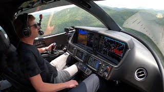
As a 747 pilot, all I can say is, Dave is 100% correct.
Could have explained that ETOPS is a thing with two engine aircraft. And that is why it makes sense to sometimes take a little turn instead of going straight from A to B.
Add "laws and regulations" to the very long list of things flerfs don't understand.
Every flat earth argument comes down to the same series of events:
Flat earther says something dumb.
Someone explains very simply why they are wrong.
They deny it.
Someone else goes in to far greater detail to prove they are wrong.
Next step: the flerfs word salad until nobody knows what they are going on about, everyone leaves and they claim a "victory"
They're a fun excuse to learn random bits about reality that I would never look up otherwise.
Nonstop commercial flights from Sydney to Santiago in 12 hours destroy all flerfer nonsense.
Except once you accept conspiracy thinking NOTHING is proof, as they could just be in on it...
If the earth isn't square then why is my amazon package always square?
And why is everything in Canada square?
"everything in canada is square"
not true
@@victorfinberg8595
all the people are, daddy-o.
@@johnqpublic7608then explain why igloos are round
@@victorfinberg8595 They're in Alaska.
@@throwawayavclubber7269 lots of inuit in canada. in fact, we even have a province named in their honour
it's funny the guy used a flat projection of a globe to make the argument that planes are traveling more or sum
Might be funnier if you could manage to express that idea properly...
I wasn’t aware that flat earthers really needed to be refuted. But here’s my refutation as a former submarine quartermaster, or watch section navigational plotter. When we got the new Tektronix computer, which could break down sailing routes trans-Pacific from say, San Diego to Hong Kong, why would the computer break down great circle sailing routes into segments all of which had different headings to continue taking the best course to your intended destination? Because after all, if the earth is flat you could sail that route using just a single compass heading. Then also, why is it that watch-standers on the top of the sail when underway surfaced can only see a few miles to the horizon? And then when at periscope depth why is it that your visible horizon through the periscope is so limited or as little as 3 miles perhaps when up atop the sail you could see over twice that distance?
I read a flat earthers post once that talked about how flights from Santiago Chile make a stop in north west Africa before reaching their final destination of Johannesburg south Africa, they claim that the flight path is a straight line.
So I asked them how many people from Santiago Chile want to schedule a flight to Johannesburg on any given day? The airlines aren't going to schedule a direct flight for just two people, those people will need to catch a connecting flight from another airport.
I then presented this information to the Flerf, I live in Santa Barbara CA, if I want to fly to Las Vegas I will need to fly to San Francisco change planes and then fly to Las Vegas or I can fly to Phoenix and catch another flight to Las Vegas or I can fly to LA and switch to another plane going to Las Vegas.
A direct flight from Santa Barbara to Las Vegas isn't offered because there's not enough people here that need to travel to Las Vegas on any given day.
The bean counters at airline company's don't like seeing airplanes takeoff half empty with passengers.
The reasons why southern hemisphere flights make a stopover in the northern hemisphere:
1) Demand. If 300 people want to go from A to B and 300 people want to go from B to A, but only 100 people want to go A to C, a stopover allow at least 500 more people to travel on that route than a direct flight.
2) Operators: A to B may be operated by one airline, and B to C by another. Neither of these operators would want an extra flight operating from A to C
3) Fuel: A two-leg journey can be operated by a smaller (cheaper) aircraft, without the fuel capacity required for the flight A to C, by making a refuelling stop at B.
4) Safety: An aircraft must be able to land (on land) in the case of an emergency such as engine failure and will attempt to fly as direct a route as possible, whilst remaining close enough to land to make a landing.
Flying airPLANES on a PLANE-t where God says it's. "like a footstool."
Does a footstool look like a basketball?
@@newworlddisorder_ Now that's funny, but also disrespectful. A footstool symbolises what is subdued. The word planet comes from the Greek planetes, which means "wanderer." Because compared to the stars, the planets appear to move (wander) across the sky relatively quickly. The "plane" in airplane goes back to the early days of flight and refers to the flat wings.
You forgot a leading reason...cabotage rules.
@@newworlddisorder_ Yes, a Basketball shaped footstool looks like a basketball.
God didn't say that, some human wrote it, like Joseph Smith or L. Ron Hubbard did...
@@newworlddisorder_we dont care what someone says god said.
Long term aviator here. First, I'm glad my many, many flights from Ascension to the Falklands never had to cross into the Northern Hemisphere; 13 hours going South all the way was quite long enough! And Port Stanley to Brazil we seemed to manage all in the Southern Hemisphere too. But as to airline routes and leaving late, there is a good margin of error built into the published arrival time to allow for contingencies such as delays and winds different to forecast. Also, when the pilots file their flight plan it will require them to follow certain specified way points, even trans-oceanic, which may not be in a straight line. If they can, they will once airborne ask air traffic for minor alterations to cut the odd corner or climb or descend if there is a better true airspeed v wind component solution to be had. They want to get there too and give the operator more time for the turnround. But airliners all tend to fly at much the same speed. This is because they generally follow airways and there is no overtaking. Therefore they tend to be designed to operate most efficiently at the same speed most guys fly. Finally, I can personally attest that line of longitude do start getting closer together again as you cross the equator!
Fun fact, flights are basically the same speed now as 50 years ago. Planes haven't gotten faster because the speed of sound hasn't been raised.
@@wiredforstereo - Actually, I was reading an article some time back ago that was showing how airline speeds have actually slightly decreased in general. Nothing to do with the speed of sound however, but everything to do with fuel efficiency. Obviously the airlines are in it to make a profit, and thus they search for whatever savings can be had by cutting costs, within reason. When you are operating 5,000 or 10,000 flights in a day, cutting travel speed by even 50knots could equate to one hell of a lot of money, not just per day, but multiply that by 365 days in a years. I'm sure you reaching into the $millions of dollars savings at that point. The article I mentioned calls this out specifically as the biggest driver for the slightly reduced flight speeds over the past couple of decades.
@@squidly2112 Well, it does, because it's uneconomical to go faster.
@@wiredforstereo - exactly!
Wow Dave. I can tell that those animated flight paths for globe vs. flat earth must have taken a TON of work to produce. Amazing work!
Hi Dave, you should do the day-night mercator map to azimuthal equidistant projection operation, using a day-night map for northern hemisphere winter, e.g. 21st December. Then ask the flerfers how a point sun can illuminate a flat plane in that way.
Watching all those planes fly in circles on the flat map was pretty funny.
Like they're circling a drain. How poetic.
@@NeutralDrow Hehe. That earned an upvote.
Still waiting for a flerf to explain why Australia is north of Scotland on thier map.
That's so the many Scots who wished to migrate to Oz could do so quite easily.
I keep asking them that too.
Or how distorted "their" portrayal of Australia is. In reality Australia is approximately 3860 kilometres long from its most northerly point to its most southerly point in Tasmania, and is almost 4000 kilometres wide, from east to west.
So apparently now the entire airline industry is in on the conspiracy
And all tourists, and all business persons and the maritime transport industry, and...
Apparently, you globists are unfamiliar with the latest science. It is well established that the Earth is mostly water. Since that water is not carbonated, the earth is indeed flat!
absolutely undeniable evidence
Very good.
(Though the earth is barely water, it's just on the surface)
A common tactic I've seen time and time again from Flerfs is to produce something that they claim is consistent with a flat Earth and then claim it as proof, while ignoring the fact that it also consistent with the Globe model (often by misrepresenting the globe model.) Flight paths in the Northern hemisphere are an example. They ignore that a "straight line" shortest distance between two points on the surface of a globe follows a geodesic, or great circle. So, for example, a flight from the PNW of the US to Finland ( a flight my Mom and sister took back in the late '70s) passes over the Northern part of Greenland on both a flat Earth map and on a globe. So at best, it is a wash and not the evidence for a flat Earth they try and claim it as.
They also ignore the fact that the opposite is true in the Southern Hemisphere, headings and distances are massively incorrect on a flat earth in the Southern Hemisphere.
I like how at 6:08, Witsit just makes something up on the spot to explain away the problem, and meanwhile Jeranism is busy Googling some way to back him up while sounding less confused.
I'm going to nitpick a bit: when you say that Stall Speed is about 250 knots, this is what is known as Knots Indicated Air Speed. "Indicated" because it is not measuring actual airspeed, but air pressure in the Pitot Tube. At 35000, 250KIAS (provided outside air temperature of -30C and sea level pressure of 1013hPa) is closer to 470KTAS (Knots True Air Speed), or roughly mach 0.8. If you wish to go 2,5 times faster you'll need a Concorde...
When Concorde flew at 60K feet, You would see earths curvature
“Straight lines are always quickest… hurdy dur!”
Dudes never heard of a Brachistochrone curve.
I flew from UK to Mauritius and the cool thing is the on-screen flight path thing. It followed the flight and aside from a slight detour avoiding Sudan, it pretty mech was a straight line. On the gleason map we'd fly over Germany, Poland and even Iran. We didn't.
Your videos are always entertaining, but I never expected to learn a new Photoshop technique. Thank you!
How to recognise flat earthers on a flight ? they’re always leaning in their seats cause they think the plane is turning the whole flight !
They also bob their heads forward and backward from time to time due to the pilot nosing the aircraft down to prevent flinging off into low Earth orbit. 🤣
Alternative title:
Southern hemisphere flightpaths make no sense on a flat earth.
Just to be nitpicking, Photoshop can't accurately wrap a Mercator map around a sphere because a Mercator projection is usually cut off at some latitudes north and south. Technically, this projection stretches infinitely vertically. On the other hand, the projection from TimeAndDate, an equirectangular projection, does the job just fine. Alternatively, any online great route mapper, if you want it to be super accurate, will do too.
Great episode anyway!
I mean yes, the most accurate way would be to take a globe. He's just using it to make an example. That's why the red line isn't straight when he converts it to a sphere, the projection itself is warped initially.
@@MeerkatADV I get hat you mean, but the UV wrapping that Photoshop is doing will never work on the Mercator map since the poles are cut off from it. The equirectangular projection that Dave used works. The reason why the red line didn't show up entirely curved was because he drew an arc of a circle on it, in stead of a sine function.
Look at how it maps the same image onto a wine bottle to get an idea of the accuracy it is even trying to make.
That said the aspect ratio of the image will tell it at what latitude the projection is cut off, and the unseen sections can be left blank in the mapping.
thanks Ole! I was going to make the same comment about Mercator vs equirectangular.
What i wonder is: Why would a company that is striving for maximum profit go out of its way slowing down airplanes and reduce passenger volume to keep up a lie?
That would cost them huge amounts of money they could get if the planes just go their most efficient, faster speed. Companies lie to maximize profit, not to reduce it.
Well done. The stall speed vs speed of sound explanation was sufficient. The flightradar shots were icing on the cake. You've got to feel sad for the flat earthers. Imagine believing that 99% of the world has been lying to you your whole life...
They just want to feel super smart and special, bless their little hearts ❤️
Dave, there were a number of inaccuracies when you talked about aircraft operations. While aircraft are mostly flown by computer (autopilot), the route that the aircraft flies, which is better known as the flight plan, is filed before the aircraft ever gets into the air, and can change significantly between flights to accomodate the specific weather that is expected en route. Flight plans consist of flying a series of legs between waypoints, which are located with radio signals, or these days GPS. As you said, airlines are in the business of saving money, so they're never going to file a flight plan for an aircraft to intentionally go out of their way without a good reason. Another bit you got a bit wrong was around diversions, and long haul flights over water. One of the reasons that an aircraft may take a non-direct (on the globe) route is to ensure that it is always within range of appropriate airfields to divert to ('alternates') in the event of an emergency, and for two-engine airliners, which covers most commercial flight, this is based on the aircraft's rated limits of sustained flight with one engine out, for example if an aircraft has an ETOPS (Extended Range Twin Operations Approval) for 3 hours, then they can be no more than 3 hours flight time away from a suitable alternate airport at any point on their route, so their route is restricted by that limitation. The longest ETOPS rating is crurently for the Airbus A350-900, which is approved for 370 minutes (5.5 hours). ETOPS is actually the main reason that aircraft never flight directly over Antarctica, because to do so would exceed that approval. The higher ETOPS certifications mean that almost the entire globe is directly accessible with an appropriate aircraft, but it also means that in the event of an in-flight medical emergency, the plane may not be able to reach their nearest alternate airport for several hours. Similarly, a small single-engine aircraft, or a twin engine without an ETOPS rating may have to take a very inefficient route and add hundreds of miles to their flight path. Another aspect about flight efficiency that you may not be aware of is that modern turbofan engines are most efficient when run for long periods at a fixed speed - to fly slower is actually less efficient. Finally the reason aircraft don't fly faster is because on those large engines, the tips of the fan (in rotation) approach or even exceeed the speed of sound, creating shockwaves, which alter the airflow, and create drag.
The flerfers are implying that a pilot wouldn't be able to understand their aircraft well enough to know when it flies 2.5x slower/faster. Do the controls of the plane know where in Australia they are and where they are going such that they limit how much thrust they give for the same speed setting of the levers?
Does the sentient plane also gradually dump fuel one way in Australia but not the other, so that the amount of fuel needed comports with globe routes? Or do the plane and the tanker truck conspire together to lie to the pilot and the ground crew about how much refueling is being done?
Tanker truck: This is how much fuel we're giving the plane for this north-south flight, you guys, for totes. Just as much as when we go east to west! [WINKS AT PLANE]
Plane: Oh, yum, exactly the same amount of fuel, how sensible and logical, given that it's the same distance, glug glug [WINKS AT TRUCK]
LOL. Poor FOT doesn't understand that the Mercator map is a distorted projection, NOT "the globe".
Dave, your ability to make Flerf arguments null and void is top notch. Keep it up.
Flerfs could go to Australia and do the east-west and north-south coast to coast drives and verify the times and distances for themselves, but they never do because THEY'RE LIARS.
Gotta love that the guy basically starts the video off by saying, "I don't know what map projections are."
It's hard for me to come to terms that there are people out there that have such little understanding of the world they live in, and they're so confident in their (little) intelligence on top of that.
I by no means am an expert on these things, but I do know I have a basic understanding, and when I don't understand something or have questions about it I look it up, learn, and add to my knowledge...
But instead of willing to learn, these people seem to deny the existence of things that they don't understand, which is crazy!
A lot of them see. To have a very high hubris. If they can't understand something, then it MUST be impossible.
Always funny when I mention that the flightplanning tool I use for my flights called Foreflight uses a visual globe to show your flightplan and other overlays relating to the flight.
The main reason airspeed is different than ground speed is because aircraft use an indicated airspeed as detected by a pressure difference between a pitot and static port. At sea level in no wind it would be pretty accurate to say indicated airspeed would be near actual ground speed but the higher you fly the faster you go yet indicated airspeed will decline. In most cases you have typical number of around 230kts indicated producing a ground speed of around 450kts give or take depending on winds aloft when in cruise flight. A better way to say it would be cruising between .78 to .83 mach depending on the aircraft model.
Also a main reason you see few flights between continents in the Southern Hemisphere is it can only be done with 4 engine airliners or twins with a high enough ETOPS to always be in range of an airstrip with a single engine failure (ex: ETOPS 240 rated twin would always need to be within 4 hours of an airport on one engine). This greatly curtails a lot of routs over open ocean unless there are islands along the flightpath with suitable airports. It was not that long ago when even flying to Hawaii from anywhere required a 3 or 4 engine jet but now almost all twins have sufficient ETOPS to make that trip from the mainland US or Asia.
I used to fly professionally, and you are right on with the flight thing. While some pilots (and airlines) will pull back the throttle, most pilots will put the aircraft at a decent speed to where they are going. My aircraft, the E175 would cruise around .72 - .76 Mach, but it should be noted, we routinely heard 737's (freaking Southwest) doing about .82/.83 on the radio, and they cruise at over .78 Mach. But the airlines will often schedule a flight for about, .72-.73 (our flights not Southwest) so that's what the route is scheduled by. So you're 100% correct, it was hard to make up time. Now, the tail number rarely matters when it comes to performance (rarely, we had one plane that would for some reason like pretending it was a rocket ship) as much as the aircraft. So that A380, most of them are only going to do about .75,.75 Mach at cruise. My guess is, if you made this recently, it was probably headwinds that caused it to be late, and it was just having a hard time catching up as A380's aren't that fast (NOTE: a 747 can do close to .85, almost .96 when empty such as Air Force 1). But the routes are also scheduled thanks to places to deviate to as well as what is most economical, so they will opt for as straight a path as possible, but will often times take a round about route thanks to ETOPS, although that isn't as much of a limiting factor as it used to be.
Measurements using my 9” George F. Cram Co. Classic Globe with a scale of 880 miles per 1 inch (standard 9” globe scale) *All verifiable using freely available flight data* :
• London to New York measures 3.8”. 3.8 x 880 = *3344 miles* .
• London to Mumbai measures 5.1”. 5.1 x 880 = *4488 miles* .
• San Francisco to Auckland, NZ measures 7.45”. 7.45 x 880 = *6556 miles* .
• Auckland, NZ to Santiago, Chile measures 6.9”. 6.9 x 880 = *6072 miles* .
• New York to Singapore measures 10.9”. 10.9 x 880 = *9592 miles* .
Flerfs, bring me a scaled flat world map that can do this. You can't. Congratulations, you falsified flat earth.
That is what Tiger Dan discovered when he tried to construct a flat earth map and found it impossible.
He is no longer a flat earther, realising he had been lied to.
@@grahvis I love showing this to flerfs. They either run away, or they end up denying that the distances of earth are "real". Imagine that? Reality deniers resorting to denying reality. Whoda thunk?
There is only 1 thing that matters when they set the flight time, that is the ideal speed in relation to cost, and that speed will be pretty much the same on all slightly longer flights.
No airline will operate less economically, to support some narrative...
"The shortest distance is always a straight line." Yeah, in basic Euclidean geometry. Wait til he learns that spheres have different geometries, like how in different geometries, the angles of a triangle can add up to more than 180 degrees.
Odd how he used the Mercator projection instead of their high holy Gleason Projection map!