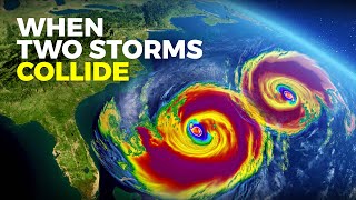
Formation Of A Tropical Cyclone

ฝัง
- เผยแพร่เมื่อ 20 ก.ย. 2017
- Access lesson resources for this video + more high school geography videos for free on ClickView ✅ clickv.ie/w/7aAw
#cyclones #hurricanes #typhoons #geography #ClickView
This video explores the life cycle of cyclones - how atmospheric conditions, ocean temperatures and the Earth’s rotation combine to create them, how they are driven by winds and eventually weaken after moving over land.
ClickView is home to high-quality, standards-aligned, ad-free videos for every subject, topic and grade.
😎 Sign up for free access: clickv.ie/w/VEDw
👀Explore our website: clickv.ie/w/WEDw
📽 Explore videos on other subjects: clickv.ie/w/XEDw


I'm here the night before exam, thank you for explaining 😅
Hope the exam went well! :)
Me aswell
My exams in 40 mins lol
Me too
You should not be here:):)
HERES THE WHOLE THING WRITTEN IF ANYONE NEEDS IT :>
(had to do it for my own studies so yeah, some are rephrased/paraphrased & there might be some mistakes)
Formation Of A Tropical Cyclone
There are three basic stages in the life of a tropical cyclone: its original source, mature stage and a dissipation stage where it dies out. they occur in a continuous process not as separate in distinct stages. Each stage may occur more than once during the life cycle as the strength of the cyclone rises and falls. It may reach land and weaken then go back out to sea where it strengthens once more. Formation of a cyclone depends upon the following conditions of a cyclone coinciding a large still and warm ocean area with surface temperature exceeding 25.6°c over an extended period, allowing body of warm air to develop above the ocean surface.
Low altitude winds are also needed to form a tropical cyclone as air warms over the ocean it expands, becomes lighter and rises other local winds blowing to replace the air that has risen then this air also warms and rises. The rising air contains huge amount of moisture evaporated from the ocean's surface as it rises it cools condensing to form huge clouds 10 km up in the troposphere more air rushes and rises drawn by the draft above rising drafts above to carry moisture high into the atmosphere so the clouds eventually become very thick and heavy condensation and releases the latent heat energy stored in the water vapour providing cyclone with more power creating self-sustaining heat.
Cycle drawn upwards by the new release of energy the cloud grows up-to 12-15 km high. Rotation on a tilted axis the Coriolis effect causes rising air to spiral around the centre of the cyclone.
At this stage the cyclone matures and the eye of the storm is created as the air rises and cools some of the dense air descends to form that clear still eye as the cyclone rages around it. The eye wall (basically the middle part) where wind is the strongest behaves like a whirling cylinder. cyclone rotation: clock for southern hemisphere and anticlockwise for northern hemisphere.
The lowest air pressure is always in the centre, usually being 950 millibars or less. Earth's average surface air pressure is 1010 millibars. One of the lowest air pressures ever recorded was 877 millibars for typhoon Ida in the Philippines in 1958 where winds reached 300 km/hr.
Cyclone follows a pathway from its source driven by the global wind circulation as warm ocean waters feed its heat and moisture the cyclone continues to enlarge
THANK U!! IT HELPED ALOT DURING OUR DISSCUSSION
legend brother helped massively
I'm here after Cyclone Tauktae passed Mumbai & has made landfall in Gujarat. Thanks for the simple explanation with good animations. Wish we had such visual aids during our school times!
Does not matter, we must grab the knowledge around in any form.
I wish you all good health.
i am here after typhoon mawar is a low pressure area now
So concise and well explained. Love the visuals. Kudos Team Clickview 👏
This was actually perfectly clear and comprehensive. Thank you!
One day to understand tropical revolving storms. Thanks for this informative video. 👌
Excellent graphic description. Very educative
Thank you for this! I am doing a project about cyclones so this really helps! :D
That's great! Good luck with the project :)
Same.
Thanks for help
Me too lol
Thank you so much... way better than my teacher's notes which told us that "air evaporates" ?????
You're welcome Eve!
They actually do and that’s how the moist warm air rises to form clouds where they thicken and form torrential rains and blustery winds and because of the earths spin on a tilted axis and bc of prevailing winds they move in a spiral swirling around the centre of the eye where it is the calmest and has the lowest wind pressure.as they hit land they weaken and die out as they are no longer fed by the warm moist air fueling it up.do not mind my unsolicited explanation your welcome.
@@ClickView
Please translate this video into Arabic
Thank you very much
@@user-qc4kg1gz6b why should he have to take the time to do that
Excellent video. To the point. Well done!
This information helps me to my Science project! Thank you so much for the information!
U explain so well, please make a video on temperate cyclone formation. I would be waiting. Please.
Thank you for this informative Video :) It helped a lot
Thank u I had a very difficult time understanding cyclones this helps Soo much
I often wonder about storm formation , thanks for the info. Its the only natural disaster I'm drawn to.
Seems most unnatural natural disaster to me. Everything seems like working on a recipe for the disaster. Stir a few things together on a zoomed up scale and there you have it. Anyway. Sad for the lives that get lost and manipulated by these.
Watched 3 videos before this one and this is the first one that is actually explaining it
we're once again experiencing a typhoon in our country the Philippines and this one, i guess from my experience and knowledge, is the first time a typhoon has struck the whole country because of its unique pathway, it has managed to struck every part of the philippines
Its called "CHEDENG"
@@SleepingZizzy not anymore
Thanks for a clear explanation Mr.
This is very logical and relevant information!
I'm here right now to understand the typhoon, we are currently experiencing it right now , im from cebu Philippines where the Eye of typhoon hit our place. Please pray for us 😭😭😭😭
typhoon Rai?
@@TipTapTippy i think
Science videos are awesome. We'll gonna wait for the next one.
Nice video about cyclones
I am saw this video.
This video is very nice.
Please throughout your solersestem video please
i love how half the 'formation of hurricanes' explanations ive visited all play rlly calm music 😂but this was rlly clear! thanksss
Exactly what i was looking for. Thanks a lot.
So glad our content is useful to you!
actually useful information unlike other sources tysm
Thanks a lot! :)
no
Very nice precise, perfect explanation of reason and ultimate effect of cyclon, it reveals that in coming years cyclonic phenomenon will increase with increasing intensity as earth temperature increases gradually due to disturbed Eco- System, our race development ignoring nature rules and Environmental Eco balance
You explain better that my teacher you are the best for explaining things😊🤗!!!!
Thx for this video ❤️
Thank you for the clear and comprehensive info. Watching this for my report tomorrow! 🤗
Hii
Here before Waram hits! I hope everyone is prepared and that losses are minimized.
Crystal clear concept...🥰
Well atleast you gave a good and longg explanation- and the video length os longer than Shinobu 👏👏
Thank you, this helped a lot! :)
Good to know :)
no
@@shogon9062 yes
Thanks a million!!!!!!!!!!!!!!!!!!!!!:)
Nice and clear explanation helped me understand my lesson
Very Interesting! Thank you very much!
shut up noob
I'm learning about this topic at school. Thanks alot
So basically earths rotation causes winds to swirl, they only thing that requires is high columns of air rising up and up and earth will do the job.
Sinking air also causes anti-cyclones
Got mock GCSEs tomo 🤞🏽
Explanation is very well
Teacher Aivie is a AP teacher that teach filipino but around the world and explaining the world. She uses the vid so we can know about them! Thank you!
thank you for the explanation
i have a question that i can't answer :
if the hot winds rotate in a right helix manner,
then how does the cold winds rotate? right or left helix?
thank you
I will use this video for my PowerPoint presentation 🤗🤗
Interesting
Nature invented physics and bound to those laws isn't it? Humans just discovered physics and still trying to understand all it's laws. Cyclones are amazing I love beast mode of nature there is something so raw about it.
When geography teacher fails to explain
TH-cam to the rescue
Ya
Yup😊👍 😂
Could you do one of a hypercane? It's a hypothetical storm first envisioned by MIT professor Kerry Emanuel. It has wind speeds of over 800 kph and is formed when ocean temperatures reach over 50 C. It's also over 38 kilometres high.
Thx for explaining it helped
thank you for explaining i need this for my task.
no
Haha, I watched this everytime when Im studying. Till now, i still dont get it. But as I go crazy I finally understood. Thanks
Great visuals
its 1am and this is what I needed
Best channel ever
...Thanks for the information
Excellent video
im caveman
Very nice video I understand a lot.... About cyclone
or a spinny cloud
Correction: Typhoon Ida of 1958 hit Japan, not Philippines. I remember I was still a young boy back then when the typhoon hit our country, I'm now 21.
At the beginning, was that hurricane Matthew?
Fantastic 👍
Ironically ida is hitting the gulf coast as we speak
3:20 crazy that rai/odette was only 200 kph. imagine houses were ripped apart & gone in the wind. stores literally exploded even when rai slowed to cat 4 in parts.
Awesome 👍🏻👍🏻
Awesome.
Thank you!
Thank u so much
So warm air is what allows the cyclone to form. What would happen if you could cool down the air before it condenses enough to form a cyclone.
I have a question: on the future hurricanes will happen in places like south Atlantic or Mediterranean
Thanks I needed this for homework
thanks for your information!
no thanks
Amazing😊
I like your video it helped me a lot
Odette devastated the Philipines particularly Visayas and Mindanao islands.
Here after Tauktae Cyclone in India.
In the atlantic and in the eastern/central pacific, we use the saffir simpson scale to describe storm intensity
Nice explaining
Thank you
thanks to this video I got full marks in my exam
My exam is in a few hours, thanks for this!
Omg thank you so muchhh!♥️♥️♥️
Thank you 🙏🙏🙏🙏🙏
Thank you for watching and enjoying our content!
Good description! Thank you.
At the end, the hurricane is like *"CMERE BOI!!"*
why did i laugh at this
@@padawan1769 idk man. This is kinda cringe
@@padawan1769 same lmfao
LMFAO BRUH
Here after Belal and Anggrek cyclones appeared as active cyclones in Indian Ocean. I wasnt surprised after what is going on in Red Sea.
Wait, was Typhoon Tip was the lowest barometric pressure ever recorded on a storm
John Daniel Esguerra Yes, 870 Millibars.
ThePhoneExpert I saw you on all of Force Thirteen’s videos!
CharlesB Hehehehehehehehehehehe
@Quoc anh Vu Pham No It isn't
Haiyan is 895 Officially
True. Typhoon Tip's intensity was measured by reconissance aircraft, which ended in the 1980's. Typhoon Haiyan's intensity was estimated using satellite data. There may have been other storms as or more intense than Tip, but without backup from reconissance aircraft, the operational meterologists were reluctant to assign any typhoon after Tip as more intense.
Tysm❤
Lot of information
too much for your pea brain to handle
Thank you to help me before exam
1:35 what does draft mean
I guess I will get a nightmare today from the Tropical Cyclones, but anyway Thankyou
Thank you thank you thank you 😊
Thanks a lot
Out teahcer let us watch this vid on the tv screen. Thx for the inform.
clock wise at N hemisphere and anti clockwise at S hemisphere 2:40
Sorry but its the other way round
N is counterclockwise
S is clockwise
Thanks
Great
Nice
Thanks sir
👏👏👏wow this is amazing
Thank you!
Yes
Thank you but, l don't understand about the low pressure in milibar = stronger storm.
for example : hurricane lan's windspeed 155mph/240kmph , pressure = 935ml
that's not too low like lda's but, at landfall at Port Myers,Fl , l saw in video that the wind was both fast, gusty & very powerful enough to knock over trucks at Sanibel causeway.
ST Noru was stronger, a cat 5 with 185mph/250kmph at Polilo island . Phillipines....pressure scale l forgot..sorry.
lt seems, the lower the pressure = stronger system.