Thanks. Nice video. I ride the trail a couple times a week. Never had a safety issue. Another feature is a gas station just up the hill from the trail end in Camino Heights. There is also a new underpass beneath Hwy 50 that allows you to continue the ride into Camino.
@@sjtaylor128 where is the overpass? I continued on the dirt which became impassable rocks and the “trail” just ended in a hard fence. did you work your way uphill through the somewhat fancy subdivision which did lead to an underpass and Carson Road? Or did I miss another crossing?
Of all the forms of transportation we have created the bike is our greatest achievement. No other comes close to it's affordability, health benefits and long term use throughout life. Love bikes!
This makes me want to travel up to the area and ride this trail. Thank you for the history and beautiful scenery. I may also visit the cafe. Great video!
I drove up to Sacramento last weekend to specifically ride the trail after watching this, it was a very nice ride. I was a bit annoyed that the parking lot on Missouri Flat Road was being dug up and I had to figure how to get back on the trail, until I saw the sign indicating the work is to build a new trail overpass .. that will be nice. I missed the turning after Placerville to get back on the trail and rode the road for a few more miles, d'oh ! One difference to your ride is that the trail was very busy. Thank you for the video.
I love it when viewers come back to talk about their experiences! Comments like this inspire me to continue filming so thank you! Sounds like it was labor day weekend you went up there? I'm glad you had a good time despite the construction and extra riders on the path! Thank you so much for watching the video and acting on it yourself! It's close to time where the weather is about to become really nice in places like Placerville. :)
@error6503 I so appreciate this comment. Send me an email at blitz.media.online and I’ll send you a free channel gift on me! Original logo anniversary pin! No pressure to claim just wanted to show you support for your efforts!
Inspired by your visit to revisit this trail on a beautiful chilly and windy fall day. Started in El Dorado. One warning: The crossing of Missouri Flat Road is closed off. You can work your way through the construction site if there are no workers on site. The good news is this construction is actually building an overcrossing of the busy road, so by next year your caveat would have been addressed!!!!
I appreciate the update! I’ll also update my notice I have in the video description to be today’s date! I’m glad you were able to safely navigate the blocked off area!
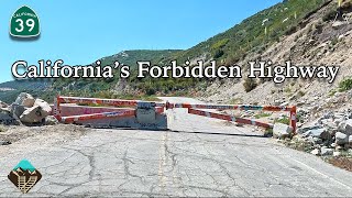
I tried to start at El Dorado station last week to ride this trail for the first time. There is construction up about 2.4 miles, just before Missouri Flat Road, that completely blocks the trail and is impassable. I had to ride back to my car at El Dorado station and drive up to Missouri Flat Road and jump back on the trail at the BMX park that is off Depot Road. From Depot Road it was great.
Ahhh I’m hearing a lot of people with this issue! I’m sorry! They are expanding the bikeway. I believe a bike bridge connecting the path over the roadway. But it’s a major issue for anyone trying to use the path at the moment! I am pleased to hear you went out there and didn’t give up! I’m glad you had a good time!
@@TrailsofCalifornia Not your fault. I just wanted others to be aware if they see your review. Construction to improve the bike path = GOOD! I've thought of making a sign and putting it up at the trail head in El Dorado for others.
I've hiked from the Missouri Flat trailhead down to Shingle Springs and back...almost 17 miles round trip, and totally worth it - except for the rattlesnake that one time. 🙂
Beautiful area of the country and what a nice rail trail. You captured it nicely. Also good to know that there's dirt/gravel option for even more miles.
Over the years there has been a few homeless encampments along or not far off the El Dorado Trail. One just past the County Jail and another up a mile or so after you cross over Mosquito Rd. Not sure where they are all went now but currently they’re gone. I would suggest riding with a friend just as a precaution since a good part of the trail is remote. In the early 90’s we would ride this trail on our Mt Bikes when it was just hard dusty dirt and gravel on each side of the tracks. I think the tracks as they currently sit date back to the 1930’s or 40’s (guessing) as the gold rush era tracks have long since been replaced. I remember in the mid 90s signing the “build the bike path” petition that eventually helped build that overpass over hwy50. The stump from the tree that the first hanging in “Ol’ Hangtown” is still in the ground inside the Hangman’s Tree Bar. We used to ride over that scenic bridge when there was just cables for barriers on each side and railroad planks with gaps between them. There was also a gap you could fall through as you were exiting. It was a real thrill back then. Also, there’s quite a bit of Poison Oak hiding in that lush foliage. So beware if you need to wander off the trail. …Great Video!
@@TrailsofCalifornia Just curious, what day of the week did you ride this trail? I assume you went west to east, it's about a 1900' elevation change with most of it from about the halfway point.
@@johnburwell6609 hello! I think I went on a Thursday! Yes east to west direction and you are right! More than half of the elevation gained happens after placerville. It is significantly harder after that point with a deceptively steady incline.
Great video. This is my home turf. About 95% of the paved trail has parallel single-track for mountain biking. You can actually ride the dirt trail west all the way down into Folsom. Suitable for gravel riding.
Nice I used to live in Roseville, early 90's I was in the Air Force at the time, I used to ride the Sacramento River Traill a lot from Folsom Lake and south and back again. I also rode a few of the trails up the hill from Rocklin. Next time I'm up that way I'll give this trail a try.
@@TrailsofCalifornia the older trials probably not much I used to ride the empty parts of Roseville on the northwest side, it was open fields but now its all residential and warehouse, lol my apartment complex used to have a pond across the street and you cold hear the frogs at night.
Your video made the trail look very nice. The bridge was definitely something impressive. I'm surprised with the low amount of trail traffic how well it has been maintained for use.
Glad to see you enjoyed our area :) By the way, if you're curious about the contraption hanging from the roof of the old train tunnel, that's a bat house. I believe it was installed by the local Boy Scouts one year? Or maybe an Eagle Scout project? Something along those lines.
Rode this yesterday. This time I was able to find where the trail continues from Main Street in Placerville but after crossing under the freeway and going past the old train station/bus stop I missed the trail head continuing the El Dorado trail. Instead, I kept going up Mosquito. Mosquito has a bike lane which quits not too far up the hill but I kept going. Steep, skinny and not much of a shoulder. Good thing was not too much traffic and drivers were kind. It kicked my butt going up but lots of fun coming back down. Now that I'm watching your video again, it looks like the trail head is across the street from the train station/bus stop? Another ride is in order. Some day I'll figure out how to get to Camino.
I am so happy to hear that you made it to the trail and had a great experience! Sorry about missing the trail entrance. The ride kicked my butt as well going up. It was a very gradual but steady incline all the way through. The quick return trip however was well worth the effort! Lots of fun. Yes, the trail is just a quick trip over the train tracks from the parking lot! Ride on!
@@TrailsofCalifornia I decided to take another shot at this yesterday before rain coming in this week. I now know all of the trailheads to get from El Dorado to Camino. Beautiful ride and a great workout. Strava showed 1,336 ft of elevation from Missouri Flat Road. Nice. I'm not usually good at hills but I felt pretty good.
Love the commitment! The elevation mixed with the slight foothill altitude in Placerville make it slightly more challenging for sure. Especially for anyone from the bay area, Sac & valley! Thanks so much for sharing your experience!
Great video! I must admit though, I was looking forward to the fast descent video, would have made a great ending to the video with majestic music as you sweep through the countryside :D
I love this type of feedback! I totally get it. Sometime I try to stick to a slower or faster music theme but you are right. A higher tempo ending would’ve worked well for this video!
Correction, those narrow gage railway tracks were installed by the lumbar companies in the early 20th century. I worked at Michigan California lumber in my youth and the history is fascinating. The gold rush was replaced with timber and trade.
Thanks for the video and making aware of new trail. I'm in Antelope, but it's just a bit of a drive up the hill to get to Eldorado. I'll need to try this when the temps are a bit lower. Are there any places to fill up on water along the trail? I usually bring a Katadyne Befree that I use to filter from creeks. The pie place looks great, I think the stop was well worth it.
There are streams in the area but be careful I don’t know how clean they are. Best bet would be to fill up in downtown Placerville! Not many water fountains along the way. I don’t recall seeing any.
Ha ha . Really. I bought my latest road bike in 2012. It came down to a Fuji or a Schwinn. I opted for the Schwinn, because it fit me best and was the smoothest riding of all the bikes I'd tried. It has a carbon frame and 105 components. It cost me a fraction of what many other brands would have cost. Still riding it today, 12 years later, even touring on it with bikepacking gear. It's been a great bike.
Honestly, I believe that! My Fuji roady was bought in 2016 and I’ve used it exclusively as my only bike. It’s been the main tool for this channel. It’s been great on all levels and it’s holding up well with just a little maintenance here and there. You really don’t need to spend too much for a bike that’ll last. I really believe that, just get what works for you! Unless you are a professional cyclist.
Outside el dorado station. It’s a small museum dirt parking lot by the old train depot. Pretty secluded. I was a little worried at first but it turned out to be ok. There are plenty of other parking options along the path that are safer and higher visibility. I just wanted to start at the furthest end of the Class I path for the purpose of this Video!
Last year I had a Patreon. However, I closed it in favor of the TH-cam membership program! I have a $1 monthly membership if you care to join! Link is in the description. I’ll have to review my footage and look into that for you! I bet some businesses in DT have bike racks. But I’m not sure I’ll find out about any public ones. None come to memory!
Number one pc of safety gear is a *mirror,* I know they are foolishly out of fashion but the glasses or helmet mounted one's are best, minimal and remove a ton of risk in traffic.
@@TrailsofCalifornia For short trips it's the mirror that get's me to use my helmet, around town I loath not having constant rear view. (once road from Bishop, CA to Alaska and back, across the desert to Utah then up the Rockies than back down the Coast, 4200 miles in 42 days, carried everything, camped all the way)
@@TrailsofCalifornia Correction--it was *42 days.* Inc. few off days and riding the ferry where days counted but not the miles naturally. 25 pound bikes w 25#s of gear before food and water. (should check my minimal diary)
@@TrailsofCalifornia I grew up in the Central Valley. I was 30 years old before I had coworkers from Southern California talking about “the 5”, “the 99”, “the 50” or “the 80”. That’s just how people from SoCal call them, since they have dozens of interstate bypasses. When all you have is 99, and 5 is miles away to the west, the number is enough.


Thanks. Nice video. I ride the trail a couple times a week. Never had a safety issue. Another feature is a gas station just up the hill from the trail end in Camino Heights. There is also a new underpass beneath Hwy 50 that allows you to continue the ride into Camino.
Another comment with great feedback! Thanks you!
@@sjtaylor128 where is the overpass? I continued on the dirt which became impassable rocks and the “trail” just ended in a hard fence.
did you work your way uphill through the somewhat fancy subdivision which did lead to an underpass and Carson Road? Or did I miss another crossing?
underpass
California, still the best place to live and enjoy every day of life. Beautiful.
Couldn't agree more!
Yes!!
Of all the forms of transportation we have created the bike is our greatest achievement. No other comes close to it's affordability, health benefits and long term use throughout life. Love bikes!
This makes me want to travel up to the area and ride this trail. Thank you for the history and beautiful scenery. I may also visit the cafe. Great video!
I hope you get a chance to go!!
Local rider who really enjoyed your video. Nice job! Thanks!
I appreciate the comment! Thanks for watching!!
Another awesome vlog!! So cool how this beautiful area is rich with gold rush history.
It really is a fascinating part of California!
I drove up to Sacramento last weekend to specifically ride the trail after watching this, it was a very nice ride. I was a bit annoyed that the parking lot on Missouri Flat Road was being dug up and I had to figure how to get back on the trail, until I saw the sign indicating the work is to build a new trail overpass .. that will be nice. I missed the turning after Placerville to get back on the trail and rode the road for a few more miles, d'oh ! One difference to your ride is that the trail was very busy. Thank you for the video.
I love it when viewers come back to talk about their experiences! Comments like this inspire me to continue filming so thank you!
Sounds like it was labor day weekend you went up there? I'm glad you had a good time despite the construction and extra riders on the path! Thank you so much for watching the video and acting on it yourself! It's close to time where the weather is about to become really nice in places like Placerville. :)
@error6503 I so appreciate this comment. Send me an email at blitz.media.online and I’ll send you a free channel gift on me! Original logo anniversary pin! No pressure to claim just wanted to show you support for your efforts!
More bike ways away from traffic is so great to see.
Thanks
You bet!
Inspired by your visit to revisit this trail on a beautiful chilly and windy fall day. Started in El Dorado.
One warning: The crossing of Missouri Flat Road is closed off. You can work your way through the construction site if there are no workers on site. The good news is this construction is actually building an overcrossing of the busy road, so by next year your caveat would have been addressed!!!!
I appreciate the update! I’ll also update my notice I have in the video description to be today’s date! I’m glad you were able to safely navigate the blocked off area!
I tried to start at El Dorado station last week to ride this trail for the first time. There is construction up about 2.4 miles, just before Missouri Flat Road, that completely blocks the trail and is impassable. I had to ride back to my car at El Dorado station and drive up to Missouri Flat Road and jump back on the trail at the BMX park that is off Depot Road. From Depot Road it was great.
Ahhh I’m hearing a lot of people with this issue! I’m sorry! They are expanding the bikeway. I believe a bike bridge connecting the path over the roadway. But it’s a major issue for anyone trying to use the path at the moment! I am pleased to hear you went out there and didn’t give up! I’m glad you had a good time!
@@TrailsofCalifornia Not your fault. I just wanted others to be aware if they see your review. Construction to improve the bike path = GOOD! I've thought of making a sign and putting it up at the trail head in El Dorado for others.
@@Mgrant8163 after reading your comment I did add a note to this video description! Ty!!
Wow! I love that bridge!! Can't believe the absence of other people on that trail, it's so pretty there!
Right?!
@@TrailsofCalifornia When were you there?
About a week ago!
One of my weekly rides
That’s an incredible trail. And more great drone shots. Inspiring work once again.
Glad you enjoyed it!
I've hiked from the Missouri Flat trailhead down to Shingle Springs and back...almost 17 miles round trip, and totally worth it - except for the rattlesnake that one time. 🙂
That’s an incredible hike! Thanks for sharing. Watch out for rattlesnakes!! Wow
Beautiful area of the country and what a nice rail trail. You captured it nicely. Also good to know that there's dirt/gravel option for even more miles.
Thank you very much!
Great ride, know the area, but haven't ridden this trail...now on my list! Rail trails have an easy climb, awesome bridge to cross!
Go for it!
Over the years there has been a few homeless encampments along or not far off the El Dorado Trail. One just past the County Jail and another up a mile or so after you cross over Mosquito Rd. Not sure where they are all went now but currently they’re gone. I would suggest riding with a friend just as a precaution since a good part of the trail is remote.
In the early 90’s we would ride this trail on our Mt Bikes when it was just hard dusty dirt and gravel on each side of the tracks. I think the tracks as they currently sit date back to the 1930’s or 40’s (guessing) as the gold rush era tracks have long since been replaced. I remember in the mid 90s signing the “build the bike path” petition that eventually helped build that overpass over hwy50. The stump from the tree that the first hanging in “Ol’ Hangtown” is still in the ground inside the Hangman’s Tree Bar.
We used to ride over that scenic bridge when there was just cables for barriers on each side and railroad planks with gaps between them. There was also a gap you could fall through as you were exiting. It was a real thrill back then. Also, there’s quite a bit of Poison Oak hiding in that lush foliage. So beware if you need to wander off the trail. …Great Video!
This commentary is amazing. Filling in all those historical gaps for me thank you! I’m going to pin your comment so others will see it!
Thank you! We live pretty close to this trail; however, we never knew of it.
Glad it was helpful!
Another great video. Well done.
Thanks John!
@@TrailsofCalifornia Just curious, what day of the week did you ride this trail? I assume you went west to east, it's about a 1900' elevation change with most of it from about the halfway point.
@@johnburwell6609 hello! I think I went on a Thursday! Yes east to west direction and you are right! More than half of the elevation gained happens after placerville. It is significantly harder after that point with a deceptively steady incline.
This trail is in my list.
Great! I hope you get a chance to go! 🙌
Thank you for that !
You are welcome!
Great video. This is my home turf. About 95% of the paved trail has parallel single-track for mountain biking. You can actually ride the dirt trail west all the way down into Folsom. Suitable for gravel riding.
Thanks for the info! I’ll have to grab a mountain bike and check the whole trail out one of these days!
I live here and I never knew that bridge was their, I’ll have to explore!
Let us know if you do!
You do a such a great job narrating the rides with trail descriptions and local facts. I enjoyed this one, keep up the great work 🚴✨✨
I really appreciate the comment! Glad you enjoyed this one! Thanks for watching and becoming a member! 🙌 🌟
Nice
I used to live in Roseville, early 90's I was in the Air Force at the time, I used to ride the Sacramento River Traill a lot from Folsom Lake and south and back again. I also rode a few of the trails up the hill from Rocklin.
Next time I'm up that way I'll give this trail a try.
I hope you get the chance to check it out! Thanks for the comment! I wish I had the chance to see what the trials looked like in the 90’s!
@@TrailsofCalifornia
the older trials probably not much I used to ride the empty parts of Roseville on the northwest side, it was open fields but now its all residential and warehouse, lol my apartment complex used to have a pond across the street and you cold hear the frogs at night.
@bikecommuter24 I love the sound of that!
If your going past placerville your going to Camino Calif jack Russel brewery
Beautiful trail. Will definitely have to check this out!
There’s a closure on Missouri flats rd. Just be aware! They are improving the bikeway but it’s not clear how to get around it
@@TrailsofCalifornia Thank you so much for the update!
Your video made the trail look very nice. The bridge was definitely something impressive. I'm surprised with the low amount of trail traffic how well it has been maintained for use.
It surprises me as well!
Glad to see you enjoyed our area :) By the way, if you're curious about the contraption hanging from the roof of the old train tunnel, that's a bat house. I believe it was installed by the local Boy Scouts one year? Or maybe an Eagle Scout project? Something along those lines.
That is very interesting! Thank you!
Rode this yesterday. This time I was able to find where the trail continues from Main Street in Placerville but after crossing under the freeway and going past the old train station/bus stop I missed the trail head continuing the El Dorado trail. Instead, I kept going up Mosquito. Mosquito has a bike lane which quits not too far up the hill but I kept going. Steep, skinny and not much of a shoulder. Good thing was not too much traffic and drivers were kind. It kicked my butt going up but lots of fun coming back down.
Now that I'm watching your video again, it looks like the trail head is across the street from the train station/bus stop? Another ride is in order. Some day I'll figure out how to get to Camino.
I am so happy to hear that you made it to the trail and had a great experience! Sorry about missing the trail entrance. The ride kicked my butt as well going up. It was a very gradual but steady incline all the way through. The quick return trip however was well worth the effort! Lots of fun.
Yes, the trail is just a quick trip over the train tracks from the parking lot! Ride on!
@@TrailsofCalifornia I decided to take another shot at this yesterday before rain coming in this week. I now know all of the trailheads to get from El Dorado to Camino. Beautiful ride and a great workout. Strava showed 1,336 ft of elevation from Missouri Flat Road. Nice. I'm not usually good at hills but I felt pretty good.
Love the commitment! The elevation mixed with the slight foothill altitude in Placerville make it slightly more challenging for sure. Especially for anyone from the bay area, Sac & valley! Thanks so much for sharing your experience!
I wish he would give more details on where the trail starts from. I’m interested in doing this ride.
I updated the description with information on the start location! Have fun! I hope you make it out there!
We love this trail! Thanks for the great video. Have you tried the one from Monterey to the old Fort Ord? Right along the ocean much of the way
Not yet! I’ll have to check that out in 25’!!
11:16 feel the burn.
Great video! I must admit though, I was looking forward to the fast descent video, would have made a great ending to the video with majestic music as you sweep through the countryside :D
I love this type of feedback! I totally get it. Sometime I try to stick to a slower or faster music theme but you are right. A higher tempo ending would’ve worked well for this video!
Thank you!
The El Dorado trail is longer than 13 miles, the majority of it is unpaved, about 33 miles total with the unpaved and paved section.
I’m glad you mentioned that!
Correction, those narrow gage railway tracks were installed by the lumbar companies in the early 20th century. I worked at Michigan California lumber in my youth and the history is fascinating. The gold rush was replaced with timber and trade.
That’s really great information. Cool that you worked at the lumber yard. Thank you!
Great review thanks
Thanks for watching!
Thanks for the video and making aware of new trail. I'm in Antelope, but it's just a bit of a drive up the hill to get to Eldorado. I'll need to try this when the temps are a bit lower. Are there any places to fill up on water along the trail? I usually bring a Katadyne Befree that I use to filter from creeks. The pie place looks great, I think the stop was well worth it.
There are streams in the area but be careful I don’t know how clean they are. Best bet would be to fill up in downtown Placerville! Not many water fountains along the way. I don’t recall seeing any.
WHAT…NO disc brakes, super wide flat tyres, or 10k frame! How can you ride?!?!?
Well done and reminds me of my time in CA..
Hah I wonder what channels you’ve been watching lately! 🤔
Ha ha . Really. I bought my latest road bike in 2012. It came down to a Fuji or a Schwinn. I opted for the Schwinn, because it fit me best and was the smoothest riding of all the bikes I'd tried. It has a carbon frame and 105 components. It cost me a fraction of what many other brands would have cost. Still riding it today, 12 years later, even touring on it with bikepacking gear. It's been a great bike.
Honestly, I believe that! My Fuji roady was bought in 2016 and I’ve used it exclusively as my only bike. It’s been the main tool for this channel. It’s been great on all levels and it’s holding up well with just a little maintenance here and there. You really don’t need to spend too much for a bike that’ll last. I really believe that, just get what works for you! Unless you are a professional cyclist.
I have a sweet riding FUJI bike too!
The best!
This looks awesome! How many miles is this trail?
13 miles or 21 kilometers!
Dry Diggins was Auburn.
Thank you!
I think Auburn was known as the North Fork Dry Diggins. Placerville was known as simply Dry Diggins, before becoming Old Hangtown.
Placerville was also the state capital for a short time
Where did you leave your car on the El Dorado end of the trail, and did you feel safe leaving it there?
Outside el dorado station. It’s a small museum dirt parking lot by the old train depot. Pretty secluded. I was a little worried at first but it turned out to be ok. There are plenty of other parking options along the path that are safer and higher visibility. I just wanted to start at the furthest end of the Class I path for the purpose of this
Video!
Where did you get that jersey ?
At an old performance bicycle store! A number of years ago before their national closures 🙁
Are there bike racks in DT Placerville?
Do you have a Patreon?
Last year I had a Patreon. However, I closed it in favor of the TH-cam membership program! I have a $1 monthly membership if you care to join! Link is in the description.
I’ll have to review my footage and look into that for you! I bet some businesses in DT have bike racks. But I’m not sure I’ll find out about any public ones. None come to memory!
Number one pc of safety gear is a *mirror,* I know they are foolishly out of fashion but the glasses or helmet mounted one's are best, minimal and remove a ton of risk in traffic.
I agree! I really like the handlebar rear view mirror. But that’s just me. Definitely a critical safety element on roads! Great tip!
@@TrailsofCalifornia For short trips it's the mirror that get's me to use my helmet, around town I loath not having constant rear view.
(once road from Bishop, CA to Alaska and back, across the desert to Utah then up the Rockies than back down the Coast, 4200 miles in 42 days, carried everything, camped all the way)
@@Mrbfgray that’s incredible!! I love the Bishop area. A trip to AK and back is a true bucket list item. I would love to know more about that story!
@@TrailsofCalifornia Love to tell it but it could only be select 'snapshots' to be short enough to post here I imagine.
@@TrailsofCalifornia Correction--it was *42 days.* Inc. few off days and riding the ferry where days counted but not the miles naturally. 25 pound bikes w 25#s of gear before food and water. (should check my minimal diary)
That bridge will loosen your teeth
Haha 😂
Hiway 50, not The 50 🙃
Ha ha, yes. We speak the *northern* California dialect up here 😉
I’ve been called out! 🙋♂️
@@TrailsofCalifornia I grew up in the Central Valley. I was 30 years old before I had coworkers from Southern California talking about “the 5”, “the 99”, “the 50” or “the 80”. That’s just how people from SoCal call them, since they have dozens of interstate bypasses.
When all you have is 99, and 5 is miles away to the west, the number is enough.
@@TrailsofCalifornia While we're at it.. it's the Sierra, not Sierras.
The word is "motherlode". "Lode", not "load".
Wow, you are completely correct! I will fix that up asap thank you!! 🙏
Learn what the word “wilderness” means. It has a specific meaning. Bikes are not allowed in wilderness areas.
Yes they are
Ohhh...another facial hair loving biker with a channel!!! Soy!!!!
Welcome aboard!