Awww, yay Kassie! It seems that some geology students have been sharing this around a bit... there's quite a few comments like this! Goodluck in the exam.
I can not even begin to explain how much sense this makes now that you've explained it so concise. I will pass my exam solely because of this video THANK YOU
Great tip, thank you for publishing it. I endorse your comments on map reading and navigation, rather than blindly relying on a GPSr. My two bobs worth is that, if your GPSr is capable of doing it, define your position format for primary displays in MGRS for bushwalking, but configure a secondary data field in lat/lon so you have it handy if assistance is required. It's my understanding that search and rescue services use degrees, minutes and decimal minutes (rather than degrees, minutes and seconds). Keep your posts coming!
Thanks for sharing that, never knew that's what the black and white lines were for! SIX Maps gives -33°47'23", 150°13'49" as the location, so you were pretty close with your guesstimation.
Love your channel! It's a big help for my cabin fever. Have you tried UTM coordinates before? It breaks the land into 1000 meter grids so you can actually calculate linear distance in the field with geometry. The UTM coordinates were under your finger at the top right of your map, and the grid on your map appeared to be UTM. Most modern GPS also can display and navigate in UTM and do map coordinate take offs and put them into your GPS. Or you can take the UTM from GPS and plot the position on map. Once I switched to UTM I'll never go back! Thanks for the videos, I love seeing the wilds in your neck of the woods!
+Andy Johnson Hey Andy, Yep... actually UTM is my baseline... it's what I use all the time as a bushwalker/hiker. I don't use lat/long for nav, it's only needed here if I need to communicate with say, a helicopter for rescue or within emergency services. So I'm totally with you on UTM love. Glad the vids help you with cabin fever.. just use the time to lay those toppo maps out and plan, dream and lock in!
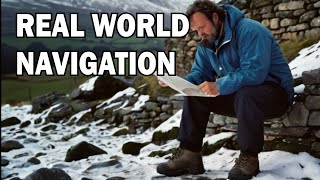
Good question Julie. Different map printers display information in different ways. If you look at the lat/long numbers printed at the edge of the margins, then it just takes a little bit more time to figure it out. This map in the example is one printed by the NSW State Govt in Australia. I like the visual clue as well as the numbers.
Caro, you're killing me! I spend all this time correcting Dunphys Car Park to Dunphys Camping Area, and you go an immortalise the bloody car park in a video! Myles didn't even drive!
Glad you like them Ellie! A DSLR would be very tricky to use out in the wilderness... with one hand... whilst speaking to camera... and walking. Although I own a 5D, it rarely comes out with me. Instead, I've been using Panasonic Lumix Tough cameras for years... I'm up to my 3rd one! Check them out here: www.panasonic.com/au/consumer/imaging/lumix-cameras/dmc-ft5.html
Tomorrow is my exam and I was so tensed that how would I learn it in one night 😭 You really helped me a lot ❤️ Thank you so much 💓 You are my life saviour ❤️💙🖤💗💜💜 Love you a lot 💖💖
Definitely agree. MGRS is still the standard for topo maps for bushwalking in Oz. This answered my curiosity about those black and white frames... I knew that they must be for a reason.
Hey Jazzie An, it all depends on whether the map makers/designers of your particular map have included the narrow black/white/black margin around the edges. Take a look 'outside the margin' also for the Lat/Long coordinates - that should give you a good idea.
Hello I understand that the latitude at top was 33 degree 45 minute But how did you know that at that point its 33 degree and 46 minute And other point 33 degree 47 minute? It's not pointed on the map how did you know??
Look closely at the video again, pause if needed. I'm pointing to the very thin (like 2mm margin) of the map where it is coloured black, then white, then black again. The start and finish of each section of black or white is the change to the next minute. Hope that helps.
I have a question and I need it before next tuesday (Cuz I will have a geography exam) Do you read Latitude first then Longitude? And is this how you read it in every map? (Topic graphic...)
If the top number on your map is 45' (forty five minutes) how/why are you counting UP to larger numbers as you move or scroll South saying " 46- 47 -48 " etc..? ....what hemisphere are you in..? If in Northern any move South or down in Latitude would cause a decrement (reduction) or smaller number not larger, if Southern then the opposite would apply and numbers would increment (increase) for a larger number as you move further from the equator. You need to prefix Lat. North or South & Lon. by East or West accordingly.
This is why in hiking and bushwalking, Lat Long isn't the best method for defining a location. A topographic map, like the one I used, is meant to be read via the MGA (Map Grid of Australia) system. Much easier and much better for defining location. ;-)
trooper2221 Gosh, wish I could help you. As an Aussie, our standard maps are 1:25,000 in kms, so when you start speaking 1:24,000 (7.5 quad) and miles... I tend to start to glaze over! Sorry I can't help you.
Hmmm, not sure if that's a question or a statement? This video is about identifying the lat/long notations on a toppo map. For bushwalking and hiking in Australia, the most common type of compass use in the bush is a baseplate compass, like a Silva Ranger, not a Brunton.
Nope, not at all... when it comes to navigation in the bush I'm definitely a grid reference / UTM / MGRS person. It's just when we need to occasionally translate when speaking with helicopters or 4WD-ers, that knowing how to get that info from a topo map can be useful!
Hmmm, that's odd @sylvia Maresca. My finger points to the numbers throughout and there are many positive comments about the video. Is it that the text is too small for you to see on the screen? If you can give me more background I could help understand what the problem is.
Justin Hessedenz No worries Justin. It's amazing how many people feel the same way... I know when I learnt how to do this I was like... "Finally! I get it." All the best.
Search and Rescue, it was a photo copied map with missing information, made it alitte confusing. half of the questions related to a creek point flowing into a lake. I failed to select the creek that was flowing into the lake making half my answers incorrect lol!
Michael Hanna But in short, the lines that travel and increase TO the east (but run north south) are called EASTINGS and lines that travel and increase to the north (but run east/west) are called NORTHINGS.


You explained this better than my college geology professor. Thank you
Awww, yay Kassie! It seems that some geology students have been sharing this around a bit... there's quite a few comments like this! Goodluck in the exam.
I'm about to take a geology lab exam, and I didn't understand this in class. Thank you so much for helping me to understand!!
Yay! You've just made my day.
I can not even begin to explain how much sense this makes now that you've explained it so concise. I will pass my exam solely because of this video THANK YOU
Woohooooo!
You are a great teacher and have a peaceful voice. Thanks for the help!
Thanks Cody!
Great tip, thank you for publishing it. I endorse your comments on map reading and navigation, rather than blindly relying on a GPSr. My two bobs worth is that, if your GPSr is capable of doing it, define your position format for primary displays in MGRS for bushwalking, but configure a secondary data field in lat/lon so you have it handy if assistance is required. It's my understanding that search and rescue services use degrees, minutes and decimal minutes (rather than degrees, minutes and seconds).
Keep your posts coming!
Seriously, thank you! I don't understand why my university course made it so complicated that I could not understand. You just made my day!
You're very welcome!
Thank you. I'm reviewing this for my geomorphology test. Much better than my professor's explanation.
Wow - if only I could get your geomorphology professor's salary! $$$
Thank you for the video! Just like allot of the other commenters said, you explained this better than my geology professor too!
Ha. It makes me laugh so much. Sometimes professors get too 'professory' for their own good.
This was really easy to understand. Thank you!
Glad you found it helpful!
Thanks for sharing that, never knew that's what the black and white lines were for! SIX Maps gives -33°47'23", 150°13'49" as the location, so you were pretty close with your guesstimation.
Ah, good to hear that I wasn't just talking crap! Yes, it came as a massive revelation to me too, so I hope it helps others.
You did an amazing job by explaining it practically.
Thanks Nitesh!
I am taking college early, you are a life saver and you have spared me many tears, thank you. 🥰
I'm so glad!
Love your channel! It's a big help for my cabin fever.
Have you tried UTM coordinates before? It breaks the land into 1000 meter grids so you can actually calculate linear distance in the field with geometry.
The UTM coordinates were under your finger at the top right of your map, and the grid on your map appeared to be UTM. Most modern GPS also can display and navigate in UTM and do map coordinate take offs and put them into your GPS. Or you can take the UTM from GPS and plot the position on map.
Once I switched to UTM I'll never go back!
Thanks for the videos, I love seeing the wilds in your neck of the woods!
+Andy Johnson Hey Andy, Yep... actually UTM is my baseline... it's what I use all the time as a bushwalker/hiker. I don't use lat/long for nav, it's only needed here if I need to communicate with say, a helicopter for rescue or within emergency services. So I'm totally with you on UTM love. Glad the vids help you with cabin fever.. just use the time to lay those toppo maps out and plan, dream and lock in!
I absolutely love this video, super simple and to the point. My question is would if my map does not have those black lines to help me find minutes?
Good question Julie. Different map printers display information in different ways. If you look at the lat/long numbers printed at the edge of the margins, then it just takes a little bit more time to figure it out. This map in the example is one printed by the NSW State Govt in Australia. I like the visual clue as well as the numbers.
Caro, you're killing me! I spend all this time correcting Dunphys Car Park to Dunphys Camping Area, and you go an immortalise the bloody car park in a video! Myles didn't even drive!
Not even the "Putt-mobile"? :-) Sorry Tom, I'm so used to calling it Carlons Carpark, it kills me to call it Dunphys in any case.
What kind of camera do you use to shoot your videos? Is it a DSLR, because I absolutely love the qualities of your videos! -Ellie
Glad you like them Ellie! A DSLR would be very tricky to use out in the wilderness... with one hand... whilst speaking to camera... and walking. Although I own a 5D, it rarely comes out with me. Instead, I've been using Panasonic Lumix Tough cameras for years... I'm up to my 3rd one! Check them out here: www.panasonic.com/au/consumer/imaging/lumix-cameras/dmc-ft5.html
Very nice video! I really needed that information!!
Glad it was helpful!
Tomorrow is my exam and I was so tensed that how would I learn it in one night 😭
You really helped me a lot ❤️
Thank you so much 💓
You are my life saviour ❤️💙🖤💗💜💜
Love you a lot 💖💖
You're welcome 😊 I get that a lot from students!!
Thanks - this was helpful in planning our journey through Wild Dogs
I still like using MGRS more, but this made lat/long super easy to understand. Thank you.
Definitely agree. MGRS is still the standard for topo maps for bushwalking in Oz. This answered my curiosity about those black and white frames... I knew that they must be for a reason.
Iv been watching your videos and have to say very informative and great content made me subscribe!!! Cheers
hello, is this still applicable if I use a scale of 1:50,000 topographic map? Thank you.
Hey Jazzie An, it all depends on whether the map makers/designers of your particular map have included the narrow black/white/black margin around the edges. Take a look 'outside the margin' also for the Lat/Long coordinates - that should give you a good idea.
This video is so helpful thanks!!!
Oh, so glad it helped
This helped me so much!! 🎉🎉 thank you!!
Yay!
THANK YOU THIS MAKES SO MUCH SENSE NOW!!!
Thanks +Bunny Lucrest - It's like a light going on, eh? That's how I felt when I first had it explained properly... and clearly.
Hello I understand that the latitude at top was 33 degree 45 minute
But how did you know that at that point its 33 degree and 46 minute
And other point 33 degree 47 minute? It's not pointed on the map how did you know??
Look closely at the video again, pause if needed. I'm pointing to the very thin (like 2mm margin) of the map where it is coloured black, then white, then black again. The start and finish of each section of black or white is the change to the next minute. Hope that helps.
I learn way more on youtube than in class which is really sad, thank you for the great video
I've heard that!
I have a question and I need it before next tuesday (Cuz I will have a geography exam) Do you read Latitude first then Longitude? And is this how you read it in every map? (Topic graphic...)
THANK YOU! I've been trying to find out how to do this !
My pleasure!
Very good video. Helped me finally understand :) Thanks
YAY - glad you found it helpful!
Can you tell me why you only use upper longitude and latitude of the map? When do we use the lower one? Thankyou :D
This video was cool and helpful for me
So glad to hear.
And what if your map doesnt have those white/black lines?
I'd wonder if it is a topographic map to start with.
If the top number on your map is 45' (forty five minutes) how/why are you counting UP to larger numbers as you move or scroll South saying " 46- 47 -48 " etc..? ....what hemisphere are you in..? If in Northern any move South or down in Latitude would cause a decrement (reduction) or smaller number not larger, if Southern then the opposite would apply and numbers would increment (increase) for a larger number as you move further from the equator. You need to prefix Lat. North or South & Lon. by East or West accordingly.
Does my accent not give it away? ;)
thank you so much!!
You're welcome!
how do you find the coordinates without guessing, how can we be more exact
This is why in hiking and bushwalking, Lat Long isn't the best method for defining a location. A topographic map, like the one I used, is meant to be read via the MGA (Map Grid of Australia) system. Much easier and much better for defining location. ;-)
I like the music. Makes me feel relaxed for my geology exam lmao
bwahaha. Goodluck for the test!
Thanks! I got an A :D
AWESOME!
Very good thank u! I'm having trouble figuring out my 7.5 quadrangle map, wouldn't 7.5 minutes be about 7.5 miles?
trooper2221 Gosh, wish I could help you. As an Aussie, our standard maps are 1:25,000 in kms, so when you start speaking 1:24,000 (7.5 quad) and miles... I tend to start to glaze over! Sorry I can't help you.
+trooper2221 7.5 minutes is about 7x8 miles at the middle latitudes of the U.S.
Hello, did you say 30 minutes 50 seconds at the end of the video.
+santos m martinez Nope... 13 minutes and 50 seconds :-)
How to use brunton compass in locating my position in a field
Hmmm, not sure if that's a question or a statement? This video is about identifying the lat/long notations on a toppo map. For bushwalking and hiking in Australia, the most common type of compass use in the bush is a baseplate compass, like a Silva Ranger, not a Brunton.
Where can I find a topo map like that for my area Alabama?
Sorry, no idea... just google "Alabama Topographic Map Shop"
Excellent! You may consider doing this again with better camera work and with a protractor or ruler. Really informative though!!
Maybe one day... too many other videos sitting in the queue to be edited... for now... it stays!
Thank you so much!
My pleasure +Chloe Longman
Can this work on a fishing map
Depends what a fishing map is. I've never seen one.
where did the 47 come from?? i thought the minutes were 45'??
oh thank you soo much you realy explained well
thanks!
Awesome! :)
Are you guys telling me you're running a "navigation challenge" with Lat/Long, and not MGRS or even UTM?!?
Nope, not at all... when it comes to navigation in the bush I'm definitely a grid reference / UTM / MGRS person. It's just when we need to occasionally translate when speaking with helicopters or 4WD-ers, that knowing how to get that info from a topo map can be useful!
Lotsafreshair Ok. That makes me feel much better, thank you.
Disappointed. Couldn't see the map nor the numbers you were talking abour
Hmmm, that's odd @sylvia Maresca. My finger points to the numbers throughout and there are many positive comments about the video. Is it that the text is too small for you to see on the screen? If you can give me more background I could help understand what the problem is.
So helpful!!
Great. Glad it was.
thank you
thanks so much my homework is finding the longitude and latitude of my map i nailed it
Smashed it!
very helpful thank you
+Bashir Saeidavi My pleasure. Glad you found it useful. It's one of those things that trips a lot of us outdoors types up.
Lat and longs are confusing for North Americans. Lats increase going north. Longs increase going west.
I think they confuse a lot of people. That's just one reason I'm happy that use UTM grids for navigating for bushwalking/hiking, not lat/long. ;)
Thak you sooooo much
My pleasure. Glad you found it helpful.
Thanks 😍
Pleasure.
omg thank you soo much! lol
Justin Hessedenz No worries Justin. It's amazing how many people feel the same way... I know when I learnt how to do this I was like... "Finally! I get it." All the best.
I still need practice, failed my map and compass exam tonight lol, but the video did help alot :)
Happy to help. What was the exam for?
Search and Rescue, it was a photo copied map with missing information, made it alitte confusing. half of the questions related to a creek point flowing into a lake. I failed to select the creek that was flowing into the lake making half my answers incorrect lol!
Thanks for the video, but actually, I don't even understand it mutch.... I'm not good in maths, and science, so I will study it until i catch it!
It could be tricky at first Melanie... just take you time and have a map in front of you might help. Goodluck.
Saved. Me.
One question, what about that W or N at the end, like the West or North thing?
Michael Hanna Thanks Michael. Glad it helped. What do you mean exactly. Do you mean Eastings and Northings?
Lotsafreshair Yeah
Michael Hanna This little video could help explain it: www.screenr.com/mEG
Michael Hanna But in short, the lines that travel and increase TO the east (but run north south) are called EASTINGS and lines that travel and increase to the north (but run east/west) are called NORTHINGS.
omg don`t understand all of it! even minutes :)
you shouldve just said long is verti and lat is hori.
Nah, I reckon it works as it is. Another way of remembering is that Latitude sounds like ladder and to think of the rungs of a ladder.
you are sweet :) nice vid and info
Absolutely not clear and confused
oh thank you soo much you realy explained well
Thank you so much !!
+Antonio Zavala No worries!