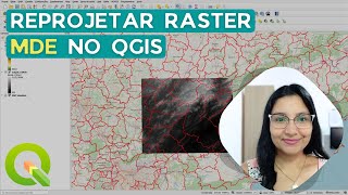
How to Reproject Raster in QGIS | How to Change the Coordinate System of Raster Dataset

ฝัง
- เผยแพร่เมื่อ 25 ส.ค. 2024
- Reprojecting or warping a raster in QGIS involves changing its coordinate reference system (CRS) to match another CRS. Here's a step-by-step guide on how to reproject or warp a raster in QGIS:
Open QGIS:
Launch QGIS on your computer.
Load Raster Layer:
Load the raster layer that you want to reproject into QGIS. You can use the "Add Raster Layer" button or drag and drop the raster file into the QGIS interface.
Activate Raster Warp Tool:
In the QGIS toolbar, go to the Processing Toolbox (you can find it by selecting "Processing" ----- "Toolbox" from the main menu). In the Processing Toolbox, expand the "Raster" group, and you should find the "Warp (Reproject)" tool.
Configure Warp Parameters:
Double-click on the "Warp (Reproject)" tool to open its configuration window. In this window, you need to set the following parameters:
Input layer: Choose the raster layer you want to reproject.
Target CRS: Select the target coordinate reference system (CRS) for the reprojected raster. You can either manually enter the CRS or use the browser to search and select it.
Optionally, you can adjust other parameters like resampling method, target resolution, and other transformation options based on your specific requirements.
Run the Tool:
After configuring the parameters, click the "Run" button to execute the Warp tool.
Monitor Progress:
QGIS will run the tool, and you can monitor the progress in the Processing Toolbox or the Log Messages Panel.
Check Reprojected Raster:
Once the tool completes, you should see a new layer added to the Layers Panel. This new layer will be the reprojected raster. Right-click on the layer, select "Properties," and go to the "Source" tab to verify that the CRS has been updated.


![[LIVE] : ONE ลุมพินี 76 | คู่เอก "ผึ้งหลวง vs สมิงดำ"](http://i.ytimg.com/vi/9SBshmGQOIM/mqdefault.jpg)
![ว้าว!ลุงบีมแบกทองมารับขวัญหลานกันยกบ้าน [cc] แดนแพทตี้ SS2 | EP.49 |](http://i.ytimg.com/vi/Osihq1OAs-4/mqdefault.jpg)

you saved my day
That's great... 😄
When I reproject a raster layer, it always appears white, as well as cliping a vector layer to the raster image. What could be the problem?
Please confirm the source and target CRS.
Does this work for reporjecting lidar .laz files?
It should work.
how come I can't find "WGS 84 / UTM 51N (EPSG:32651)" in "my target crs [optional]".
There's only ESPG: 25394 AND ESPG: 4326
Hello, Jay.
It should be there, perhaps you search keenly. Unless the projection doesn't exist.
@@SurveyingSolution I see I see. I'll try to ask a friend. Thanks for the response btw. I really appreciate it!
OK, but your coordinates are till in lat/long.
Hello, Alfred.
Have you checked the properties of the raster layer?
@@SurveyingSolution Hello. Yes and still cannot get it to show me coordinates in UTM....
Hello @@alfredo9173, are you referring to the video or your personal practice?
@@SurveyingSolution Well, actually I thought you were trying to show how to change from lat/long angular to cartesian UTM. Yes, I do have an issue.... Thx