Not only a beginners guide, I explained projection to my friend and googled, this was the first result and it did not disapont, the visuals are amazing I also got a new grasp of prespective
hey, a great introductory video! wanted more, but don't see any more educational content uploaded since. so many requests down in the comments, pls find time, because your wisdom and style is wonderful.
Good video, but I would like to point out an error, or at least an apparent error. It is not correct to say that a map projection is the process of transforming a spherical object into a two-dimensional flat surface. The process of map projecting is more general than that and does not require that the source object be spherical nor that the destination surface must be flat or two-dimensional. In fact, it is possible to project the three-dimensional surface of a hypercube onto the three-dimensional surface of a hypersphere. Yes, there was a qualifier added of "as you can see on screen at the moment", which could be taken to mean "in the context of the example shown on screen at the moment" but it seems the implication was that the definition given was not meant to be a restrictive one applicable only to the presented example. A more general definition woud be that a map projection is the result of a methodical process of presenting the features of one surface onto another surface, especially when done in such a way as to maintain some recognizable correlation between the source features and their projected representations.
We all know the earth is flat. It's easy to see how a photograph like that could fool the untrained eye. The curvature is really just the use of the wide angles lenses from the satellites, its just a deception of the public. That's why sailing in a straight line does not work and you have to pivot around the centre of the earth (also known as north pole). On the outside of flat earth there would be the south pole with 150-foot high wall of ice. The truth is, people know very little about Antarctica, and it makes sense because it is the latest piece of island to be discovered (and even Pluto was discovered before Antarctica). The bible even says it's flat, regardless of what science tells us. It's simply blind faith and to reject the evidence of your own senses. It's a joke btw
Your projection pyramid is incorrect, you cannot have a sphere at the top, an image of a sphere does not have enough data to generate a Mercator projection! It is the AE or Azimuthal Equidistant map that can be converted to a Mercator and then into a sphere. Just more lies...


Not only a beginners guide, I explained projection to my friend and googled, this was the first result and it did not disapont, the visuals are amazing I also got a new grasp of prespective
I have a test in an hour...this has been really helpful
hey, a great introductory video! wanted more, but don't see any more educational content uploaded since. so many requests down in the comments, pls find time, because your wisdom and style is wonderful.
just wanted you to know that your my homework for this week :)
😎🖊️📚
First 4 words said in this video made my day
what was it?
@@legendaryhelp7806Hey guys, what's cracking?
I needed this lecture!
Thanks so much! I understand map projections much better.
Very nice video , thanks for the info !
Excellent explanation
Glad you think so!
Thanks Buddy it will help in my today's geo practical
Brillant!
Well explained, now I understand a bit better.
Awesome video, super helpful!!
Thanks! Great help!
nicely explained
Thank you 😃
I've always thought Russia, Canada, Greenland and other "polar" locations were actually bigger
Now i know better 👏🏾
Amazing video THANKYOU 😇
Good explanation
This is great content...and I like to make a video like this
Excellent thank you!
Great job, thanks!
but Google did not create Mercator projection, of course :)
No, Google created the Web Mercator projection :)
best explanation
thank you very much
Global Business Class, ugh. Thanks for making maps explainable.
Any time!
very simply and playfully taught a very difficult subject
1:58 find the apple logo
Hahaha so funny y
Jennifer Donaldson Lol poor Samsung
Something more like: "Apple Projection"
@@fwdgd Macator Projection 😁
Cool graphic !
Thanks, but I'm not sure which graphic?
Mantul cok
SYAZWAN ISKANDAR santuy
But why is the the map of earth is known to be not good at size (area) preservation
how about the south part ? did you measure the south polar region ?
The distortions are the same in the North and South so it will appear the same way as you saw in the video, just inverted.
LOVE It
is that Apples custom projection?
That's the Macator Projection
I like the video!!
How often do you still post im a wind energy major who is taking GIS ArcMap
Stay tuned, we'll be posting much more in 2020!
👏 😮
🙏🏽🙏🏽
Good video, but I would like to point out an error, or at least an apparent error. It is not correct to say that a map projection is the process of transforming a spherical object into a two-dimensional flat surface. The process of map projecting is more general than that and does not require that the source object be spherical nor that the destination surface must be flat or two-dimensional. In fact, it is possible to project the three-dimensional surface of a hypercube onto the three-dimensional surface of a hypersphere. Yes, there was a qualifier added of "as you can see on screen at the moment", which could be taken to mean "in the context of the example shown on screen at the moment" but it seems the implication was that the definition given was not meant to be a restrictive one applicable only to the presented example. A more general definition woud be that a map projection is the result of a methodical process of presenting the features of one surface onto another surface, especially when done in such a way as to maintain some recognizable correlation between the source features and their projected representations.
Google originally created the Mercator projection? Lol. I guess you probably meant the Web Mercator projection.
My bad. Thanks for the spot, I've watched that video so many times and never noticed I said that!
The actual Mercator projection, was designed in 1569 to help sailors navigate around the globe.
l use google earth ..its a globe Also on googles marcator map as you scroll away from the equator the scale line increases in lenth
whats orthomorphic projection in a nutshell ?
how map projections produce the two common coordinates systems
Yang Kesini gara gara Pak Pratama
Like
Excellent video... except, how can I trust the information from someone who doesn't know the difference between a soccer ball and a football?
charles dickens Culture gap!
Soccer is called football in Europe and Latin America just to name a few.
He’s in a different country
They call a soccer ball a football in the UK
Yeah, trust webmercator projection about the Greenland size:)
Flatearth map reward now over $71M. Antarctica is optional. :)
I don't know why this subject interests me
We all know the earth is flat. It's easy to see how a photograph like that could fool the untrained eye. The curvature is really just the use of the wide angles lenses from the satellites, its just a deception of the public. That's why sailing in a straight line does not work and you have to pivot around the centre of the earth (also known as north pole). On the outside of flat earth there would be the south pole with 150-foot high wall of ice. The truth is, people know very little about Antarctica, and it makes sense because it is the latest piece of island to be discovered (and even Pluto was discovered before Antarctica). The bible even says it's flat, regardless of what science tells us. It's simply blind faith and to reject the evidence of your own senses.
It's a joke btw
Gregory Barseghyan uh
Had me in the first half ngl
I WHANT THIS VID TO HAVE ADOPT ME NOT BORING STUFF!
Bruh Apple Maps were taken too literally.
Oceania
HI
bob
boong boong yg asli ada badaknya
Great! I'm indian. And you?
Who cares? This is not a video about nationality or culture.
Your projection pyramid is incorrect, you cannot have a sphere at the top, an image of a sphere does not have enough data to generate a Mercator projection! It is the AE or Azimuthal Equidistant map that can be converted to a Mercator and then into a sphere.
Just more lies...
Thanks for the correction.
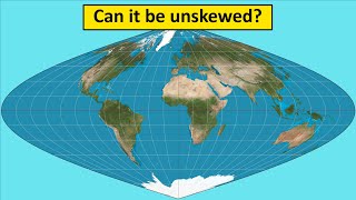
Flat earther's map :|
Earth is Flat EARTH is FLAT
You wish.
that's a soccer ball ya brit
Earth is not a sphere!!!! #earthchan
Elva Lin and you have a map of you flat earth?
Steve Rushforth flat earth? I was talking about oblate spheroid.
sorry Eiva I put my comment on the wrong thread
@@elvalin9474 .....close enough, what's 50 miles difference when your dealing with 25000?
I'll call it a sphere.
JT León sure, call it what you want. I don’t mind.
More lies
how do you struggle with something this basic?
More stupid