What is a Bathymetric Survey?

ฝัง
- เผยแพร่เมื่อ 6 ส.ค. 2019
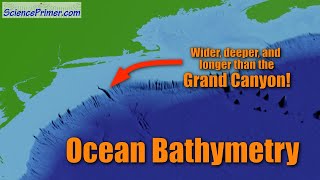
- What is Bathymetry? We explain the basics and the technology behind how bathymetry works.
How to conduct a Bathymetric Survey: • How to conduct a Bathy...
-----
Website: exo-env.co.uk
Email: enquiries@exo-env.co.uk
Twitter: / exo_env
Facebook: / exoenv
LinkedIn: / 5046489 - วิทยาศาสตร์และเทคโนโลยี


does bathymetry need levelling and traverse? if yes how to do that
Hello! Good question! There are many controls to ensure the accuracy of the survey. Unlike ground based measurements which remain positionally fixed, positional accuracy on the water is somewhat difficult to pinpoint to such a level of accuracy, especially where there are tidal influences.
In order to achieve the best quality data, RTK GNSS positioning system is used with a reference base station on a known point. This provides cm accuracy throughout the survey at sub second intervals to correct for things like tide or heave. The other aspects of measuring the depth have a lower accuracy overall (the sonar) and are therefore the limiting factor. In those aspects of the bathymetric system, accurate calibration of the echosounder and measurement of the sound velocity in the water both before and after the survey are essential.
Lastly, the survey is performed with overlapping survey lines to allow for comparison of the final calculated depth at locations where the lines intersect. This allows positional quality control across the entire area, not too dissimilar to a levelling traverse procedure. Hope that helps!
Thank you ..great videos from your channel. Keep them coming.
Glad you're enjoying them, stay tuned!
👏👏👏👍👍keren
When doing bathymetry measurements, do you use some kind of IMU to measure roll on the boat or is it assumed that the position of the boat is flat at all times?
Hi! If you want to achieve the highest order of accuracy then yes you should use a dedicated motion sensor, however in shallow waters and calm conditions the effective error of not using one is negligible. The positioning system (GPS) also corrects for tide and the heave of the boat. Hope that helps!
Exo Environmental Thank you, great informational videos!
Is this role same as hydrograhic survey wrt to finding depth of water body?
Yes, it is indeed! Thanks for watching.
great
Thanks!
what is the least count of the device u used?
Do you mean the minimum number of pings/measurements per unit area? That would depend on the depth/level of prevision required (i.e. IHO special order)
@@ExoEnvironmental yes thank you for your timely response
@@dhanushjayakumar537 No worries. In one of our recent surveys in a shallow water environment (