What is 2-D Modeling?

ฝัง
- เผยแพร่เมื่อ 14 ต.ค. 2024
- Sam Crampton and Eric Zgonina introduce 2-D modeling as a powerful hydraulic engineering tool.
www.dewberry.com
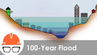
Sam Crampton: Hydraulic modeling is the application of fluid dynamics to simulate the movement of water. We use hydraulic models to determine the extent of a floodplain and the probability of a floodplain occurring. We use hydraulic models to simulate what would happen if a dam failed. With that information, we can determine how far the extent of the inundation goes, how fast it's going to be, so that we can prepare evacuation maps and emergency action plans. The biggest advancement I have seen in hydraulic modeling over the last 10 to 15 years has been the application of 2-D models.
Eric Zgonina: Two dimensional models have been around for over past I'd say 15 to 20 years. The real problem that consulting firms and municipalities weren’t using the modeling software is because the computational resources to run a model they just weren’t available at that time. They weren’t economical.
Sam Crampton: The only thing the 1-D model really calculates is how deep that water is going to get. It doesn’t determine the direction. That is really down to the engineer to actually determine which direction that water's going to go, which are seen in most places certainly mountainous areas, it goes downhill confined within the embankments of a valley. Though the 1-D might be suitable in most places where you’ve got steep terrain, the 2-D modeling can be very useful in areas where the flow patterns are very irregular, whether it's out in the central valley of California where you’ve got a big alluvial floodplain with a lot of levels and unconfined flooding; down in Florida where it is a bunch of interconnected swamps, very unconfined flooding where the water essentially goes in every direction because it's so flat in a highly urbanized area, in a city center you are going to have flow going around buildings and through roads. That's where the 1-D model is very challenging.
Eric Zgonina: Now the issue with using a 1-D model to display and compute velocities is that you must interpolate the velocity from cross section to cross section. A subdivision for example - you will be able to calculate the velocity at one particular house, but you won’t be able to accurately predict the velocity at your neighbor’s house. Now in a 2-D model, we can accurately predict the velocity at each individual structure, so not only now are we showing the depth and the impact to the structure, we are also more accurately showing the velocity. In a lot of scenarios most of the damage can be done in very low depth but high velocities.
Sam Crampton: One of the pieces of software that I am particularly excited about is the HEC RAS 2D. HEC RAS is the river analysis system developed by the US Army Corps of Engineers Hydraulic Engineering Center. One of the advances of this is that it uses a new finite volume method, which is a very efficient way to process the terrain data and run the simulation. We've used it extensively. We've performed canal break simulations, dam break simulations, urban flooding simulations, overland flooding from combined sewers, and it has provided a very, very efficient way to simulate these things that typically were just too complex to model efficiently using 1-D. And that's where using 2-D models has allowed us to simulate that much more efficiently and with a much greater level of accuracy and confidence. The real benefit to our clients is they are going to get much more advanced, a much more defensive model yet the level of effort can be significantly reduced.