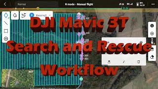
Deployment of the DJI Mavic 3T for Missing Persons in the Water

ฝัง
- เผยแพร่เมื่อ 3 เม.ย. 2023
- When it comes to missing persons, no matter if it’s in a river, lake or any coastal area, the DJI Mavic 3T is a great tool to enhance search-and-rescue efficiency. Mike Sember, a South Florida firefighter, demonstrates how the Mavic 3T can be used in marine operations and expedite the rescue of missing persons.
While flying over the ocean, Mike demonstrates key functionalities of the drone to aid in these types of emergencies. Watch the video to learn more.
Contact us for more information on the DJI Mavic 3 Enterprise Series Drones at experts@dronenerds.com or bit.ly/3GYQ6e0 - วิทยาศาสตร์และเทคโนโลยี


I have flown my Mavic 3T over the ocean a handful of times and this is very helpful. I was one of the 4 individuals rescued off the coast of NC in the early morning hours of August 14th. I will recommend to the USCG station at Oak Island, NC, to use a drone once they arrive in the search area. Don't know if they'll use that info, but it might've helped to find us in the water sooner. I realize we were far out to sea and well out of range from the shore, but, having one aboard their 47' Rescue Craft searching in Thermal cannot be anything but helpful.
Ben Wiggins
Hampstead, NC
We're just happy that you were found! Drones are becoming much more common for search and rescue operations, so it isn't too far-fetched an idea that organizations like the USCG will being implementing them out at sea.
Why not? Another tool in the toolbox. Get the job done lives at risk.
This is very helpful and informative. Thank you and keep sharing!
Thank you! Glad it was helpful!
My pleasure, thanks for the good content
Much appreciated!
Where do you see the gps location of the drone to relay the info
Awesome info!!!!
Thanks for watching!
Thanks for the video. Do you recall what the approx ambient temp was, as well as the water temp that morning? Thanks.
Very helpful video, not many around for marine sar
We're glad to hear that you found our drone helpful, particularly for marine search and rescue. Our team strives to create informative and valuable content for our viewers, and we appreciate your positive feedback!
Defining the southern range would restrict the targets, they would stand out (for ex. tmp between 90 deg and 107 deg).
Great job ! I noticed you can't see what's under the water.
Mike, are you guys a dealer for DJI? I’m looking to pick up the enterprise 3E for mapping .
Hi Mark! Yes, we are a DJI dealer and can assist you with your purchase of the DJI Enterprise 3E for mapping. Please feel free to contact us at experts@dronenerds.com and we'll be happy to answer any questions you have and guide you through the purchasing process. Thanks for considering us as your drone supplier!
cool👍
Great stuff! Im always partial to White Hot. For me, normally its the easiest to pick out targets. But this shows examples of scenarios when Black Hot is useful!
Looks like when the sun is up and to the drones back Black Hot works really well! With the sun to its front White Hot works better. For my eyes anyway. Im old too! lol
Now. Back 1980 - 1990s a true Nerd carried a walkie talkie. How can you be a Nerd without a Walkie Talkie? Gosh how times have changed! 🤣
de Whiskey Whiskey Five Romeo Mike
73
What if it’s raining?
If you're operating in areas with frequent rain or inclement weather, the Matrice family of drones are IP rated to fly in less-than-favorable conditions!
actually how we get a oversea business opportunity
Are you allowed to use DJI for unofficial use since DeSantis banned DJI for government use?
Great question! For the most accurate answer, please refer to your local government for laws and regulations.
Same here, they are not allowed for government use in south florida. Would be a great tool for Fire Rescue.
Very interesting video. Are the surfers wearing wet suits? This may change visibility.
Thermal would pick up heat signatures from the wetsuit
If a target is located can you retrieve the Lat and Long?
It does not have a rangefinder like a M30T. I suppose if you flew directly over the subject. You can relay that information.
@@DroneNerds How cool would that be if you get realtime latitude and longitude on the screen. The data is definitly there because of the GPS. Rigged for rescue and has deployable flotation or dye marker.