we are closely following you on fb posts. Stay safe on the BRT. I should admit I never have heard of such trail until you brought it up in your announcement. Always learn something new with you crazy hikers!
The BRT is my creation. I had been working on it as a bit of a side project, and after canceling the GET this spring, just decided to go for it! Hope you enjoy the updates. Can't wait to share the videos with you this fall!
Yes check it out, I think you will like it! GET is 3 weeks away now, gonna have to see where we're at in another 2 weeks though... resupply already looks tough, many common hiker items are sold out (granola bars, protein bars, tp, hand sanitizer, mountain house meals etc). And who knows what kind of travel restrictions and things will be in place tomorrow, let alone 3 weeks from now. Lots of additional logistical challenges. I want to be super excited right now for the GET but also trying to be realistic. Ugh!
@@SeekingLost You make valid points. I have wondered about the thru-hikers especially when, at times, hikers eat/lodge at trail towns. That throws a wrinkle in the journey, but you mention other things as well to figure out. It's an additional challenge. On the other hand, a sojourn sounds like the best remedy to avoiding the modern world crowds! Wishing you well, and other thru-hikers, on the weeks ahead.
Good video. Glad to see you are still around. If you get the chance generate more content and your subscriber base will grow. You provide good content. Video ideas, where did your CDT hiker name originate? I don't think it was in any of your previous vids. Also are you still in touch with Hopeful and Katie? Future hikes with them?
Hey thanks Bill, I appreciate that. I wish I had more time to dedicate to content creation, I've got a long list of videos I'd like to make. I've been spending most of my free time creating a new cross country style thru hike route in the west.... Nevada, Oregon, Idaho, Wyoming, northern Utah, Colorado, southern Utah and Arizona. I'm hoping to get a video out soon on that with more details. Good question about the trail name... so when i first arrived in Lordsburg to start the CDT, I was walking down the street and saw a couple hikers. They introduced themselves, and one of them said "oh you must be Eric". I never met them before, I was trying to understand how they knew who I was. I asked how she knew my name, and she said "oh you're famous". After a few times being called "famous" the name stuck. Ultimately though it was the CDT facebook group that we were all a part of that was the connection. Yup Hopeful, Katie and I all still talk. I was trying to get a little reunion together for the 3 of us with a hike in the Winds this summer. One of them will not be able to make it, but still planning on getting out there. Wind River Range High Route 2.0! Katie joined me for my hike in Glacier National Park last September, second attempt at the highline trail: th-cam.com/video/Eal0c09Ku6o/w-d-xo.html
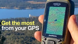
I'm new to GPS hiking. How does your GPS device know that you are on your track? Does the CalTopo overlay the installed Garmin topo map once you are in the field at your starting waypoint (the one you drew at home on your computer)? I am planning a canoe trip and my Etrex 20x already has the Garmin Topo map installed. Do I just draw up my route on Basecamp and transfer my route, then when I get to my starting point the Etrex will find my track and overlay it on my topo map?
Yup exactly. The route you draw on caltopo is an overlay, it is overlaid on top of the base map. Just make sure to enable the track you created in the track manager on your GPS, if this is not already done by default. This gps stuff can be confusing, it takes a couple trips on the field to get the hang of it


we are closely following you on fb posts. Stay safe on the BRT. I should admit I never have heard of such trail until you brought it up in your announcement. Always learn something new with you crazy hikers!
The BRT is my creation. I had been working on it as a bit of a side project, and after canceling the GET this spring, just decided to go for it! Hope you enjoy the updates. Can't wait to share the videos with you this fall!
Thanks, Famous! I am going to try out Caltopo. And, I'm gettin' excited for your GET hike!
Yes check it out, I think you will like it! GET is 3 weeks away now, gonna have to see where we're at in another 2 weeks though... resupply already looks tough, many common hiker items are sold out (granola bars, protein bars, tp, hand sanitizer, mountain house meals etc). And who knows what kind of travel restrictions and things will be in place tomorrow, let alone 3 weeks from now. Lots of additional logistical challenges. I want to be super excited right now for the GET but also trying to be realistic. Ugh!
@@SeekingLost You make valid points. I have wondered about the thru-hikers especially when, at times, hikers eat/lodge at trail towns. That throws a wrinkle in the journey, but you mention other things as well to figure out. It's an additional challenge. On the other hand, a sojourn sounds like the best remedy to avoiding the modern world crowds! Wishing you well, and other thru-hikers, on the weeks ahead.
Good video. Glad to see you are still around. If you get the chance generate more content and your subscriber base will grow. You provide good content. Video ideas, where did your CDT hiker name originate? I don't think it was in any of your previous vids. Also are you still in touch with Hopeful and Katie? Future hikes with them?
Hey thanks Bill, I appreciate that. I wish I had more time to dedicate to content creation, I've got a long list of videos I'd like to make. I've been spending most of my free time creating a new cross country style thru hike route in the west.... Nevada, Oregon, Idaho, Wyoming, northern Utah, Colorado, southern Utah and Arizona. I'm hoping to get a video out soon on that with more details.
Good question about the trail name... so when i first arrived in Lordsburg to start the CDT, I was walking down the street and saw a couple hikers. They introduced themselves, and one of them said "oh you must be Eric". I never met them before, I was trying to understand how they knew who I was. I asked how she knew my name, and she said "oh you're famous". After a few times being called "famous" the name stuck. Ultimately though it was the CDT facebook group that we were all a part of that was the connection.
Yup Hopeful, Katie and I all still talk. I was trying to get a little reunion together for the 3 of us with a hike in the Winds this summer. One of them will not be able to make it, but still planning on getting out there. Wind River Range High Route 2.0! Katie joined me for my hike in Glacier National Park last September, second attempt at the highline trail: th-cam.com/video/Eal0c09Ku6o/w-d-xo.html
Thank for sharing your knowledge! This will be so helpful!
Tnx for bringing in. Now, does it work with Zumo 660 as well ???
No clue, give it a shot!
CalTopo also has a phone app now for those who use their phones for GPS navigation
Yup they do. I'm planning on using the caltopo app as my navigation backup for the GET.
Hi. Is that the desktop app? The current web app doesn't have the same toolbar - so no export etc...
This is the web version. It used to look like the desktop version currently does, until a few months ago
Is it still possible to export KMZ maps with layers? I don't see that option anymore.
I'm new to GPS hiking. How does your GPS device know that you are on your track? Does the CalTopo overlay the installed Garmin topo map once you are in the field at your starting waypoint (the one you drew at home on your computer)? I am planning a canoe trip and my Etrex 20x already has the Garmin Topo map installed. Do I just draw up my route on Basecamp and transfer my route, then when I get to my starting point the Etrex will find my track and overlay it on my topo map?
Yup exactly. The route you draw on caltopo is an overlay, it is overlaid on top of the base map. Just make sure to enable the track you created in the track manager on your GPS, if this is not already done by default. This gps stuff can be confusing, it takes a couple trips on the field to get the hang of it
Thank you for the explanation!
👍🏻🇺🇸