Great video. You helped me decide to purchase the DJI Mavic 3 Enterprise to expand my drone photography services. I will most definitely be watching this series of yours for more tips and tutorials.
Yes it can (I tested this morning). You will need the RTK module installed the same as with the M3E. If you don't have one let me know and I'll point you to where you can get one a bit cheaper than buying in the US.
Hello, I'm new and I've already seen many of your videos. Question: to use the DJI MAVIC 3E+ the RTK Module, is it mandatory to also purchase the D RTK-2? I am thinking about doing topographic surveys, what precision would I obtain with and without RTK.
Hi. Thanks for the question. No, it is not necessary to buy the D-RTK-2 if you have an RTK unit. You have several options: 1. D-RTK-2 - this is your own base station but must be placed on a known point. If you know how to create a known point - great. If not, see my other video that shows how to find an existing one th-cam.com/video/Bt8MfWU0Q8I/w-d-xo.html. Note that the D-RTK only works with DJI - it is easier to set up on DJI but if you buy another type of drone or want to use it with a GNSS rover then you could be stuck. 2. Buy another precision GNSS rover, such as an Emlid Reach RS2 or RS3. The M3E can connect to this easily and it is cheaper and works with anything, so you are not locked in to DJI which, if you live in the US with the law changes proposed might be a good thing. 3. Use a CORS / NTRIP server. These are base stations that are all over the country. that broadcast connection signals that you can connect to over the internet. Many municipalities have free ones that you can connect too and there are also paid ones. I showed how to do this using Dronelnik in a previous video (th-cam.com/video/2wQCyeOGqYc/w-d-xo.html) and using it with Pilot 2 is very similar. This also has information on how to buy an RTK module at about 1/3rd the US price (if you are in the US). I will also be putting out a new video tonight that shows how to connect to a free service that is a global called RTK2Go so if you are subscriber you will get notified of that when it goes out this evening. Hope that helps!
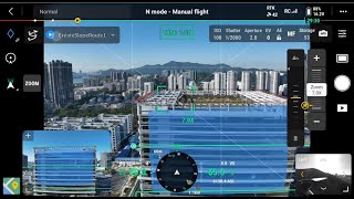
Doing a test mission today, and the drone couldn't get down low enough because of obstacle avoidance to capture the base of the facade. I set the downward avoidance to 3'. Any other suggestions?
@@dragonflyguyana here is a link that will show dealers around the world. emlid.com/dealers/. There is no reason why it would not work in South America, however I would suggest contacting Emlid directly in case there are any differences in software such as licensing restrictions or language differences.
Que buen video, muchas gracias. Queria preguntarte cuando se necesita cubrir toda la fachada como se hace? Porque veo que permite cubrir una area pequeña pero cuando es mas grande como se podria configurar para que no exista diferencias en la fotogrametria.
Sorry - I think I need a bit more information. Are you asking when it is legal to use it (which will vary by location) for mapping and cartography? Or are you asking about areas where the maps you generate can be used/sold to clients?
@@mundocoban It can be, but it really depends what you need to achieve. A drone is just a tool so it can be used for a lot of things. Do you have a construction client that needs something, or you want to sell them your services?
I don't deliver to clients using TH-cam - that's just for training videos. I have portals that can host geotiff photos (orthos/maps), 360 photos, standard images and video. These are put into a portal - usually with regular captures so that the clients can compare progress on site. The portal I use depends on the client needs. So if you can tell me what products you expect to deliver I can offer some suggestions on software that can do that.


I would have never figured this out on my own. Thank you so much!
You're welcome! Glad it helped.
Superb tutorial! By far the best explanation for this type of missions. Thank You
Glad it helped!
I didn't even suspect this! Thanx
You're welcome!
Great video. You helped me decide to purchase the DJI Mavic 3 Enterprise to expand my drone photography services. I will most definitely be watching this series of yours for more tips and tutorials.
Glad I could help! The M3E is a mapping beast!
Thanks for creating this, really useful to see it being used. Look forward to trying out myself.
Glad you found it helpful
Fascinating. Good to have yet another tool/service to offer to clients. "You can do that?!" 🙂
Knowing how to use the tools available really helps to build confidence
Excellent video! question does the mavic3 thermal have these features that were presented?
Yes it can (I tested this morning). You will need the RTK module installed the same as with the M3E. If you don't have one let me know and I'll point you to where you can get one a bit cheaper than buying in the US.
Hello, I'm new and I've already seen many of your videos. Question: to use the DJI MAVIC 3E+ the RTK Module, is it mandatory to also purchase the D RTK-2? I am thinking about doing topographic surveys, what precision would I obtain with and without RTK.
Hi. Thanks for the question. No, it is not necessary to buy the D-RTK-2 if you have an RTK unit. You have several options:
1. D-RTK-2 - this is your own base station but must be placed on a known point. If you know how to create a known point - great. If not, see my other video that shows how to find an existing one th-cam.com/video/Bt8MfWU0Q8I/w-d-xo.html.
Note that the D-RTK only works with DJI - it is easier to set up on DJI but if you buy another type of drone or want to use it with a GNSS rover then you could be stuck.
2. Buy another precision GNSS rover, such as an Emlid Reach RS2 or RS3. The M3E can connect to this easily and it is cheaper and works with anything, so you are not locked in to DJI which, if you live in the US with the law changes proposed might be a good thing.
3. Use a CORS / NTRIP server. These are base stations that are all over the country. that broadcast connection signals that you can connect to over the internet. Many municipalities have free ones that you can connect too and there are also paid ones. I showed how to do this using Dronelnik in a previous video (th-cam.com/video/2wQCyeOGqYc/w-d-xo.html) and using it with Pilot 2 is very similar. This also has information on how to buy an RTK module at about 1/3rd the US price (if you are in the US).
I will also be putting out a new video tonight that shows how to connect to a free service that is a global called RTK2Go so if you are subscriber you will get notified of that when it goes out this evening.
Hope that helps!
@@aviosmedia Great, thanks for your response. Resolve my doubts.
I will be attentive to the new video!
Great
Doing a test mission today, and the drone couldn't get down low enough because of obstacle avoidance to capture the base of the facade. I set the downward avoidance to 3'. Any other suggestions?
It's quite a wide angle lens, so my assumption is you are too close to the building. Try moving back a bit. That will also help with gps accuracy.
Does the emlid work outside the US? We operate in South America and are looking for a good Base and Rover to use with the M3E.
@@dragonflyguyana here is a link that will show dealers around the world. emlid.com/dealers/. There is no reason why it would not work in South America, however I would suggest contacting Emlid directly in case there are any differences in software such as licensing restrictions or language differences.
Que buen video, muchas gracias. Queria preguntarte cuando se necesita cubrir toda la fachada como se hace? Porque veo que permite cubrir una area pequeña pero cuando es mas grande como se podria configurar para que no exista diferencias en la fotogrametria.
You just need to be far enough away to fit everything into the picture before pressing C1. Then adjust the size to cover the area you need.
Gracias @@aviosmedia
Welcome!
Nice!
Thanks!
Recently, I bought a M3E for mapping and cartography, In What circunstances can I use this tool?
Sorry - I think I need a bit more information. Are you asking when it is legal to use it (which will vary by location) for mapping and cartography? Or are you asking about areas where the maps you generate can be used/sold to clients?
@@aviosmedia Thanks, I mean this solution is for construction?
@@mundocoban It can be, but it really depends what you need to achieve. A drone is just a tool so it can be used for a lot of things. Do you have a construction client that needs something, or you want to sell them your services?
@@aviosmedia the second is the answer, I am geologist and usually I use photogrametry. How do you record this work an then you can show by you tube?
I don't deliver to clients using TH-cam - that's just for training videos. I have portals that can host geotiff photos (orthos/maps), 360 photos, standard images and video. These are put into a portal - usually with regular captures so that the clients can compare progress on site. The portal I use depends on the client needs. So if you can tell me what products you expect to deliver I can offer some suggestions on software that can do that.
Wow..Great idea with this Slope feature..I was using the Area mapping tool and did not try something like this..Useful and very I sightful here🙏🏼🙏🏼🦺
Glad it was helpful!