Nice. Thanks Rich. I’ve used this software a couple times. I’m in the process of starting up my business. I’m in my last class to get my certificates in UAV Drone mapping and GIS. Hopefully soon, I’ll get it off the ground. I’ve done several “practice” mapping jobs from areas around where I live and learned quite a bit just from that. I enjoy your videos, very informative. Thanks again. Dave
Very cool Dave! I personally enjoy doing the modeling flights, and time lapse work with construction groups. I think seeing things come together over time, and documenting that type of work is enjoyable. Glad you're enjoying the videos here as well. :)
Dave , Rich is a great instructor / mentor. You should think about joining the Patreon. We have a great bunch of guys. We learn and help each other whenever we can. Congratulations on your mapping Cert.
Looking forward to the video/ course where you cover the ground control points. Will you be using the data in Agisoft to produce contour lines and more accurate measurements? I hope you cover choosing placement for the gcps and the acquisition of their GPS data.
That's the plan! I'll also be testing with WebODM as well as Metashape. I've already done one series recently that hasn't been posted yet. It shows what inaccurate measurements can do. I want to share the good and the bad.
I am completely new to this field I just bought a dji mini 3 a few days ago and it’s still in the box. Do you take all the pictures manually? Or how do you get the images? Is there an application you use?
Congrats on the DJI Mini 3. I haven't tried that one out myself, but looks really nice. If you're looking to create Ortho models or 3D models you'll most likely want some type of autonomous flight app like Drone Harmony, Map Pilot Pro, Pix4D Capture, Litchi 3 etc (there are a lot of autonomous capture apps out there). The app flies a grid pattern and collects images every so many seconds or so many feet. Taking images manually would be tough especially on big sites. At present I'm not sure what apps work with the Mini 3 yet. Just looking at Litchi's supported drones, they currently don't list the Mini 3. Also looking at Pix4D's Capture the mini 3 is not yet supported. That doesn't mean they won't support the Mini 3, but sometimes it takes time with newer drones.
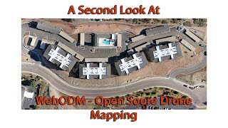
Drone data is used for a lot of services beyond the ones we provide. Agriculture, infrastructure, transportation, construction, and more. In the case of a lot of the work we do, clients want to see the changes to their build sites over time. We produce before and after orthomosaics, 3D models, time lapse still photography, and time lapse video. Clients can look at our latest reports and see how much has changed on their job site over time. To learn more, check out classes.azdrone.net/p/make-money-with-your-drone
So far I've been feeling comfortable with it. It's a very simple interface, with a lot of tools hidden beneath the surface. Since it's open source you'll find a glitch here and there, and you'll probably spend time checking through the forums on it. For beginners level, I think folks will ease into it nicely. When you want to tweak more of the settings I can see it getting more complex.
Good morning. The WebODM Class link is: classes.azdrone.net/p/beginner-s-guide-to-webodm-open-source-mapping-and-modeling There's a 40% off discount as well if you use the coupon code "40PERCENT". There are several videos available to Preview as well.
You can use the Mavic Air2s with WebODM. WebODM just assembles your models with the images you provide it. The bigger question is whether or not you can use an autonomous flight app like Drone Harmony, Map Pilot Pro, Drone Deploy, etc. And checking the app developers "supported drones" I found that you can use the Air2s with Drone Harmony, Map Pilot Pro, and Drone Deploy. If you're interested in other flight apps just check their supported drones information to make sure the Air2s is on their list. You should be good to go!
WebODM's command line interface does make it feel like older applications. Fortunately with their Web interface newer users should be able to get a start into modeling, and learning more about it. And since its open source there's a larger development community behind it.


Love the info and channel, subbed a while ago, but also wanted to say, I think you could be a stunt double for Bill Hader, which is a compliment.
LOL!
Nice. Thanks Rich. I’ve used this software a couple times. I’m in the process of starting up my business. I’m in my last class to get my certificates in UAV Drone mapping and GIS. Hopefully soon, I’ll get it off the ground. I’ve done several “practice” mapping jobs from areas around where I live and learned quite a bit just from that. I enjoy your videos, very informative. Thanks again.
Dave
Very cool Dave! I personally enjoy doing the modeling flights, and time lapse work with construction groups. I think seeing things come together over time, and documenting that type of work is enjoyable. Glad you're enjoying the videos here as well. :)
Dave , Rich is a great instructor / mentor. You should think about joining the Patreon. We have a great bunch of guys. We learn and help each other whenever we can. Congratulations on your mapping Cert.
@@jerseydronephotography7430 thank you. Maybe I’ll check it out!
Nice recap. Looking forward to the whole series and I'll grab the Teachable sub once you release that one too 🙂
The course is coming along. I have several beta testers at the moment, and as I get their feeback I'll be improving it before the final launch.
I built a comm site on Hi Lonesome about 40 miles NE from Roswell.
Looking forward to the video/ course where you cover the ground control points. Will you be using the data in Agisoft to produce contour lines and more accurate measurements?
I hope you cover choosing placement for the gcps and the acquisition of their GPS data.
That's the plan! I'll also be testing with WebODM as well as Metashape. I've already done one series recently that hasn't been posted yet. It shows what inaccurate measurements can do. I want to share the good and the bad.
@@AZ-Drone
Perfect 👍👍👍
I am completely new to this field I just bought a dji mini 3 a few days ago and it’s still in the box. Do you take all the pictures manually? Or how do you get the images? Is there an application you use?
Congrats on the DJI Mini 3. I haven't tried that one out myself, but looks really nice. If you're looking to create Ortho models or 3D models you'll most likely want some type of autonomous flight app like Drone Harmony, Map Pilot Pro, Pix4D Capture, Litchi 3 etc (there are a lot of autonomous capture apps out there). The app flies a grid pattern and collects images every so many seconds or so many feet. Taking images manually would be tough especially on big sites.
At present I'm not sure what apps work with the Mini 3 yet. Just looking at Litchi's supported drones, they currently don't list the Mini 3. Also looking at Pix4D's Capture the mini 3 is not yet supported. That doesn't mean they won't support the Mini 3, but sometimes it takes time with newer drones.
Hi there! Do you know if it is possible to export from WebODM to some format that can be used in Sketchup?
Hey could you make a video on what exactly this data is used for? Why would I as a construction company care about a 3D modeler photo Mosaic of the
Drone data is used for a lot of services beyond the ones we provide. Agriculture, infrastructure, transportation, construction, and more. In the case of a lot of the work we do, clients want to see the changes to their build sites over time. We produce before and after orthomosaics, 3D models, time lapse still photography, and time lapse video. Clients can look at our latest reports and see how much has changed on their job site over time. To learn more, check out classes.azdrone.net/p/make-money-with-your-drone
Is webodm easy to learn ?
So far I've been feeling comfortable with it. It's a very simple interface, with a lot of tools hidden beneath the surface. Since it's open source you'll find a glitch here and there, and you'll probably spend time checking through the forums on it. For beginners level, I think folks will ease into it nicely. When you want to tweak more of the settings I can see it getting more complex.
Where are your WebODM courses?
Good morning. The WebODM Class link is:
classes.azdrone.net/p/beginner-s-guide-to-webodm-open-source-mapping-and-modeling
There's a 40% off discount as well if you use the coupon code "40PERCENT".
There are several videos available to Preview as well.
Can i use a Mavic air2s with webodm? anyone know?
You can use the Mavic Air2s with WebODM. WebODM just assembles your models with the images you provide it. The bigger question is whether or not you can use an autonomous flight app like Drone Harmony, Map Pilot Pro, Drone Deploy, etc. And checking the app developers "supported drones" I found that you can use the Air2s with Drone Harmony, Map Pilot Pro, and Drone Deploy. If you're interested in other flight apps just check their supported drones information to make sure the Air2s is on their list. You should be good to go!
@@AZ-Drone Thank you so much. Map pilot pro actually is not unlimited i guess right.
@@AZ-Drone you rock thank you. when using map pilot pro, can i use it multiple times or do I need to pay?
@@AZ-Drone I don’t need to buy an autonomous flight app if my drone app already got that option?
@@henriettahawkins5349 correct 👍
its like old DOS systems.
No customer support - what a shame as it looks like you made it 80% of the way. Newbies need a contact phone contact.
WebODM's command line interface does make it feel like older applications. Fortunately with their Web interface newer users should be able to get a start into modeling, and learning more about it. And since its open source there's a larger development community behind it.