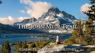
This was the longest hike I have done to date and most favorite by far! The fresh alpine air, scenic vistas, mountain passes, wilderness, and hiking with my good friend @harmenhoek were key attributes in making the experience very memorable for me. There is something so magical about the Sierra Nevada Mountains that keep drawing me back. I hope you enjoy the film as much as I enjoyed hiking the North to South Lake Loop trail and editing the various clips together. Many more films to come this year - enjoy!! 🏕
@@jeffreyvasquez3911 did I? Doesn’t feel like much, especially when starting early. In retrospect, I could have used maybe 1 more night between Wanda and Bishop Pass trailhead, but we were racing a pretty big storm.
@@Sheety33 you are going with an incredible pace, we tried the same route and could hardly do half the mileage. The high altitude and packs slow us down considerably.
I have to agree. I've hiked many miles in the Sierra mountains since 1975 and the Loop is still my favorite. You really captured it well. The Golden Trout fishing in Evolution Creek is outstanding. And Piute creek is great, too. What about that climb up from LeConte to Bishop Pass!!
Amazing job as always 😍 SOOO wonderful and unfortunately rare to enjoy a backpacking video without music added. You do the best backpacking videos on TH-cam!
Like 180, Great impressive footage capturing the beautiful alluring scenery as the gift of the mother nature that entice some of the viewers to keep on watching, thanks for sharing and bringing us to this wonderful relaxing place and stay safe always.
Hi Scott, lover your videos. Couple years back loved a video you did in Rock Creek and the fall colors. It got me back into doing trips to the eastern Sierra. My question is when did you do this loop and where did you cross the SJR with the bridge gone?
Excellent filming, North/South loop is incredible. I'm excited to get back to the Sierra next year, headed for Ionian Basin. One of the prettiest ranges in the world.
Trip looks great! Those were some long days too. Can you explain the "trail" v.s. "hiked" miles and also the logistics of getting back to your starting point "A" from your ending point "B". (If this is all explained in a future video, I'm happy to wait until it's posted for the answers).
Great questions! In reading trip reviews, the official distance is around 52 trail miles, meaning the trail is 52 miles long from point A - B. My mileage came in just over 70, possibly due to camera set ups, walking around camp, and maybe even slightly deviating from the trail here and there. I was lucky to have my parents drop me off using their car at the Piute Pass trailhead, and left my car parked at the Bishop Pass trailhead. There are summertime shuttle options however which can be booked in advance with Eastern Sierra Transit. This hike almost needs a video guide!
@@Sheety33 Thanks for the reply. Definitely on my bucket list of hikes. That's good info to know regarding mileage and shuttle service. Nice to have someone able to drop you off at the starting point too! Happy hiking.
Hi neighbor!!! I love your videos and they have been a big inspiration to me. I will be doing this similar trip. I’m wondering, is it better to do this around 3rd week of July or 2nd week of September..??
Thank you so much. I recommend later in the season - especially given the snowfall the Sierra has and will likely continue to receive this spring. Hope this helps!
@@joveccastelo4456 thermarest makes pretty good light weight sleeping pads. For a lightweight, warm, and compact blanket I would recommend an Enlightened Equipment quilt.
Amazing as always, very cool you met up with Harmen. How much food did you bring? How many calories you think you consumed a day? Also batteries for the cameras, portable charger enough to recharge them for the entire trip or solar needed?
Brought too much food - calculated 4500 calories per day and ended up consuming about 3,000…no shortage of calories :) I took 6 a6500 batteries, and probably used half, along with a 20,000 mha bank. Had plenty of power on the trip.
Beautiful, thanks for sharing! I did notice one thing … you usually tap the sign as you enter the JM wilderness ( or other similar signs) but you didn’t this time!


This was the longest hike I have done to date and most favorite by far! The fresh alpine air, scenic vistas, mountain passes, wilderness, and hiking with my good friend @harmenhoek were key attributes in making the experience very memorable for me. There is something so magical about the Sierra Nevada Mountains that keep drawing me back. I hope you enjoy the film as much as I enjoyed hiking the North to South Lake Loop trail and editing the various clips together. Many more films to come this year - enjoy!! 🏕
Curious to why you hike so many miles in a day. Especially being so beautiful.
@@jeffreyvasquez3911 did I? Doesn’t feel like much, especially when starting early. In retrospect, I could have used maybe 1 more night between Wanda and Bishop Pass trailhead, but we were racing a pretty big storm.
@@Sheety33 you are going with an incredible pace, we tried the same route and could hardly do half the mileage. The high altitude and packs slow us down considerably.
Awesome job Scott! It was great having someone around on trail for once!
Thank you - enjoyed the adventure!!
I have to agree. I've hiked many miles in the Sierra mountains since 1975 and the Loop is still my favorite. You really captured it well. The Golden Trout fishing in Evolution Creek is outstanding. And Piute creek is great, too. What about that climb up from LeConte to Bishop Pass!!
Thank you! It’s a climb up Bishop Pass from LeConte, but what got me was the subtle climb from the JMT / Piute Pass junction to Wanda Lake!
Yes. The hike/climb from the bridge at San Juaquin to Muir Pass Summit is a looooong one
Pristine and magnificent beauty of world! Thanks for sharng your adventurous experience and making the video. It's awesome!
Your best film ever! Epic trek! You crunched some big daily miles.
Thank you so much!😊
Amazing job as always 😍 SOOO wonderful and unfortunately rare to enjoy a backpacking video without music added. You do the best backpacking videos on TH-cam!
Wow, thank you!! Appreciate the good words!🙏
Wow, such a great adventure! Absolutely stunning work my friend! This looks spectacular!
Thank you very much!
Awesome video!!! Headed to the Sierras in Sept...can't wait! Love watching all of your backpacking videos...they get me pumped up to get out & hike!
Thank you so much 😊
Wow! The views are absolutely amazing! Nice video! Thanks for sharing the beauty of the Sierras!
Thank you!🙏
Amazing video! Thanks for sharing, this trip is definitely on my to-do list!!
Thank you!🙏
Loved it..what more to be said 😊
Thank you!
Like 180, Great impressive footage capturing the beautiful alluring scenery as the gift of the mother nature that entice some of the viewers to keep on watching, thanks for sharing and bringing us to this wonderful relaxing place and stay safe always.
This is your best video sp far. Wonderful.
Thank you so much! 🙏❤️
Hi Scott, lover your videos. Couple years back loved a video you did in Rock Creek and the fall colors. It got me back into doing trips to the eastern Sierra. My question is when did you do this loop and where did you cross the SJR with the bridge gone?
Thank you! Cross the SJR right where the bridge was washed out. This was September, so water levels were slow and manageable.
Excellent filming, North/South loop is incredible. I'm excited to get back to the Sierra next year, headed for Ionian Basin. One of the prettiest ranges in the world.
Thank you! Agree - my favorite hike through the Sierra yet. I need to head to Ionian Basin - looks amazing. Have a great trip!
Amazing! This loop looks beautiful! You should try going to Lamarck Lakes, intense hike up, but stunning!
Added to the list! 🤙
Beautiful video. What time of year did you do this hike?
Thank you! End of September 2023.
Trip looks great! Those were some long days too. Can you explain the "trail" v.s. "hiked" miles and also the logistics of getting back to your starting point "A" from your ending point "B". (If this is all explained in a future video, I'm happy to wait until it's posted for the answers).
Great questions! In reading trip reviews, the official distance is around 52 trail miles, meaning the trail is 52 miles long from point A - B. My mileage came in just over 70, possibly due to camera set ups, walking around camp, and maybe even slightly deviating from the trail here and there.
I was lucky to have my parents drop me off using their car at the Piute Pass trailhead, and left my car parked at the Bishop Pass trailhead. There are summertime shuttle options however which can be booked in advance with Eastern Sierra Transit. This hike almost needs a video guide!
@@Sheety33 Thanks for the reply. Definitely on my bucket list of hikes. That's good info to know regarding mileage and shuttle service. Nice to have someone able to drop you off at the starting point too! Happy hiking.
Absolutely stunning hike! Would you mind posting a map or all trails link of this hike?
Thank you! Just added a link in the description.
Hi neighbor!!! I love your videos and they have been a big inspiration to me. I will be doing this similar trip. I’m wondering, is it better to do this around 3rd week of July or 2nd week of September..??
Thank you so much. I recommend later in the season - especially given the snowfall the Sierra has and will likely continue to receive this spring. Hope this helps!
@@Sheety33 thank you so much! Any recommendations on lightweight and comfy bed and blanket?
@@joveccastelo4456 thermarest makes pretty good light weight sleeping pads. For a lightweight, warm, and compact blanket I would recommend an Enlightened Equipment quilt.
Amazing as always, very cool you met up with Harmen.
How much food did you bring? How many calories you think you consumed a day?
Also batteries for the cameras, portable charger enough to recharge them for the entire trip or solar needed?
Brought too much food - calculated 4500 calories per day and ended up consuming about 3,000…no shortage of calories :)
I took 6 a6500 batteries, and probably used half, along with a 20,000 mha bank. Had plenty of power on the trip.
Great video Scott! What time of year did you do this hike?
Thank you! Late September
Beautiful, thanks for sharing! I did notice one thing … you usually tap the sign as you enter the JM wilderness ( or other similar signs) but you didn’t this time!
Ahh how could I have forgotten! Need to refilm this summer ;) Tapped in Harmen’s video!
Great video and thanks for doing it! Curious as to when did you do the hike?
Thank you! End of September 2023
Was the before or after the bridge collapse?
After the bridge was gone
What was the noise at Wanda Lake?
An owl?
@@Sheety33 Oh wow. Thanks. I'm going to attempt that hike in late August this year if I can.
Your videos are a great help. 👍
@@Sheety33 Hey wait, are there really owls in the Sierra Nevada above 11,000 ft?
how many snakes do u see up their ???
None this time!