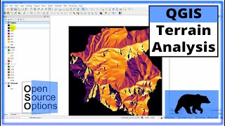
Slope Analysis/Reclassify from a DEM in QGIS 3 (in degrees/percentage)

ฝัง
- เผยแพร่เมื่อ 9 ธ.ค. 2019
- Reclassification of a Slope/Raster in QGIS 3
1. At first load your DEM Raster to Qgis canvas/screen,
2. If your Input DEM Raster is on 'Degree/WGS_1984' then,
Reproject your DEM Raster layer's EPSG from Geographic CRS 'Degree/WGS_1984' to
Projected CRS 'Transverse_Mercator/WGS_1984_UTM_Zone_..N'
#[Raster-Projections-Warp 'reproject']
3. Now, goto Raster-Analysis-Slope,
4. On processing toolbox, type reclass and select 'Reclassify by table',
5. If you want to vectorize that classified slope then go to Raster-conversion-Raster to Vector
To download Processing Algorithms (tools for automation):
1. For Projected DEM: drive.google.com/file/d/1PBRy...
2. For Geographic (WGS DEM):
drive.google.com/file/d/1dyjy... - วิทยาศาสตร์และเทคโนโลยี


thanks, heaps mate, I have been searching for a solution to my problem for ages nothing seemed to fix it. your method worked! cheers!
Thanks for video sir..sir if I would like analyze one dtm relative to another dtm as reference...and the result is a classify dtm every 1 meter above and below the reference dtm...how to do that?
I don' understand. When shapfile has been created, it doesn't look like the reclassified raster...
How can I get a shapefile with the exactly the same classes of raster?
thank you a lot...
you will have to polygonise
why the map turns orange after it is polygonized
By system, you have to categorize from symbology
How's the minimum and maximum value taken?
Checkout my latest video
why you used min
It reclassifies a raster band by assigning new class values based on the ranges specified in a fixed table. That is a comparison rules for the classification: the expression "min