
- 36
- 369 041
Philip White
เข้าร่วมเมื่อ 5 ต.ค. 2011
Hi I'm Phil White, Earth, Environment & Geospatial Librarian at the University of Colorado. The content of my videos have to do with finding library sources and data. Thanks for watching! :-)
ArcGIS Pro Geocoding & Address Locators
Quick video demonstrating how to geocode in ArcGIS Pro and connect to an external geocoding service.
มุมมอง: 10 743
วีดีโอ


LandsatLook: View Satellite Imagery Over Time
มุมมอง 7973 ปีที่แล้ว
Just a quick video demonstrating how to view Landsat imagery over time. This could be useful for just doing a little bit of "reconnaissance" or as an alternative discovery tool to EarthExplorer. landsatlook.usgs.gov/explore

What is GeoJSON? How to use it in GIS
มุมมอง 24K3 ปีที่แล้ว
In this video, I discuss the GeoJSON data standard and how to add it to QGIS and ArcGIS. Check out the NY Times Election data web map: www.nytimes.com/interactive/2021/upshot/2020-election-map.html And, geojson.io/

Finding GIS Data for GIS for Geology Class Spring '20
มุมมอง 2624 ปีที่แล้ว
This is an intro video for finding GIS data designed for the GIS for Geologists course at CU Boulder. The full playlist is available at bit.ly/findGIS

Extracting Data from OpenStreetMap using QGIS & QuickOSM
มุมมอง 177K4 ปีที่แล้ว
In this video, I demonstrate a quick and easy method of downloading OpenStreetMap data and converting it to shapefile using QGIS and the QuickOSM QGIS plug-in.
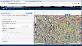
Finding & Downloading Elevation, Hydrography, & more from the National Map.
มุมมอง 6614 ปีที่แล้ว
In this video, I demonstrate how to find the National Map download application, review how to use it, and note a few stumbling blocks to the interface.

Finding Aerial and Satellite Imagery in EarthExplorer.
มุมมอง 2.3K4 ปีที่แล้ว
EarthExplorer is the USGS' site for finding and downloading a huge amount of remotely sensed data captured by US government agencies.

Finding Common Vector Data and Shapefiles: TIGER, GADM, & Natural Earth
มุมมอง 4324 ปีที่แล้ว
In this video I review my go-to sources for vector GIS data (shapefiles, that is). I review TIGER data from the US Census, global administrative boundaries from GADM, and all purpose vector data for cartography from Natural Earth.

Finding Local GIS Data
มุมมอง 7134 ปีที่แล้ว
This video covers data sources for finding local Colorado GIS data sets.
Joining Census Data to a Shapefile in ArcGIS (Table Join)
มุมมอง 6K4 ปีที่แล้ว
Demo on joining tables in ArcMap, including how to avoid the common pitfalls of Excel stripping zeros and screwing up field types.
Delineating Watersheds in ArcGIS Pro
มุมมอง 28K5 ปีที่แล้ว
A sequel to my previous video on delineating drainage basins. This one goes a step further to pick out a specific watershed. Here is the link to the Esri tutorial: support.esri.com/en/technical-article/000012346
Delineating Drainage Basins in ArcGIS Pro
มุมมอง 13K5 ปีที่แล้ว
A quick video demonstrating the process for delineating drainage basins in ArcGIS Pro. An alternative method using the watershed tool: support.esri.com/en/technical-article/000012346 Basin tool vs Watershed tool: support.esri.com/en/technical-article/000012352 An overview of the Hydrology toolset: pro.arcgis.com/en/pro-app/tool-reference/spatial-analyst/an-overview-of-the-hydrology-tools.htm
Finding FEMA Flood Zone GIS Data
มุมมอง 7K6 ปีที่แล้ว
A quick video on downloading FEMA flood zone GIS data and understanding the flood zone codes embedded in the attributes.
Adding Business Analyst Data to ArcMap
มุมมอง 4456 ปีที่แล้ว
Quick tutorial for adding Esri Business Analyst Data to ArcMap 10.6.
ArcGIS Online Sharing
มุมมอง 746 ปีที่แล้ว
This video was created specifically for Lisa Dilling's ENVS 4800 class (spring 2018), but it provides an overview of sharing in ArcGIS Online that anyone might find useful. No concurrent editing!!! Only one person can edit at a time. If two or more people try to edit an item at a time, your changes may be lost.
Web of Science: Tracking Citations, Finding Important Papers
มุมมอง 1808 ปีที่แล้ว
Web of Science: Tracking Citations, Finding Important Papers
How to Google Scholar plus pros and cons!
มุมมอง 2978 ปีที่แล้ว
How to Google Scholar plus pros and cons!
Finding Case Law with Lexis Nexis and Google Scholar
มุมมอง 9498 ปีที่แล้ว
Finding Case Law with Lexis Nexis and Google Scholar
How to Find a Book in the UW Libraries' Catalog
มุมมอง 1439 ปีที่แล้ว
How to Find a Book in the UW Libraries' Catalog
68282 Lorna Park
Wow Thanks a bunch!
Is there a way to automate downloading these for all counties in the US? Or is there a separate website that would provide these for each county within a given state and then for all the states in the US?
Thanks for sharing this great piece of information
TNX BRO
Thanks Philip, you’re a lifesaver.
Brilliant love this so helpful Legend
Hi. How can I extract roads for the past 5 years?
pefect and very helpful
How to add Open Street Map as a base map in QGIS? Please reply.....
via QuickMapServices Plugin. I found it under another comment. Thankyou so much!
Didn't work :(. The watershed layer isn't visible.
Useful one
عمل جيد
thank you very much!!
how get the building data height for LCZ properties
Can you help me create geocoding for advanced scientific data for a specific area? What are the steps to follow?
I don't know how tot hank you enough. Thanks, Thanks, Thanks, Thanks
How can I add a google Geocoding service to ArcGIS ? My country doesn’t have a dedicated Geocoding service
lost me, waay to hard to follow for a first time user......
Thanks
Hi Phil...I watched your video on creating a watershed using a DEM. I have a 2ft elevation contour feature class already created from a DEM, and want to use it as the basis for creating a watershed for a local pond here on LI. Can I do that? Do you have a video for that process?
Hi Bob, no I don't have a video quite like that, but if you have the DEM then you should be able to use that to delineate the watershed. good luck!
Thanks much Philip!! You revealed exactly what I was looking for and a couple of other bonus bits of info too.
Thanks for the easy to follow video !
Thanks a lot
Thank you for posting this, it was so much help! I’ve been struggling with finding an available census source for weeks!
they not showing small village houses how do ?
nice
Thank You
Thank you for sharing this. I couldn't find the answer how to connect to a REST service to geocode address in other searches, but I found your video. Do you know if there's a way to geocode address fields on a feature class, and not a table?
I think I figured out my answer-- I need to run Reverse Geocode to add addresses to my point feature class.
This is quite bit confusing to me I have NO IDEA of what I am doing any suggestion. Videos are to no help when all my drop down menus does not coincide with what to do next
short n crisp like White butter..mr white. thaak u
Thank you! I was struggling to figure out this source
Thank you sir for the detailed and helpful video.
Thanks a lot!!
Very Helpful! Thank you for sharing!
Just awesome, thanks!
Thank you so much for posting this video. Very helpful.
wonderful video and easy to understand
Thankyou sir to make easy to understand this GeoJSON
Guys, could you catch the software name that has explain in video
THANK YOU SO MUCH!!!!!!!
I didn't realise QGIS could do that! Cool!!
FUCKING LIFE SAVER!!!
Nice
Great video, a real clear and easy to understand explanation
Very good information thanks so much!
Can you export a shapefile to a GEOjson in Qgis?
Yep--just right click on the layer and choose 'Save Features As' and change the format to geojson
Big brain, thanks
Thanks for your great crash course! I am working on a pretty much same project. And I am having hassle with data queries! I already have a plain maps with certain boundaries and I am adding street names on! Any idea how I can search the data like street names on a map? like searching for street names on google maps?
LOL SMH I didn't have to finish this video to come to the conclusion, "&*@! ESRI!" This shyt makes me so frustrated, like tech development in retrograde. I want some points, lines, and polys to represent a rural area and a table of demographics. And I want to put in online so that it is publicly available and easy to use. As I am teaching myself R, I'm coming to the conclusion I might need to learn about JSON file type. Ok, I'm a GIS--no biggie. NOPE. Thanks for the video, now I know it's not just me.
Thanks a lot
is it possible to save each building as a separate layer?