
- 26
- 62 975
The 3rd Dimension
Canada
เข้าร่วมเมื่อ 3 ม.ค. 2009
The 3rd Dimension is non-profit with the sole intent of providing a zero-cost-to-consumer education on Surveying & Geospatial data capture and processing.
LiDAR to Design to Survey Layout - Riegl VZ600i
In today’s video we’re going to try something a bit different. I’m going to bring you along from start to finish how I went from scanning a site, turning raw data into a point cloud, cleaning that point cloud & removing off ground points, creating a surface, creating a design surface off the measured surface, calcing volumes between the two and finally staking out the design in the field.
00:00 - Intro
01:39 - Where & What?
03:19 - RiSCAN PRO
07:33 - Lets Talk About Accuracy
10:16 - Cleaning & aligning the cloud in CloudCompare
13:36 - Scanning Vs Traditional Surveying
16:05 - Earthworks Design & Volumes
19:53 - Septic Design
23:04 - Field Layout
27:01 - Final Thoughts
00:00 - Intro
01:39 - Where & What?
03:19 - RiSCAN PRO
07:33 - Lets Talk About Accuracy
10:16 - Cleaning & aligning the cloud in CloudCompare
13:36 - Scanning Vs Traditional Surveying
16:05 - Earthworks Design & Volumes
19:53 - Septic Design
23:04 - Field Layout
27:01 - Final Thoughts
มุมมอง: 743
วีดีโอ


Land Surveying Layout - Faster, Easier & More Accurate
มุมมอง 1.3K21 ชั่วโมงที่ผ่านมา
In today's video we look at a newer product from RS Survey Systems that greatly improves accuracy & efficiency of survey layout on hard surfaces. You can find more information about them here... www.meterriss.de/en/ 00:00 - Intro 00:58 - Walls 02:17 - Floors 03:29 - Ceilings 03:57 - Formwork 06:48 - Cons 09:43 - Layout Competition 15:12 - Final Thoughts

Land Surveying 101 - Total Station Levelling Error
มุมมอง 1.5Kหลายเดือนก่อน
In this video I explore the errors associated with the improper levelling of a total station and how to retain good accuracy when your instrument drifts out of level. 00:00 - Intro 00:49 - Level Compensators 01:45 - Compensator Index Error 03:15 - Standing Axis Error 04:12 - The Test 05:51 - Test Results 08:34 - Final Thoughts

The Future of 3D Scanning & LiDAR Control - RS System
มุมมอง 3.2K3 หลายเดือนก่อน
In today's video we are going to look at the one point fits all system from Rothbucher Systeme (RS) RS Website: www.meterriss.de/en/ White Paper on prism accuracy: www.meterriss.de/images/PDF/RS_White_Paper_EN.pdf Magnets I used to glue the one point disc to: www.amazon.com/dp/B0CD9M4YSB?ref=ppx_yo2ov_dt_b_product_details&th=1 00:00 - Introduction 01:20 - RSFP-X90 02:39 - Mounting Options 03:12...

Sharing Point Clouds Online - FOR FREE
มุมมอง 1.1K4 หลายเดือนก่อน
In today's video I discuss how to upload your point clouds online so that they can be shared with a click of a button instantaneously Download Link: 1drv.ms/f/s!AkXoacH8d5pAhIcx3PotzG1coqEysw?e=cf8C3w 00:00 - Introduction 01:14 - What is the PCV & how does it work? 03:15 - Web Server 03:42 - Download Source Code 04:03 - Convert your LAS 08:33 - Customization 14:22 - Final Thoughts

Land Surveying 101 - Prism Selection
มุมมอง 3.3K4 หลายเดือนก่อน
In today's video we discuss how much of an impact prism selection can have on accuracy and give you a few tips on how to make that choice for yourself. 00:00 - Intro 00:45 - A little bit of history 01:58 - Why does prism selection matter? 03:51 - Prism Centering Error 05:49 - Anti-Reflex Coating 08:09 - Prism Size 09:43 - Beam Deviation 10:19 - Pointing your prism 10:44 - Nodal vs Non-nodal 11:...

Planning Your Survey Control Network
มุมมอง 2.5K5 หลายเดือนก่อน
In this video we look at how you can make use of STAR*NET's Preanalysis tool to plan your survey control networks to give yourself a very good idea that you will hit the accuracy specification you're after. STAR*NET KML Converter: support.microsurvey.com/convert/kmlms.html STAR*NET Free Trial link: www.microsurvey.com/products/starnet/ 00:00 - Intro 02:47 - Pros & Cons 04:15 - What is Preanalys...
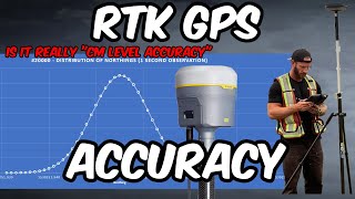
Land surveying 101 - How accurate is RTK GPS
มุมมอง 8K6 หลายเดือนก่อน
Today's video will discuss some important details to keep in mind when deciding if RTK GPS is accurate enough for the work you are trying to do. 00:00 - Intro 00:10 - Precision vs Accuracy 02:38 - What do the manufacturers have to say? 04:36 - Do RTK measurement errors follow a normal distribution? 07:25 - What causes errors in GNSS measurements? 11:04 - ISO Testing & manufacturers specs 12:49 ...

Land surveying 101 - How accurate is your total station?
มุมมอง 4.4K6 หลายเดือนก่อน
Today's video I will discuss some important details to keep in mind when you're using a total station and aiming for high accuracy work. 00:00 - Intro 01:08 - Angular Accuracy 02:28 - What is a standard deviation? 04:10 - Direction vs angle accuracy 05:52 - Use both faces 07:17 - EDM accuracy 08:10 - Point error ellipse 09:39 - Other sources of error 10:14 - Final thoughts
Improving Your Survey Control - Least Squares Adjustment with Starnet
มุมมอง 2.3K7 หลายเดือนก่อน
In this video I look at processing total station observations with different methods of adjustments. 00:00 - Intro 01:21 - Looking at different data sets 02:49 - QC methodology 06:09 - The unadjusted traverse 08:44 - Compass, Transit & Crandall Rule adjustments 09:45 - Least Squares Adjustment without common ties 10:56 - Least Squares Adjustment with common ties 13:28 - Final thoughts
Lidar Accuracy Comparison - 13 Different Sensors!
มุมมอง 2K8 หลายเดือนก่อน
In this video we are going to compare 16 different Lidar sensor data sets from some of the leading manufacturers in the reality capture industry & try to crown a champion. 00:00 - Intro 00:54 - Where & How 04:01 - Issues 06:55 - Error 09:18 - Conclusion
Photogrammetry to 3D Gaming/Cinematic Asset
มุมมอง 839ปีที่แล้ว
In this video I look at a couple techniques to increase the accuracy and density of your photogrammetry results and look at some possible uses cases of your model.
The PCV Crash Course
มุมมอง 364ปีที่แล้ว
In this video I give a fast paced, brief overview of The 3rd Dimension Point Cloud Viewer Download Link For Source Code 1drv.ms/f/s!AkXoacH8d5pAhIcx3PotzG1coqEysw?e=j6o0w6 Music by White Raven - Psychotria - httpsthmatc.col=B77C77A0
GCP vs RTK Drone Accuracy
มุมมอง 9Kปีที่แล้ว
In this video I look at the accuracy drone photogrammetry using GCPs and RTK and compare the two. 00:00 - Intro 00:34 - Field Methodology 01:24 - Connecting a to a Trimble R10 Base 02:16 - Verify RTK connection in the Pilot 2 app 02:45 - GCP color 05:26 - Defining the check points from export data 06:41 - GCP only results 08:15 - RTK flights 09:55 - Losing RTK connection mid flight 11:04 - Maxi...
Analyzing and Visualizing Scan Data
มุมมอง 727ปีที่แล้ว
In this video we discuss how to compare your scan data to design and compare scan data of the same object at different epochs and how to visualize your analysis. 00:00 - Intro 01:13 - Modelling design data 04:10 - Meshing round design objects 08:48 - Using navisworks to export an FBX 10:18 - Importing data into CloudCompare 13:16 - Signed distances along the normal 18:24 - Cloud to mesh distanc...
Improving Your Drone Photogrammetry Results
มุมมอง 10Kปีที่แล้ว
Improving Your Drone Photogrammetry Results
Cleaning a Point Cloud & Creating a Ground Surface in Civil3D
มุมมอง 7Kปีที่แล้ว
Cleaning a Point Cloud & Creating a Ground Surface in Civil3D
Setting up a Civil 3D drawing for Land Surveying
มุมมอง 1Kปีที่แล้ว
Setting up a Civil 3D drawing for Land Surveying
1 - Introduction - The 3rd Dimension Point Cloud Viewer
มุมมอง 1.1Kปีที่แล้ว
1 - Introduction - The 3rd Dimension Point Cloud Viewer
Error Propagation of a Total Station - Survey Buddy
มุมมอง 889ปีที่แล้ว
Error Propagation of a Total Station - Survey Buddy
i dont know what else to add to the actual comments, great video and great explanations.
Thank you!
@@The3rdDimensionSurveying I have noticed now that the link isn’t working
do you work in meters?
Sometimes, others in feet. It depends on the project.
@@The3rdDimensionSurveying I mean in this video. To understand what 0.1 is.
This dataset was in meters.
Awesome video! It's so nice seeing content publicly available that deep dives into different scanning platforms like this. From both the hardware and software side, it's refreshing to see deep dives that are more than just a 1-2 minute marketing video. Great work! Did you rent this Riegl or did they just hook you up for all these videos you do? I'd love to do some comparisons to our RTC's, Faro Premiums, and X9's and see just how superior the VZ 600i is, lol. Last I heard when I reached out to a rep was that it wasn't (rentals) something they offered in the US. 😢 Side note, with Leica software, unless I misunderstood your statement, you can share licenses by setting them up as network licenses. We've been doing that with all our ~20 Reg360, 3DR, and Cloudworx licenses. They're shared between about 50 users and as long as one is available, anyone can pull the license. Works well so long as your license server/Internet doesn't go down 😆.
Thank you! No it wasn’t a rental or a freebie unfortunately, that would have been nice. We do have an RTC as well so expect a comparison in the not too distant future. There are pros and cons to each. Yes you can check out and check in licences for register360 but one licence cannot be used by two users simultaneously. With RiSCAN, that is not the case. There is no checking in and out and multiple users can work in RiSCAN at the same time. Considering the amount we pay for a scanner it’s an odd business tactic to sell a tool that is useless without paying a yearly fee and that yearly fee being stuck to one user at a time makes it worse. I can see it from a solely software based company that needs continual income to fuel R and D but I’m not a fan of the pay to play approach that hardware manufacturers take with their processing software that makes the scanner useless without it. Coming from a customer, this 100% affects where I’m willing to spend my money. But at least it’s better than the pay to process approach that other manufacturers take, that we also own hardware of, which is many times worse than a floating license. Haha yes, the check in/check out process can be frustrating for sure.
Ah, that is an interesting and much better approach to licensing with RiScan Pro. Thanks for the clarification. I look forward to any comparisons you have planned for the future! It's always one thing to see the white paper comparisons Leica does behind the scenes to compare their systems to competitors like Riegl, but for end users like ourselves, understanding the whole process start to finish for real world projects and scenarios is far more valuable than something done in an almost laboratory controlled environment, haha.
My dream is to watch an 1hour video of you just working in the field and showing your procedures to make such great science and piece of art called surveying.
I love this! Riegl is so pricey but it seems like maybe its worth it!
Once again, another great video. How does a Canadian surveyor get a gig down in florida?😅
Amazing video once again! This channel is an absolute gem, and I'm so grateful that someone is putting information like this out there. I did schooling in Geomatics, but as I've entered the industry I've realized I have been woefully under prepared on real world best practices and procedures. I would love to see more videos like this if you ever have the time, just showing how you go from an initial request to final deliverables. Thank you once again, also would love to support this channel if you ever create a patreon or something.
Thank you very much! Absolutely, I will try to work in real world jobs into future videos more.
I am always amazed with the speed and amount of data that can be gathered with a scanner ten minutes from out of case for a single scan to putting it back is about the same as we get from our Faros but we don't have the built in rtk. I can't think of a reason we would use it besides to help with registration. the accuracy we would want to be using a traditional scanner versus a mobile scanner would make it kind of hard not to use a total station to establish control just to maximize the accuracy of the scan. We are now using the RS systeam due to your video and we have done an entire waste water treatment plant with it and are getting phenomenal results from so thanks for your videos
I agree, given the accuracy spec of the point cloud "controlled" by the RTK antenna, there really would be few use cases for us as well. And I really haven't struggled with registration when I haven't used the RTK antenna either. I could see some outfits having niche use cases for the optional RTK antenna but I would imagine they are the exception, not the rule. Perhaps if a company only needed less accurate point cloud data and didn't have SLAM, Mobile or Aerial LiDAR available to them and only had this I could see it but the main reason we opt for terrestrial scanning over those other options is accuracy. Thanks fantastic to hear about your experience with the RS system. It's a hidden gem, but hopefully not hidden for too much longer.
I use the rtk only for registration. I always tie in with control points. Seperately. But great scanner for sure. I use a vz400i. Filtering should be done in Riscan while you have it. not in cloudcompare. Also tie in with control is very easy with Riscan. I do all upon exports in Riscan
Absolutely, and we do too if the necessary accuracy spec of that job dictates we should. That was really the main point of running the scan this way, to test the claims of 1-2cm in absolute accuracy from RTK alone. Yes, the method of aligning data to control really is quick and easy in RiSCAN. I'll respectfully disagree with your statement "Filtering should be done in Riscan while you have it. not in cloudcompare." Cleaning the point cloud can and should be done wherever it is done the best. If you can do a better job in RiSCAN than CloudCompare, by all means, that is the right tool for you. If someone else has different tools available to them that do a better job, then that is the right tool for them.
@@The3rdDimensionSurveying didn't mean you shouldn't use another software but Riscan uses all the parameters from the measured data the best. My 2cts of course.
Ahhh I see. To be honest I need to put more effort into learning all the filtering tools of RiSCAN. Like I said in the video, it really is an impressive piece of software.
This channel is pure gold! Thanks for your effort!
Thank you for sharing this!! I always appreciate your content, honest opinions, and how thoroughly you test and demonstrate new products on the survey market! I always like to hear what you have to say and learn some new tips and tricks of the trade!
Two things: Most building sites I work on wouldn't benefit from this because of sighting issues. More often than not, there is something in the way. Second, why don't you glue a small bubble to the thing yourself? You can buy one pretty cheaply.
1. Of course, you’ll need line of site. If you couldn’t use the RS150M you couldn’t use a mini or RL and if you’re using a full size rod then you’re only working on the ground and much less accurately mind you. That is but a fraction of where one would use the RS150M. It’s up to the surveyor to decide when to make the extra effort of setting a new setup point to maintain line of site or accept the degradation in accuracy by adjusting methods to be more efficient. 2. The minor benefit of having a spirit level bubble providing a flat BM line is far outweighed by me trying to glue a cheap little bubble vial on it and hope it’s level. I’d hate to Frankenstein a beautiful piece of equipment that way. That being said, RS actually reached out and informed me they are currently working on a bubble adapter for the reason I mentioned in the video.
Great videos! For the examples of utilisation you showed it's unbeatable. If you ever forget it at the office try "free-handing" the peanut prism against the wall or floor or use the little "C" shaped piece of metal that comes with the peanut prism.
i spoke with Georg at Geobusiness and he did have a prototype with a bubble vail. I asked him a few weeks ago to implement that for vertical ines. He will work on it for future release.
Man, I loves your stuff. Binging watching all your videos. 💯👍
thanks
Awesome review guys, great job 👏🏻
always comp. level your base before you attach your scope. feel the ground and ensure no vibration or movement occurs.
please reupload datasheet this item might not exist
1drv.ms/x/s!AkXoacH8d5pAhJoQKFZxGUBbTAsqzA?e=5DT3qm
@@The3rdDimensionSurveying THANKS
Great video, I frequently use traverse editor and had not used side shots before. With bearings/distances, I like to use the number format so I can keep my hand on the numpad. For example, N 54-47-19 E would be 1..54.4719 where 1 is quadrant 1 for NE. May be helpful with your work. Thank you for your videos!
If I could give you 100 thumbs-up, I would. Excellent video. Hands-down the best RTK primer for surveyors I've seen on you-tube. Bar none. There are too many right out of college 2nd year practitioners giving half-good advice here. I'm happy to say that this video is nothing of the sort. Let me detail why I can say that and why my opinion might matter a little bit. I've been active as an RTK surveyor since the mid 90's, built and manage a GNSS network, trained surveyors for 2 decades, spoken at our state conference on RTK precision, help with standards development for a large state DOT, evaluate new systems before we purchase them and many other aspects of this work in my 33 year career. I've been doing these test you show for 20 years. I got fed up in the early 2000's when I couldn't get a straight answer, just like you described, so I started testing myself. I am constantly amazed at how well RTK works, as well as how it can hurt you when you trust it too much. My findings match yours very closely and really haven't changed much in the last 20 years. Around 2008 or 2009, I saw a slight bump in vertical precision when we started using RTN. I estimated that it approximately halved the PPM error, and sure enough, they ended up putting that in the specifications years later when the Trimble R10 was released. That was very satisfying. I summarize it like this (Basically what you said!!): we can generally take the specs shown as usually good to 2-sigma as long as we have low DOP and good atmospheric conditions. However, probably 1/20 - 1/50 of the measurements will be way worse than all the others, and there is no way of knowing which those are unless we shoot them again later. Also, this assumes that we have well maintained and calibrated equipment and good procedure and adherence to those procedures. Once you get into a less-than-ideal situation, all bets are off. I will say that tightly coupled inertial systems have the potential to change this dynamic under certain conditions (over a short period of time), but I'm now in a managerial role and don't supervise field crews, so I don't think I'll ever be testing that . I've run so many spreadsheets with custom stats and graphs. I've lost more than I can now find. One thing that opened a lot of people's minds was when I did a test of 'dumping' the receiver and re-measuring, which is something that I always have argued against, despite it being one of the favorite things sales-people showed us to do in the 90's when these were being rolled out. I was able to show the positional bias over a short period of time, proving that you must have a time separated measurement to get a normal distribution. I believe you shared a similar finding. I've also been combining RTK, static and terrestrial measurements for a long time and am constantly frustrated that it isn't done more, even in my department. I can't stand that people still shoot in RTK 'pairs' and then "lock 'em down" before starting a traverse. Why hold 1 elevation over another? Just hold them both and run a least squares adjustment (I use TBC and TGO before that). The way I describe the precision/accuracy is this. RTK will bring you precision, your constraint to your control and its quality brings in the accuracy. For years we would just occupy passive grid coordinates and do check shots. When we started using our RTN in the mid 2000's, we started doing site calibrations/localizations. The latter gives you a pretty good idea of your survey accuracy. Then, if you shoot 1 point on the site about 15x and run the stats, you can get an idea of the precision at that site. But that is only for the same person, using the same equipment, in the same conditions. I really can't talk about when we are going to start to reign in the non-professional activities that some are using these tools for, but a movement is afoot in my state. It isn't the tool, but the use that is the issue. The first thing that needs to get cleaned up is we surveyors have to be better at using this tool Your video here a good start, so thanks for taking the time to share this. I never had much interest in editing videos, so I do appreciate the amount of work that went into this. You can DM me if you want any additional information from me.
By far the best comment I've ever received & couldn't agree more with everything you've said. Thanks for taking the time to write this out. Too bad you've lost most of the data comparisons you've made over the years, it sounds like it would be a wealth of knowledge that would be invaluable to the younger generation of surveyors coming up!
Amazing , thank you so much for the video and very useful information.
The sun heating one leg of the tripod, is annoying, and will affect the plummet. In a case like this, the compensator works good. However vibrations can mess things up beyond what the compensator can handle. There times were you can not see a big change in the plummet, and only staking a controlpoint will tell the truth.
Great information ! Thanks.
Do you have the list of what total stations you used? Do you have the specs on what each manufacturer states the amount of compensation their compensator will handle? In situations where resections are performed with a significant temperature shift (20 degrees F up and back down) from the start to mid day to the end of the day from one set up, and no back-site rechecks performed, how well is the typical compensator performing? This example is pretty typical for general contractors self performing their own construction staking, grade checking and running machine control with a total station and a dozer. A really great video, with good info to help those who overly complicate certain aspects of how to use instruments. Looking at myself here. that's a pretty sweet location you performed your tests. Was that site pre-existing or did you develop that location for this and other videos?
I used a 0.5" Trimble S9. I do not have the compensator spec, only real world observations on how it actually performed. If there is that amount of temperature shift and a backsight isn't performed over an extended period of time you are going to be dealing with other error sources creeping in. I would be more worried about tripod hysteresis at that point. Whenever I was doing construction layout I would always have a backsight setup to reorient every 10-30 minutes depending on conditions. You'd really be playing with fire if you didnt have a point you can continually check into and reorient when doing precision layout. That is a pre-existing location, I wish I had it just for video creation.
Thank you for this comparison!!! Awesome data
if i level the station and do a resection on uneven ground (where it can easily move to 1 min out after a bit of time), are you suggesting that as long as I reset backsite I should still be accurate? Also, does distance from the total station affect anything here?
As the instrument settles and BEFORE reorientation there will be an increase in error. Once you reorient, the error caused by settlement will be reduced to a negligible level, until it begins to settle again. Distance always increases error of a total station. Both angularly and the EDM has a scaler component to the error spec as well.
Great video, thanks for all the work :)
I love your vids, I could nerd out on your shit all day!
Love your content! Thanks and I look forward to seeing the follow up videos!
good content
Youre doing God-tier work!
Loved it.
Excellent content sir
I ran a similar test - not as extensively or as systematically - some years ago with a Trimble 5603 and got similar results. Up to about 3 minutes out of level the angles were consistent. I also reached the same conclusion about centering errors. Which makes resected setups all the more attractive.
good to know, ty
Thanks for the detailed review, I wouldn't have known just how good that is if it wasn't your other videos on Total station and prisim accuracy.
Would PPK processed flights hold the same accuracy results as RTK
PPK yields better accuracy, it just takes more effort and time. It also has the benefit that you don’t need to maintain radio communication between each receiver.
It would be so great if u can tell me why my traverse resulted in such a large error: # Fixed Coordinates C 1003 836044.396 816902.257 ! ! 'Old Station C 1002 836097.870 816901.489 ! ! 'Old Station C 1004 836042.680 816876.946 ! ! 'Old Station # Observations D 1003-1002 53.480 D 1003-1004 25.370 D 1003-1 45.417 D 1-2 98.501 D 2-3 15.616 D 3-4 15.357 D 4-1002 94.586 B 1003-1002 359-10-30 B 1003-1004 266-07-12 B 1003-1 354-57-35 B 1-2 60-39-37 B 2-3 81-07-20 B 3-4 280-58-03 B 4-1002 241-20-36 B 1002-1003 179-10-30 # Fixed Bearing B 1003-1002 359-10-30 ! B 1003-1004 266-07-12 !
I can sort of see the manufacturers point, you could use their product with many different correction sources all with different outcomes in precision...
Great video, thank you. The link to your datsheet seems to not be working, is it possible fix this?
Your content has been very helpful. I've been soaking up so much knowledge from your channel. It really simplifies the complexities of the surveying world for me, making it much easier to understand. Thanks for all the valuable insights!
Thank you for the kind words!
Please somebody reply to me, when I set up the TS resection and stake out a points and move to another location and set up the TS with the same standard deviation and stake out the same point give error in the point location till 5 cm . What is the reason ?!.
There is way too many variables to give you an accurate answer based on what you've provided. What I can say is the standard deviation of your setup can hide a lot of potential error. If you're resecting off points bunched together even the smallest error will propagate significantly. If you are surrounded by resection points, your setup will have a lot more geometric strength.
@@The3rdDimensionSurveying All required parameters are available in the resection , reflector constant, resection angle and distances. I used two devices, and each device calibrated , but the results were similar
@@muhammedjawad6928 Its too difficult to say without looking at all the raw data.
@@The3rdDimensionSurveying can we contact on whats app for more information ?!. Please
We kept having our pvc sheet targets stolen and so we had an aluminum target template cut for us. We started experimenting with different paints and found that Black and/or red chalk paint works the best. The chalk paint is extremely flat and we didn't get the reflective shine when at certain angles in high sun. It's a little more expensive and messy but works so much better.
Very interesting! I've never tried matte paint before but I would imagine it would have a similar effect. Thanks for sharing!
I just find this useful video i install cloud compare sw and follow the steps but the option CSF filter is not active so any one can advise how to make it it active(I do not have Civil3D)
You need to highlight the point cloud in the file tree first
Dam! I need a DUMB video to understand how to do the things properly, in the field and in the office. I've just relized I know NOTHING. That's hurting a lot. Thanks for this awesome video.
Hello my friend! Thanks for the aweosme videi! Do you have any video telling us about working with total stations and GNSS? Wich method is the best to get all data fitted: site calibration, applying avarage combined scale factors for the entire site or applying combined scale factor for every single point of your project, accordingly to the N,E and ortho height of the point? How to survey out of site calibration and still get accurated survey data, like the total station measurements? For example for larger sites or linear projects, which method would you use to convert the GNSS data to ground? I struggle so much with these questions and how to keep things under control. Thanks if you could bring some light on this topic!
Hello! Hands down using STAR*NET. 100% the right tool for that task. I don't have a video on exactly how to do that yet, but it is on the To Do list. Hopefully within the next month or two. I really makes it amazingly easy to switch between grid and ground by exporting two separate control files and automatically calculates your CSF based on the point you want to scale about. Its fantastic at merging total station and GPS data in the same project as well. There may be other Least Squares Adjustment programs out there that do the task as well but all the others I've tried don't hold a candle to STAR*NET.
Outstanding job! BUT, for a job of this size, seems that traditional surveying with Total Station and RTK would be faster for post-processing.
You could certainly make that argument and you may be right. This was more showing the process of how the PCV can be used to digitize. It would be fun to “race” another surveyor using both methods on the same site.
I would like to send this video to my boss. I've considered spending my own money on a GMP101 just to make my own life easier. I don't think the bosses full grasp that if you're looking for a consistent under 3mm accuracy from different setups on different days over long periods of time, that you cannot expect things to work properly if you allow your layout distances to be as great as 30m away. You're already starting off with a resection that is not as tight as it should be, even if the numbers tell you otherwise. That's why limiting number of setups, distances to layout, and having checkshot locations peppered throughout the project, is how you keep things tight. Better gear, better practices, reduces headaches far more than trying to fix things. Instead, they insist on spending more and more time doing traverses. It's like, at a certain point, does doing another traverse really help, when you're not getting repeatable resections off those traverses anyways? Garbage in, garbage out. I'm a big fan of Trimbles traverse prisms. Solid, don't get to use those enough. And I've noticed that the Leica GRZ101 is still better than the knockoff versions of the GMP111' s or the non-nodal miniprisms. They're pretty consistently within 2mm of my points. Using a more old school approach to surveying with an instrument man and a party chief, non-nodal prisms still have their place...They just don't have any place in robotics...which is basically all I do these days.
amazing