TH-cam
US
The Problem With the USA's Borders
32:53
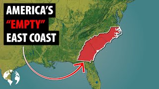
Why So Few Americans Live In This HUGE Area Of The East Coast
11:53
What If The United States Had MORE States?
14:18
ไม่น่าเชือว่าแค่ใช้ปูนและเกรียง จะทำให้ก็อกน้ำแสนธรรมดากลายเป็นสิ่งนี้ #negi #diy
00:39
规则,在门里生存,出来~死亡
00:33
มายคราฟแต่ถ้าผมเห็น "สีส้ม" คลิปนี้จะระเบิด!?
00:47
What If Every State In America Had Natural Borders? | American Politics
Monsieur Z
ติดตาม
236K
ดาวน์โหลด
โหลดลิงค์.....
มุมมอง 268 643
0
0
เพิ่มลงใน
เพลย์ลิสต์ของฉัน
ดูภายหลัง
แชร์
แชร์
ฝัง
ขนาดวิดีโอ:
1280 X 720
853 X 480
640 X 360
แสดงแผงควบคุมโปรแกรมเล่น
เล่นอัตโนมัติ
เล่นใหม่
เผยแพร่เมื่อ 27 ก.ย. 2024
ความคิดเห็น • 1.6K
ต่อไป
เล่นอัตโนมัติ
32:53
The Problem With the USA's Borders
Atlas Pro
มุมมอง 3.4M
11:53
Why So Few Americans Live In This HUGE Area Of The East Coast
Geography By Geoff
มุมมอง 6M
14:18
What If The United States Had MORE States?
General Knowledge
มุมมอง 324K
00:39
ไม่น่าเชือว่าแค่ใช้ปูนและเกรียง จะทำให้ก็อกน้ำแสนธรรมดากลายเป็นสิ่งนี้ #negi #diy
NEGI
มุมมอง 116K
00:33
规则,在门里生存,出来~死亡
落魄的王子
มุมมอง 8M
00:47
มายคราฟแต่ถ้าผมเห็น "สีส้ม" คลิปนี้จะระเบิด!?
Zalmonz
มุมมอง 274K
00:14
爸爸太笨了!被女兒套頭拿走錢都不知道去哪裡找了! #萌娃#funny#整蠱爸爸
多米和爸爸
มุมมอง 2.4M
22:15
What If Every State Had Natural Borders? Pt.2 | American Politics
Monsieur Z
มุมมอง 74K
18:53
🇺🇸 DOES YOUR FLAG FAIL? Grey Grades State Flags!
CGP Grey
มุมมอง 11M
14:55
Why The Northeast Megaregion Is So Dominant In The The United States
Geography By Geoff
มุมมอง 403K
4:42
Canada & The United States's Bizarre Border
CGP Grey
มุมมอง 28M
32:04
A Regional Breakdown of the United States - Part Two
That Is Interesting
มุมมอง 136K
10:34
What If Every U.S. State Became Independent?
General Knowledge
มุมมอง 2.5M
11:07
What's The Future Of American Politics?
Monsieur Z
มุมมอง 266K
1:30:17
Making a Map of the US Out of Wood From Each Official State Tree - Compilation
justinthetrees
มุมมอง 638K
10:17
Five Events That Will Change America By 2050
Geography By Geoff
มุมมอง 1.2M
2:21:44
LIVE : Buriram United vs Kaya FC-Iloilo | SHOPEE CUP 2024/25 | 26.09.24
BG SPORTS
มุมมอง 668K
2:08:52
🔴Live โหนกระแส ปิดกล่อง ทองแม่ตั๊ก หลายหน่วยงานจองกฐิน เตรียมดำเนินคดี
โหนกระแส [Hone-Krasae] official
มุมมอง 2.5M
15:13
โบ๊ท 14วิ ยิงประตู แรกในไทยลีก!! นรา ยูไนเต็ด VS ยะลา ซิตี้ (โบ๊ทสร้างตำนานอีกแล้วว)
Kamsing Family Channel
มุมมอง 160K
00:43
ชีวิตสุดเจ็บปวดของ ริก C-137 #rickandmorty #ricksanchez #เรื่องนี้ต้องดู #tooneytunes
Tooney Tunes
มุมมอง 252K
00:18
Officer Rabbit is so bad. He made Luffy deaf. #funny #supersiblings #comedy
Funny superhero siblings
มุมมอง 3.3M
00:23
Wow!😮 Delicious Candies Turned Into A Snail Dessert!🐌🍭 #catvideos #catmemes #trending
Oscar's Funny World
มุมมอง 27M
34:57
50 ชั่วโมง ภารกิจด่วน!! ตะลุยช่วยผู้ประสบภัยน้ำท่วม!!
OAUJUN HI-END
มุมมอง 404K
00:30
เสียสละเพื่อคนส่วนมาก เจ้าของฟาร์มจระเข้ เผยสาเหตุเชือดยกบ่อ : Khaosod - ข่าวสด
Khaosod TV - ข่าวสด
มุมมอง 1.3M