TH-cam
US
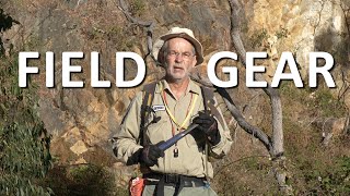
Field Equipment for Geological Mapping
9:22
Interpreting a geological map - with faults
23:33
Geological symbols such as strike and dip in QGIS (Otago Geology)
7:59
อาหมัดร่างก็อตแบกทั้งโลก! สนับสนุนโค้งเจ๋งลุยกันต่อพวกเรา หลังเกมสะใจโว้ยยย แมนซิตี้ 1-2 แมนยู
1:22:39
🔴Live : ไทย พบ มาเลเซีย #MATCHDAY รวมพลัง #เชียร์ไทยให้กึกก้อง
2:49:36
When Rosé has a fake Fun Bot music box 😁
00:23
Geological Mapping Data Workflow
GeologyUpSkill
ติดตาม
27K
ดาวน์โหลด
โหลดลิงค์.....
มุมมอง 9 441
0
0
เพิ่มลงใน
เพลย์ลิสต์ของฉัน
ดูภายหลัง
แชร์
แชร์
ฝัง
ขนาดวิดีโอ:
1280 X 720
853 X 480
640 X 360
แสดงแผงควบคุมโปรแกรมเล่น
เล่นอัตโนมัติ
เล่นใหม่
เผยแพร่เมื่อ 15 ธ.ค. 2024
ความคิดเห็น • 26
ต่อไป
เล่นอัตโนมัติ
9:22
Field Equipment for Geological Mapping
GeologyUpSkill
มุมมอง 16K
23:33
Interpreting a geological map - with faults
Rob Butler
มุมมอง 7K
7:59
Geological symbols such as strike and dip in QGIS (Otago Geology)
Otago Geology
มุมมอง 9K
1:22:39
อาหมัดร่างก็อตแบกทั้งโลก! สนับสนุนโค้งเจ๋งลุยกันต่อพวกเรา หลังเกมสะใจโว้ยยย แมนซิตี้ 1-2 แมนยู
ArmMear
มุมมอง 72K
2:49:36
🔴Live : ไทย พบ มาเลเซีย #MATCHDAY รวมพลัง #เชียร์ไทยให้กึกก้อง
THAIRATH TV Originals
มุมมอง 998K
00:23
When Rosé has a fake Fun Bot music box 😁
BigSchool
มุมมอง 6M
00:20
人是不能做到吗?#火影忍者 #家人 #佐助
火影忍者一家
มุมมอง 7M
6:57
Fake Gossans and How to Spot Them
GeologyUpSkill
มุมมอง 19K
4:58
Interpreting Old Mine Workings
GeologyUpSkill
มุมมอง 9K
6:24
Plotting Geological Structure Measurements
GeologyUpSkill
มุมมอง 3.8K
4:32
Alunite and Pyrophillite
GeologyUpSkill
มุมมอง 16K
27:46
Interpreting faults on a map
Rob Butler
มุมมอง 12K
10:23
The mapboard, reimagined digitally - building a user interface tailored field geological mapping
Daven Quinn
มุมมอง 891
14:57
Find, Buy, and Print Your Own Topo Maps
STOKERMATIC
มุมมอง 39K
10:59
Steps by step guide for how to map a geological outcrop
Catherine Mottram
มุมมอง 20K
12:49
Consulting Geo Ep.1 When to Jump
GeologyUpSkill
มุมมอง 2.9K
02:52
Stray Kids "Walkin On Water" M/V
JYP Entertainment
มุมมอง 15M
9:07:36
การแข่งขัน RoV นานาชาติ AIC 2024 รอบ Swiss Stage วันที่ 7
Garena RoV Thailand
มุมมอง 1.1M
00:27
คำนี้‼️อ่านว่าอะไร⁉️✅❌
WhiteLine TV
มุมมอง 23K
00:35
กินขนมมั้ยจ้ะน้อง หนมน้า😝
Eoirndaime
มุมมอง 151K
00:39
Part 3🌬️หญิงสาวได้สูดอากาศบริสุทธิ์อีกครั้งหลังติดอยู่ในดินโคลน #shorts #chinesedrama #cdrama
ละครหวาน
มุมมอง 58K
18:38
รวบของเด็ด! 'งานกาชาด 2567' เดินเพลินรอบสวนลุม ไม่อิ่มแน่นพุงไม่กลับ | อปป้าพาฟิน SS3 EP.60
MAWIN FINFERRR
มุมมอง 185K
1:10:57
[UNCUT] เก็บ "สจ.โต้ง" เอี่ยวมาเฟีย รู้ตัวคนบงการ ก่อนสั่งลั่นไก I คนดังนั่งเคลียร์ I 13 ธ.ค.67
ช่อง8 : Thai Ch8
มุมมอง 868K
16:46
เค้นสอบ "สุนทร-พวก " พร้อม แจ้ง 2 ข้อหาหนัก | ข่าวเที่ยงช่องวัน | สำนักข่าววันนิวส์
ข่าวช่องวัน
มุมมอง 825K