ฝัง
- เผยแพร่เมื่อ 14 เม.ย. 2024
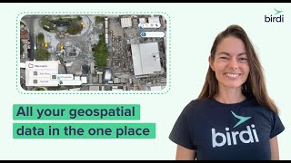
- With Birdi, you can visualize all of your geospatial data on the one map. Whether it's captured by drone, smartphone, 360 degree camera or more, you can see it altogether for contextual, location-based insights.
Go to www.birdi.io to Book a Demo or Request Platform Access. - วิทยาศาสตร์และเทคโนโลยี