If you want to master Toposolids in Revit, we offer a full Site Design and Coordination Course for Revit. You can find it here: balkanarchitect.com/p/site-design-coordination-in-revit
Great tips. I recently opened the new sample project for Revit, and it has a nice, simple approach on how to design roads: they are nothing but a subdvision, shorter than other subdvisions (such as grass and sidewalks). 😉
Modeling Landscapes is absolutel the hadest among all the disciplines. Neither architecture, nor MEP or ther engineering divisions have and need such complicated modeling. Landscape is absolutely the most challenging and it is great to see that more and more features and being added to make things easier.
Yet another half-finished "upgrade" by Autodesk. At least the have advanced part of the tool beyond 1997... Thanks for your detailed overview, Balkan Architect.
Great tutorial. @Balkan Architect, the option about CUT/FILL is OLD, more than 17 years ;). Congratulations for your patience and quality of the content. Cheers from Brazil.
subregion couldnt even do positive offsets.. only stay on the surface.. now it would be nice if it could subtract sure. but isnt worse. Now I thought the new landscape would be faster - but moving a single point of height takes 1 minute on a good pc with a recenably large landscape - ouch!
thx for the turorial. I would be more curious in Revit 2023 how would you go about making a topo for an existing house on a very sloped terrain and also phase that terrain for the proposed works. The real problem is when a house is carving into the surface and trying to phase that out. Maybe you find some time to talk about it. Thank you.
As always... Extreemely clear and concise. I would like you to know that when I did download the newest revit and saw this changes... I inmediately thought of you. Probably I´d be taking the site course in a couple weeks as well. Thanks you !
Please make a video and explain how these three parameters work in the properties of the level: On the floor above, Load-bearing structures, building a floor.
The voids are all good and well, but when the site is sloping more drastically, it does not fill the gap which exists above the surface but under the floor. So far I am not having much luck with the new Toposolids...
Excellent presentation, thank you. Another easy way to create a pad is to split the topo as you demonstrated and reset the shape, then you can adjust the height to suit. It is annoying how you can't delete sub-elements, or am I missing something?
@6:00 your import looks like it adhered to the contour lines exactly, but when I imported mine, it did not. I've gone down so far as importing 0.1m and 0.25m contour lines, but it STILL does not adhere to the contour lines. Is it possible to refine the mesh/decrease the size of the mesh faces in Revit? I've tried every different way of exporting the file with different contours/points/grids I can think of and nothing works very well.
Please make a tutorial in which you actually build a structure or a small house on an irregular site and then calculate cut and fill and put the house on same level and after that please create elevations with site line
When I use Graded Region, I have two toposolids, one in existing phase and one that has some mass removed in new phase. Revit only gives a number in the "filled" tab, but shouldn't this be in the "cut" tab?
Thank you for your video, would it be possible to do a tutorial on how to build underground while keeping the original topographyon top of the building? As this feature didn't exist in revit 2023.
Can you do a video on correct practice for detailing/annotating a Topo solid site. I find that there is an issue with dimensioning sloping gradients. Revit will now dimension lock on the hypotenuse(slope) rather and therefore site information that would be presented in 2D is different to 3D. I.E the steeper the slope of a ramp the difference between 2D and 3D will become larger. There must be a term for this perhaps.
Hi, talking about graded region, you show that moving sub elements gives the correct net cut/fill value. Is there a way to cut toposolid with in place components or families, and keep having the correct net cut/fill value, without using Environment plug in?
You are amazing! Can you show a quick video on how to plot point on excel? I do civil but we mostly work with horizontal and vertical points but you mentioned that we need “z” points 🙏
tip 1 - don't switch to revit 2024 to avoid using toposolids. Because there will be no way back to topo surfaces and you will spend 100x more time editing toposolids. And it's not an exaggeration. briefly: 1. new functions are nice 2. toposolids can't be texturized as toposurfaces could be 3. at any complex terrain adding or editing any point takes at least decades of seconds whereas at toposurfaces I could place decades of point and it would only take some time when accept changes
Nope. For complete civil earthworks, grading, long sections you still need civil 3D. Revit cannot do that. Topo solids in revit are for presentation purposes only. Specially when doing roads.
can u snap a vertex (for topo/floor/whatever) to LOWEST lidar poins in a specified radius or drape a shape on the lidar points (lowest points of course)
What I do not understand is why the toposolid is acting like a robot with such harsh contours. I am trying to create a toposolid to act the way the toposurface previously acted, where I input my topo points and it creates a smoothed organic surface. This topo solid looks like jagged rocks in the mountains! Please help me with a fix.
17:48 this subdivision can be turned on a estructural element and apply to it some rebars? It can be perfect to modeling a nailing soil, (a type of soil stabilization.)
Thanks for the tutorial, very helpful. Question, once the Toposolid has been split, how do you unsplit it or merge one toposolid to another? Without undoing? Revit 2023 used merge which was brilliant to adapt a topography to show different options as the project evolved. The join tool does not suffice, as you're still left with many pieces of toposolid. Help on the subject would be much appreciated.
when i set the visual style to realistic it just showed the usual grey material. Did you customize the materials to show grass & earth textures/colors?
Creating Toposolid by using excel points. Does it means coordinates? or can you make tutorial showing points table also that how you add and thenuse it in revit to create toposolid?
Thanks alot for the video!, I have a problem with setting the levels and adjusting the building hieght based on toposolid generated from a CAD file with real levele hights above the sea, How am i going to adjust the levels all at once? is there any method to do it! it is driving me crazy XD!
Hi. Great Video. I tried to create the toposolid from an autocad file and then my toposolid is flat and there are no contour lines. Do you know why? Is something regarding the autocad file? Thank you
Is there a way for the toposolid to keep the paths and roads generated from AutoCad on the model also? I am doing a winery on the river Seine in France and when I created the toposolid it swallowed up half of the generated buildings
Why, when I create the toposolid and want to make a path, it doesn't let me change said path or give it depth? It doesn't allow me to place anything in negative quantities
Waiting for my Co to implement upgrade. Can anyone tell me if you can have varied ground layers under surface. Can you specify these levels to get an idea of how these levels will look?
Thanks for this tutorial. I found it very helpful. I have one question. @21:04 when I apply the -200 offset to my cut it moves the whole cut down by 200 which means I will have a protrusion at the bottom. Can you help me find out how to resolve this?
i cant for the life of of my get rid of the terrain inside the house i made. the building pad feature was so easy to use, but my group insists on making the house in 2024 and this feature is no longer there.


If you want to master Toposolids in Revit, we offer a full Site Design and Coordination Course for Revit.
You can find it here: balkanarchitect.com/p/site-design-coordination-in-revit
I used floors instead of Topo surface since 2018. Happy with it so far. And the best thing about it, is that you can phase it!
You can phase subregions too... but this new version is shite haha
You are amazing. You have been my best teacher. I'm grateful
Thanks this changed on new version was confusing.
Really grateful for such a full tutorial!
Great tips. I recently opened the new sample project for Revit, and it has a nice, simple approach on how to design roads: they are nothing but a subdvision, shorter than other subdvisions (such as grass and sidewalks). 😉
I honestly don't use topography enough. Thanks for sharing your tips
Wow, first video ever with a really interesting sponsor moment.
Yes sir ! I was waiting for this !!
Finally we can applied differents patterns on topography, for 3D views this is a big improvement
You could always split topo and apply different patterns.
Modeling Landscapes is absolutel the hadest among all the disciplines. Neither architecture, nor MEP or ther engineering divisions have and need such complicated modeling. Landscape is absolutely the most challenging and it is great to see that more and more features and being added to make things easier.
thank you revit god
Yet another half-finished "upgrade" by Autodesk. At least the have advanced part of the tool beyond 1997... Thanks for your detailed overview, Balkan Architect.
Great tutorial. @Balkan Architect, the option about CUT/FILL is OLD, more than 17 years ;). Congratulations for your patience and quality of the content. Cheers from Brazil.
I HOPE U CAN DO A NEW VID ON SCHEDULES FOR TOPOSOLIDS, IM HAVING ISSUES WITH GETTING THE CUT/FILL PARAMETERS TO SHOW UP, UR VIDS ARE REALLY HELPFUL!!
Exactly what I needed, thanks!
Literally all what I needed.. thank you VERY MUCH
Great Tutorial as always. Thank You Sir.
The fact that you can’t create negativ values for subdivisions makes this tool a lot worse
Huh come again ?
Yeah they should allow negative values for subdivisions.
exactly
subregion couldnt even do positive offsets.. only stay on the surface..
now it would be nice if it could subtract sure. but isnt worse.
Now I thought the new landscape would be faster - but moving a single point of height takes 1 minute on a good pc with a recenably large landscape - ouch!
Thanks, exactly what I needed. Very simple to understand.
thx for the turorial. I would be more curious in Revit 2023 how would you go about making a topo for an existing house on a very sloped terrain and also phase that terrain for the proposed works. The real problem is when a house is carving into the surface and trying to phase that out. Maybe you find some time to talk about it. Thank you.
It helped me a lot !!! Thank you :)
thank you so much!
great explanation! thanks one more time!
thanks for your amazing video
As always... Extreemely clear and concise. I would like you to know that when I did download the newest revit and saw this changes... I inmediately thought of you. Probably I´d be taking the site course in a couple weeks as well. Thanks you !
I laughed at the "(and I really dont like them)" part hahahahahahah
Great video. Thank you
I've been waiting for these features for years! Thank you for your videos.
Thanks!
Fantastic.
bro you are amazing. thanks for your content
I appreciate that!
THANK YOU
Amazing sir
Thanks a lot well explained.
Great! Thanks!
Please make a video and explain how these three parameters work in the properties of the level: On the floor above, Load-bearing structures, building a floor.
Amazing content! thanks for that
Oh!! Nice :3
Absolutely amazing tutorial! For me, the video thats useful for me starts from 14:21 - Contours (Graphics) till the end!
The voids are all good and well, but when the site is sloping more drastically, it does not fill the gap which exists above the surface but under the floor. So far I am not having much luck with the new Toposolids...
THE GOAT
Excellent presentation, thank you. Another easy way to create a pad is to split the topo as you demonstrated and reset the shape, then you can adjust the height to suit. It is annoying how you can't delete sub-elements, or am I missing something?
No encontré ningún video en español que me explicara ciertas cosas que tu explicaste, gracias.
You can use shaft to make a pad in the tobosolid
thanks, this video help me a lot
@6:00 your import looks like it adhered to the contour lines exactly, but when I imported mine, it did not. I've gone down so far as importing 0.1m and 0.25m contour lines, but it STILL does not adhere to the contour lines.
Is it possible to refine the mesh/decrease the size of the mesh faces in Revit? I've tried every different way of exporting the file with different contours/points/grids I can think of and nothing works very well.
Thank you a lot
Please make a tutorial in which you actually build a structure or a small house on an irregular site and then calculate cut and fill and put the house on same level and after that please create elevations with site line
Great video. But what about creating building pads in Lite? Can't use Massing or Component-Model-in-Place.
the split or subdivide topography is real janky was allot simpler before keeps coming up as an error
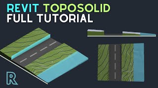
I wolud like to see a tutorial about creating water and shoreline, as is pictured in the thumbnail.
why would they remove the building pad?!! they didn't give any better solution, using the void is so stupid and ineffective
When I use Graded Region, I have two toposolids, one in existing phase and one that has some mass removed in new phase. Revit only gives a number in the "filled" tab, but shouldn't this be in the "cut" tab?
Thank you for your video, would it be possible to do a tutorial on how to build underground while keeping the original topographyon top of the building? As this feature didn't exist in revit 2023.
Im convinced they are taking notes from blender
Wow, some great improvements, but still some tools need a review, subdivisions would be a powerful tool for large urban projects like airports.
😁
perfect
You cant copy topo points by simply LCLICK+CTRL DRAG and whrn you move a point in 3d it arbiratry changes its level!
Can you do a video on correct practice for detailing/annotating a Topo solid site. I find that there is an issue with dimensioning sloping gradients. Revit will now dimension lock on the hypotenuse(slope) rather and therefore site information that would be presented in 2D is different to 3D. I.E the steeper the slope of a ramp the difference between 2D and 3D will become larger. There must be a term for this perhaps.
Hi, talking about graded region, you show that moving sub elements gives the correct net cut/fill value. Is there a way to cut toposolid with in place components or families, and keep having the correct net cut/fill value, without using Environment plug in?
You are amazing! Can you show a quick video on how to plot point on excel? I do civil but we mostly work with horizontal and vertical points but you mentioned that we need “z” points 🙏
Perhaps you can try this:
th-cam.com/video/sgeCHdDqtLE/w-d-xo.html
tip 1 - don't switch to revit 2024 to avoid using toposolids. Because there will be no way back to topo surfaces and you will spend 100x more time editing toposolids. And it's not an exaggeration.
briefly:
1. new functions are nice
2. toposolids can't be texturized as toposurfaces could be
3. at any complex terrain adding or editing any point takes at least decades of seconds whereas at toposurfaces I could place decades of point and it would only take some time when accept changes
No more need to use Civil 3D for contouring, Now Revit is amazing software for even everything ❤❤❤
Nope. For complete civil earthworks, grading, long sections you still need civil 3D. Revit cannot do that. Topo solids in revit are for presentation purposes only. Specially when doing roads.
Excelente!
thanks for this but you didn't demonstrate how to create a toposolid from an imported survey plan using the sketch method. cheers
can we create the terrain with curved lines? instead of dots
The contours are not smooth compared to previous versions. Which sucks
can u snap a vertex (for topo/floor/whatever) to LOWEST lidar poins in a specified radius or drape a shape on the lidar points (lowest points of course)
how to watch projects in 3d on mobile phone, and level by level
What I do not understand is why the toposolid is acting like a robot with such harsh contours. I am trying to create a toposolid to act the way the toposurface previously acted, where I input my topo points and it creates a smoothed organic surface. This topo solid looks like jagged rocks in the mountains! Please help me with a fix.
Can you do a video around taking lidar data and making a topo solid?
17:48 this subdivision can be turned on a estructural element and apply to it some rebars? It can be perfect to modeling a nailing soil, (a type of soil stabilization.)
The balkan-ignit
how parking component could be fitted correctly on toposolid?
They're hosted only horizontally
Is there a way with Dynamo to host a floor to the toposolids? It would be nice for phasing to use floors
Thanks for the tutorial, very helpful. Question, once the Toposolid has been split, how do you unsplit it or merge one toposolid to another? Without undoing? Revit 2023 used merge which was brilliant to adapt a topography to show different options as the project evolved. The join tool does not suffice, as you're still left with many pieces of toposolid. Help on the subject would be much appreciated.
i believe you just delete the subdivision
"unfortunately you cannot copy points" you said it
What about the shared coordinates ? If we want actual coordinates ?
pads used to work both ways. you could have a building pad ABOVE the topo and it would fill below it. is there no way to do this now??
when i set the visual style to realistic it just showed the usual grey material. Did you customize the materials to show grass & earth textures/colors?
Hard way to do simple things...This is Revit.
Creating Toposolid by using excel points. Does it means coordinates? or can you make tutorial showing points table also that how you add and thenuse it in revit to create toposolid?
Thanks alot for the video!, I have a problem with setting the levels and adjusting the building hieght based on toposolid generated from a CAD file with real levele hights above the sea, How am i going to adjust the levels all at once? is there any method to do it! it is driving me crazy XD!
yes great, but can we now dimension to it in section?
Hi. Great Video. I tried to create the toposolid from an autocad file and then my toposolid is flat and there are no contour lines. Do you know why? Is something regarding the autocad file? Thank you
Is there a way for the toposolid to keep the paths and roads generated from AutoCad on the model also? I am doing a winery on the river Seine in France and when I created the toposolid it swallowed up half of the generated buildings
Is it possible to add toposolid after the structure has been modeled? Thanks
I cant find the sub-divide option in revit 2024
Voids don't factor into cut/fill calculation... unless I'm missing something?
i tried to modeling with structural slabs but this type of soil stabilization need to be aligned exactly to the surface
Why, when I create the toposolid and want to make a path, it doesn't let me change said path or give it depth? It doesn't allow me to place anything in negative quantities
Waiting for my Co to implement upgrade. Can anyone tell me if you can have varied ground layers under surface. Can you specify these levels to get an idea of how these levels will look?
I literally can't change the material of my divided topo solid. I can paint new material onto the OG solid but not the split. Please help!
Hi sir, to draw path around building should we use property line itself in the new revit
?
Can Revit Toposolid sculpture like Zbursh or lumion, blender?
Thanks for this tutorial. I found it very helpful. I have one question. @21:04 when I apply the -200 offset to my cut it moves the whole cut down by 200 which means I will have a protrusion at the bottom. Can you help me find out how to resolve this?
Great tutorial! However, the Subdivide and Split tools generate too many errors with complex topo... back to the 2023 =(
Where can I find the 'floor base void' component?
i cant for the life of of my get rid of the terrain inside the house i made. the building pad feature was so easy to use, but my group insists on making the house in 2024 and this feature is no longer there.
My tool bar is very limited when editing modify sub element doesn't even show up