I've done Mt. Whitney many, many times over the last 3 or so decades. The advice here is extraordinarily helpful, either for a first-timer or someone like me, who can always use friendly reminders. Well done!
You guys should do more videos like this. Talking through the prep and the landmarks would be really helpful for people that want to reproduce your hikes. Great info.
For inexperienced hikers the best time to hike Whitney is late summer/early fall after the snow has melted, and the weather is more stable - ideally September. Anyone in reasonable fitness can day-hike it with some physical preparation - preferably similar hikes at high altitude. On a good day you don't need all that equipment and clothing - just some long pants and a waterproof windbreaker jacket. Take lots of food and a water filter and you're set. Leave the trailhead at 4:00 am and be back at sun-down around 8pm. 16 hrs. is a decent average round-trip time. You reach the peak at 12:30 - 1 pm, just before the afternoon thunderstorms roll in, though they are not on a schedule and can appear anytime. Have lots of electrolytes, and don't chug your Gatorade - it will make you sick.
Nice video. My brother and I were on the summit just over a month ago. Horseshoe Meadows to the summit and out Portal. Great weather and no major problems. 👍
Congrats. Also one of my best experiences. But kids weight 50% less than adults, and have twice the energy. Try it again in your mid 50's and get back to us.
Did this hike in August 2005 at age 57 with my wife at age 51. Did it as a day hike starting at 3:30 AM from Whitney Portal, and returning at 7:30 PM after spending an hour at the summit. Our conditioning consisted of mostly high elevation hikes of approximately 8 to 10 miles per hike. No snow to contend with, and trail was well marked. Made sure we had plenty of water (3 liter Camelback, along with 3-4 extra bottles of water for me), my wife had 1.5 liter Camelback. We returned with almost half our water remaining. Sunscreen and lip balm is essential. Food was our regular sandwiches, veggies and cookies along with trail mix. No potty issues, no wag bags needed, and no altitude sickness. Most of this video is for travel in snow conditions, with a plan to stay overnight. Most of this gear is not needed for a long day hike with no snow. Yes we were very tired. Yes we were glad we did it. A day hike is very doable if you are in good shape, have done some hiking at elevation or otherwise trained for constant uphill hiking at elevation. Sunrise on the trail should not be missed; spectacular!
Great advice for people looking to summit in a day! Thanks for your comment :) Thomas actually attempted to summit in a single day, but the person he went with wasn't able to keep going. We ended up spreading it out over a few nights because of the added difficulty of filming, but of course that adds it's own challenges like needing more food and gear. Either way, it's a beautiful place! Cheers :) -Andrew
I did the hike in one day in early August circa 1978 when I was in my early thirties. I was a regular runner, and, back then, as I recall, I also did a little training going up and down flights of stairs (I'm a flatlander from Louisiana). I arrived in Lone Pine the morning before the hike to pick up a permit at the ranger station. The weather was beautiful. A few sections of the trail still had snow, but nothing along the trail was difficult to traverse. It just took some stamina. By late afternoon, I was back in Lone Pine eating steak at a cafe and ready to hit the sack in my motel room.
Better to go back together and try another time, than to keep going and stay on the mountain forever. Words to live by. This video should be required viewing for anyone going there and has value that goes with many outdoor activities.
Did it back in 1972. No fancy nothing. Had cheap Kmart work boots on a backpack, tent and gear. Went up and over into kings canyon. No idea what I was doing.I keep going for six months. Grand Canyon twice in 3 days .hit one national park after the next what a summer. Walked so much wore hole threw boots .stuffed it with cardboard till I got home.a priceless memory.
Great video. Love the part about wag bags. I am local to the area, and we get really tired of people coming up from LA or wherever and $hiting all over everything. These guys have a positive, respectful frame of mind, and are the type of visitors we enjoy. Keep up the great work bros!!😁👍🏽💪🏽🤘🏽
Climbing Mt Whitney with my friend when we were in HS is a cherished memory. We planned all our trips well ahead of time, mostly for food and equipment lists, not itinerary. My dad dropped us off and we spent the first night at Whitney Portal, the trail head. The next night we stayed at Mirror Lake, a few miles up the trail. After a couple days at Mirror Lake, we packed our day bags and headed up to the summit. It was indescribably beautiful. We ascended the 97 switchbacks, and the view from the saddle was breathtaking. We looked across the Owens Valley to the White Mountains, and in the other direction are the Sierras, with row upon row of ranges, and dotted with lakes that look like blue ink. The sky was deep blue, due to the altitude. The weather was mild, maybe low 70's, but the sunlight was intense. We hiked to the peak and stayed too long. We did not get back to our camp at Mirror Lake until 1 AM. Good thing we had flashlights. This was in 1970, and was a great adventure. If you can do it, I highly recommend it. There is something to seeing sights that can only be reached by extreme effort that is deeply satisfying.
This video is GOLD! In addition to helping people get in shape and prepared its really helping park services avoid unnecessary rescues due to exhaustion and completely avoidable lack of prep related issues.
Each time Ive done it I get the 1 day pass and get into the permit zone at midnight - summit around dawn and hike down. This video is more geared to prep for transecting the equator or something. If youre a decent hiker and on the Whitney Trail, its just a long hike.
Great, concise video. One thing that I'm sure has been mentioned in the comments but was not mentioned [or filmed] in the video is that for overnight trips you are required to carry your food in a bear-proof canister such as a Garcia Bear Canister, Bear Vault, Counter Assault, or the fancy Bearikade. They can be rented from the outdoor shop in town for not very much. They do ask you when you pick up your permit and if a ranger finds you overnighting without one you will be asked to leave and, likely, cited.
Great video my outdoors friend. Greetings from Sacramento. Thank you for sharing. Way back Oct. 1971 my neighbor and I summited Mt. WHITNEY. It is a miracle that we made to the top. Altitude sickness is a great pointer. There was no internet then and no permits were required. This is an awesome video presentation. I do hope that those considering climbing Mt. WHITNEY will take your information to heart. Take care out there and have fun. 🤗
I have done Whitney twice. The first time we backpacked in, and that’s what I would recommend. The second time was in one day and it really wasn’t as much fun. I am from Colorado and do lots of hiking so I was in good shape, but the route is just so long and ruthless that there really isn’t much time to take it all in. In contrast, with packing in there was some extra time to really immerse oneself in the moments, look, take photos, etc. I have to say, though, there was a huge sense of relief and accomplishment when we returned to Whitney Portal after the one-day blitzkrieg.
Thank you for all the great information. Another tip: Be sure to eat regularly and drink plenty of fluids, especially the night before you hike. Cramping at altitude can be severe.
Altitude is the vertical distance between an object and the earth's surface. Elevation is the term we (in Colorado) use. People who say altitude, we considered beginners. (This post is just a friendly tip)
What a great video! Easy to watch and full of helpful information. My husband and I summited in 2002, after altitude sickness at Trail Camp took us out the year before. Loved your pictures and scenery. Just breathtaking! Your video should be recommended by the park service and required watching for most people. The best advice was being prepared and being willing to turn around if circumstances call for it. As you said, no one wants to stay there forever. Thank you gentlemen! 👏👏👏👍👍👍
Great tips. I have taught at summer camps wilderness training certificates. Conditioning, preparing is so important. Equipment, proper clothing layers, understanding how to use emergency equipment such as first aid, Personal locator beacons or emergency satellite messengers etc. As mentioned in the video knowing before you go helps along with their other tips. Thanks for sharing.
We got our permit for a Oct. 10, 2000 summit. Acclimated for 3 days prior with increased elevations each day. We were in great shape and it paid off big time. Portal to summit in13 hours
I'm planning on hiking Mt.Whitney this year, this is a very good and informative video. I've also spoke to locals who have hiked it and gave me some very useful information. I'm an avid hiker and camper and I don't want to be on an episode of 'I shouldn't be alive'.
Summited Whitney the first week of April 2016 by the Mountaineers Route. Fun climb! Training was a winter of hiking and ice climbing in the White Mountains of NH.
We've gone up 4 times in the last 12 years. I never got a permit ahead of time. If you go to the station Monday through mid-week there are usually a half dozen or more cancellations that are made available. Only once did we need to wait a day to get a permit.
ha! this is great reference for me because going on the dates of your permit, I'm only a day later this year so weather and conditions might be as similar as possible!
LEAVE NO TRACE !!! I've had to pack out other hiker's wag bags on Whitney twice in the past couple years, which is rather unpleasant. Mostly all great info guys! I only had minor gripes with some of your recommendations or lackthereof. It will be good to do a follow up video in the next couple of years as you grow your audience and get more mountain experience under your belt. Happy trails to you four!
When my husband and I did Outer Mountain Loop in Big Bend this winter, he insisted on the wag bags. They did snag on the cacti so we figured out to put them into the used freeze fried food bags, which are thicker and have a more scent proof zipper. Each mountain house meal bag could hold 3 poops worth FYI. Peeing outside the bag is excellent advice too! We also reused the plastic jugs from water cache as another layer of hard plastic to prevent puncture. True love is hiking your partner’s poop 30 miles across the desert and over the mountain. Love your channel guys!
Yeah, I agree it was a crazy winter/spring that year. Mammoth didn't close until first week of August in 2017. So while you guys were climbing Whitney, people were still riding at Mammoth.
I did this hike a couple years ago. We ended up doing it in one day. It was a long day. We started at 3am and finished about 7pm. Mt Whitney is like Mt Everest, the most popular for being one of the highest 14K ft mountain the lowest 48 states in North America but not the hardest. I think one of the hardest 14K is mouth Williamson. It took me 3 tries to get to the summit. Nice video..
Longs Peak in Colorado is a great 14'er to hike. Shorter than Whitney, but in ways more difficult. Lots of rock scrambling, and some scary ledges, but great views.
2 of us went in Oct. 1996. No permit. We just took off and spent the night in my truck. Had the correct gear and food. Freezing cold. Got to Trail Camp, tent went up. Then.......a huge snow storm came. Had to retreat. Beautiful area. Never went back.
So it looks like I've added Whitney to my bucket list. I am trying to get used to elevation at Yosemite by hiking all the strenuous stuff. I can do 18-20 miles in a day now. Excellent video. Lots of good info. Thanks so much for sharing!
I was totally on-board with prepping for a hike up Mt. Whitney until the whole wag bag thing came up. I haven't had to consider poop packaging that extensively since my kids were infants and I'm not particularly fond of re-visiting that time. However, that hike is tempting...
This is useful. I'm not sure if I'll do Mt Whitney though... I'm not one to seek heights. But you've given me a lot to think about with this. especially with the training for a incline intensive trip which is something I've been struggling with. Especially since I'm out of shape, and been trying to get back into shape.
I hiked up and down Whitney several times in my 20's in a day. Nothing more than slight headache, course I was still in Marine Corps, best shape of my life. 40 years later might do it again. Apparently I was very lucky, no preparation, permits, lottery, and the weather was excellent. This time I would slow way down ( naturally) spend several days. I have got most of my light weight equipment and an going to start ordering light HAM Radio for Morse code. At dawn, should be able to get into Asia as long as I don't get electrocuted. I am thinking maybe bamboo poles for hiking, light weight hopefully durable enough to last a few days and double as an antenna mast. Just downloaded Mt Whitney app appears to be excellent for offline use. Would consider mountaineering route if with group, definitely not solo for me.
Thank you for all the advice and info on how to prep! This video is incredibly helpful... I am looking forward to hiking Mt Whitney in a year if possible! I was so happy to hear you were respectful of the land and taking out your trash( wag bags) ... some humans can be quite unconscious about this matter. peace and good vibes! I have enjoyed watching and you all inspire!
What a great video! Thank tyou for this; I attempted it back August 14 2016 and got only as far as Outpost camp, spended the night with 32 degree and slight headache and had to go down because mountain sickness next day as I was recommended to not keep going up from more experience hikers; my ascend took almost 8 hours for those 3+ miles while the GPS said I hiked about 7 miles; I was going up 20 to 50 steps before stopping to catch m y breath since I was and are still so out of shape; I was being passed along the way by everyone so I was going really really slow and stopping for the scenery a lot too, not only ascending but also taking pics and videos; so that is the explanation why so long to ascend so little and then the descend was about 3 hours down from Outpost camp to Portal, leaving outpost around noon reaching Portal around 3.00pm (and having one of those gigantic burgers there yes! shame on me, lol) I carried 26 pounds total on way up, left portal little after 1.00pm and got to camp around 8.00pm, really tired, I was then, just like now still 70 pounds overweight and did not hidrated as I should have, also the acclimatization for me was only one night at the portal, I want to do it again, only right now I have a broken ACL which I am going for surgery to repair soon. I wonder how long before I can attempt it again; I am not going to lose all that weight before it happens so I would go slowly again and try to be better acclimatized; this time I would take oxigen cans with me and drink water more often and if I can do and prepare some cardio rutines months before I will do so; I think the phisiotheraphy after the surgery I can set myself with exercises rutines better this time which may help my general shape but Whitney is in my sights still, shaped or not; Last time I had a 3 days permit and that was not enough. Next time I want to summit it. I would always try to do it mid August, I think those are the best days, if not this year, then the next and so forth.
Thanks for this video! Just really started getting into hiking again and now especially backpacking. Preparing to do Mt. Whitney next summer 2023 in June with my friend!! Getting ready for that snowy trail in June, gotta get those microspikes ready. Already getting stuff ready and preparing for that. Acclimating to 8,000 for the first night, then heading up to trail camp and spending a night. Then summiting the next day and coming back down to stay another night at trail camp! Then go all the way back down. Pretty excited and decided to make sure to get used to the altitude by staying the 3 nights instead of doing it in one day. Why not enjoy the time you're there! This video definitely helped and I've got a lot of planning done. I'll be 17 doing it really excited even though its still more than a year away.
You can also make it more enjoyable (if you have the time) by spending the first night at Outpost camp. It's a great area with abundant water sources, a waterfall at night for great white noise, and at 10,400 feet it allows you to acclimate a bit further before going up to Trail Camp at 12,000. Trail Camp is like camping on the moon, no shade, and if its windy it'll be a lot worse up there. Good luck on your hike, hopefully you have put in for the Whitney lottery because this month is going to fly by.
Mount Whitney is the tallest mountain in the contiguous United States and the Sierra Nevada, with an elevation of 14,505 feet (4,421 m). It is located in East-Central California, on the boundary between California's Inyo and Tulare counties, 84.6 miles (136.2 km) west-northwest of the lowest point in North America at Badwater Basin in Death Valley National Park at 282 ft (86 m) below sea level. The west slope of the mountain is in Sequoia National Park and the summit is the southern terminus of the John Muir Trail which runs 211.9 mi (341.0 km) from Happy Isles in Yosemite Valley. The east slope is in the Inyo National Forest in Inyo County.
I tried to summit on Halloween but didn't make it. I started at 12:30am Way too early and I shouldve packed a puffy jacket in my bag because I sweat underneath all of my layers and came close to hypothermia. I did the first 3 miles in 40 min. If I went back I would've started around 3/3:30. For people in decent shape that's a good starting time unless youre going to walk at 1 mile per hour. Also I underestimated the altitude on this hike. I was taking Diamox in preparation and still got a massive headache. I usually dont get altitude sickness but next time I will be camping at the trail head to acclimate.
I climbed this twice in 1970, once with a friend and next with a troop of cub scouts. We camped at timberline to acclimate and made the summit the second day. This was in August which was the safest month I was told. We never saw any lakes so the trail must have changed since we went . There was only one trail from the parking lot to the summit. We made our descent after signing the book at the top and marveling at the horizontal icicles. We also climbed White Mountain just across highway 395 from Whitney. There was a road all the way to the top and a high altitude testing station at that summit staffed with college kids who would always offer climbers some tea, food and a place to sleep if you needed. They would say that White was taller than Whitney but apparently Whitney was more popular or political so his mountain got the honor.
Great memories I'm sure. On my list of peaks to bag if I can. Reminds to me get on it. 1970 was the year I was born, and compared to most people on the trails these days, I'm an old dude.
Hulda Crooks hiked Whitney 23 times. She hiked it for the first time at 66 years old and for the last time at 91. She holds the record as the oldest person to hike Whitney. When I learned this I felt that I could hike Whitney. After this video, im now terrified, lol. Just joking, great video, helpful info.
Thanks for emphasizing LNT principles and the wag bag. Other outdoor channels don't do it enough. As more people are inspired to go visit the great outdoors because of youtube, they should also learn to be good stewards of the land so that there isn't a Tragedy of the Commons.
Can you elaborate on the weather? What if you get the date you want but if it rains? I assume there are no refunds or exchanges due to weather conditions. What time of year is best? Also I wonder if other fourteeners are better for a first time 14Kft summit day hike? Like Colorado has a lot (Elbert etc). Either way Thanks for the great info (whether or not I ever climb Whitney)
Highly recommend "Mediocre Amateur" a smaller vlog hiking channel. Absolute beasts summited in a day and regularly run routes that are more than a marathon.


Successfully summited Mt. Whitney 2 weeks ago thanks to this video.
Can't believe we never replied to this, but congratulations and we're really glad our video helped!
Nice!
I've done Mt. Whitney many, many times over the last 3 or so decades. The advice here is extraordinarily helpful, either for a first-timer or someone like me, who can always use friendly reminders. Well done!
Now that’s a good review of this video!
You guys should do more videos like this. Talking through the prep and the landmarks would be really helpful for people that want to reproduce your hikes. Great info.
For inexperienced hikers the best time to hike Whitney is late summer/early fall after the snow has melted, and the weather is more stable - ideally September. Anyone in reasonable fitness can day-hike it with some physical preparation - preferably similar hikes at high altitude. On a good day you don't need all that equipment and clothing - just some long pants and a waterproof windbreaker jacket. Take lots of food and a water filter and you're set. Leave the trailhead at 4:00 am and be back at sun-down around 8pm. 16 hrs. is a decent average round-trip time. You reach the peak at 12:30 - 1 pm, just before the afternoon thunderstorms roll in, though they are not on a schedule and can appear anytime. Have lots of electrolytes, and don't chug your Gatorade - it will make you sick.
Great Info, Thanks!
Can't wait to climb Whitney. You guys have the best videos and I'm very appreciative of all your work. Thank you!
Nice video. My brother and I were on the summit just over a month ago. Horseshoe Meadows to the summit and out Portal. Great weather and no major problems. 👍
I didn't train at all and I'm 12 years old and I did it in a day. Best experience of my life
Congrats. Also one of my best experiences. But kids weight 50% less than adults, and have twice the energy. Try it again in your mid 50's and get back to us.
Now that is one hell of an accomplishment. I'm 16 and I could only dream of doing it
@@aliensoup2420shut up whining victim
@@aliensoup2420 kids also have much less muscle than adult so pls do not diminish this 12 year old's incredible accomplishment.
Did this hike in August 2005 at age 57 with my wife at age 51. Did it as a day hike starting at 3:30 AM from Whitney Portal, and returning at 7:30 PM after spending an hour at the summit. Our conditioning consisted of mostly high elevation hikes of approximately 8 to 10 miles per hike. No snow to contend with, and trail was well marked. Made sure we had plenty of water (3 liter Camelback, along with 3-4 extra bottles of water for me), my wife had 1.5 liter Camelback. We returned with almost half our water remaining. Sunscreen and lip balm is essential. Food was our regular sandwiches, veggies and cookies along with trail mix. No potty issues, no wag bags needed, and no altitude sickness. Most of this video is for travel in snow conditions, with a plan to stay overnight. Most of this gear is not needed for a long day hike with no snow. Yes we were very tired. Yes we were glad we did it. A day hike is very doable if you are in good shape, have done some hiking at elevation or otherwise trained for constant uphill hiking at elevation. Sunrise on the trail should not be missed; spectacular!
Great advice for people looking to summit in a day! Thanks for your comment :) Thomas actually attempted to summit in a single day, but the person he went with wasn't able to keep going. We ended up spreading it out over a few nights because of the added difficulty of filming, but of course that adds it's own challenges like needing more food and gear. Either way, it's a beautiful place! Cheers :) -Andrew
what time were you guys at the top with 3:30 am start?
@@TrekkingPals We summited about 12:30 pm; stayed about an hour before returning. Got back to Whitney Portal around 7:30 pm.
@@sherrypalmer1283 Thank you!
I did the hike in one day in early August circa 1978 when I was in my early thirties. I was a regular runner, and, back then, as I recall, I also did a little training going up and down flights of stairs (I'm a flatlander from Louisiana). I arrived in Lone Pine the morning before the hike to pick up a permit at the ranger station. The weather was beautiful. A few sections of the trail still had snow, but nothing along the trail was difficult to traverse. It just took some stamina. By late afternoon, I was back in Lone Pine eating steak at a cafe and ready to hit the sack in my motel room.
Better to go back together and try another time, than to keep going and stay on the mountain forever. Words to live by.
This video should be required viewing for anyone going there and has value that goes with many outdoor activities.
Did it back in 1972. No fancy nothing. Had cheap Kmart work boots on a backpack, tent and gear. Went up and over into kings canyon. No idea what I was doing.I keep going for six months. Grand Canyon twice in 3 days .hit one national park after the next what a summer. Walked so much wore hole threw boots .stuffed it with cardboard till I got home.a priceless memory.
I used your video and others to help my group make it to the top for first time. Thanks for all the good info!
Great video. Love the part about wag bags. I am local to the area, and we get really tired of people coming up from LA or wherever and $hiting all over everything. These guys have a positive, respectful frame of mind, and are the type of visitors we enjoy. Keep up the great work bros!!😁👍🏽💪🏽🤘🏽
Wow! Good to know. I hope it isn’t gross on the trail from those who don’t use the wag bags.
@@immnotaboutthatlife2086 Unfortunately sometimes it gets a little $hitty lol. Be safe out there, and watch your step 💩😅.
Climbing Mt Whitney with my friend when we were in HS is a cherished memory. We planned all our trips well ahead of time, mostly for food and equipment lists, not itinerary. My dad dropped us off and we spent the first night at Whitney Portal, the trail head. The next night we stayed at Mirror Lake, a few miles up the trail. After a couple days at Mirror Lake, we packed our day bags and headed up to the summit. It was indescribably beautiful. We ascended the 97 switchbacks, and the view from the saddle was breathtaking. We looked across the Owens Valley to the White Mountains, and in the other direction are the Sierras, with row upon row of ranges, and dotted with lakes that look like blue ink. The sky was deep blue, due to the altitude. The weather was mild, maybe low 70's, but the sunlight was intense. We hiked to the peak and stayed too long. We did not get back to our camp at Mirror Lake until 1 AM. Good thing we had flashlights. This was in 1970, and was a great adventure. If you can do it, I highly recommend it. There is something to seeing sights that can only be reached by extreme effort that is deeply satisfying.
This video is GOLD! In addition to helping people get in shape and prepared its really helping park services avoid unnecessary rescues due to exhaustion and completely avoidable lack of prep related issues.
i did whitney in 1 day, nothing like 20hrs on the mountain!
Each time Ive done it I get the 1 day pass and get into the permit zone at midnight - summit around dawn and hike down. This video is more geared to prep for transecting the equator or something. If youre a decent hiker and on the Whitney Trail, its just a long hike.
Great, concise video. One thing that I'm sure has been mentioned in the comments but was not mentioned [or filmed] in the video is that for overnight trips you are required to carry your food in a bear-proof canister such as a Garcia Bear Canister, Bear Vault, Counter Assault, or the fancy Bearikade. They can be rented from the outdoor shop in town for not very much. They do ask you when you pick up your permit and if a ranger finds you overnighting without one you will be asked to leave and, likely, cited.
Great video my outdoors friend. Greetings from Sacramento. Thank you for sharing. Way back Oct. 1971 my neighbor and I summited Mt. WHITNEY. It is a miracle that we made to the top. Altitude sickness is a great pointer. There was no internet then and
no permits were required. This is an awesome video presentation. I do hope that those considering climbing Mt. WHITNEY will take your information to heart. Take care out there and have fun. 🤗
I have done Whitney twice. The first time we backpacked in, and that’s what I would recommend. The second time was in one day and it really wasn’t as much fun. I am from Colorado and do lots of hiking so I was in good shape, but the route is just so long and ruthless that there really isn’t much time to take it all in. In contrast, with packing in there was some extra time to really immerse oneself in the moments, look, take photos, etc. I have to say, though, there was a huge sense of relief and accomplishment when we returned to Whitney Portal after the one-day blitzkrieg.
Great video! Thanks for all the information!!
Thank you for all the great information.
Another tip: Be sure to eat regularly and drink plenty of fluids, especially the night before you hike. Cramping at altitude can be severe.
Altitude is the vertical distance between an object and the earth's surface.
Elevation is the term we (in Colorado) use. People who say altitude, we considered beginners. (This post is just a friendly tip)
Second this!! We had to return back from mt. Adams bc you buddy got bad leg cramps.
What a great video! Easy to watch and full of helpful information. My husband and I summited in 2002, after altitude sickness at Trail Camp took us out the year before. Loved your pictures and scenery. Just breathtaking! Your video should be recommended by the park service and required watching for most people. The best advice was being prepared and being willing to turn around if circumstances call for it. As you said, no one wants to stay there forever. Thank you gentlemen!
👏👏👏👍👍👍
Outstanding, well-organized video. I'm hoping to get the lottery next year.
Great tips. I have taught at summer camps wilderness training certificates. Conditioning, preparing is so important. Equipment, proper clothing layers, understanding how to use emergency equipment such as first aid, Personal locator beacons or emergency satellite messengers etc. As mentioned in the video knowing before you go helps along with their other tips. Thanks for sharing.
We got our permit for a Oct. 10, 2000 summit. Acclimated for 3 days prior with increased elevations each day. We were in great shape and it paid off big time. Portal to summit in13 hours
I'm planning on hiking Mt.Whitney this year, this is a very good and informative video. I've also spoke to locals who have hiked it and gave me some very useful information. I'm an avid hiker and camper and I don't want to be on an episode of 'I shouldn't be alive'.
Summited Whitney the first week of April 2016 by the Mountaineers Route. Fun climb! Training was a winter of hiking and ice climbing in the White Mountains of NH.
We've gone up 4 times in the last 12 years. I never got a permit ahead of time. If you go to the station Monday through mid-week there are usually a half dozen or more cancellations that are made available. Only once did we need to wait a day to get a permit.
ha! this is great reference for me because going on the dates of your permit, I'm only a day later this year so weather and conditions might be as similar as possible!
LEAVE NO TRACE !!! I've had to pack out other hiker's wag bags on Whitney twice in the past couple years, which is rather unpleasant.
Mostly all great info guys! I only had minor gripes with some of your recommendations or lackthereof. It will be good to do a follow up video in the next couple of years as you grow your audience and get more mountain experience under your belt. Happy trails to you four!
lEaVe nO TrAcE! HiKe yOuR OwN HiKe! bE BeAr aWaRe! tHe mOuNtAiN WiLl aLwAyS Be tHeRe! pAcK It iN PaCk iT OuT!
Fabulous information, did this in 1987 with a group of friends it was fantastic. Great video!
Did it as a day hike on 10/4/2021. This video inspired me to do Mt. Whitney. Thank you.
When my husband and I did Outer Mountain Loop in Big Bend this winter, he insisted on the wag bags. They did snag on the cacti so we figured out to put them into the used freeze fried food bags, which are thicker and have a more scent proof zipper. Each mountain house meal bag could hold 3 poops worth FYI. Peeing outside the bag is excellent advice too! We also reused the plastic jugs from water cache as another layer of hard plastic to prevent puncture. True love is hiking your partner’s poop 30 miles across the desert and over the mountain. Love your channel guys!
Hahaha all good advice! And can’t disagree with that, there’s very few people whose poop I will carry 30 miles.
Not sure about whether it would hold 3 of my poops. Some of them are disturbingly large.
Thank you for all the info on the hike! I am waiting on the date for our hike! All of the content in this video will go a long way!
Good job on the video guys. Good enough to sell in dvd/blu-ray
Yeah, I agree it was a crazy winter/spring that year. Mammoth didn't close until first week of August in 2017. So while you guys were climbing Whitney, people were still riding at Mammoth.
Great info, guys. It'd be great to see more of these videos for other trips. Thanks!
We certainly will!
This video is EXTREMELY important to me. THANK YOU VERY MUCH!
I did this hike a couple years ago. We ended up doing it in one day. It was a long day. We started at 3am and finished about 7pm. Mt Whitney is like Mt Everest, the most popular for being one of the highest 14K ft mountain the lowest 48 states in North America but not the hardest. I think one of the hardest 14K is mouth Williamson. It took me 3 tries to get to the summit. Nice video..
Longs Peak in Colorado is a great 14'er to hike. Shorter than Whitney, but in ways more difficult. Lots of rock scrambling, and some scary ledges, but great views.
I would sure love to hike that for my 56 Bday next year. Planning...
2 of us went in Oct. 1996. No permit. We just took off and spent the night in my truck. Had the correct gear and food. Freezing cold. Got to Trail Camp, tent went up. Then.......a huge snow storm came. Had to retreat. Beautiful area. Never went back.
Awesome video. Very informative.
So it looks like I've added Whitney to my bucket list. I am trying to get used to elevation at Yosemite by hiking all the strenuous stuff. I can do 18-20 miles in a day now.
Excellent video. Lots of good info. Thanks so much for sharing!
Yosemite is not sufficient elevation to train. Try San Gorgonio via the Vivian Creek trail.
I was totally on-board with prepping for a hike up Mt. Whitney until the whole wag bag thing came up. I haven't had to consider poop packaging that extensively since my kids were infants and I'm not particularly fond of re-visiting that time. However, that hike is tempting...
Sooo... I'll probably never climb Mount Whitney, but this is a fun video to watch!
Excellent information. Thank you!!
This is useful. I'm not sure if I'll do Mt Whitney though... I'm not one to seek heights. But you've given me a lot to think about with this. especially with the training for a incline intensive trip which is something I've been struggling with. Especially since I'm out of shape, and been trying to get back into shape.
I hiked up and down Whitney several times in my 20's in a day. Nothing more than slight headache, course I was still in Marine Corps, best shape of my life. 40 years later might do it again. Apparently I was very lucky, no preparation, permits, lottery, and the weather was excellent. This time I would slow way down ( naturally) spend several days. I have got most of my light weight equipment and an going to start ordering light HAM Radio for Morse code. At dawn, should be able to get into Asia as long as I don't get electrocuted. I am thinking maybe bamboo poles for hiking, light weight hopefully durable enough to last a few days and double as an antenna mast. Just downloaded Mt Whitney app appears to be excellent for offline use. Would consider mountaineering route if with group, definitely not solo for me.
Carbon poles might be more durable than bamboo. Sounds like an interesting project.
Starting training this week for our planned trip in July! Crossing our fingers for the permit approval! Thanks for the vid!
Best of luck!
Thank you for all the advice and info on how to prep! This video is incredibly helpful... I am looking forward to hiking Mt Whitney in a year if possible! I was so happy to hear you were respectful of the land and taking out your trash( wag bags) ... some humans can be quite unconscious about this matter. peace and good vibes! I have enjoyed watching and you all inspire!
Nice job Andrew & Thomas. Hope to see more videos like this. Lots of helpful info. 👍👍
one of the most useful videos i've ever seen
Thanks so much! Glad you found it useful :)
Dude! Thanks for this. I just decided to try to go this year for first time and been watching videos since yesterday ha
Wow..Most informative Whitney Vid on TH-cam ! i think i watched them all ...thankyou gentlemen for making this awesome ,information pack Vid !!
Thank you! This along with your Whitney video was so helpful. We finally got a permit to backpack this year on the same day you guys did! Can't wait!
Great video💪🏻🙂Now I know everything. I come from Poland and want to climb the mountain this year.❤
What a great video! Thank tyou for this; I attempted it back August 14 2016 and got only as far as Outpost camp, spended the night with 32 degree and slight headache and had to go down because mountain sickness next day as I was recommended to not keep going up from more experience hikers; my ascend took almost 8 hours for those 3+ miles while the GPS said I hiked about 7 miles; I was going up 20 to 50 steps before stopping to catch m y breath since I was and are still so out of shape; I was being passed along the way by everyone so I was going really really slow and stopping for the scenery a lot too, not only ascending but also taking pics and videos; so that is the explanation why so long to ascend so little and then the descend was about 3 hours down from Outpost camp to Portal, leaving outpost around noon reaching Portal around 3.00pm (and having one of those gigantic burgers there yes! shame on me, lol)
I carried 26 pounds total on way up, left portal little after 1.00pm and got to camp around 8.00pm, really tired, I was then, just like now still 70 pounds overweight and did not hidrated as I should have, also the acclimatization for me was only one night at the portal, I want to do it again, only right now I have a broken ACL which I am going for surgery to repair soon. I wonder how long before I can attempt it again; I am not going to lose all that weight before it happens so I would go slowly again and try to be better acclimatized; this time I would take oxigen cans with me and drink water more often and if I can do and prepare some cardio rutines months before I will do so; I think the phisiotheraphy after the surgery I can set myself with exercises rutines better this time which may help my general shape but Whitney is in my sights still, shaped or not; Last time I had a 3 days permit and that was not enough. Next time I want to summit it. I would always try to do it mid August, I think those are the best days, if not this year, then the next and so forth.
Other than getting your ACL fixed, the thing that will help the most is losing the extra 70 lbs. More than oxygen probably. Good luck.
Thanks for this video! Just really started getting into hiking again and now especially backpacking. Preparing to do Mt. Whitney next summer 2023 in June with my friend!! Getting ready for that snowy trail in June, gotta get those microspikes ready. Already getting stuff ready and preparing for that. Acclimating to 8,000 for the first night, then heading up to trail camp and spending a night. Then summiting the next day and coming back down to stay another night at trail camp! Then go all the way back down. Pretty excited and decided to make sure to get used to the altitude by staying the 3 nights instead of doing it in one day. Why not enjoy the time you're there! This video definitely helped and I've got a lot of planning done. I'll be 17 doing it really excited even though its still more than a year away.
You can also make it more enjoyable (if you have the time) by spending the first night at Outpost camp. It's a great area with abundant water sources, a waterfall at night for great white noise, and at 10,400 feet it allows you to acclimate a bit further before going up to Trail Camp at 12,000. Trail Camp is like camping on the moon, no shade, and if its windy it'll be a lot worse up there. Good luck on your hike, hopefully you have put in for the Whitney lottery because this month is going to fly by.
Thank you for all the advice
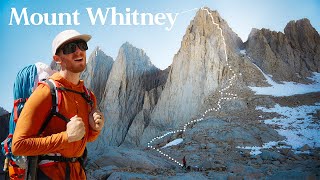
Mount Whitney is the tallest mountain in the contiguous United States and the Sierra Nevada, with an elevation of 14,505 feet (4,421 m). It is located in East-Central California, on the boundary between California's Inyo and Tulare counties, 84.6 miles (136.2 km) west-northwest of the lowest point in North America at Badwater Basin in Death Valley National Park at 282 ft (86 m) below sea level. The west slope of the mountain is in Sequoia National Park and the summit is the southern terminus of the John Muir Trail which runs 211.9 mi (341.0 km) from Happy Isles in Yosemite Valley. The east slope is in the Inyo National Forest in Inyo County.
Awesome video y'all! I'm planning on hiking Mt. Whitney so all this info helps! :)
thank you for this video it was incredibly helpful!
Very helpful guys. Well done!
Shitting in the mountains not like it use to be . I will do it carry it out 👍😁
Super great video! i havent been there yet but its definitely on my list!
Great video! Thomas has a topographical 3D Map. That's hardcore.
Really cool format to your video and a great way to deal with living in different cities. Well done!
Great and useful video. Wish you could have provided links to things you talked about: map, etc. thanks
Loved this, great advice....your camera work is cinematic inspiration ❤️
Great video! Is that a 3D topo map on the table? If so, where did you get it?
We need to get you guys set up with a nice Outdoor Vitals 60L pack!
We'd love to talk too!!
The WAG bag talk at the end ... so great!
woah, loads of info. thanks for taking us on these journeys
I tried to summit on Halloween but didn't make it. I started at 12:30am Way too early and I shouldve packed a puffy jacket in my bag because I sweat underneath all of my layers and came close to hypothermia. I did the first 3 miles in 40 min. If I went back I would've started around 3/3:30. For people in decent shape that's a good starting time unless youre going to walk at 1 mile per hour. Also I underestimated the altitude on this hike. I was taking Diamox in preparation and still got a massive headache. I usually dont get altitude sickness but next time I will be camping at the trail head to acclimate.
Hope you go back again to finally conquer it!
@@AdventureArchives Already have plans to go back in the warmer months lol
Great guide. What about cell reception in 2020?
Hmm, I'm not sure, but I don't remember having cell access when we did this, which I was in 2017. Thank you for watching!
according to Thomas, the way he has been training for it, it should of been a day hike lol
Lol! Andrews training montage !
I liked that part too. lol. I'm still waiting on his weekly vlogs... hint hint Andrew.
Absolutely, and Andrew's always been my favorite! 😁
great info
😅 i’m looking to do the john muir trail don’t know why i watched this but i did
I climbed this twice in 1970, once with a friend and next with a troop of cub scouts. We camped at timberline to acclimate and made the summit the second day. This was in August which was the safest month I was told. We never saw any lakes so the trail must have changed since we went . There was only one trail from the parking lot to the summit. We made our descent after signing the book at the top and marveling at the horizontal icicles. We also climbed White Mountain just across highway 395 from Whitney. There was a road all the way to the top and a high altitude testing station at that summit staffed with college kids who would always offer climbers some tea, food and a place to sleep if you needed. They would say that White was taller than Whitney but apparently Whitney was more popular or political so his mountain got the honor.
Great memories I'm sure. On my list of peaks to bag if I can. Reminds to me get on it. 1970 was the year I was born, and compared to most people on the trails these days, I'm an old dude.
Hulda Crooks hiked Whitney 23 times. She hiked it for the first time at 66 years old and for the last time at 91. She holds the record as the oldest person to hike Whitney. When I learned this I felt that I could hike Whitney. After this video, im now terrified, lol. Just joking, great video, helpful info.
had two buddy's share a wag bag at Escalante, back to back, they got some good food off that dare
I approve of the number of times poop was said in this video. XD
Awesome. Great info. Thank you
Thanks for emphasizing LNT principles and the wag bag. Other outdoor channels don't do it enough. As more people are inspired to go visit the great outdoors because of youtube, they should also learn to be good stewards of the land so that there isn't a Tragedy of the Commons.
Absolutely! The freedom that the wilderness gives us also requires some responsibility and care for the environment in return :) Thanks for watching!
How many military jet fighters flew over Mt. Whitney when you were there? I glissaded down the last several thousand vertical feet. I hit 15 mph!
Great advice thank you!
Awesome video! Thank you!
I know people who hiked the PCT with synthetic sleeping bags jackets and were very happy.
thanks guys
Very well explained video.
Phenomenal video
Awesome video and very informative. However, I'm questioning the 3L water reservoir for 4 days of hiking with no water filter???!!
Usually have water purifier tablets
Great info guys!
Very hard for many to hike a 14'er without being acclimated to the altitude. As you said, know when to quit.
Very detailed tips, Thanks!! Are you an accountant?? Detail oriented is a good thing!! Where did u get your maps?? Excellent presentation!!
What's the best time to start the hike if it's a day hike?
Can you elaborate on the weather? What if you get the date you want but if it rains? I assume there are no refunds or exchanges due to weather conditions. What time of year is best?
Also I wonder if other fourteeners are better for a first time 14Kft summit day hike? Like Colorado has a lot (Elbert etc).
Either way Thanks for the great info (whether or not I ever climb Whitney)
Cool thank you for the advice!
Highly recommend "Mediocre Amateur" a smaller vlog hiking channel. Absolute beasts summited in a day and regularly run routes that are more than a marathon.