Photogrammetry Deliverables- What you NEED to know

ฝัง
- เผยแพร่เมื่อ 28 ก.ย. 2024
- Be sure to check out this cool app: UAV Glossary
apple.co/2Zcnt48
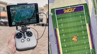
This video is not a how-to create your deliverable. This is more like What do I need to know before I give my client the data I created from my drone. If you are not sure what to do once you have made a map or you are not even sure of the different files that you can create from photogrammetry software, then watch this video. I give you some good basic information to help you get started.
GM6 Solutions Consulting- www.gm6solutio...


I rarely comment on videos but thank you so much for posting this! Very helpful information!!
You are very welcome. Im glad you found it helpful
For someone looking for a good start in mapping and photogrammetry, you are doing a great service. Accessible and easily understandable information.
Thank you very much. It helps to hear that.
Amazing one of the most useful video I seen so far on delivery clients the end results :D
Thank you sir, I appreciate that.
You are shaking up the industry I love it thank you for your wisdom student for life.
Well Im not sure about shaking up the industry, but I definitely love the compliment. Thank you, and I glad I was able to help.
You have confirmed everything I've experienced so far in drone mapping. There is no one size fits solution. Each platform has certain pros and cons. Anyhow I'm getting ready out here in California to test out 3dr by site scan. Runs on the same pix4d engine. I'm teaching myself how to make holgramic 3d animated models all in VR. Hope that makes sense?
I totally get it. Ive been experimenting with similar stuff. Check out my website. www.gm6solutions.com
Where are you in CA. I have a property in San Diego guthattet needs to be done
@Chris Bock, if you don't hear back from him then let me know. I can probably find someone to help you out
Thank you for sharing your knowledge and experience. I have been using DroneDeploy on a trial basis. Let me ask, is there any particular reasons that you chose Pix4D? It is certainly much more expensive than DD. I could not afford Pix4D at this time. Thanks!
Thomas Rayborn thank you, I appreciate your comment. I have actually switched to Agisoft Photoscan a while back. Its expensive too, but processing locally on your own system gives you the freedom to correct your maps and models when there is a problem with the images. DD has 1 way to process and if your map fails you have to re-fly. Plus I can handle bigger data sets on my system and I can use ground control points without paying more money. Overall its gives me more options for every thing.
Yes, i have more control over the project settings. In DD you dont set up anything. If your project fails you have to go re-fly it. However, if DD is working for you and saves money, stick with what works.
Muy bueno. Espero poder dedicarme a esto muy pronto
@juan perez Eres muy bienvenido
How much should one expect to spend on a monthly subscription to pix4d or other programs you had mentioned. DroneDeploy is very expensive if you opt for the package that allows exporting various file types.
Thats a very good question. Pix4D at minimum is $350USD a month. Agisoft Photoscan is $3500 USD for a 1 time license.
What about topographic relief, camera tilt, and distortions in camera optic?
Im not sure I understand the question. Those are issues that ground control points will fix.
Thank you for the video. I like to follow your informations about mapping 3D.👍
Awesome, I love the 3D modeling stuff. Let me know if you think we should do more on modeling.
Are the videos in Drone Mapping from A to Z in the order that you recommend to watch them in? If not, could you suggest to order to watch these videos in?
I probably need to clean up the order but they go in order from newest to oldest. Meaning, it would probably be best to start at the oldest first.
GM6 Drone Mapping Thank you very much.
What types of drone-based mapping can be accomplished without GCPs?
Any of it really, accurate is relative. If you're not a surveyor then your map can't be used for an official purpose. The question becomes, how accurate does the client need it to be. You can make the map very accurate even without GCPs
@@GM6DroneMapping What methods would you use for that? Several scale constraints in leu of GCPs to force the map a touch in the x, y, and z?
Possibly yes. If an object can be measured physically then It can be constrained. However for the Z a gcp would be needed. But if correct altitude is needed then it goes back to your point. GCPs and check points are needed
I heard the Book of Photogrammetry was viewed as heretical by some 13th Century Monks and thus not included in any common edition.
Well yes, it makes perfect sense. Those Monks were running around taking selfies instead of mapping their journey. ; D
These were really good advice. Thank you
This video is really cool. As far as measurements are concerned, it's now possible to perform them together with photogrammetry in a new cloud-based platform dedicated to drone data: delair.ai.
Love theese videos so so much! Keep them up.
Just subscribed
Thank you, sir. I will certainly try.
Your microphone is incredible!
Oh really? Ok. Thanks. Im definitely not good at audio.
Thank you sir. Very detailed and concise which is hard to do. Great tutorial for us beginners in this area!
You're welcome, just don't forget me when you are shooting the beaches in the summer. ; )
@@GM6DroneMapping
I won't forget! Maybe I'll get some extra attractive behind the scenes footage and send you a direct link lol.
Hopefully I'll be at more construction sites than beaches but this past summer I actually did both. Major Beach replenishment projects here which I shot a lot of and found pretty interesting. Hope to have an informational video about that done soon. Unfortunately the timing never worked out for me to be able to shoot the guys who were surveying in the water. I met them one morning after I had used up my batteries and the other times I went they didn't happen to be there :-(
By the way, the hopper dredge ship that looks to be a couple hundred yards off shore is actually much further away. it's a pretty big boat so the scale is deceiving. I did get out there, get some shots and get back without any issues but I was surprised how far away it was...
What is your website?
What is the maximum accuracy that you have achieved using a P4P?
I believe that it was 3in/7.62cm that is without any control points. With control, I don't remember but it has always been better than the requirements for that job.
Please make a video on how to improve on accuracy using GCP's and other methods to improve accuracy.
It would be a great help to a good number of people.
@@abhishekprajapati5567 Yes I agree that would be a good one. I do have plans to make that video. It's a difficult topic to break down in an easy to understand way. I will make it though.
@@GM6DroneMapping um, how can you define accuracy without having check points to compliment your GCPs and validate the accuracy
?
@@chrisalexander2478 I don't suppose you can. Unless you use a scale constraint in the software. But that only servers to scale it correctly not verify the global accuracy. I use GCPs without checkpoints when I want the map to be accurate but its not a requirement. Like if I am mapping a construction site as a means of documenting the progress but the client is not using it to verify the contractors measurements. (as an example)
Sir I am complete surveyors course, and start Road survey through drone, how to start this, and our clients need cad file, kindly help me I am from India
Well, Im not sure that is an easy answer. If you can go to the ABOUT section of my channel and email me, I will try to help. Let me know what kind of data you need to create and deliver.
can you tell me how much a drone mapping
I am not sure I understand what you are asking.
Love that book you referenced. Haven't read the entire thing yet, but it has changed my life. Great video.
Thank you, it has changed my life too.
Thanks for making these videos man, think i might get into mapping as a career in a few months. I wouldn't really know quite where to start without these vids!
Thank you Robbie, it means a lot to hear that.