ROS | Husky Map-Based Navigation [Tutorial]

ฝัง
- เผยแพร่เมื่อ 16 ส.ค. 2022
- This video demonstrates the simulation of autonomous map-based navigation of Husky in Gazebo (3D Robot Simulator) using Robot Operating System (ROS).
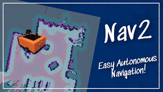
Husky used Gmapping SLAM to generate a static occupancy grid map of its environment ( • ROS | Husky SLAM [Tuto... ), based on which it localizes itself within the environment by matching the laser scan features and odometry data. Specifically, the localization algorithm (particle filter) probabilistically updates the pose belief (indicated as green vectors in RViz) and covariance (indicated as purple ellipse in RViz) of the robot as it moves through the environment.
Husky then navigates autonomously with the help of intelligent path planning and control algorithms. Specifically, Husky uses Dijkstra's Algorithm for global planning (indicated as green path in RViz) and Dynamic Window Approach (DWA) for local re-planning (indicated as yellow path in RViz). The controller then computes linear and angular velocities for the robot to track its local trajectory, which are converted to joint velocities using inverse kinematics (IK) and passed on to the actuators so that the robot drives towards its goal while avoiding any obstacles in its way. The actual path traversed by the robot is determined based on odometry data (indicated as red vectors in RViz).
All the instructions and code is available at: github.com/Tinker-Twins/Husky
------------------------
Specifications:
------------------------
OS: Ubuntu 20.04
ROS: ROS Noetic
Package: Husky - วิทยาศาสตร์และเทคโนโลยี
![ROS | Husky Map-Based Localization [Tutorial]](http://i.ytimg.com/vi/RrX4_UMeTQ8/mqdefault.jpg)
![ROS | Husky Map-Based Localization [Tutorial]](/img/tr.png)


It could not be better. Well explained and you covered everything in your code and videos. Thanks alot
Thank you for your generous comment!
@@TinkerTwins You are very welcome.Do you have any similar videos for A* path planning and also how we can use our own map with the husky you taught us in your video? I am wondering to replace my own map.yaml with the predefined world. Do you have any suggestion?
@@SamarAshrafii We have implemented A* path planning with custom map generation and loading using AutoDRIVE Ecosystem (autodrive-ecosystem.github.io). Here's a video of it in action: th-cam.com/video/piCyvTM2dek/w-d-xo.html
P.S. We are the developers of AutoDRIVE Ecosystem. It is a fully open-source ecosystem for prototyping autonomous vehicles and comprises a hardware testbed, a high-fidelity simulator as well as an exhaustive software development framework. You can check it out on GitHub: github.com/Tinker-Twins/AutoDRIVE