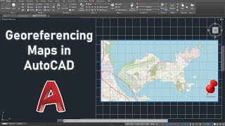
Geolocation|| autocad civil3D geolocation using projected coordinate system ||

ฝัง
- เผยแพร่เมื่อ 25 ส.ค. 2024
- Today, we'll talk on how to set autocad Civil3D geo location.
firstly, you create account with autodesk for you to sign in as autodesk user, then you set the coordinate system of the project location. the Geolocation icon will appear and then you click on it. geolocation using projected coordinate system
Join me on social Media
facebook: / 458151859. .
telegram: t.me/+M2g8qeenrB9IOTFk
Linkedin: / felix-ade. .
Email: surveygoteasier@gmail.com
#civil3d #engineering #surveying


![[LIVE] : ONE ลุมพินี 76 | คู่เอก "ผึ้งหลวง vs สมิงดำ"](http://i.ytimg.com/vi/9SBshmGQOIM/mqdefault.jpg)
![ว้าว!ลุงบีมแบกทองมารับขวัญหลานกันยกบ้าน [cc] แดนแพทตี้ SS2 | EP.49 |](http://i.ytimg.com/vi/Osihq1OAs-4/mqdefault.jpg)


Wowww, this is great.
Thank you Boss ❤️
You're welcome
Help me!
My civil 3d is crack, why sign?
Check our video on sign in problem