Fly & Drive (LiDAR Lower Power Lines View)

ฝัง
- เผยแพร่เมื่อ 21 ก.ย. 2024
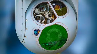
- For this data capture, we have used a LiDAR scanner from YellowScan, Survey Ultra 2, mounted on the car. The aim was to capture high-quality data about the Lower Power Lines.
For this service in Eastern Europe contact: office@skylinedrones.ro or check our website : skylinedrones.ro/
For equipment and more information, you can access the link below:
laorizont.ro/
#lidar #survey #powerlines #drone #payload #scanner #datacapture #YellowScan #SurveyUltra2 #Fly&Drive #pointcloud #Skylinedrones #Laorizont #droneprofesionale #scanarelidar


womit wurde das aufgenommen?
It was captured with YellowScan - Fly & Drive (Ultra 2). For more information you can reach us via e-mail. Thank you!