The steepest mountain in the world is in Cuba????? | Caribbean geology

ฝัง
- เผยแพร่เมื่อ 19 ก.ย. 2024
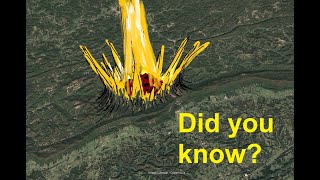
- Qomolongma (Mt. Everest) and the Big Island of Hawai'i both get hype as Earth's greatest mountain, but there's a mountain in the Caribbean Sea that beats them both in terms of sustained steepness. Its long-distance slope steepness from the base of the Cayman Trench to its summit is exceeded nowhere else on the planet over. This mountain probably pushes the limits of what Earth's rocks can support under the force of Earth's gravity. It's on the south coast of Cuba, and most people haven't even heard of it.


I like this channel that feeds my enthousiasm for geology.
Try to get some more Caribbean stuff going soon.
This is great. I never knew.
Steepest and deepest places are inherently scenic and fascinating. Some of my favorites are Black Canyon of the Gunnison, Torre del Paine, Molokai cliffs, Yarlung Tsangpo Grand Canyon in Tibet, Lake Baikal, and Sognefjord.
Fascinating! Transform boundaries often make for steep escarpments, both on land and offshore. I'll wager that transform faults are the most effective at decoupling and juxtaposing pieces of crust of wildly different densities and thicknesses. Thus strong contrast in freeboard over short distance with one. Restraining bends on transforms are also great for making mountain ranges pop up on Continental crust.
Fascinating; thanks for posting.
wow very cool
I’ve been to the Brisas resort in the area. Stunning place! The view was fantastic. You took an elevator down to the beach lol. Cuban people are really nice. Hope things improve in the near future for Cubans and their governments international relations.
Oh geez you already made a video about the Caribbean. Nice.
Try to do a couple more. The "bottomless waterfall" vid about jamaica on my page is interesting (it's an older vid and silent).
@@TheGeoModels awesome. Thank you man.
Wow, that’s like doubling the relief on Telescope Peak in Death Valley. Roughly 11000 ft over 10 or 15 miles if memory serves. And it’s pretty damn impressive!
I stand behind Cayman Trench to Turquino being unbeaten. Nowhere else does old, dense oceanic crust get placed next to continental-ish crust with no transitional zone. Nat Geo "Drain the Oceans" needs to get on this one!
@@TheGeoModels fpr sure. The example you show is crazy relief. I had never heard of it before
10:38 holy cow! We're looking a Lichtenberg structure right there. Andrew Hall might be on to something?
thanks for the info. Apparently their is some uplift on the eastern part of cuba since they find coral line plateau up to 50M high.
What's always puzzled me is why the amounts of continental & oceanic crust almost coincide with land & sea.
Finally, someone else has pointed this out. I discovered this on my bored google earth sessions.
I processed a 2D line from the west coast of Florida. Some crazy dips on the escarpment, perhaps 45 degrees if I’m remembering correctly. Can’t recall total relief. Well under 10000 ft I think
Had some Houston friends involved with Bahamian fold belt studies on the north coast. There's nice fold-thrust structure down there, but nobody seems to be moving towards producing it, if there's anything to produce. Also owe you an e-mail!
@@TheGeoModels I will look for it in my archives and email it to you. Doubt any drill bit will touch this stuff in our lifetimes
@@MorganBrown I hear you. I swear various onshore Caribbean settings are ripe for the picking though. Someone needs to show up and erect a cable tool rig like There Will Be Blood.
great info!!
It's one-of-a-kind. Got to include a couple other Caribbean mountains shortly here. Remarkable stuff so close to the US that never gets attention!
If you drain the sea . . . Wow!
What is that angle of steepness? Do you know that percentage? I'm getting flashbacks to using the pythagorean theorem in grade school.
Soh cah toa!! For Turquino to the trench, it's about 15 degrees...maybe a bit more. The "overall" Marianas Trench is about 10 degrees, which is considered quite steep globally. Big Island Hawai'i is under 10. It doesn't sound like much, but Turquino-Cayman Trench is legitimately significantly steeper over 10's of miles than anything else. Got to keep in mind this is very big picture; smaller-scale, individual slopes on mountainsides are a different story.
I suppose this depends on what metrics you use to define "steepest."
For example, Mt. St. Elias rises 18,000 feet in just 11 miles, to about 1640 feet per mile, which is slightly faster than the 1,500 or so feet per mile for Pico Turquino.
Interesting...I measured Turquino over the same distance interval and it's something pretty close to that--18,000-19,000 feet. I suppose I was going for sustained topographic gradient over the longest distance, which Turquino will still do because it's juxtaposed against the Cayman Trench. I had always heard Denali tapped as the most prominent mountain, and I don't know how it stacks up against St. Elias. The high peak on South Georgia Island is also up there, but both it and St. Elias sit on continental lithosphere, so the coastline is more of a water boundary than a geomechanical boundary. Alaska's mountains are absolutely off the charts, though, and are to say the least intimidating...
It looks like the Cayman Islands and Cuba were ones the same land mass.
Look into the pacific origin model. Theory suggests every island in the Caribbean was once a part of the same land mass that originated in the pacific and crashed into north and South America ripping them and the land mass itself apart.
@JC-ji1hp the same landmass that crashed into north america and made baja parts of alaska and the west coast of washington?