HEC-HMS for HEC-RAS Users Part 4 of 4: Setting up a basic HEC-HMS model and comparing to HEC-RAS

ฝัง
- เผยแพร่เมื่อ 29 ก.ค. 2024
- To mark yesterday’s release of the highly anticipated HEC-HMS Version 4.9, we’ve put together some video tutorials showing how easy it is to use HEC-HMS to delineate catchments/watersheds and flow paths, which can be very useful for setting up HEC-RAS models.
Part 1: Introductory comparison of rainfall runoff routing (HMS) and rain-on-grid (RAS) • HEC-HMS for HEC-RAS Us...
Part 2: Delineating watershed boundaries and flow paths in HEC-HMS • HEC-HMS for HEC-RAS Us...
Part 3: Using boundary and flow path shape files in HEC-RAS rain-on-grid models • HEC-HMS for HEC-RAS Us...
Part 4: Setting up a basic HEC-HMS model and comparing to HEC-RAS, manual delineations in RAS Mapper using GIS commands
0:00 Introduction
0:20 Merge and split HEC-HMS elements
0:48 Create new meteorological model
2:19 Create new control specification
3:16 Enter basin losses, transform, and baseflow
5:21 Enter reach properties
7:05 Create new simulation run
7:35 Export results
9:34 Add basins manually in RAS Mapper using Geospatial Operations command
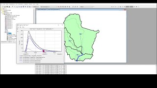
13:40 Hydrograph comparison
14:18 QGIS course for creating watershed maps
14:47 Summary
Here are some of the links we reference in the videos along with some additional resources:
* HEC-HMS training courses, webinars, and other resources: www.surfacewater.biz/hms/
* HEC history and list of HEC programs and guidelines: www.surfacewater.biz/hec/
* Free HEC-HMS webinar with the HEC developers, Part 1: • Modelling with HEC-HMS
* Free HEC-HMS webinar with the HEC developers, Part 2: • What's new in HEC HMS,...
* Summary of new features in Version 4.9 and future developments with the HEC-HMS development team: • New and Future HEC-HMS...
* Using depth varying roughness with HEC-RAS rain on grid models: • What's new in HEC-RAS ...
* Free QGIS webinar demonstrating how to create the watershed map of this basin: • QGIS for preparing and...
* Hands-on QGIS course for creating the same watershed map yourself: awschool.com.au/training/on-d... - วิทยาศาสตร์และเทคโนโลยี


Thank you for all you do getting us jump started using the software and learning about new features.
Thanks a lot! Very informative. I would like to watch you doing a "rain on grid" in RAS with several watersheds and different precipitation hyetographs for each one. Thanks.
This was very informative and helpful, thank you!
This is gold! Thank you.
just wanted to ask do we have to import subbasins which were generated in hechms, in hecras and then do we need to define boundary condition for each subbasin separately or do we have to create a single 2d flow area perimeter for all the subbasins as whole, for 2D flood modeling?
Hello, thank you for the valuable information. I have a doubt: is it possible to estimate or simulate the in-channel infiltration? what should be the best way to do it? thanks in advance.