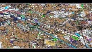
How to Download Open Street Map data in Shapefile format

ฝัง
- เผยแพร่เมื่อ 15 ก.ย. 2024
- Openstreetmap Data into vector layer like Land use, Road, Railway,Buildings,Water body,Point Data
Dear Friends You Can Join Our Telegram Group or WhatsApp Group for Learning (ArcGIS, Erdas Imagine, Q-GIS, ENVI software)
Telegram Group Link
t.me/joinchat/...
Follow this link to join my WhatsApp group:
chat.whatsapp....
Download Free Very High Aerial Imagery 0.5 meter, SRTM DEM,sentinel-2, Hyperion, LANDSAT-8 & Aster
• Download Free Very Hig...
How to calculate land surface temperature from Landsat 8 Satellite Data
• How to calculate land ...
How to Create LULC using ArcGIS/ Supervised Classification
• How to Create LULC usi...
How to Create coronavirus Map in ArcGIS !! Health GIS
• How to Create coronavi...
Generate Contours and Slope From Google Earth in ArcGis
• Generate Contours and ...
How to delineate watershed using DEM
• How to delineate water...
Digitization in Arc GIS
• Digitization in Arc GIS
georeferencing and projection
• georeferencing and pro...
Download Very High Resolution Google Earth Image//Georeferencing in ArcGIS
• Download Very High Res...
Email:-Vikasghadamode7@gmail.com


![[LIVE] : ONE ลุมพินี 79 | คู่เอก "ก้องชัย vs อาเมียร์"](http://i.ytimg.com/vi/WfPSA1A0NHc/mqdefault.jpg)

Great sir, it is a Authentic data or not..??
Its Authentic any one can use
Sir sewer network design using qgis it is possible or not can you please give me solution
Thanks Sir
Good job
sir, how to get historical road osm data. i needed osm data for 2001
We don't get historical data from osm
Sir please tell me from where can i get boundary shapefile of city Faridabad. Please reply
th-cam.com/video/SoFkRHY8F-0/w-d-xo.html
From survey of India you can download Faridabad shapfile i have share video here that might be helpful for you
Sir i want to clip my area administrative block from this how can i do it
You can download OSM data bigger then Administrative block and the you can clip osm data with shapefile of Administrative block
Can I download full Maharashtra state map?
You need to download small small portion and then merge all files together