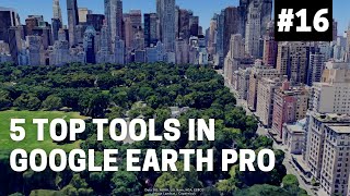
See Previous Map or places on Google Earth pro| How to see Old Map on Google| Hidden facts| GeoJin

ฝัง
- เผยแพร่เมื่อ 22 ต.ค. 2024
- #Map #previousMap #googleearthengine
It's easy to find out previous old maps and analyze an area that how it changes throughout time and periods.
To view previous maps or places on Google Earth Pro, follow these steps:
Open Google Earth Pro.
Click on the "View" menu and select "Historical Imagery".
A timeline will appear in the upper-left corner of the screen.
Slide the timeline to the date you want to view.
Google Earth will show the map as it appeared on the selected date.
Note: The availability of historical imagery may vary depending on your location and the date you select. Some areas may have limited or no historical imagery available.
By using the historical imagery feature in Google Earth Pro, you can see how an area has changed over time and explore past maps and locations.
#GoogleEarthPro #HistoricalImagery #PreviousMap #PastMap #OldMap #GeospatialTechnology #Mapping #GIS #TimeTravel #GeoHistory.


thanks you saved my day
Glad to hear it
Thanks ❤
You're welcome 😊
Hi....now earth pro does not show images before 2018 ..... earlier I used to see 2002 images ...now it's not showing what has happened??
Any other source for old satellite images
@@chinnamosa2732 no idea...
Hi few months ago i was able to see till year 2004 but now i am able to see only 2 years ago in the same place...how can i see that old data till 2004
Hi....now earth pro does not show images before 2018 ..... earlier I used to see 2002 images ...now it's not showing what has happened??
Any other source for old satelite image's...?
@@vigneshwaranviki4439 now I can see images till 2013..maybe they were doing some maintainance... please check again...I downloaded latest version
thank you, u saved my time
you are welcome!
Thanks for all! It was so useful for me.
Good
Thanks
What
🌱
@@geojin bhai ab yaisalgata hai ki bhor hi purana map update hai
2017 kaho