Monitoring Crop Health With Drones | Maryland Farm & Harvest

ฝัง
- เผยแพร่เมื่อ 28 ก.ย. 2024
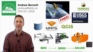
- We travel to Middle Neck Farms, where farmer Sam Parker has hired MADTECH Drones to come survey his fields. This startup, run by Tom and Zach Marnane, helps farmers analyse crop health through aerial photography. Through infrared photos, they can tell if plants need more or less water or fertilizer, and see possible problems before the human eye can tell. This cutting edge technology helps farmers be more efficient and cost effective.


Honestly, I've always been watching all your videos and whenever I watch, it's giving me a calm and relaxing vibes and a positive energy. Also, your videos help me relieve my stress. Always take care and so is your family. Thank you for always giving us these wonderful videos ❤
Using drones in farming contributes to sustainable agriculture in terms of social, economic and environmental dimensions.
Agricultural Drones Market size was valued at USD 1,197.05 Million in 2021 and is projected to reach USD 6,029.86 Million by 2030, growing at a CAGR of 19.68% from 2023 to 2030.
The global commercial drone market is projected to reach the size of around 58.4 billion U.S. dollars in 2026. [Statista; Verified Market Research] 3:13
You also need spraying drone
How does that flight map really work ....the module used???
Where can i get that multispectral camera
nice
Great
Heyywhich software you have used for monitoring the crop health??please can you tell
Please tell me the answer?
Aggremo does the magic
Which software are using for the monitoring?
Is it done by image sensing and acquisition in digital image processing concept?
Please tell me the answer, because I am a Aeronautical student ,so my project is crop monitoring,so please help me?
Hey klrahul😁 even I am a Aeronautical Engineer and worked on similar project
Hello
@@klrahul6912 I am doing a project farming with aerial photo analysis
For this I used gimp but it is not working can you help me
@@prajwaljoke2392hey