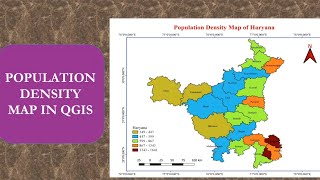
HOW TO CREATE LOCATION MAP OF STUDY AREA IN QGIS | HOW TO DOWNLOAD FREE SHAPEFILE AND ADD LAYERS

ฝัง
- เผยแพร่เมื่อ 6 ก.ย. 2024
- How to create location map of study area in qgis
HOW TO CREATE STUDY AREA MAP IN QGIS USING ESRI IMAGE👇🏻
• HOW TO CREATE STUDY AR...
To download free shapefile 👇🏻
www.diva-gis.org/
HOW TO ADD GML FILE IN QGIS | HOW TO DOWNLOAD SHAPEFILE FROM MARINE REGIONS WEBSITE
• HOW TO ADD GML FILE IN...
/ itiscivilengineering
Follow @itiscivilengineering on instagram


thank you so much for this video. you explained it very very simply and it was very easy to understand. i was struggling with map creation since too long and you solved the problem. thank you so much. this short video is way more worth it than other very long videos on youtube. thank you so much
India k andar weast Bengal ko kaise High light kare study area main
I've been struggling with this thing for so long!!! But, after watching your video, I'm thinking what exactly have I been struggling cuz the way you explain is so easy to understand and catch up! Thank you so much for this video!
Thank you so much!! You delivered what I was searching for more than 2 nights. Nobody has explained as simple as you stepwise! Keep up the good work.
What do you do when diva Gis doesn't respond
Thank you so much ❤️ You explaination very clear and I can easily understand what you teach ☺️
Good one.You can use filter option to select the state and city by using id_1 and id_2
You are really amazing. You made me plot my own study area in one go😍😍😍😍
its great job thanks every one
from ethiopia ,haremaha university.
Thank you so much. u explained in the best possible way as compared to other videos found
Mistakely I removed the option of right side like item properties, layout ang guides. How can I get that back? please help me
For that click on view
Then Panels and then you can tick the checbox of item properties or any other you want.
Watched 3 4 times
Also want a video of how to put points from ground to town map and georeferece and put another points from different places in that map! Pls mam
I should thank you a lot for the great help to get to understand some tools I hadn't used before. Your explanation is so nice and clear that even a beginner will understand it.
Really thank you for this wonderful and detailed video. This helped me a lot
best tutorial till now 🔥
Namaste ma'am
Mujhe Qgis sikhna hai
Please ma'am aap tution de dijiye ma'am
Really thanks this helped a lot.
Thanks a lot,,, it was amazing ... U have explained very keenly... Thanks for helping us...... We want further videos like this.... We wll be waiting⏳.
Nice video and good thought in making this video would have got excellent screen time
Thank you very much for this video ma'am. 😊
Hey Miss, Thanks for share with us. But on 9th min 55sec, I was lost,.. how to add item Properties?
For that click on view
Then Panels
Then tick the checkbox of Item Properties.
Why J&k is like this?
Some portion seems to be missing.. I doubt🤔
If the portion of your interest is missing in this shapefile then you may download shapefile from marine regions website.
Nice explanation. Easy to follow
Very helpful video - thank you very much. Besides, you got a beautiful voice!
god bless you thank you so much
perfect!
the river flows in more than three to four province then how we select the river basin at that situation instead of districts.
You will have to delineate watershed! th-cam.com/video/hkdNXYKW240/w-d-xo.html
@@itiscivilengineeringcivilelite indus river basin
U can use query builder to select them, much easier
good teacher te
Many thanks, super clear
How to create a map of a particular area of a district along with vegetation in that area ?
You'll have to do Landsat image classification. You can refer this video 👇🏻
th-cam.com/video/31CaDGLTm3s/w-d-xo.html
Thank you@@itiscivilengineeringcivilelite
You are the best!
Maam at 4:16 In Open Attribute Table I left click on the row but still I am unable to select the districts. Please help me regarding this. Thank you Maam
Then you can follow the below steps
Open Attribute Table
In toolbar you will find "Select features using an expression" Click on that
Then double click on
Field and Values
then double click on "NAME_2" below you will find = operator select that and then put a space then 'districtname'
Like I want to select the row for surat, then it will be
"NAME_2" = 'Surat'
Thank you boss🙏
you are god
Superb
Good Job! Thank you for sharing. :)
Hi mam, good day. I have a question when i draw 3rd map of my study area upon drawing coordinates its not visible how can i fix it?
If the coordinates are not visible then in CRS set it to Project CRS: EPSG:4326 - WGS 84
@@itiscivilengineeringcivilelite Its visible now thank you so much 🤗✨ you made my day 🍒💞
Miss, how i should do if it do not have line between state.. it just empty
For which state you want to create location map?
Thanks a lot.......
@1037_Sheerin Natasha "I'm not able to right click and get the export option. What should I do mam?"
On top you will find Layer
Click on Layer then click on Save As
Im not able to select many districts as they are in not line so could you please tell me how to select
You can use field calculator! Select from field and values!
It's not happening
THANK YOU SO MUCH .
Thank you
when I add grids, it doesn't show up. I don't know how to do it
In CRS set it to Project CRS: EPSG:4326 - WGS 84
Once you'll set it and tick the checkbox of draw coordinates, the coordinates will be visible.
thank youuuuu...really help me a lot =)
May i ask? Im using the latest version of Qgis and when i try to save multiple maps like you were doing over there, one of my maps will be distorted ut will become very small and the others will be fine. But if i save one map as it will go well and im using google earth shape files
I suggest you to try this with 3.16 version of qgis
You are indeed a phenomenal instructor but, I personally would have loved it if you eased off on your accent. Like soon after creating coordinates in their ascending order, you then say, " on the left side, add what? I have failed to pick it up. If possible, could you reiterate? Thank you, again.😊😊😊
As I made changes in item properties which is on the right side i.e. I changed the coordinates to vertical ascending, those changes got reflected in my map which is on the left side. This is what I meant, nothing else.
mam, I am nitin, I watched your video in the shapefile all districts of Maharashtra names is not coming and I want to draw three district map, these three districts names also are not coming in the map, I follow your video as it is. what shall I do?
Please let me know your district names. I will check once.
@@itiscivilengineeringcivilelite Bid, Osmanabad and Latur
Bid, Osmanabad and Latur
@@nitinbhagat2172
Follow the below steps:
1) Right click on layer "IND_adm3"
2) Open attribute table
3) As you want to create map showing three districts, so first select "all the rows" with
NAME_1 Maharashtra
NAME_2 Bid
4) Close attribute table; again right click on IND_adm3 and then click on Export and Save Seleted Features as, then give filename of your choice (e.g. Bid) and click ok
Same way you will have to do for other two districts.
Print Layout creating prodecure is same as I have shown in video.
Mam I want full videos of Qgis
can u share this study area pdf
your video is amazing
mast thnq
but how i add shape file of river basin.
In the same print layout you can add your river basin! Add your shapefile then untick other layers and add map in print layout! As I have done for country, state and place same way you can do it! If you want to show country, state and river basin steps are same! Only instead of place shapefile you will add your river basin Shapefile
still problem
sir share your whatapp
@@arifhussain796 You can mail me itiscivilengineering@gmail.com
How will I be able to select the state odisha? Is there any specific key
You can right click on the layer IND_adm --> Open attribute table --> Click on select features using expression --> Go to field and values then double click on NAME_1 then click on equal operator. On right side in Values search for Orissa, double click on it then click on select features.
Look at Northern India
HOW YOU DID BOB
Failing to download Diva gis
I wont to more videos on qgis........
check Indian boundary is incorrect
study area not save
Please elaborate..
how to select?
What do you want to select?
Mustafa Akman: "Great job.
Thanks.
May I ask you a question? Can we you use GML file in QGIS?
Like this:
In the site, there are many
GML files.
How can I use it in QGIS? www.marineregions .org/eezdet..."
Yes @Mustafa Akman you can add GML file in QGIS. I will soon upload a video on that.
My scale values are shown in negative, but I want the scale values in positive.
@@nimraashraf6101 In Scalebar item properties keep Segments as "left 0"
Aina Naziehah @itiscivilengineering CIVILELITE i want to select like u did at 4:16 but don't know how ?" @Aina Naziehah In Open Attribute Table left click on the row you want to select.