
ฝัง
- เผยแพร่เมื่อ 12 ก.ย. 2024
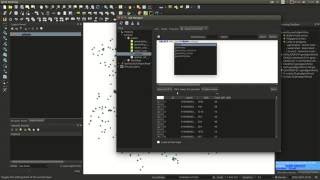
- Geopackages are the default datastore in QGIS. They're based on SQLite and so they are databases! That means we can do database STUFF with them. Far out. Part of that STUFF is SQL... you should learn SQL. It's really useful. If you don't have time to learn SQL ask ChatGPT to knock out the code you require. ALSO... at 7:50 I messed up the zoom and pan so the code is out of view. You can download it here docs.google.co...
If you enjoyed this video you can support the channel and buy me a coffee using this link:
paypal.me/burdGIS
🌐 Visit our site 🌐
www.burdgis.com
🌐 Take an online GIS course 🌐
www.udemy.com/...
🌐 Find us on facebook 🌐
/ burdgis
Use coinbase as the home for your crypto-currency:
www.coinbase.c...


![โฮ่ง! (SUGOI) - LYKN [ OFFICIAL MV ]](http://i.ytimg.com/vi/nFp4zjAARFs/mqdefault.jpg)


Excellent, helpful content - and really appreciate the straightforward and efficient video with no intros or animations!
Thanks Oscar. I used to include all the intro etc but I think for instructional vids just better to get straight to it
Such a magnificent video! Thank you very much for sharing!
Glad you liked it :-)
Trigger functions in a geopackage are quite fun, maybe cover that next? I suppose you can create a lot of similar functions in attribute widgets though 🤔
Oooh very good suggestion. Thanks Phil.
Great video, appreciate the time you put in making this content !
Thanks phil. I appreciate you watching them! 🙂 I hope they inspire your mapping
SQL & spatialite are very powerful tools, along with virtual layers + DB Manager I find them easier to use than processing tools
thanks for posting
PS from 7:50 the screen is cut off and what you type is not visible 🙂
Thanks Stefano. And yikes! I'll look into fixes for the 7:50 blunder
Hmm, it looks like TH-cam no longer allow you to edit and overlay text on a video
the final query isn't shown on the screen
Thanks for watching. You're not the first to notice this :-) From the description...
ALSO... at 7:50 I messed up the zoom and pan so the code is out of view. You can download it here docs.google.com/document/d/1k7mQX5EFT4FUQv9UtTAWHhbiymsIimjPN1lgdqB_BUo/edit?usp=sharing
Hello, very informative video. I am completely new to QGIS and therefore have a question and I will be glad if you will be nice to support.
I have connected an access DB with ODBC to QGIS. But the coordinate systems in the database are Gauss-Krüger coordinate system format. The mapped points therefore do not show up and not read into the maps at all. Can you guide me with how best to make the points readable in QGIS. Thanks in advance
What is the EPSG code for the Gauss-kruger coordinate reference system? Also is this a spatial database or is it just a table with coordinate columns in it? If it's the latter you'll need to convert that table to have geometry.
Hi @budrGIS
please do you know if a SQL'd layer can be saved in the GeoPackage along with its script? like with virtual layer for instance
at the moment I can only save it (preserving the SQL to create it) in the project file,which is saved in the GeoPackage
thanks
Hmm good question. I don't know. Did you get any further with this? You can always export the data but the script wouldn't be preserved
@@burdGIS not really, the way around so far is creating a virtual layer with the SQL, since the QGZ file is saved in the GeoPackage the VL is saved too. cheers