Importing Excel Coordinates to ArcMap and Plotting

ฝัง
- เผยแพร่เมื่อ 5 ก.พ. 2025
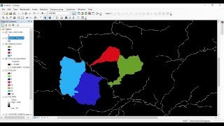
- This tutorial shows you how to import Latitude and Longitude coordinate information from excel and plot them in ArcGIS
⭐NOTE:
‘Kite’ is an excellent tool that can help you boost your productivity when it comes to programming with its free Artificial Intelligence (AI) powered coding assistant. Kite is a plugin which provides smart completions and documentation as you’re typing-in your code, and its compatible with most of the well-known IDEs such as PyCharm, Spyder and VS Code. I absolutely love it, and recommend you guys to try it out as well.
www.kite.com/g...


ArCGIS student here. Thanks so much
Many many thanks brother . I was spending a lot of time but could not solve the problem but your only 4 minute video solve my problem .Highly recommended your channel
Thank you so much.. Every step and point is well explained but the most best part of this video is your voice...
Thank you, this is exactly what I need to do in many situations
You are welcome
very clearly explained. Thank you
Thanks
Thank you so so much you helped me a lot !!! you have no idea it was exactly what i needed to pinpoint the samples in the map i needed. And it is the first time i am using this software but your explanation was so clear thanks again
it was very useful tutorial thank you
Amazing!! Thank you so much 🙂
thanks brother!!! u made my live longer!! huaa
Madhawa aiya... ❤️
Is he a Sri Lankan?
Thank you so much. Clear instructions
Great video my friend, sure helped alot! keep up the good work!
You are welcome :)
Thanks to u bro but i have for that stations scale is more larger than my studya area how can i fix bro please respond to me bro its more important issue to me thanks
Thank you so much brother. You are a great man
thank you very much
Thanks for good presentation,
I want know how can I add KmL file into ArcGIs?
Thank you for your video
You are welcome
Thanks, a good demonstration
Glad you liked it! :)
Very Helpful, thanks!
tHANK YOU SIR FOR HELPING US SAVE THE WORLD WITH U
OR GIS
You are welcome :)
Thanks🙏
Thank u so much 👏🏻👏🏻👏🏻
Thank you tons sir.I have been referring to your tutorials on phython which has been handy in my research on climate change.I cannot thank you more sir and kindly request you if you could please prepare videos on projection and transformation in Arcgis UTM to MUTM and vice versa.Thank you in advance.
Just make sure you get China and India on board with massive Climate Change regulations ASAP!!! Nobody pollutes the environment that these two countries and until THEY make these drastic changes, there will be no change in the quality of air for millions of people on that side of the world.
Very informative video..sir please tell me how to make a study map using arcgis.i have made an excel file that contains latitude and longitude value . My thesis is on hospitals in Lahore Pakistan.
@geodeltalabs Where are you pick Singapore data from?
Thank you
You're welcome
tk yu, im from Indonesia
Thanks !
Thank you so much sir
Why can’t I upload my excel file to arcgis? There’s an error message saying that “failed to connect to database. An underlying database error occurred. Class not registered “ however i saved the excel data sheet as Excel 97-2003 workbook .
please help me to resolve it!
Good! Thank you
It was great job .can you insert the UTM coordinates instead of lat.Log...?
Thanks a lot.
so how do i copy the shape file created to word document?
sir latitude and longitude option are not shown what i do, where the whole process is same
when I add the station coordinate, the latitude and longitude don't show up?
How shape file was prepared
Thanks, dude~
Thanks soo much
You're welcome!
Thanks! It was very helpful.
I have question, How can we add jurisdictional boundaries of stations. suppose we are working on police stations in a city, so, a police station must have jurisdiction, so what data need to collected and what terminologies are to use?
Hi, since the jurisdictional boundary is something that was demarcated by the respective authorities/ government, you will need to see whether that particular information is available for you to be downloaded in a GIS format. If they are not readily available in digital formats, another possibility would be to georeference a scanned map which indicates those boundaries, and then digitize it by yourself (and again, this is assuming that you have access to at least a printed version of a map)
How to write station name in study area?
where to get the basemap for Singapore?
Hi. This was really helpful. But the challenge I have right now is that the coordinate points are not appearing inside the map but outside. How can I fix this?
1. Check if you are selecting the right coordinate system when importing the data.
2. Check if you are mixing up X and Y. These 2 are some common mistakes that hinder one from getting to points to place correctly on the map
@@geodeltalabs thank you. I will do it all over again and check that out!🙏
Sir, Please make a video on how do I calculate the Positional Accuracy of GCP points?
Dear sir your video is very good always. Please make a video to generate the geotiff raster by CSV data containing lat lon and data using Python
Thank you :)
how could i receive the excel please?
Awesome
In my case points are plotted but attribute table is showing nothing
Try exporting and saving the temporary file as a proper ESRI shapefile. that should work
Hi ! I am totally new to ArcGIS. I am just wondering if you could just add your points on Singapore from any of the default basemaps instead of creating a shapefile for Singapore. Would adding all the other layers to the basemap reduce coordinate related errors ?
Thanks
You are welcome ☺️
The point did not appear when add like you? I did not found any solution on the internet why it did not appear. Please help me?
Possible causes:
1. Accidentally mixed up X and Y value fields when assigning them to Latitude and Longitude
2. Did not set the coordinate reference system of ArcMap to the correct CRS before importing the points
3. While importing data, the specified coordinate reference system was incorrect
You may see if any of this above is applicable for your case.
Thank you for this video! It was exactly what I was looking for to help plot my points. Just a quick question if you could help please. When I uploaded the data and plotted the points, I was unable to get the attribute data. Is there anyway I can get it to display? Could there be an issue with my formatting on excel? Any help to get my attribute data to display is very much appreciated. Thank you.
Hello, were you able to resolve this? I'm also having the same issue.
@@bidhanghimire6868 no I don’t remember being able to fix it :(
I have a csv data file and I am trying to upload it on arcmap....everytime I select the option display on xy dialog box appears but the x and y field doesn't show latitude and longitude
Did you save it in Excel (.xls) 2003 format?
Same issue even with 97-2003.xls file. No option to select Lat or Lon.......
I have coordinates collected in UTM but since GIS requires lat/long is there an easy way to convert it without needing to do it manually
If that's the case, you can bring in your coordinates to ArcMap using the same method that's explain in this video, BUT first you need to set the coordinate system of the ArcMap dataframe/ project to that particular UTM coordinate system. Then you can being in your UTM coordinates and it will get stationed at the correct locations.
Thank you sir. Do we have to put North or South Latitude as well as East or West Longitude in excel sheet along with the coordinate points?
No, since you are importing points, just the lat and lon of the corresponding point is sufficient
Thank you..
My coordinates are in Northing and Eastings. I find that when I plot it in ArcMap it locates the points way off (way way off)where they're supposed to be. Can you kindly help me with it? Thank you.
Hi, if your coordinates are in Northing and Easting, you need to find out first in which coordinate system those points were created. After finding out, you have to change the coordinate system of the ArcMap dataframe to be on that correct coordinate system, and then only proceed to import those points from your Excel.
If you import coordinates corresponding to a projected coordinate system to an ArcMap dataframe which is in a geographic coordinate system, then it is obvious that the locations will be way off because ArcMap does not know the original coordinate system of the data points. Hope this helps.
@@geodeltalabs Thank you.
Thanks for ur efforts, but when I come to to put the x and y into their places I can't find the columns ?):why
You have to use the right cordinate
Thank you for an excellent video..Do you think it would be possible to plot a position in real time on a map within excel, from live coordinates from a gps unit? Your thoughts would be appreciated..Thank you..
Hi, can you give an example of such a case, I might be able to give you some insights better if I can look at an example
...thank you for your response...I help to support a local school electric car racing team, and we have a direct radio telemetry link which brings up data on our laptop, from the car, in real time.. The telemetry software on the laptop is displayed within Excel...A future development is that our car will incorporate a GPS module, initially to indicate road speed...Do you think it would be possible, if we get the GPS to transmit the coordinates, to add a sheet within our telemetry program that would show a plan of a racetrack with the live car position being indicated..? I really don't want to take up too much of your time here, so a simple yes or no as to the feasibility of the idea would help me to decide whether to research the idea more, or not...Thank you again for responding..John..UK
Hi John, I think this is doable in python with the help of a bit of an advanced library like Dash. I haven't explored Dash to it's core, but based on a cursory reading of their documentation, it seems like its doable. I'll direct you to the page of one of the TH-camrs who has covered certain aspects of Dash, so that you might be able to get an idea how the library works and how you might be able to alter the functionalities to fit to your purpose. This tutorial is just a representation of how Dash can be used to develop graphs, but I'm sure it might be possible to do the same with geographical data as well
th-cam.com/video/J_Cy_QjG6NE/w-d-xo.html
Hope this helps!
It does help, thank you..I’ll do some more research..Thank you for your thoughts and advice.. John..UK
Hi, i'm trying to put my x and y coordinates in excel but it's not working. For example, i have this coordinate 52.274967, 4.794477. But when i put it in excel it turns into 52.274.967 and 4.794.477
I can't get these locations to show up in ArcGIS. I tried converting the cells to text instead of number but then i can't add them in ArcGIS either. What can i do to remove that 2nd dot because excel keeps adding it
Hi, you can first paste it in Notepad before pasting it into excel. Does that work?
Wow
😮
Thank you much
Thanks so much SIR
You are welcome :)
Thank you
thanks
You are welcome :)
Thank you