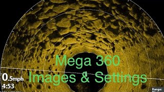
Waypoint accuracy check with Humminbird 360

ฝัง
- เผยแพร่เมื่อ 5 ต.ค. 2024
- In this video I will show just how accurate, or not, your waypoints can be when you place them. If you are interested in more information it can be found at www.gps.gov/. Thanks for watching!


![[#SHORTS CLIP] ใช้ของของตัวเองไปเลยสิคะ l ซานิเบาได้เบา l One Playground](http://i.ytimg.com/vi/Ea_mTywx2p4/mqdefault.jpg)


This one is 5.5 years old but I like it. I like it a lot.
You're probably busy with life but I'll watch for anything new.
Subscribed.
Not undermining you at all, but the way point is exact on both sides. The main reason is, I see that you are on 15' rings on the 360. The 360 transducer is in the front of your boat (the image on the 360 does not relate to the boat length at all), so you have to figure your boat is probably at least 18-20' long. Well that puts the back of you boat at or just past that first ring on your 360 off the back. This puts the waypoint almost dead on where it is shown at on the left screen, which is right off the back of where the motor probably is. I use to think the same thing and started asking around and once I was told this it made all the sense in the world.. I sure hope this helps..
A waypoint is a static location and returning to it is in relation to the gps location of the receiver. In my case most waypoints are marked using the console unit and fished with the bow unit. Since the waypoint is a fixed location on earth it will be shown on my bow unit in relation to the gps in my bow unit. That being the case the accuracy will be as good as the conditions allow for that day. My location, atmospheric conditions, quality of my receiver, etc all makes a difference. Give the website gps.gov a read and it will make more sense.
Like it, exactly what I was trying to understand.
Very informative! Most people do not understand the inaccuracy of GPS!!
Very true.
Enjoyed your video. Great explanation of issues with GPS. Also, really showed the value of 360.
Thanks ......
The 360 really is a valuable fishing tool.
Very well explained. Plz keep bringing your expertise as many of us need all the help we can get. I just subscribed and hope to see more of your videos in the near future. Thks for all you do.
The target isn't further away. it's actually closer. You need to subtract the black space "depth" your in from the distance.
For example: if the target is 40 feet away on your unit and your in 10 feet of water. The target is actually 30 feet away.
I’m aware of that. The point of this video was to debunk the information on the internet that gps is accurate to inches. If a person marks a target on Si and it’s not dead on there waypoint it’s always the manufacturer at fault. It’s never the inaccuracy of the gps system. The reality is most days gps isn’t that accurate but it’s much better than what came before it 😃
I like it learned a new tip! Thanks. Ill be checking all your 360 stuff out.
I have a 360 and at 35-40 feet it will quit reading the bottom. Maybe that is the max depth it can read the bottom I don't see any adjustment for depth . I might be missing something not sure
I did enjoy it. Having trouble sharing my waypoint between units which are equipped with Ethernet. Could u do video on the best way to share between units. Thanks
Great vid mate. Best explanation I've actually understood 😍🇦🇺✝🎣 Keep it up. I'm a saltwater fisho so tree stumps etc I'll relate as underwater obstructions and weed beds etc. I've got two Helix 9 side imaging one as a gps the other as sounder and seriously thinking about purchasing 360 stern transducer. Now I'm convinced. Thanks and keep up the great info 😍🛥
What’s the best screen to put a 360 on?
Sorry guys, I didn't see your post. I would say a 10 is OK but the 12 was made for a 360.
Question ..... i just got mega 360 ...... can I get waypoints to show up on my mega 360 if I mark the waypoint from my console helix 9 gn3 ... I am one boat networking
Hi, I have questions about the external heading censor for the GPS. This is on and can also be found in the menu. Now I'm looking for how to turn on the heading censor line or direction line.
I finally got a Humminbird setup. Does anyone know if waypoints can be saved and viewed later on side imaging like they can with Mega 360? I have set waypoints using my side imaging but when I come back to fish them I only see them on my chart view and not on side imaging any longer. Please let me know. Thanks
Excellent video. Helpful.
Thanks! Glad it helped you.
So would marking waypoint on the 360 be more accurate? You should do a video on marking waypoints on the 360 and how accurate it would show up on the map and drive by that waypoint see where it is marked on the side imaging
I've already tried that and it makes no difference. It's just the inherent inaccuracy that makes marking waypoints less than an exact science.
Thanks for watching.....
truth, thanks
Can you mark weigh points on the 360 graph? If so, wouldn't it make dropping weigh points more accurate? Just trying to figure this all out before buying a unit. Thanks, Tony
If you have a heading sensor hooked to the bow unit you can use it to mark waypoints on the 360. That feature has to be turned on but it does work well.
You can take all the care in the world marking a waypoints but the GPS system will always introduce "real world" errors into the outcome. Atmospheric conditions, satellite repositioning and location, etc is the challenge. The only way to get a perfectly accurate waypoint mark and return is to be using a ground based augmentation system that uses something like a cell phone tower to help with accuracy. WAAS is a fairly common system and can be used in most gps enabled systems. It's not always available, or has good signal strength, but it works and the price is right :-) Most areas of the country have WAAS antennas so it's worth giving it a try. GPS.gov is a good read to understand more of what is happening in the GPS world.
@@pickwickmarineelectronics1019 Hi, I just wanted to thank you for your reply. Can you tell me approximately how much more the electronics you mentioned will cost for improving the accuracy of GPS waypoints? Also, is this something that alot of fishermen are buying to improve GPS accuracy? Thanks, Tony
@@TonyGruber2009 most instruments that use ground based augmentation cost in the thousands. The gps systems in modern electronics are pretty good. Most areas of the country have a WAAS signal so I turn that feature on when doing an install. There is a lot that goes into waypoint accuracy and the truth is that most of us are well served with the consumer grade equipment. Features such as 360, and now live sonar, make finding and fishing waypoint targets much easier than in years past. I can remember when gps was accurate to within 100ft and it was better than any system before it. I think the accuracy of the gps system is like 5 meters at any given time. I've never understood why folks think they even need accuracy to a centimeter.
Is there a way that once you know your waypoint is not accurate to move it once you use 360? Please explain if you can. Thanks
Even if you move it the satellites are not perfectly stationary in space. Odds are the next time you return to it the waypoint won't show in the same location.
You just cost me $1600. I do not trust the way points now. So I guess I better buy the 360.. I thought you were teaching how to line up GPS on a point without 360. Dang
What do you know a shift of true north?
I'm not sure what you are asking Nick?
Garmin Pan optics is where its at
I run the LiveScope also. They both have their place and one doesn't replace the other. For fishing through an area and finding targets you may have missed the 360 is hands down the best tool on the market. For targeting fish that you are trying to catch the LS has the edge.
LOL...