Sir apke views kam aa rhe he but plz aap class lena band mat kijyega......dhire-dhire sabse jyada viewer apke channel ka hoga sir avi jyada student ko pta ni he islliye views kam aa rhe he...
1.Yukon River -> Alaska(USA) -> mouth -> Bering Sea -> flows B\W Alaska and Brooks Range, 2. Mackenzie River -> Canada -> longest river of Canada -> mouth -> Beaufort Sea, 3.Peace River -> Canada -> mouth Athabasca river, 4. Fraser River -> mouth Pacific -> Vancouver nearest place, 5. Saskatchewan River -> mouth -> Winnipeg Lake -> Nelson River starts from this lake -> ends in Hudson Bay...
Hello sir good morning Sir aapki geo ki classess dekh kr mujhe ab geo itni ache se aagai ki dashbord pr ab koi problem educator se puchta h to uska answer mere pass hota hain and bohot asaani se answer de bhi deti hu aap class m shi khte the ki geo m kuch nhi hain agr ache se class m dekhoge to rocket bn jaaoge sch m real m ab revision krne se aur ache se aajaega. And jese dash bord pr puchte bhi h ki aap ne konse educator se pdha h geo to answer ek hi h one of the best teacher sudarshan sir jo daatte bhi h to hsi aa jaati hain so thankyou sir geo ke liye aapko shyd ki kbhi bhool paaenge kbhi moka mila to aapse jroor milna chahungi ☺️☺️ again thanks sir we all love you bcz hmari life m geo aasan bna di ☺️☺️
Thank you so much sir. Aap geography study krne ka sahi method bta diya ... Mere jeevan me geography ka jo dar tha vo ab door ho gya hai guru ji. Sir ji touching your feet 🐾. 😊. Apke pas geography padhane ka jo method hai vo kisi aur teacher aur coaching me nahi hai not even VISIONIAS. 😢
1. Colombia River -> Colombia Plateau -> mouth Pacific Ocean -> USA, 2. Colorado River -> Colorado Plateau -> Dams -> Hover & Boulder Dams -> mouth -> Gulf of California, 3. Missouri + Mississippi River -> longest river of USA and NA -> limestone -> create bird foot delta -> mouth -> Gulf of Mexico, $. Rio Grande -> Natural Border -> USA & Mexico -> mouth -> Gulf of Mexico...
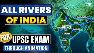
civil services exam ke sabse lokpriya shikshakon me se ek world mapping ke liye jatte han sir mane aapke world mapping ki all classes ke notes bi bnaye han sir please india mapping or kraye or rivers ke every year 2 question aate han or indian rivers ki new series time milte he start kijiye
Sir hum ki respect kartey hea sab se phalay like kartey phir video sunta hn or notes bhi sath bnata hn me Pakistan se hn❤. CSS ka paper dea chuke hn result ana hea mera
Thank you sir. Sir mujhe phle world map se dar lagra tha but aapki sari video dekhkr asa lga jse puri dunia hi ghum li mne.thank you so much sir. please sab like kiya kro.ase sir bhut kam milte h.😊😊
Sir U have boosted the confidence in us.. Thank You so much for providing & explaining sir.. especially for simplified Maps of different terrain of respective continents
Thank you so much for your great efforts sir 🙏😊💐🥰🌺🌷🌹💙🍩...... this was another valuable and informative session for us sir.... Thank you so much sir 🙏😊💐🥰🌺🌷🌹💙🍩🥰♥️😍💝🍫🍭🍭🍫🍫💝💝🍫🍭🍭🍫🍫💝💝🍫🍭🍭🍫🍫💝💝🍫🍭
Fall in love with your teaching skills and style sir daily 2 video before sleeping is compulsory Mussoorie is the largest and Mississippi is the second largest of North America and USA ❤🙏
Yukong River , Alaska usa , between brooks and alaska range Canada Mekangee river , canada , longest river of canada , end byufort sea Peace River , canada ,start rocky , end athawaska lake , Frasher River , pacific ocean , baikuar place Saskechwan river , canada , end vinipeg lake , yahi se nelson river start and end hadsan khadi St Lawrence River , canada , origin onterio lake , end gulf of saint lawrance USA Colmbaia noth coleredo south A word pehle aata Colambia River , pacific , colombai platue , tributary sanke river Colerado river , colerado platue , usa , gulf of California pacific , hower dame , bolder dam Missori and misisipi river , longest river of North America and usa , end Gulf of Maxico , chhone pathhar area , bird foot delta Rio Grande River , natural boarder between Mexico nd USA, end gulf of maxico
It is a great initiative by U Sir and these are very important for those students who starts preparation they can understand geography and other subjects easily.. So Thank you Sir And your team who helps you to prepare PPT and all
Yukon R alsaka b/w brook and alska ranges Canda Mackenzie longest of canda mouth beaufort sea Peace mouth athbasca lake Ferager mouth pacific ocean vancuwar Sacketchwan mouth winnipeg- origin nelson mouth hudson St.lawrence origion onterio mouth gulf of lawrence Natural border b/w usa and maxico rio de grande Usa Colombia mouth pacific plateu colombia tributory Snake river Coloredo coloredo plateu mouth gulf of california Dam hover dam and boulder dam Missorie+mississippi mouth gulf of maxico longest of usa and north america Desret Great basin usa Mohave desert usa Sonaran desert usa Chihuahuan desert maxico Thnkyou sir🙏🏻🙏🏻🙏🏻


Sir apke views kam aa rhe he but plz aap class lena band mat kijyega......dhire-dhire sabse jyada viewer apke channel ka hoga sir avi jyada student ko pta ni he islliye views kam aa rhe he...
Mene kabhi jagah map ke video dekho par par yeh sabse best h
Shi h na..dusron ko n hi pta lge itna achha source😅❤❤
@@Simran_2-l6lBhai kisi ko compete karna hai to padhai karke pichhe chhodana chahiye na ki raste se hi hata Diya Jaye 😊
@@islamicvibes78654great
1.Yukon River -> Alaska(USA) -> mouth -> Bering Sea -> flows B\W Alaska and Brooks Range, 2. Mackenzie River -> Canada -> longest river of Canada -> mouth -> Beaufort Sea, 3.Peace River -> Canada -> mouth Athabasca river, 4. Fraser River -> mouth Pacific -> Vancouver nearest place, 5. Saskatchewan River -> mouth -> Winnipeg Lake -> Nelson River starts from this lake -> ends in Hudson Bay...
❤
Well done 👍🏾✅
Hello sir good morning
Sir aapki geo ki classess dekh kr mujhe ab geo itni ache se aagai ki dashbord pr ab koi problem educator se puchta h to uska answer mere pass hota hain and bohot asaani se answer de bhi deti hu aap class m shi khte the ki geo m kuch nhi hain agr ache se class m dekhoge to rocket bn jaaoge sch m real m ab revision krne se aur ache se aajaega. And jese dash bord pr puchte bhi h ki aap ne konse educator se pdha h geo to answer ek hi h one of the best teacher sudarshan sir jo daatte bhi h to hsi aa jaati hain so thankyou sir geo ke liye aapko shyd ki kbhi bhool paaenge kbhi moka mila to aapse jroor milna chahungi ☺️☺️ again thanks sir we all love you bcz hmari life m geo aasan bna di ☺️☺️
Thank you so much sir............💯 Missouri river is the longest of North America and USA
Rio Grande river border between USA and MEXICO asked in UPPCS PRELIMS 2023.
Thank you so much sir for this amazing session 😊.
Missouri (3767km) is the the longest river of North America.
Thanks sir ❤aapke charno me mera pranam🙏🙏🙏
Thank you so much sir. Aap geography study krne ka sahi method bta diya ... Mere jeevan me geography ka jo dar tha vo ab door ho gya hai guru ji.
Sir ji touching your feet 🐾. 😊. Apke pas geography padhane ka jo method hai vo kisi aur teacher aur coaching me nahi hai not even VISIONIAS. 😢
Thenqu sir ji
Bdi mehnat lgi hogi maps bnane mei...AisA map Google pe b nhi h 🙏❤️🔥🔥
Thank u sir
1. Colombia River -> Colombia Plateau -> mouth Pacific Ocean -> USA, 2. Colorado River -> Colorado Plateau -> Dams -> Hover & Boulder Dams -> mouth -> Gulf of California, 3. Missouri + Mississippi River -> longest river of USA and NA -> limestone -> create bird foot delta -> mouth -> Gulf of Mexico, $. Rio Grande -> Natural Border -> USA & Mexico -> mouth -> Gulf of Mexico...
Nice 👍🏾
thank you so much sir jii 🙏🙏🙏🙏🙏🙏🙏🙏🙏🙏🙏 osm mapping content class
30:44 missori river
Thank you sir👍☺
Itne easy tareke se geography samjha dete h
civil services exam ke sabse lokpriya shikshakon me se ek world mapping ke liye jatte han sir mane aapke world mapping ki all classes ke notes bi bnaye han sir please india mapping or kraye or rivers ke every year 2 question aate han or indian rivers ki new series time milte he start kijiye
Thank u sir soo much
Sir hum ki respect kartey hea sab se phalay like kartey phir video sunta hn or notes bhi sath bnata hn me Pakistan se hn❤. CSS ka paper dea chuke hn result ana hea mera
Thanku so much sir you are great teacher ❤
U make mapping so easy and comprehedible.
Sir aap bahut shandar padhate h maja aa jata h aur bahut achhe se samjh me bhi aa jata h
Thanks sir
Thankyou sir I have watched all your mapping series. You are pro 💪💪 no competition at all.
Thank you sir...
Best continent series sir
Thank you ❤❤❤❤sir jiiiii you r हीरो ❤❤
Sir ka koi jawab nhi sach me🙏🙏🙏🙏
Thank you so much sir
Ans- Longest River of USA& north america - *Missouri River* 3,767km
Thank you so much sir 😊😍
Dhanyawaad Sir
Pranam 🙏
चरण स्पर्श,
धन्यवाद गुरुजी 🙏🙏
Lajvab session sir
Very very very very very very very very very nice teaching sir you are a best geography teacher in the whole world❤❤❤❤❤❤❤❤❤❤
Best mapping series available on the YT!❤
Peace river - Canada
Missouri River (3767 km) is longest river of USA and North America
Thank you sir😊
Thank you sir. Sir mujhe phle world map se dar lagra tha but aapki sari video dekhkr asa lga jse puri dunia hi ghum li mne.thank you so much sir. please sab like kiya kro.ase sir bhut kam milte h.😊😊
Thank you so much sir 🙏
Ans. Missouri is the longest river of usa and /or N America
Thanks sir for give us such a great content 🙏🙏
Sir please take rest of the classes to cover remaining continents
Thank you sir 😃😃
sir SALINITY pr ek class la dijiye pls.....iske question test series me jyada mil rhe....
Love ❤u sir
Nice explanation
Sir U have boosted the confidence in us.. Thank You so much for providing & explaining sir.. especially for simplified Maps of different terrain of respective continents
Shukriya sir 🙏🏿🙏🏿❤️
Thqku so much sir 🙏, amazing class and u explained everything in very intresting way.
Thankyou sir ❤️💯
Nelson river in Canada
Thank you so much sir ❤️
Yucon, Mackenzie, peace, Fraser
Tysm sirrrrrr
Sir aapka hamare bhavishya banane mai sabse bada aur mulayvan hat hoga
Mississippi river is longest river in USA and North America
Thankyou so much sir 🙏🙏
Missouri
Thank u so much sir ji 🙇🏻♀️❤️
Thank you so much sir🙏🙏🙏🙏🙏🤍🤍🤍🤍🤍🤍🤍🤍
Very helpfull to cover mapping
Bohut dhonyowad sir 🙏🏻
Thank you
Missouri is the longest it is flowing from Rocky mountains and then meets with Mississippi and ends in Gulf of Mexico...
Sir question 2 ka answer Missouri longest river of North America 😊😊❤❤
शानदार पढ़ाते हैं सर जी ❤
nice thanks sir💯💯💯
RIo Grande River - UPPSC Prelimes 2023 14th May 2023
Missouri(2540miles)
Mississippi(2340 miles)
Missouri is the longest river of NA by 3767 km Mississippi river is 3766 km
Missouri 3767
Mississippi 3766
Some teachers not only teach us ..they also teach how to learn ..
Thank you so much for your great efforts sir 🙏😊💐🥰🌺🌷🌹💙🍩...... this was another valuable and informative session for us sir.... Thank you so much sir 🙏😊💐🥰🌺🌷🌹💙🍩🥰♥️😍💝🍫🍭🍭🍫🍫💝💝🍫🍭🍭🍫🍫💝💝🍫🍭🍭🍫🍫💝💝🍫🍭
Outstanding class
Thnku soo much for this splendid session 🙏
Thanks 👍 sir....
Fall in love with your teaching skills and style sir daily 2 video before sleeping is compulsory
Mussoorie is the largest and Mississippi is the second largest of North America and USA ❤🙏
Thanku so much sudarshan bhaiya ❤
Bahut kuch seekh aapse or BAhut kuch sekhna baki hai sir ❤🙏
Love you 🥰
God bless u 🌹 sir
missouri river is longest river of the n A
Nice class sir ji...
Thanku sir ❤️🙏🏻❤
Sir if possible please bring a lecture on rivers and it's tributaries- INDIA .
Thankyou for these sessions!!
hai behen lecture sir ka
Yukong River , Alaska usa , between brooks and alaska range
Canada
Mekangee river , canada , longest river of canada , end byufort sea
Peace River , canada ,start rocky , end athawaska lake ,
Frasher River , pacific ocean , baikuar place
Saskechwan river , canada , end vinipeg lake , yahi se nelson river start and end hadsan khadi
St Lawrence River , canada , origin onterio lake , end gulf of saint lawrance
USA
Colmbaia noth coleredo south
A word pehle aata
Colambia River , pacific , colombai platue , tributary sanke river
Colerado river , colerado platue , usa , gulf of California pacific , hower dame , bolder dam
Missori and misisipi river , longest river of North America and usa , end Gulf of Maxico , chhone pathhar area , bird foot delta
Rio Grande River , natural boarder between Mexico nd USA, end gulf of maxico
It is a great initiative by U Sir and these are very important for those students who starts preparation they can understand geography and other subjects easily..
So
Thank you Sir
And your team who helps you to prepare PPT and all
U r great
Yuckn river -B
1. Yukon river flows b\w Alaska and Brooks Ranges, 2. Missouri, 3. Rio Grander...
thankyou sir
Sir maja aa gaya ! Plz continue kare aap
Yukon R alsaka b/w brook and alska ranges
Canda
Mackenzie longest of canda mouth beaufort sea
Peace mouth athbasca lake
Ferager mouth pacific ocean vancuwar
Sacketchwan mouth winnipeg- origin nelson mouth hudson
St.lawrence origion onterio mouth gulf of lawrence
Natural border b/w usa and maxico rio de grande
Usa
Colombia mouth pacific plateu colombia tributory Snake river
Coloredo coloredo plateu mouth gulf of california
Dam hover dam and boulder dam
Missorie+mississippi mouth gulf of maxico longest of usa and north america
Desret
Great basin usa
Mohave desert usa
Sonaran desert usa
Chihuahuan desert maxico
Thnkyou sir🙏🏻🙏🏻🙏🏻
Fraser river mouth pacific ocean
Excellent session sir can you pls cover volcano and plateau as well
missouri river is the longest river of north america !! H.W done (i would mark mississippi before)
Thanks gujjar bhai
Best one .....👍👍
India,s best teacher for competitive exam in geography subject
sr i think there is a correction, peace river ends in slave lake not in Athabaska lake.
No. It drains into lake Athabasca …… 😊
Thanku❤❤
Love you sir ❤❤❤❤❤
Missouri lambi h mississippi River ki apexa 🙏
Great besin, Mohave, Sonoran, Chihuahuan
MISSOURI RIVER-3767 KM. MISSISSIPPI RIVER-3766 KM
Ty sir for this awesome session
Irus sea between Ireland and UK
Awesome sir 👏👏