i've been lost in Auckland too but might have been more related to the beer. Back in the day, a few minutes before 10pm, the bar keeps in the hotels would shout "Time Gentlemen Please!" and there was a rush for a last round and some take away beers.
Thank you this has confirmed the ta app has it,s shortfalls . Maps are well tested over time but if you struggle to understand or use them a course in the use of a compass and maps is well worth the time. Great advice
Another very thought out and straight forward video about the TA. This answered a lot of my questions about the apps and the strengths and weaknesses about each. One day I’ll get back and hike. Perhaps Jacinda will hire you as a TA ambassador. 👍
Thanks for the nice video! I learned a lot. I was wondering: for the GPS you're showing you need some kind of satellite subscription on top of it? Is it expensive? Currently looking to an affordable feature to keep people at home up to date on my status :)
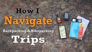
Hi, and thanks for your comment! Yes, you're right you need a subscription for the Garmin GPS. It cost me $40 per month to have it registered and on the plan that I chose (this was one step up from the base plan of $20). If you don't need to send messages back and forth to your friends and family, you might want to consider using an InReach mini on the lower subscription plan, as I believe that includes a certain number of preset messages (i.e. 'I've reached camp', 'I'm leaving now' etc.) per month. I'm not an expert on the plans, though, so it might be wise to read through the options and touch base with Garmin if you have any questions.
What do you mean how long? As in how long was i estimating the whole trail would take me? I didn't have an exact number of days because I just knew it would take as long as it takes, but in general most people average between 120 and 150 days to complete the entire trail depending on fitness.
Hello. I see you did a OTNZ river safety course. OTNZ also offer navigation. Fee free to touch base with your local branch or PM me for more details . John. OTNZ bush 2 instructor, assessor.
Thanks John, it was always my intention to do an OTNZ navigation course ... I've just been struggling to find the time. I highly recommend your courses to anyone who is planning on undertaking an adventure like this though (or just spending some time in the backcountry). Very helpful, and excellent instructors!
Thanks for the review. Did you find the Garmin GPS device allowed you to download LINZ topo gpx files? This is something I've had issues with on Garmin devices in the past.
When I bought it I also purchased the Maptoaster (I think?) card which inserts into the device. This gives me access to topo maps. I also then downloaded the .gpx files provided on the Te Araroa trust website into the device as well. Although I very rarely used this for navigation, it was great to know I had it as a backup.
@@LongWhiteGypsy you ended up with a set of draft maps without the contours for that year. These were posted in error and replaced a week later but of course a lot of downloads had been done. The source of the background is identical to the published raster maps, the only changes were to keep the data as vectors and some symbology was changed to reduce file sizes. This year with the handover to the Walking Access Commission we are changing to the raster backdrop for consistency with the app which also uses the raster map service.


This is good info for someone dreaming about doing the TA before his wairua departs in the other direction. Kia ora.
Quite like this , to date im using all trails app-so far so good
All Trails is great, especially for finding really awesome private tracks 🤩
I was wondering if you were going to do a video about maps. I'm a big map nerd. Thanks for the great video!
I must have read your mind! Thanks for the comment :)
*Long White Gypsy* Perfect as always. Have a good day :p
Thank you! You too!
Excellent video, thanks
You're welcome, glad you found some value in it Richard!
Very useful thank you
i've been lost in Auckland too but might have been more related to the beer. Back in the day, a few minutes before 10pm, the bar keeps in the hotels would shout "Time Gentlemen Please!" and there was a rush for a last round and some take away beers.
Hahah, yes you need a different kind of map for that one!
Very interesting. Thanks
Very welcome!
Thank you this has confirmed the ta app has it,s shortfalls . Maps are well tested over time but if you struggle to understand or use them a course in the use of a compass and maps is well worth the time. Great advice
Absolutely Darren, couldn't agree more.
Another very thought out and straight forward video about the TA. This answered a lot of my questions about the apps and the strengths and weaknesses about each. One day I’ll get back and hike. Perhaps Jacinda will hire you as a TA ambassador. 👍
Haha now wouldn't that be something :) Thanks Dan
Thanks for sharing!
You're welcome :)
@@LongWhiteGypsy we have a good time making outdoor videos also
Great video , I get lost walking to my letterbox lol ....
You might need more than the tools suggested in this video if that's the case lol :D
Thanks for the nice video! I learned a lot. I was wondering: for the GPS you're showing you need some kind of satellite subscription on top of it? Is it expensive? Currently looking to an affordable feature to keep people at home up to date on my status :)
Hi, and thanks for your comment! Yes, you're right you need a subscription for the Garmin GPS. It cost me $40 per month to have it registered and on the plan that I chose (this was one step up from the base plan of $20). If you don't need to send messages back and forth to your friends and family, you might want to consider using an InReach mini on the lower subscription plan, as I believe that includes a certain number of preset messages (i.e. 'I've reached camp', 'I'm leaving now' etc.) per month. I'm not an expert on the plans, though, so it might be wise to read through the options and touch base with Garmin if you have any questions.
Thank you!!!!
You're welcome!
Sorry if this has been asked but how.ling did you plan for?
What do you mean how long? As in how long was i estimating the whole trail would take me? I didn't have an exact number of days because I just knew it would take as long as it takes, but in general most people average between 120 and 150 days to complete the entire trail depending on fitness.
Hello. I see you did a OTNZ river safety course. OTNZ also offer navigation. Fee free to touch base with your local branch or PM me for more details . John. OTNZ bush 2 instructor, assessor.
Thanks John, it was always my intention to do an OTNZ navigation course ... I've just been struggling to find the time. I highly recommend your courses to anyone who is planning on undertaking an adventure like this though (or just spending some time in the backcountry). Very helpful, and excellent instructors!
Thanks for the review. Did you find the Garmin GPS device allowed you to download LINZ topo gpx files? This is something I've had issues with on Garmin devices in the past.
When I bought it I also purchased the Maptoaster (I think?) card which inserts into the device. This gives me access to topo maps. I also then downloaded the .gpx files provided on the Te Araroa trust website into the device as well. Although I very rarely used this for navigation, it was great to know I had it as a backup.
Very accurate.
Thank you Kim
@@LongWhiteGypsy you ended up with a set of draft maps without the contours for that year. These were posted in error and replaced a week later but of course a lot of downloads had been done. The source of the background is identical to the published raster maps, the only changes were to keep the data as vectors and some symbology was changed to reduce file sizes. This year with the handover to the Walking Access Commission we are changing to the raster backdrop for consistency with the app which also uses the raster map service.