OpenStreetMap has become the world's Trail Map

ฝัง
- เผยแพร่เมื่อ 5 ก.ย. 2024
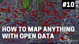
- The crowd-sourced mapping project, OpenStreetMap, was launched in London and is still best known for its urban geography. But over time, OSM has also become the world's most complete database of recreational trails.
See also this 2018 essay on OSM's limitations: / use-caution-with-trail...
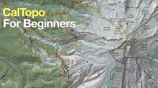


Glad you like the video, and I'll consider your suggestion: I can see the need. The example contained within this video was done using the OpenStreetMap ID editor, which is the easiest of the three available on the OSM site. You might check it out. Mapping a hiking path is identical to mapping a road, except that you tag it as a path.
Outstanding quality, thank you!
Thank you!
9:01 Geofabrik MapCompare site - crazy cool tip!
Thanks
Hi Bart, Thanks for another great video. I have started adding paths in my hometown and have many GPX traces of local hiking paths. I can't figure out how you load that into OSM to then trace a path. Could you explain or show that in a video?
Sorry this is so belated, but this video attempts to show how to upload both GPX tracks and points of interest from OsmAnd to OpenStreetMap. th-cam.com/video/FnsCsedKfWQ/w-d-xo.html
How do you start learning about OpenStreetMap?
OSM itself has a lot of information about contributing to the project, including a beginner's guide: wiki.openstreetmap.org/wiki/Beginners%27_guide
And I'm happy to answer more specific questions here.
hello Mr Bart
i'd like to start my website that helps moroccan hikers for safe trips
but i still cant find the path to start this journey
can you please provide me help
thanks in advence
Hi. Are you referring to a path that's already on OpenStreetMap. Or a path that you think should be on OpenStreetMap, but isn't? Or are you asking how to put OpenStreetMap maps on your website? Or how to determine which paths are safe?
@@barteisenberg I'll try to start with actual paths on OSM and after ill see if I can add mine too
thank you for the fast response, I'm afraid of not finding the guidance
For actual paths on OSM, I think you'd want to walk them to make sure they meet your criteria of safety. That's the only way to be sure.
For adding new paths, my video shows the basic process: you walk the route with a GPS, upload the GPX, trace it, and tag it. OpenStreetMap's beginner guides are extensive and found here: wiki.openstreetmap.org/wiki/Beginners%27_guide. The best editor to start with is ID, which can be accessed from the OSM page itself once you've registered.
@@barteisenberg thank you so much for your time I really appreciate that. I'll try my best to understand everything needed
I'm happy to help. One other English language web page might be of use: www.alltrails.com/morocco. AllTrails is a service in which people identify and describe hikes they like. So like OpenStreetMap itself, it's crowd-sourced. The information is only as good as the people who contribute it.