GeoPython 2024: DuckDB Spatial Supercharged Geospatial SQL!

ฝัง
- เผยแพร่เมื่อ 11 ต.ค. 2024
- Max Gabrielsson
DuckDB-Spatial: Supercharged Geospatial SQL!
An introduction to DuckDB, a free open-source embedded SQL database tuned for analytical workloads, and how to leverage its geospatial extension to supercharge your local GIS workflows (with python!)
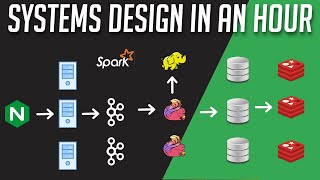
We present DuckDB, a novel embedded data management system designed for analytical SQL workloads. By incorporating decades of clever techniques and algorithms from the database research community, DuckDB empowers data engineering on a single machine to reach a whole new level of scale and performance, without the hassle and operational overhead commonly associated with traditional database and data warehouse systems.
One way DuckDB aims to achieve this goal is through its unique in-depth integration with Python, allowing for seamless interoperability with the existing data science ecosystem through familiar APIs and zero-copy data sharing between staple libraries like Numpy, Pandas and Arrow.
Another way is through its flexible extension system, which allows users to greatly extend the functionality of DuckDB and bring its power to entirely new domains, such as geospatial data processing and analysis. In this talk we'll showcase DuckDB's "spatial extension" which exposes hundreds of geospatial SQL-functions and import/export capabilities to a wide array of geospatial vector formats. With the help of the usual suspects, GDAL, PROJ, GEOS as well as a host of natively implemented algorithms all neatly packaged into a single binary with no runtime dependencies, DuckDB spatial is quickly becoming a Swiss-army knife for wrangling geospatial data.
Are you allergic to SQL? Fear not! We'll demonstrate how this extension can be used to perform complex geospatial analysis on large datasets, all from the comfort of Python!