Staldenried 4K 🇨🇭 The highest vineyards in Europe & Scenic Drive To Gasenried - Valais / Wallis Ep#4

ฝัง
- เผยแพร่เมื่อ 12 ก.ย. 2024
- Canton of Valais / Wallis - Episode #4
Staldenried 4K 🇨🇭 The highest (1,052 m) vineyards in Europe & Scenic Drive To Gasenried
Subscription : / @magicboxswitzerland
Videography by Magic Box Switzerland
Copyright ⓒ 2021 MAGIC BOX SWITZERLAND, All Rights Reserved.
*** 1st Drive Journey Map link : goo.gl/maps/Vi...
*** 2nd Drive Journey Map link : goo.gl/maps/RA...
*****************************************************
The Epic Road Trip Itinerary:
00:18 Stalden, Canton of Valais in Switzerland
06:58 Niederried, Staldenried
07:57 Furrershaus, Staldenried
11:01 Zer Chirchu, Staldenried
12:44 Zer Tannu, Staldenried
15:28 Zer Chirchu, Staldenried
29:10 Furrershaus, Staldenried
30:15 Niederried, Staldenried
33:16 Jump to Riedmatten, St. Niklaus
39:55 Rittinen, St. Niklaus
40:53 Niedergrächen, Grächen
41:18 Rittinen, St. Niklaus
42:55 Gasenried, St. Niklaus
*****************************************************
Canton of Valais / Wallis
It is one of the 26 cantons forming the Swiss Confederation. It is composed of thirteen districts and its capital and largest city is Sion. The flag of the canton is made of thirteen stars representing the districts, on a white-red background. Valais is situated in the southwestern part of the country. It borders the cantons of Vaud and Bern to the north, the cantons of Uri and Ticino to the east, as well as Italy to the south and France to the west. It is one of the three large southern Alpine cantons, along with Ticino and the Grisons. It is a bilingual canton, French and German being its two official languages. Traditionally, the canton is divided into Lower, Central and Upper Valais, the latter region constituting the German-speaking minority. Valais essentially coincides with the valley of the Rhône from its headwaters to Lake Geneva, separating the Pennine Alps from the Bernese Alps. A major wine region, the canton is simultaneously one of the driest regions of Switzerland in its central Rhône valley and among the wettest, having large amounts of snow and rain up on the highest peaks found in Switzerland, such as Monte Rosa and the Finsteraarhorn.
Stalden
It is a municipality in the district of Visp in the canton of Valais in Switzerland. It lies at the foot of the Mischabelhörner and Dom (4,545 m [14,911 ft]). Stalden has an area, as of 2011, of 10.5 square kilometers (4.1 sq mi). Of this area, 10.0% is used for agricultural purposes, while 71.9% is forested. Of the rest of the land, 6.4% is settled (buildings or roads) and 11.7% is unproductive land. The municipality is located in the Visp district, at the branching of the Matter and Saas valleys. It consists of three formerly independent villages Stalden Dorfmark, Chinegga (since 1805) and Niederrusen (since 1817, now called Neubrück). Being well within the Alps, the region of Stalden is notably the driest location in Valais and Switzerland, with 545 mm of rainfall per year measured at the Ackersand meteorological station.
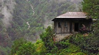
Staldenried
It is a municipality in the district of Visp in the canton of Valais in Switzerland. It has an area, as of 2011, of 14.3 square kilometers (5.5 sq mi). Of this area, 23.1% is used for agricultural purposes, while 42.9% is forested. Of the rest of the land, 2.2% is settled (buildings or roads) and 31.7% is unproductive land. It has a population (as of December 2020) of 537. Most of the population (as of 2000) speaks German (549 or 99.1%) as their first language, French is the second most common (1 or 0.2%) and Romansh is the third (1 or 0.2%). There is 1 person who speaks Italian.
St. Niklaus
St. Niklaus (French: Saint-Nicolas) is a village and a municipality in the Mattertal, part of the district of Visp in the canton of Valais in Switzerland. The municipality is located in the Visp district. It is the main settlement in the Matter valley (also called the Nikolai valley). It consists of the settlements of Riedmatten, Dorf, Stalu, Ze Schwidernu, Mattsand, Herbriggen, Breitmatten on the valley floor and the alpine settlement of Gasenried on the eastern slope.
Grächen
Grächen is a municipality in the district of Visp in the canton of Valais in Switzerland. The village is situated at an altitude of 1,620 meters (5,310 ft) on a terrace above St. Niklaus in the Mattertal, north of the Mischabel range (and Dom).
Gasenried
Gasenried (Valais German Gasuriäd), sometimes short Ried (Valais German Riäd ), is a large clustered settlement inhabited all year round in the municipality of St. Niklaus (Valais German Zaniglas ) in the Valais district of Visp. It lies at 1659 m above sea level. M. on the right flank of the valley above St. Niklaus Dorf (1120 m above sea level).
* Source : Wikipedia
#Staldenried #Gasenried #Valais #Switzerland #Wallis #Niederried #Furrershaus #Zer_Chirchu #Zer_Tannu #Riedmatten #St_Niklaus #Rittinen #Niedergrächen #Grächen #Stalden