
- 32
- 91 341
Hem Raj Awasthi
Nepal
เข้าร่วมเมื่อ 6 ก.พ. 2018
3D Flood Animation | ArcGIS | ArcScene | ArcMap
In this Tutorial, I have shown how to make a 3D Flood Animation model using ArcMap+ArcScene.
Watch it full without skipping to learn it.
Thank You!
SHARE/LIKE /SUBSCRIBE
Watch it full without skipping to learn it.
Thank You!
SHARE/LIKE /SUBSCRIBE
มุมมอง: 114
วีดีโอ
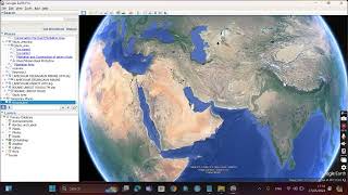

Digitization in Google Earth/ create a point/line/polygon and Prepare a Map layout in Google Earth
มุมมอง 3818 หลายเดือนก่อน
This tutorial will help you to create and digitization of Polygon, Line, and Point Features in Google Earth Pro and Save image as a map layout #google_earth #polygon_feature #Line_feature #Point_feature #Digitization #software #map_layout

How to install R and R studio on Windows 11
มุมมอง 688 หลายเดือนก่อน
Go through the step-by-step process of installing R and RStudio on Windows 1. Download and install R: Download R from the official site of R distribution for Windows a 2. Install RStudio: Once R is installed, download and install RStudio. By the end of this tutorial, you'll have R and RStudio installed on your Windows. Subscribe to the channel for more information. Thank You !!!

Watershed Delineation in ArcGIS Using DEM in Nepali/ Watershed Delineation कसरी गरिन्छ ? नेपालीमा l
มุมมอง 1.3K8 หลายเดือนก่อน
In this Tutorial, You will learn How to download DEM and delineate Watershed from a digital elevation model (DEM) using ArcGIS. Stream delineation, watershed delineation, drainage analysis, watershed delineation using dem, stream analysis, stream order, GIS application in watershed delineation Stream delineation, watershed delineation, drainage analysis, watershed delineation using dem, stream ...

Nepali Local Village Dogs 🐕 🐕 Playing together
มุมมอง 182ปีที่แล้ว
Nepali Local Village Dogs 🐕 🐕 Playing together

ArcGIS Training Day 4: Study area map preparation, Layout design and working with multiple dataframe
มุมมอง 191ปีที่แล้ว
ArcGIS Training Day 4: Study area map preparation, Layout design and working with multiple dataframe

ArcGIS Training Day 3: Working with Raster Data and Vector Data
มุมมอง 86ปีที่แล้ว
In this session, we learn to Create Slope, Aspect, Hillshade, Viewshed and Contour creation from DEM data and learn about geoprocessing tools i.e. Buffering, Intersect, Union, Merge, Clip etc...

Day2;Part 2: Georeferencing and Digitization in ArcMap, Creating point, line and polygon features
มุมมอง 75ปีที่แล้ว
Georeferencing in ArcMap with Toposheet Steps: 1: Add Toposheet to ArcMap 2: Selection of coordinate reference system and assignment to Layer 3: Projection of Toposheet to the defined coordinate system 4:Activating Georeferencing toolbar 5: Deactivate auto adjust 6: Selection of Ground Control Points(Min. 4) 7: Enter Control Points (x, y) coordinates 8: Reactivate auto adjust 9: Finally rectify...

ArcGIS Training Day 2; Part 1: Overview of ArcMap Interface and Concept of Georeferencing
มุมมอง 92ปีที่แล้ว
#In this session we learn about general overview of ArcMap interface and Georeferencing . For toposheet follow the link given below for your exercise Download link : pahar.in/nepal-topo-maps #Georeferencing: Georeferencing is a vital procedure that involves associating geographic information with a digital image, such as an airphoto, scanned geologic map, or a picture of a topographic map. By d...
ArcGIS training Day 1: Introduction to GIS and Installation of ArcGIS Software
มุมมอง 269ปีที่แล้ว
In this training day 1, we learn about the basic concept of GIS and the installation of ArcGIS 10.8 software. This is for educational purposes only and you can buy ArcGIS software and a License from ESRI official website. Link for software download: drive.google.com/file/d/1pTB7qkNMgGCyHNBiagKL5LRI6dPvmX9m/view?usp=drivesdk GIS: Introduction and Uses Introduction to GIS: GIS stands for Geograph...
How to draw Climograph (Climatic Diagram) in MS Excel
มุมมอง 2723 ปีที่แล้ว
This tutorial helps you to make climatic diagram in MS Excel Download sample data from link given below drive.google.com/file/d/1cpD1SnjK_4BKLm3m0-keiSX0hwLG8hwx/view?usp=sharing
Status and Distribution of forest fire in last 18 year in Nepal
มุมมอง 2433 ปีที่แล้ว
This shows distribution of forest fire in Nepal during the year from 2003 to 2021 within 6 months time lapse . Data Coverage: 15 November 2003 to 30 April 2021 Note : Mid November - Mid May is Forest fire season in Nepal Source: NASA, MODIS Satellite.
Distribution of forest fire incidents in Nepal between 2021 January to 2021 May 7.
มุมมอง 1243 ปีที่แล้ว
This shows distribution of forest fire in Nepal during this year from 2021 January 1st week to May 1st week with 6 days timelapse. Green coloured point haiving less than or equal to 50 % confidence and Red coloured point are fire hotspots having more than 50% confidence level. Source: NASA, MODIS Satellite.
ArcGIS tutorial 12: How to Calculate NDVI
มุมมอง 4364 ปีที่แล้ว
This tutorial will help you to calculate NDVI Using ArcGIS from two menthos in ArcGIS/Arcmap Method 1Using Image Anlayis Method 2: Using Raster Calculater Normalized Difference Vegetation Index (NDVI) quantifies vegetation by measuring the difference between near-infrared (which vegetation strongly reflects) and red light (which vegetation absorbs). NDVI always ranges from -1 to 1. But there is...
QGIS Tutorial 5 : How to create a map layout using QGIS
มุมมอง 1K4 ปีที่แล้ว
QGIS Tutorial 5 : How to create a map layout using QGIS
QGIS Tutorial 4 : How to generate points along line at equal distance of interval Using QGIS
มุมมอง 16K4 ปีที่แล้ว
QGIS Tutorial 4 : How to generate points along line at equal distance of interval Using QGIS
ArcGIS Tutorial 10 : Interpolation Using Arcgis Desktop
มุมมอง 2514 ปีที่แล้ว
ArcGIS Tutorial 10 : Interpolation Using Arcgis Desktop
QGIS Tutorial 3 : Sample Plot Design and Block Division Using QGIS
มุมมอง 3.7K4 ปีที่แล้ว
QGIS Tutorial 3 : Sample Plot Design and Block Division Using QGIS
QGIS Tutorial 2 :Make a Polygon From xy co-ordinate(Excel To Polygon) In QGIS
มุมมอง 13K4 ปีที่แล้ว
QGIS Tutorial 2 :Make a Polygon From xy co-ordinate(Excel To Polygon) In QGIS
QGIS Tutorial 1 : Download and Install QGIS (An open Source GIS) For free From Official Site Of QGIS
มุมมอง 1574 ปีที่แล้ว
QGIS Tutorial 1 : Download and Install QGIS (An open Source GIS) For free From Official Site Of QGIS
A Complete Tutorial On Google Earth Pro For Beginner
มุมมอง 6324 ปีที่แล้ว
A Complete Tutorial On Google Earth Pro For Beginner
ArcGIS Tutorial 9 : Mother tree selection using interactive selection method in arcgis /arcmap
มุมมอง 1.2K4 ปีที่แล้ว
ArcGIS Tutorial 9 : Mother tree selection using interactive selection method in arcgis /arcmap
ArcGIS Tutorial 4 : How to Prepare map layout and export as image in arcmap/arcgis
มุมมอง 1994 ปีที่แล้ว
ArcGIS Tutorial 4 : How to Prepare map layout and export as image in arcmap/arcgis
ArcGIS Tutorial 8 : Divide a polygon into equal parts using arcgis
มุมมอง 30K4 ปีที่แล้ว
ArcGIS Tutorial 8 : Divide a polygon into equal parts using arcgis
ArcGIS Tutorial 5 : How to create slope, aspect, contour creation from DEM
มุมมอง 4984 ปีที่แล้ว
ArcGIS Tutorial 5 : How to create slope, aspect, contour creation from DEM
ArcGIS Tutorial 7 : Fire risk mapping using arcgis/arcmap
มุมมอง 12K4 ปีที่แล้ว
ArcGIS Tutorial 7 : Fire risk mapping using arcgis/arcmap
ArcGIS Tutorial 6 : Model Builder Using Arcgis/arcmap
มุมมอง 4295 ปีที่แล้ว
ArcGIS Tutorial 6 : Model Builder Using Arcgis/arcmap
ArcGIS Tutorial 3 : Slope analysis using arcgis/slope map preparation from contour using arcgis
มุมมอง 1.7K5 ปีที่แล้ว
ArcGIS Tutorial 3 : Slope analysis using arcgis/slope map preparation from contour using arcgis
ArcGIS Tutorial 2 : sample plot design for forest resource inventory
มุมมอง 1.7K5 ปีที่แล้ว
ArcGIS Tutorial 2 : sample plot design for forest resource inventory