
- 81
- 6 948
Geomatics Planet
United States
เข้าร่วมเมื่อ 2 ก.ค. 2017
Geoinformatics, Surveying, UAV|Drone, Remote Sensing, Geospatial analyst, GIS, Hydrographic Surveying, Engineering Surveying.
________________________________________________________________________________________
.To download the data used in the video
Join our WhatsApp using the link below
________________________________________________________________________________________
.To download the data used in the video
Join our WhatsApp using the link below
Working with Vectors, Layouts, and Map Elements in ArcMap
GIS skills with this detailed tutorial on working with vector data in ArcMap, focusing on points, lines, and polygons.
Learn how to effectively manage your layout view, including saving and reusing layouts for future projects.
This video covers advanced techniques such as managing legends and grid coordinates, creating and using bookmarks, and working with specific features like lakes, game reserves, and airports.
Additionally, discover how to add a north arrow and design a choropleth map. Ideal for both beginners and advanced users, this guide provides practical tips and clear instructions to elevate your mapping and data visualization capabilities in ArcMap.
มุมมอง: 13
วีดีโอ


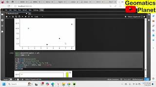
Basic Python in Google Colab
มุมมอง 614 ชั่วโมงที่ผ่านมา
The fundamentals of Python programming with this comprehensive tutorial using Google Colaboratory. This video covers essential Python basics, including syntax, indentation, variables, comments, multiline comments, and variable casting. You'll learn how to get the type of a variable, understand Python's case sensitivity, and explore the rules of variable naming. Additionally, the tutorial walks ...

Creating UTM Zone Map and Guide to Selections, Editing, Symbology, Map Export
มุมมอง 24วันที่ผ่านมา
In-depth tutorial covering a wide range of essential GIS skills. Learn how to make selections using rectangle, lasso, circle, line, by attribute, by location, and manual methods, including the use of Shift and Ctrl keys for multiple selections. This video also walks you through importing shapefiles, editing polygons (including splitting), and understanding UTM zones with Google Earth Pro. Enhan...

Topographic Mapping: Extracting Contours and Data Integration with OpenDEM, OpenTopography, BBBike
มุมมอง 15328 วันที่ผ่านมา
Detailed topographic maps by extracting contours from various sources like OpenDEM, OpenTopography, BBBike, and Google Earth. This comprehensive tutorial walks you through the process of extracting OpenStreetMap data, performing interpolation using kriging, and creating a fishnet for precise mapping. Finally, discover how to integrate all this data into ArcMap to produce a high-quality topograp...

Controlling Bar Color and Legend Entries in Matplotlib
มุมมอง 5228 วันที่ผ่านมา
Learn how to effectively control bar colors and legend entries in Matplotlib using the color and label parameters of the bar function. This tutorial provides a detailed, step-by-step guide on customizing your bar charts, ensuring your data visualizations are both informative and visually appealing. Perfect for both beginners and advanced users, this video uses practical examples with import mat...

Matplotlib: Bars, Histograms, and Pie Charts
มุมมอง 16หลายเดือนก่อน
Matplotlib with this extensive tutorial covering bar charts, histograms, and pie charts. This video guides you through creating vertical and horizontal bar charts, customizing bar colors using color names and hex codes, and adjusting bar width and height. Learn how to generate and plot histograms using NumPy random distribution data, and dive into pie charts, covering labels, start angles, expl...
Matplotlib: Scatter Plots, Color Customization, and Bar Charts
มุมมอง 22หลายเดือนก่อน
Matplotlib: Learn how to create scatter plots, compare plots, and customize colors for each dot using ColorMap. Discover how to adjust dot size, apply transparency with alpha, and combine color, size, and alpha for advanced visualizations. Additionally, get an introduction to creating bar charts in Matplotlib. Perfect for both beginners and advanced users, this video provides practical examples...

Extracting OpenStreetMap Data with BBBike
มุมมอง 53หลายเดือนก่อน
BBBike extracts is a service that allows you to extract specific areas from OpenStreetMap (OSM) data. Here are some key points about it: 1. Formats: You can choose from various file formats, including OSM, PBF, CSV, SVG, GeoJSON, and more 2. Worldwide Coverage: It provides global map extracts, so you can select areas from anywhere on the planet. 3. Customizable: Specify the area you want to ext...

Highlighting the Active Cell in Excel
มุมมอง 45หลายเดือนก่อน
Learn how to easily highlight the active cell in an Excel worksheet with this comprehensive tutorial! This video will guide you through the process of using conditional formatting and other techniques to make the active cell stand out, enhancing your navigation and data entry experience. Perfect for both beginners and advanced users, this guide provides practical examples and clear instructions...
Extracting OpenStreetMap Data with Overpass Turbo for GIS
มุมมอง 75หลายเดือนก่อน
Discover how to extract OpenStreetMap data using Overpass Turbo and convert it for use in various GIS applications like ArcMap, QGIS, and ArcGIS Pro. This tutorial provides step-by-step instructions on querying and downloading data from Overpass Turbo, transforming the data into different formats, and importing it into GIS software to create detailed maps. Perfect for GIS professionals and enth...
Matplotlib in PyCharm with Jupyter Lab: Grid Lines and Subplots
มุมมอง 54หลายเดือนก่อน
Data visualizations using Matplotlib in PyCharm with Jupyter Lab! This tutorial covers adding grid lines to your plots, specifying which grid lines to display, and customizing their properties. Additionally, discover how to create multiple plots in one figure using the subplot() function and how to add titles to individual plots and the entire figure. Perfect for both beginners and advanced use...
Creating an Inventory Tracker in Excel
มุมมอง 13หลายเดือนก่อน
Learn how to create a powerful inventory tracker in Excel that helps you monitor product quantities and manage stock levels efficiently. This step-by-step tutorial shows you how to set up a tracker to record the number of items and use filters to distinguish between products in stock and out of stock. Perfect for both beginners and advanced users, this video provides practical examples and clea...
Format Painter in Excel
มุมมอง 18หลายเดือนก่อน
Format Painter tool in Excel with this comprehensive tutorial Learn how to quickly and efficiently copy formatting from one cell or range to another, streamlining your data presentation. Perfect for both beginners and advanced users, this video provides clear, easy-to-follow instructions and practical examples to help you enhance your Excel skills and improve your workflow.
Creating Dynamic Actual vs. Target Charts in Excel
มุมมอง 50หลายเดือนก่อน
Create dynamic Actual vs. Target charts in Excel This video will guide you through the process of setting up interactive charts that update automatically based on your data. Perfect for both beginners and advanced users, this guide offers practical examples and easy-to-follow steps to help you visualize your performance metrics effectively and enhance your data analysis skills.
Georeferencing in ArcMap
มุมมอง 70หลายเดือนก่อน
Georeferencing in ArcMap with this detailed tutorial! Learn how to accurately georeference both raster images and shapefiles to ensure your spatial data aligns perfectly with real-world coordinates. This step-by-step guide provides clear instructions and practical examples, making it perfect for both beginners and advanced users looking to enhance their GIS skills and data accuracy in ArcMap.
Matplotlib Plotting in PyCharm with Jupyter Notebook
มุมมอง 62หลายเดือนก่อน
Matplotlib Plotting in PyCharm with Jupyter Notebook
Extracting Day, Month, and Year from Dates in Google Sheets
มุมมอง 23หลายเดือนก่อน
Extracting Day, Month, and Year from Dates in Google Sheets
Creating Drop-Down Lists in Google Sheets with Conditional Formatting
มุมมอง 30หลายเดือนก่อน
Creating Drop-Down Lists in Google Sheets with Conditional Formatting
Mastering Google Earth Pro: Measuring, Digitizing, and Integrating with ArcGIS
มุมมอง 112หลายเดือนก่อน
Mastering Google Earth Pro: Measuring, Digitizing, and Integrating with ArcGIS
Setting Up PyCharm with NumPy, Matplotlib, and Jupyter Lab
มุมมอง 121หลายเดือนก่อน
Setting Up PyCharm with NumPy, Matplotlib, and Jupyter Lab
Tracking Projects in Google Sheets: Checkboxes, Progress Bars, and Conditional Formatting
มุมมอง 21หลายเดือนก่อน
Tracking Projects in Google Sheets: Checkboxes, Progress Bars, and Conditional Formatting
Extracting First and Last Names in Excel
มุมมอง 46หลายเดือนก่อน
Extracting First and Last Names in Excel
Importing Web Data to Excel: Automatically Update Data from Web Sources
มุมมอง 162 หลายเดือนก่อน
Importing Web Data to Excel: Automatically Update Data from Web Sources
Creating Drop-Down Lists in Excel with Conditional Formatting
มุมมอง 1552 หลายเดือนก่อน
Creating Drop-Down Lists in Excel with Conditional Formatting
Importing Web Data to Excel: Automatically Update Data from Web Sources
มุมมอง 222 หลายเดือนก่อน
Importing Web Data to Excel: Automatically Update Data from Web Sources
Transpose Data in Excel Using the Paste Option
มุมมอง 302 หลายเดือนก่อน
Transpose Data in Excel Using the Paste Option
Extracting Elevation Data from Google Earth Pro to ArcGIS
มุมมอง 1212 หลายเดือนก่อน
Extracting Elevation Data from Google Earth Pro to ArcGIS
How to Install and Set Up PyCharm Community Edition with Jupyter Lab
มุมมอง 1782 หลายเดือนก่อน
How to Install and Set Up PyCharm Community Edition with Jupyter Lab
Creating a Progress Bar in Excel Using the REPT Function and Stencil Font
มุมมอง 952 หลายเดือนก่อน
Creating a Progress Bar in Excel Using the REPT Function and Stencil Font