
- 81
- 317 012
Easyy Learn
เข้าร่วมเมื่อ 25 มี.ค. 2019
Effectively conveying complex technical engineering stories in a simple and accessible manner, requires a profound level of comprehension.
Dedicated to all Engineering Knowledge Pursuers... Land Surveyors, Geodesy, Geomatics, GIS Professionals, Geodesy or Civil Engineering students, and enthusiasts...
*Content presented in English and Macedonian*
Find out more about SGIS Desktop at www.simplegissoft.com
Dedicated to all Engineering Knowledge Pursuers... Land Surveyors, Geodesy, Geomatics, GIS Professionals, Geodesy or Civil Engineering students, and enthusiasts...
*Content presented in English and Macedonian*
Find out more about SGIS Desktop at www.simplegissoft.com
Create a DEM Grid from LiDAR Point Cloud Based on IDW Spatial Interpolation
A DEM is a grid of squared cells (pixels), each assigned an elevation value (Manuel, 2004). Different interpolation methods applied to the same dataset can produce varying results, depending on the technique used.
Inverse Distance Weighting (IDW) is a common spatial interpolation method used to create continuous surfaces, such as Digital Elevation Models (DEMs) or hillshades, from LiDAR point clouds. LiDAR data consists of discrete points, each with specific coordinates and elevation values, but to perform meaningful terrain analysis-like generating hillshades or contour maps-a continuous surface is needed.
In SGIS v.R, this process is straightforward;
Read More On : simplegissoft.com/idw-interpolation/
#Hillshade #lidar #lidarscanner #remotesensing #gis #algorithmdevelopment #greenit #sgis #sgistechnology
มุมมอง: 31
วีดีโอ


A Step-by-Step SGIS Guide: Replace and Auto-Link Attributes from Text Files | Import Attributes
มุมมอง 923 หลายเดือนก่อน
Find out more on: simplegissoft.com/ Try Demo: simplegissoft.com/sign-up-for-latest-updates/ Effortlessly Replace and Link Attribute Data Using Text Files Automate Attribute Management #linkattributestogeometry #sgissoftware #gis

QGIS: Smooth Contour Lines | Styling Contour Lines
มุมมอง 2923 หลายเดือนก่อน
How to Smooth Contour Lines from Raster Files (TIFF, DEM) | GIS Tutorial Discover how to smooth contour lines from raster files in this GIS tutorial! Perfect for GIS professionals, cartographers, and mapping enthusiasts, this video will teach you how to transform your contour maps with clean, aesthetically pleasing lines and accurate elevation labels. Key Topics Covered: -Importing raster files...

SGIS: Automatic Length Calculation | Autopopulating Segment Lengths in the Attribute Table in GIS
มุมมอง 575 หลายเดือนก่อน
SGIS : Automatic Length Calculation & Autopopulating Segment Lengths in Attribute Table | GIS Tips In this SGIS tutorial, we'll explore how to automate length calculations and populate segment lengths automatically in the attribute table. Learn efficient GIS techniques to streamline your workflow and save time with automatic length calculation features in SGIS. #sgisdesktop #autopopulateattribu...
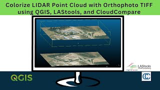
Colorize LIDAR Point Cloud to RGB | Colorizing LIDAR data with TIFF | QGIS + LasTools + CloudCompare
มุมมอง 4916 หลายเดือนก่อน
In this tutorial video, I'll guide you through the process of colorizing a LAS point cloud into RGB using QGIS, LASTools, and Cloud Compare. It's important to note that, while LASTools is open-source, some commercial features like lascolor may require licensing. I recommend checking LASTools' license.txt or reaching out to them for clarification, especially if you plan to use these features com...

Landsat 9 + QGIS | Band Combination and Pan-sharpening
มุมมอง 3539 หลายเดือนก่อน
Download the latest Landsat 9 data: earthexplorer.usgs.gov/ Learn more about available bands: www.usgs.gov/faqs/what-are-band-designations-landsat-satellites #landsat9 #gis #remotesensing
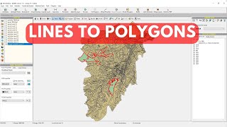
Convert Lines to Polygons | How to convert Line to Polygon | Convert Polylines to Polygons
มุมมอง 2209 หลายเดือนก่อน
How to convert Lines to Polygons in under a second! GIS Line features to Polygon Features #sgisdesktop #letsmakegisprecise #linetopolygon

LAZ to LAS | Converting multiple LAZ LiDAR files to LAS format. | QGIS + LAStools
มุมมอง 2.2K9 หลายเดือนก่อน
Decompressing many LAZ LiDAR point cloud files to LAS using laszip tools from LAStools Unzip LAZ file LAZ to LAS Lidar data QGIS @LasTools #gis #remotesensing #lastools

Split a Polygon Feature with a Digitized Line / Divide Polygons with a Previously Drawn Line Feature
มุมมอง 849 หลายเดือนก่อน
How to split polygons with a line using SGIS Desktop In this video we are working on the Latest Demo Version of SGIS Desktop Create Polygons Line Features Lines to Polygons #letsmakegisprecise #sgisdesktop #sgistools
SGIS Software: How to calculate the length of multiple lines in GIS?
มุมมอง 1.3Kปีที่แล้ว
Visit: www.simplegissoft.com and try out our SGIS Demo Version for FREE!!! Find more related stories on: www.simplegissoft.com/sgis-stories/ Length Measurement in GIS: Geometry vs. Attributes Imagine you are working on a project where you need to measure the length of various polyline features that meet certain criteria. In traditional scenarios, you might need to manually select each relevant ...
SHP to KML | How To Convert Shapefile to KML | Export a Shapefile to .KML
มุมมอง 1.3Kปีที่แล้ว
Visit: www.simplegissoft..com and try out our SGIS Demo Version for FREE!!! You can find more related Tech Posts and Articles on www.simplegissoftcom/sgis-stories/ How to export a shapefile to a .kml file suitable for Google Earth and other applications. How to convert Shapefile to Google Earth KML file Convertir shp a kml/kmz / Convert shp to kml/kmz Convert Shapefile to KML Format Convert Sha...
How to Convert KMZ file to ShapeFile in SGIS | KML / KMZ to SHP | Google Earth
มุมมอง 228ปีที่แล้ว
Visit: www.simplegissoft.com and try out our SGIS Demo Version for FREE!!! Read more related How To Insights on: www.simplegissoft.com/sgis-stories/ How to convert KML or KMZ data to SHP or Shapefile format in SGIS Converting kml to shape file in SGIS Digitize shapes on google earth pro, save as kml or kmz, and make a map or some analysis inside a GIS environment. Convert KML to Shape file in S...
SGIS Desktop: Automatic Land Parcel Subdivision | Divide Multiple Parcels By Layer
มุมมอง 12Kปีที่แล้ว
Visit: www.simplegissoft.com and try out our SGIS Demo for FREE!!! #gissoftware #sgis #landsubdivisionsoftware Can a Parcel of Land Be Split Automatically? SGIS Says Yes! In traditional land subdivision workflows, parcel division required meticulous manual calculations and delineation. However, with SGIS’s cutting-edge tools and algorithms, dividing polygons automatically becomes a swift and ac...
SGIS Desktop: Calculate Total Length of Multiple Lines | FTTH Network Design Tools
มุมมอง 234ปีที่แล้ว
Visit: www.simplegissoft.com and try out our SGIS Demo for FREE!!! How to calculate total length of multiple lines in SGIS? How to measure length in GIS software? [Apps to measure length] [Application to measure length] #totallength #gissoftware #sgisdesktop #FTTHNetworkDesignTools #Calculatetotallength #Linemeasurement #networkinfrastructure #Fiberopticnetwork #GeographicInformationSystem #GIS...
SGIS Desktop: How to Count how many Buildings are there in a SHP layer?
มุมมอง 144ปีที่แล้ว
Visit: www.simplegissoft.com and try out our SGIS Demo for FREE!!! Recently, we received a common query: Is there an easy way to determine the total count of objects within a single shape layer? Absolutely, there is! Without relying on pre-existing patterns from other GIS software in the market, we will demonstrate our unique approach to achieving this task. Let us guide you through the seamles...
SGIS Software: How to sum total area of polygons?
มุมมอง 1.7Kปีที่แล้ว
SGIS Software: How to sum total area of polygons?
SGIS Desktop: Snap By Layer | Smart Snapping | Snapping Tools
มุมมอง 193ปีที่แล้ว
SGIS Desktop: Snap By Layer | Smart Snapping | Snapping Tools
SGIS Desktop: What makes the 'Open Folders' Tool, a Smart Tool?
มุมมอง 9Kปีที่แล้ว
SGIS Desktop: What makes the 'Open Folders' Tool, a Smart Tool?
What is the INVERT SELECTION tool? Why is it useful?
มุมมอง 3.2Kปีที่แล้ว
What is the INVERT SELECTION tool? Why is it useful?
Export Labels Placed In Visual Center As TXT File With SGIS Desktop
มุมมอง 1.8Kปีที่แล้ว
Export Labels Placed In Visual Center As TXT File With SGIS Desktop
Identifying And Removing Duplicate Geometry Features With SGIS *Why is this important?*
มุมมอง 2Kปีที่แล้ว
Identifying And Removing Duplicate Geometry Features With SGIS *Why is this important?*
SGIS: Remove Duplicate Geometry Automatically
มุมมอง 2.9Kปีที่แล้ว
SGIS: Remove Duplicate Geometry Automatically
SGIS: Highlight Unclosed Polylines - Automatic Detection of Unclosed Polylines
มุมมอง 2.6Kปีที่แล้ว
SGIS: Highlight Unclosed Polylines - Automatic Detection of Unclosed Polylines
Why Integrate CAD and GIS anyway?? GIS and CAD Fusion*
มุมมอง 4.3Kปีที่แล้ว
Why Integrate CAD and GIS anyway?? GIS and CAD Fusion*
SGIS: Create Buffer Polygons *Merge Polygons
มุมมอง 1.5Kปีที่แล้ว
SGIS: Create Buffer Polygons *Merge Polygons
SGIS: Points to Polylines; Generate Polylines from TXT/CSV file (FTTH Network Design)
มุมมอง 212ปีที่แล้ว
SGIS: Points to Polylines; Generate Polylines from TXT/CSV file (FTTH Network Design)
SGIS IMPORTant: Generate Polygons from TXT/CSV file
มุมมอง 186ปีที่แล้ว
SGIS IMPORTant: Generate Polygons from TXT/CSV file
Thanks for sharing, im from Brazil and this video helped me a lot.
Thank You! Glad to hear that!
Thanks this tutorial was helpful.
Wow you just made my day with this 😊 I have been searching for how to do this in qgis for the longest time🎉 can you also make a video where the building and streets a clear and visible for digitization purposes
Thank you!
KatastRsko oddele ie strumica❤
Seems to me that for a paid tool it doesn't work very well. Looks like most of the polygons were not in the right place?
It's true that tools designed to extract features often face challenges with accuracy and precision. This is something we see across many platforms that rely on automated processes. They are incredibly useful, but they do often need some manual tweaks or validation to get the most accurate results.
what software that help you made this video? Thank u
Thank you! The only video explaining this
Glad it helped!
Me me me im a pdf file
That’s crazy
ayoooo?🤨📷
Perfect tutorial! thank you!
Thank you
Another way to do this is to use the simple filter tool with the smooth option on the DEM first and then create the contours.
Nice ❤❤
My qgis lascolor is not working, I've input las and tiff file but after I run the process, no file was saved. tried many times, but it's still not working..
Same having no luck. DId you work it out?
U a saint. Love u
Tnx!
So funny 😆
I cannot figure out her accent.
Take a guess! 😊😉
Oh, come on! If I had to guess, I would say Norwegian.@@EasyyLearn
OHH, i thought it was short for pedophile. This makes so much sense now.
of all the tutorials everywhere. All I needed to know there was a measure area area button under view...... thankyou
Thank you! Glad You found it helpful! 😊
Thank you for sharing!
Thank you
Thank you, your video helped a lot!
What algo does it work on?
geoid definition noun the hypothetical shape of the earth, coinciding with mean sea level and its imagined extension under (or over) land areas.
Thank you, that was exactly the tutorial I was looking for! you went at a nice pace and you were easy to hear.
Thank you! Glad to hear that!
how to include the PI?
thanks for the video, I checked the price of your software, much less than ArcGIS, but it would be useful to know what SGIS offers more than an alternative free option like QGIS, like a comparison table for instance
Sir, I wrote them an email and I received a reply that a functionalities and capabilities list along with detailed videos will we uploaded on the official page. In the meantime, I downloaded the demo version. I quite like it. Has some interesting functions that I haven't previously found in any other gis software. Especially in the attributes section.
thanks for sharing
Thank you!
Do you have to pay for this tool?
Their website provides all the information regarding the availability of free and paid features.
thank you for this video but you should mention that Mapinfi is not free
Thank you! Mapinfo is not once mentioned in this video... 🙂🙂
Map flow is not free!
That is correct! However, to get started you do receive free credits after registration 🙂
Great Video, very informative. Do you know how I would be able to count the number of buildings in specific area?
Thank you! We usually count the number of elements with SGIS, using the smart polygon selection and then exporting selected elements in new layer. In the info tab, the number of *polygons (parcels, buildings), lines (routes), or points, are automatically displayed 🙂
👌💫
😮😢
How do you make the DSM? I don't see it?
Hello! The making of the DSM starts at 1:00. Start with removing noise/outliers, and after as described. What you get is a three-dimensional representation of the heights of the Earth's surface, including natural or man-made objects located on it. 🙂
❤❤❤
i
Is it in meters, feet, miles, inches? What are the units and why is it so opaque on this front?
Hey, This #length function from the Field Calculator, is a measurement of whatever map units are specified in your project properties or CRS. Mine are in meters.
Hello I have problems in merging the polygons 😢
Hope this video helps! th-cam.com/video/yfxqRNlYW2g/w-d-xo.html If not, we will soon upload another one on merging polygons using our new software SGIS. Maybe that would help :)
can i convert to kml to open in google earth?
Definitely! Just set your desired CRS and export to Google Earth
good any idea as to when the software will be available to the public? thanks
Very soon! :)
😊🎉😂😊😅😮🎉🎉🎉🎉🎉🎉🎉🎉🎉🎉🎉😂😂😂😊😊
looking forward to trying SGIS once available 🙂
Thank you! Looking forward to your review!
Thanks a lot for your sharing Teacher.
Thank You!
You save my life
good one, when is SGIS going to be available?
@Easyylearn will post in the Community posts the official release date, as well as the link to the official SGIS Soft web page. Thank you for keeping up! 🙂
hello. what is the format of the txt file to import? thank you.
Hey, It is a plain text document file that contains data(coordinates) - line separated 🙂
Thank you for this video from the Mapflow team!
Thank you! When you stumble upon something good and useful - the right thing is to share it! :)
@@EasyyLearn absolutely! Our new video on how to combine photogrammetry, AI-mapping, and Web GIS: th-cam.com/video/fwHUhlsR534/w-d-xo.html
Great Video. Please add links to GPS visualizer in description!!!
Hi, please where can I download this version? the trial one available from Simple GIS looks different, thanks
Hi Stefano, this software differs from Simple GIS. This is SGIS Desktop software, and the free trial, as well as the official licensed version, will launch soon. We will publish here the official release date.
your voice is so sweet and beautiful. thanks for informate.
Thank you!
Excellent stuff, saved me hours of manual work.