
- 27
- 169 617
Pix4D Agriculture
Germany
เข้าร่วมเมื่อ 21 ม.ค. 2022
PIX4Dfields is a unique hybrid drone and satellite agriculture mapping software for aerial crop analysis and digital farming.
Crop damage detection and assessment | Crop insurance with PIX4Dfields
Facilitate the crop insurance claim process for you or your clients!
PIX4Dfields provides fast and accurate crop damage detection and assessment of any crop at any stage! Whether the crop damage is caused by wild animals, insects, or extreme weather conditions like hail, floods, or hurricanes, you can gain valuable insights and receive detailed, customized & ready-to-use PDF reports for your insurance claims!
➡️Get your 15 day FREE trial of PIX4Dfields today: hubs.li/Q01tCQBF0
PIX4Dfields Support & Documentation: hubs.li/H0XNzlh0
PIX4Dfields Community: hubs.li/H0XNzhw0
Topics covered:
0:00 Introduction
0:30 Creating a Field Boundary
1:00 Adding Geotagged Images
1:30 Using the MagicTool for Damage Detection
1:53 Refining Annotations
2:22 Generating a PDF Report
3:11 Conclusion
มุมมอง: 420
วีดีโอ


AMAZONE spot spraying maps and simplified precision agriculture applications
มุมมอง 9646 หลายเดือนก่อน
➡️Get your 15 day FREE trial of PIX4Dfields 2.6 today: hubs.li/Q01tCQBF0 PIX4Dfields Support: hubs.li/H0XNzlh0 PIX4Dfields Community: hubs.li/H0XNzhw0

Introduction to PIX4Dfields
มุมมอง 1.6K7 หลายเดือนก่อน
#PIX4Dfields is a hybrid drone and #satellite mapping software for aerial crop analysis and #precisionagriculture. ➡️Get your 15 day FREE trial of PIX4Dfields today: hubs.li/Q01tCQBF0

Green on Brown Spot Spraying - Mapping fallow weeds with PIX4Dfields
มุมมอง 2.3K9 หลายเดือนก่อน
Delve into an efficient PIX4Dfields workflow, specifically tailored for green on brown spot spraying.🌱 ✅Discover how to utilize RGB vegetation indices for accurate weed detection, to save up to 70% on chemicals.💰 ✅Step-by-step guidance on mapping weeds on fallow with an RGB dataset from a 20MP sensor. ✅Techniques for effective green on brown spot spraying, optimizing your agricultural workflow....

How to upload your application map to John Deere Operations Center
มุมมอง 2.5K10 หลายเดือนก่อน
PIX4Dfields quickly processes high-resolution drone and satellite images, allowing you to create prescription maps in minutes. These maps can be directly sent to your John Deere machinery for agricultural applications. Upload your field boundaries, aerial maps, and crop health and prescription maps for variable rate applications and spot spraying directly to your John Deere Operations Center ac...

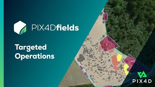
How to spot spray with your tractor | PIX4Dfields
มุมมอง 3Kปีที่แล้ว
Targeted Operations creates highly customizable prescription maps for variable rate or spot spraying applications that you can use directly with your spray drone, tractor, or field sprayer. With these maps, the tractor applies inputs like fertilizers, herbicides, or pesticides only where it’s needed, staying within the given field boundaries and avoiding areas marked as obstacles when creating ...
Spot spraying prescription maps for DJI Agras, XAG and Tractors
มุมมอง 11Kปีที่แล้ว
PIX4Dfields offers a seamless and cost-effective workflow for precision agriculture applications. Enjoy highly customizable variable rate and spot spraying prescription maps for spray drones, tractors, and field sprayers. Leverage your agriculture workflow and save time money and resources! ➡️Get your 15 day FREE trial of PIX4Dfields today: hubs.li/Q01tCQBF0 PIX4Dfields Support: hubs.li/H0XNzlh...

How to create RTK field boundaries with DJI Mavic 3 Multispectral and PIX4Dfields
มุมมอง 6Kปีที่แล้ว
PIX4Dfields is a unique hybrid drone & satellite solution for smart agriculture. Leverage your agriculture workflow and save time, money and resources with spot spraying and variable rate application maps. ➡️Get your 15 day FREE trial of PIX4Dfields today: hubs.li/Q01tCQBF0 PIX4Dfields Support: hubs.li/H0XNzlh0 PIX4Dfields Community: hubs.li/H0XNzhw0 00:00 Introduction 0:22 Why boundaries? 2:03...

Precision agriculture with PIX4Dfields | In-field Tutorials
มุมมอง 1.7Kปีที่แล้ว
PIX4Dfields es una solución híbrida única de dron y satélite para una agricultura inteligente. Aproveche su flujo de trabajo agrícola y ahorre tiempo, dinero y recursos con pulverizaciónes dirigidas y mapas de aplicación de tasa variable. Estamos encantados de lanzar nuestra serie de vídeos sobre PIX4Dfields con Gregorio Becerra, Ingeniero Agrónomo & director técnico en AGRODEX SL. ¡Estad atent...
How to have a successful season with a complete agricultural drone mapping solution
มุมมอง 3.2Kปีที่แล้ว
Do you want to hear about a #smartagriculture solution? In this #webinar you will discover how #PIX4Dfields software, a YuneeC H520E drone and a LaQuinta multispectral sensor were used for #precisionagriculture and #smartfarming during the last growing season of De Databoerin. Try PIX4Dfields for free hubs.li/Q01yK3zD0 Check our community hubs.li/Q01ghv4Q0 Visit our support website hubs.li/Q01h...
How to use DJI Mavic 3 Multispectral | PIX4Dfields in-field Tutorials
มุมมอง 85Kปีที่แล้ว
PIX4Dfields is a unique hybrid drone & satellite solution for smart agriculture. Leverage your agriculture workflow and save time money and resources with spot spraying and variable rate application maps. ➡️Get your 15 day FREE trial of PIX4Dfields today: hubs.li/Q01tCQBF0 PIX4Dfields Support: hubs.li/H0XNzlh0 PIX4Dfields Community: hubs.li/H0XNzhw0 Topics covered: 0:00 Introduction 0:44 DJI Ma...
Magic Tool | PIX4Dfields beginner tutorials
มุมมอง 7Kปีที่แล้ว
Try PIX4Dfields for free ➡️ hubs.li/Q01tCQBF0 Read more on our support article ➡️ support.pix4d.com/hc/en-us/articles/7886486253213-Magic-Tool-PIX4Dfields Visit our community page ➡️ hubs.li/Q01tb_Hn0 0:00 Intro 1:05 Magic tool - where to find it 1:42 Grid Creation 2:47 Labeling 4:01 Cleanup 5:06 Convert 5:42 Result 6:05 Tips 7:23 Speedruns 8:13 Outro
PIX4Dfields
มุมมอง 602ปีที่แล้ว
There’s something magical about the end of the year - and we have a new surprise waiting for you! Check out this teaser for the newest update coming to #PIX4Dfields - it’s something magical! Try PIX4Dfields for free hubs.li/Q01tCQBF0 #shorts #agriculture
Your camera is not supported at this time | PIX4Dfields Beginner Tutorials
มุมมอง 1.1K2 ปีที่แล้ว
Try PIX4Dfields for free ➡️ hubs.li/Q014gFn_0 Visit our community page ➡️ hubs.li/Q01ghv4Q0 Find the XML on our support article ➡️ hubs.li/Q01hGj1x0
Exporting and sharing layers | PIX4Dfields Beginner Tutorials
มุมมอง 2.9K2 ปีที่แล้ว
Exporting and sharing layers | PIX4Dfields Beginner Tutorials
Field boundaries | PIX4Dfields Beginner Tutorials
มุมมอง 3.5K2 ปีที่แล้ว
Field boundaries | PIX4Dfields Beginner Tutorials
Introduction to the dashboard | PIX4Dfields Beginner Tutorials
มุมมอง 5K2 ปีที่แล้ว
Introduction to the dashboard | PIX4Dfields Beginner Tutorials
Creating and processing a project | PIX4Dfields Beginner Tutorials
มุมมอง 4.7K2 ปีที่แล้ว
Creating and processing a project | PIX4Dfields Beginner Tutorials
Vegetation indices | PIX4Dfields Beginner Tutorials
มุมมอง 9K2 ปีที่แล้ว
Vegetation indices | PIX4Dfields Beginner Tutorials
Webinar | Drone Uses in Conservation and Natural Resource Management
มุมมอง 2592 ปีที่แล้ว
Webinar | Drone Uses in Conservation and Natural Resource Management
Zonation and Prescriptions in PIX4Dfields | PIX4Dfields Beginner Tutorials
มุมมอง 4.9K2 ปีที่แล้ว
Zonation and Prescriptions in PIX4Dfields | PIX4Dfields Beginner Tutorials
Annotations and Comparison tool | PIX4Dfields Beginner Tutorials
มุมมอง 2.2K2 ปีที่แล้ว
Annotations and Comparison tool | PIX4Dfields Beginner Tutorials
Prescription maps for Variable Rate Application | PIX4Dfields Tutorials
มุมมอง 4.5K2 ปีที่แล้ว
Prescription maps for Variable Rate Application | PIX4Dfields Tutorials
How to use DJI Phantom 4 Multispectral | PIX4Dfields in-field Tutorials
มุมมอง 2.1K2 ปีที่แล้ว
How to use DJI Phantom 4 Multispectral | PIX4Dfields in-field Tutorials
How to map your crop in minutes | PIX4Dfields in-field Tutorials
มุมมอง 1.8K2 ปีที่แล้ว
How to map your crop in minutes | PIX4Dfields in-field Tutorials
High Definition digital surface models | PIX4Dfields Tutorials
มุมมอง 1.4K2 ปีที่แล้ว
High Definition digital surface models | PIX4Dfields Tutorials
Bring Your Own Drone | PIX4Dfields in-field Tutorials
มุมมอง 6532 ปีที่แล้ว
Bring Your Own Drone | PIX4Dfields in-field Tutorials
Do you need DRTK for your Mavic 3Multispectral?
Is it possible to get a more pin point on the exact weed?
Hi maybe i missed in the video. What was the time taken for the flight for this particular area? I am trying to determine how much area can be covered in one full 15 minute flight. Thank you
Ok stupid question. He's using a dji Mavic 3. Which unit has the multi sensors? I don't see it at dji site.
Good afternoon. Is it possible to count the stand of plants born from soybeans and corn with this equipment? Or using PIX4DFields?
Hello, yes it is possible! You can check our article for more details support.pix4d.com/hc/en-us/articles/3600428292028.
What computer are you using to run ?
Great video! Did you guys use RTK for this mission?
Hi Pix4d. I will write a separate email but pix4d fields is so fast and superior at creating orthomosaic images than any other software I use. I don’t need or use it for fields as I have a Mavic 3 Enterprise. 90% of the time I do not need a 3d model just a simple ortho output. I’m creating 4 test ortho’s using the same data, 2 are from pix4d fields using fast processing and then accuracy processing. 1 from metashape using the highest settings possible and then 1 from Reality capture. With pix4d fields I got a GSD of Fast processing - 1.3cm Accuracy processing -1.02cm Can you point me in the direction of documentation of what FAST and ACURRACYdo differently from each other? I guarantee if you created a software package purely for orthomosaic processing with no picture limit like others, priced around $20-30 dollars it would create so much extra revenue from those whole can’t afford pix4d fields. Im currently using a 14 day trial but will be sad as I really cannot afford the subscription prices due to cost of living and I have a young family but if the price ever comes down please let me know. Best wishes, Lee
Hello, thank you for your feedback! You can learn more about PIX4Dfields' processing options on our article support.pix4d.com/hc/en-us/articles/360028421272. Please contact our sales team in order to assist you with your request here www.pix4d.com/contact/.
How can I prevent the drone from covering the entire field, i want to avoid the 0 Liters areas
As of right now you can’t, you stuck flying the areas that don’t need sprayed
Hello, in order to avoid flying over areas with 0 rate you would need to adjust the boundaries of the operation manually when creating the prescription map in PIX4Dfields. In case you have more questions please contact our support team www.pix4d.com/support/.
I have a Mavic 3T would i be able to use this with it. Can it analyze solar fields. I do both Agriculture and Solar
Hello, yes you can use this drone with PIX4Dfields. About solar field analysis, you could fly with high overlap (85% side and front) and process the images with PIX4Dfields' accurate processing.
Hi! The pix4d app doesnt support any of my drones (Dji mini pro 3 and Dji mavic pro platinum) Can you recomend me a software to make the mapping mission to then upload it to pix4d and generate the map? thanks Juan and greetings from Cordoba, Argentina.
Hello, thank you for your interest. DJI Mini 3 pro is supported, please see our support article here support.pix4d.com/hc/en-us/articles/8946053605149.
Hello! Can i use my Dji mini 3 pro? To do a weed mapping for spot spraying. Thanks!
Hello, DJI Mini 3 Pro is supported by PIX4Dfields. You can see the weed mapping workflow for spot spraying in detail here support.pix4d.com/hc/en-us/articles/17246143431325.
Hi! Multispectral is obligatory? Can i use a mávic pro?
Hello, you can also use RGB only as mentioned in the video, without multispectral. DJI Mavic Pro is supported by PIX4Dfields. You can see all supported drones here www.pix4d.com/supported-drones. You might also find this article helpful: support.pix4d.com/hc/en-us/articles/17246143431325.
@@pix4dagriculture Nice Thanks! can you send me a link or article on how to plan the mission for my dron to map my fields? Looking to jump into Pix4d!
hola, tienen el mismo video en español?
Hola, gracias por su interés. Hemos publicado subtítulos en español para este vídeo. Puede verlos haciendo clic en los ajustes del vídeo, luego en subtítulos y, a continuación, seleccionando ''Español''.
Hi I am having problems with my 3M..I dont have a option for mapping! I only have waypoint Route, Area Route, Linear Route, Slope Route and Geometric Route... Can someone please help me with this problem
Hello, you would need to opt for Area Route.
Thank you
If the drone is not RTK, can it cause problems or are the differences insignificant?
Hello, the level of detail possible is determined by the GPS accuracy at the time of image capturing. In case the drone is not RTK, it is possible to add a buffer to the prescription map created in PIX4Dfields.
Hey can you make an example how to export and IMPOT spot spraying on XAG P100 pro. And what do to on XAG One app. I'm intereating to buy your software, it looks amazing!
Hello, thank you for your interest! You can find answers to your questions on this video: th-cam.com/video/MxYgogezKbY/w-d-xo.htmlsi=BX-IfiRz26ixy8d3 as well as on our support article: support.pix4d.com/hc/en-us/articles/12451352818973. In case of any other problem you could contact our support team: www.pix4d.com/contact-support/.
@@pix4dagriculture Thanks. Is that applicable after i make spot spray zones ? For example to use magic tool for weed.
Very nice video and helpful. I will buy Pix4D Agriculture in near future. Can you name the company for plant counting. I couldn't hear. Or maybe Pix4D have plant counting now ?
Hello, thank you for your feedback! Plant counting was added to the latest PIX4Dfields release. You can see the latest update and download it here www.pix4d.com/blog/pix4dfields-manual-plant-counting/.
After putting this into the t40 remote, my gal/acre is stuck at 60 gal. How do I fix this.
Hello, it's possible that the incorrect area unit was selected when importing the map.
🌾🌾🌾🌾🌾🌾🌾🪴🪴🪴🪴🪴🪴🪴🌳🌳🌳🌳🌳🌳🌲🌲🌲🌲🌲🌲🌲🌻🌻🌻🌻🌻🌻
Is their any training course available now
Hello, thank you for your interest! You can find our training course here: training.pix4d.com/bundles/pix4dfields-essentials-online-course-and-certification-exam
You want $1600 a year for this software and this is the best English speaker you could come up with to explain the software?
Hi, what is the flight height ? I am trying to count corn plants in e field.
Hello, the flight height depends on the camera and type of crop. For example, when using a DJI Mavic 3M, a flight height at 25m with 1cm GSD would be good. You can read more about PIX4Dfields' manual plant counting here support.pix4d.com/hc/en-us/articles/3600428292028.
Using a calibration panel that was designed for a camera with different wavelengths is definitely going to affect the precision of reflectance values. DJI Mavic3M wavelengths: Green: 560 ± 16 nm; Red: 650 ± 16 nm; Red Edge: 730 ± 16 nm; Near infrared: 860 ± 26 nm; Micasense Altum, RedEdge 3 and RedEdge-MX (which I am assuming this older bigger panel is from): Green: 560± 20 nm; Red: 668 ± 10 nm; Red Edge: 717±10 nm; NIR: 840±40 nm; That should be pointed out!
It has nothing to do with the camera that Micansense was using it for. It's about the reflectances of the panel it self. You can use it for the M3M as it covers the wavelengths of that camera as well
What’s the price tag for the dji mavic 3m
Does Pix is only compatible with John Deere or can it be used by other brands
Hello, PIX4Dfields is compatible with various brands that you can find here: support.pix4d.com/hc/en-us/articles/360038644731-How-to-export-a-variable-rate-map-to-a-tractor-sprayer-terminal-PIX4Dfields.
I think we should make sure de-warping is ON.. right? It's annoying.
Which drone did you use for this datasheet? Thanks
I Like the drone technology, are you providing training based on the image processing software? or is any means i can get free from you thank you
Hello, thank you for your interest. You can find more info about PIX4Dfields training here training.pix4d.com/bundles/pix4dfields-essentials-online-course-and-certification-exam
P4 vs mavic multispectral? Your opinion?
Question 🙋♂️ So after mapping the area, you get your normal A B lines. Is there a way to have it follow your spray path Basically I’m going to be spraying ditches the ditches are in a form of a long snake. So I’m trying to find out if I can follow just the ditches or will it only fly the A B lines?
Hello, you could manually draw spray zones, no-sprayzones and obstacles, use the magic tool to automatically detect the ditches area and the area out of them so to create a spot spraying map only for the ditches area or mark the area outside of the ditches as obstacle. You could check our step-by-step quide on how to create a spot spraying map here: support.pix4d.com/hc/en-us/articles/11186798543261-How-to-create-a-targeted-spraying-map-PIX4Dfields
Great tutorial. Does the Mavic 3 support planning and executing of missions requiring multiple batteries?
Hello, yes, it supports multiple batteries!
Are there any specific conditions regarding the time of the multispectral data collection?
Hello, you can find this info on our article: support.pix4d.com/hc/en-us/articles/5648296477981-How-to-capture-drone-images-for-optimal-results-in-PIX4Dfields
@@pix4dagriculture thankyou!
Hi Julius, I have an issue with sending a targeted operation to my XAG drone. I generate the map as your video show but when I send it to my drone there are some sections not there. Have you seen this in the past?
Hello maybe you find this aricle helpful support.pix4d.com/hc/en-us/articles/12451352818973-Targeted-spraying-maps-for-XAG-P100's-drones-with-PIX4Dfields.
Buenas noches. Cuánto cuesta sale un cielo de mapeo multiespectral..?
💃 Promo'SM
What about other brands of sprayers? I couldn't find any information or tutorials about how to set up the created VRA or Spot Spraying maps into the sprayer's monitors.
With the new release we have export formats compatible with most tractor terminals like shapefile, ISOXML and geotiff. The exact instructions on how to import a map are different for the many manufacturers. It's best to check with your terminal manufacturer how the procedure is. But we will document it as soon as we learn about it, in a dedicated article throughout the next season. In general you find all the export option in the Export Menu under Operations. 6:03
Will Pix4D fields do stand counts?
Please compare and what is the difference between Pix4D and DJI Terra
Hi! how do Pix4d Field use the calibration picture? How can we check it? Any tips for buying a calibration panel in Europe?
Hello, the panel type that you can use depends on the camera model you have. PIX4Dfields currently supports the following reflectance panels: Parrot, Airinov Aircalib, Sentera and Micasense. PIX4Dfields detects reflectance panel images and warns the user that calibration images were found and that they will be used to process the dataset. You can check our support page for more info: support.pix4d.com/hc/en-us/articles/360022919691-Radiometric-correction-PIX4Dfields#label7.
Hi, will the analysis and processing work without the calibration panel? Seems hard to get and absurd expensive
Hi, is it possible to upload a field scan to fendt one?
Hello, yes this possible as long as ISOXML or shapefile are supported.
We’re you able to fly that entire plot with one battery?
Could you share capacity ?ha/hours.
Hello. So the QGIS is not needed anymore, like in the previous tutorials?
Hello, yes you are correct, QGIS is not needed anymore with PIX4Dfields' latest update.
Hi Guy's, I have just purchased pix4d fields and a DJI mavic 3m and cannot seem to export the field to my XAG V40. I tried to get FMS but only comes up with log in not create an account. Not sure on what to do, Can you help.
Hello, you would need to create an account using the XAG ONE app first. In case of any further issues you can contact our team here www.pix4d.com/support/.
How do you know how much chemical to put if it’s variable rate?
Hello, you could watch this video for more insight th-cam.com/video/wWOifd3Xzo4/w-d-xo.htmlsi=ynAvz-0Qusw7SeJt.
Hi, great video? What calibration target are you using for the Phantom 4 M? Where can I buy one?
Hello, you could try MicaSense's calibration panel. Here you can also find all panels supported by PIX4Dfields: support.pix4d.com/hc/en-us/articles/360022919691-Radiometric-correction-PIX4Dfields#label7.
Thank you very much for the thorough view of the integration between Pix4D and M3M. This combination is quite good for customers which would like to do “the things” in house and w/o having deep knowledge of NDVI, CWSI and other indices. Really helpful!!!