
- 32
- 5 298
Budding Geographers
India
เข้าร่วมเมื่อ 11 ก.ค. 2018
Hello geographers! Welcome to my channel,where we'll explore the exciting world of geography.Join me, Akash Kumar Manna, a passionate postgraduate student of geography,as we discuss the current UG and PG syllabus of Calcutta University. Let's explore the diverse landscapes, cultures, and concepts that shape our planet to the complexity of remote sensing and GIS. Together, let's discover, investigate, and deepen our understanding of the world.
Plant Species Diversity using Shannon and Simpson Index|Soil and Bio Geography Practical|
Plant Species Diversity using Shannon and Simpson Index|Soil and Bio Geography Practical|
#plantspecies #biodiversity #soil #biology #calcuttauniversity
#plantspecies #biodiversity #soil #biology #calcuttauniversity
มุมมอง: 20
วีดีโอ
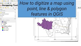

QGIS Series 7: How to digitize a map using point, line & polygon features in QGIS| Snapping Tool|
มุมมอง 127 ชั่วโมงที่ผ่านมา
How to digitize a map using point, line & polygon features in QGIS| Snapping Tool Enable| Series 1: Introduction to Qgis Software th-cam.com/video/11a-GGgcv54/w-d-xo.html Series 2: How to install and download Qgis th-cam.com/video/1nlG30_UkBM/w-d-xo.html Series 3: Basic introduction to Qgis interface th-cam.com/video/5RbvijZ7Wx4/w-d-xo.html Series 4: How to download LISS III image from the Bhoo...

QGIS Series 6: Image-to-Image Georeferencing using Map Canvas in QGIS| Base Map Georeferencing|
มุมมอง 2312 ชั่วโมงที่ผ่านมา
QGIS Series 6: Image-to-Image Georeferencing using Map Canvas in QGIS| Base Map Georeferencing| Series 1: Introduction to Qgis Software th-cam.com/video/11a-GGgcv54/w-d-xo.html Series 2: How to install and download Qgis th-cam.com/video/1nlG30_UkBM/w-d-xo.html Series 3: Basic introduction to Qgis interface th-cam.com/video/5RbvijZ7Wx4/w-d-xo.html Series 4: How to download LISS III image from th...

Residual Mapping Tutorial|Absolute Residual Calculation|Regression Analysis|Quantitative Techniques|
มุมมอง 2112 ชั่วโมงที่ผ่านมา
Residual Mapping Tutorial|Absolute Residual Calculation|Regression Analysis|Quantitative Techniques| #calcuttauniversity #statistics #residual #quantitativetechniques #régression

Location Quotient|Measurement of Inequality|Regional Analysis|Geography Practical|
มุมมอง 1914 ชั่วโมงที่ผ่านมา
Location Quotient|Measurement of Inequality|Regional Analysis|Geography Practical| #locationquotient #inequality #geographypractical #regionalanalysis #calcuttauniversity

QGIS Series 5: Georeferencing using GCPs in QGIS|Georeferencing Topo Map|Enable Georeference tool|
มุมมอง 3614 ชั่วโมงที่ผ่านมา
Georeferencing using GCPs in QGIS|Georeferencing Topographical Map|Enable Georeference tool| Series 1: Introduction to Qgis Software th-cam.com/video/11a-GGgcv54/w-d-xo.html Series 2: How to install and download Qgis th-cam.com/video/1nlG30_UkBM/w-d-xo.html Series 3: Basic introduction to Qgis interface th-cam.com/video/5RbvijZ7Wx4/w-d-xo.html Series 4: How to download LISS III image from the B...

Z- Score Calculation|Standard Score|Normal Probability Curve|Quantitative Analysis| Practical|
มุมมอง 2316 ชั่วโมงที่ผ่านมา
Z- Score Calculation|Standard Score|Normal Probability Curve|Quantitative Analysis| M.sc Geography Practical| #statistics #quantitativetechniques #zscore #standardscore

QGIS Series 4: How to download LISS III image from Bhoonidhi website| Download free data source|
มุมมอง 90วันที่ผ่านมา
QGIS Series 4: How to download LISS III image from Bhoonidhi website| Download free data source| Series 1: Introduction to Qgis Software th-cam.com/video/11a-GGgcv54/w-d-xo.html Series 2: How to install and download Qgis th-cam.com/video/1nlG30_UkBM/w-d-xo.html Series 3: Basic introduction to Qgis interface th-cam.com/video/5RbvijZ7Wx4/w-d-xo.htmlsi=MkFhJMjhVyWyDyVM #gissoftware #qgis #DEM #sat...

QGIS Series 3: Basic Introduction to Qgis Interface and How to Add Panel, toolbar, and Layers |
มุมมอง 16วันที่ผ่านมา
QGIS Series 3: Basic Introduction to Qgis Interface and How to Add Panel, toolbar, and Layers | Series 1: Introduction to Qgis Software th-cam.com/video/11a-GGgcv54/w-d-xo.htmlsi=qH8kuA5t6LCrtzYb Series 2: How to install and download qgis th-cam.com/video/1nlG30_UkBM/w-d-xo.htmlsi=VhEh0Q5U5DFmD33k #gissoftware #gis #remotesensing #qgis
Crop Combination by J.C Weaver's Method|Minimum Average square deviation method|Geography Practical|
มุมมอง 16วันที่ผ่านมา
Crop Combination by J.C Weaver's Method|Minimum Average square deviation method|Geography Practical| #calcuttauniversity #stateuniversity #practical #alluniversity #quantitativetechniques
QGIS Series 2: How To Download and Install QGIS on Windows|Download the latest version for free|
มุมมอง 26วันที่ผ่านมา
How To Download and Install QGIS on Windows|Download the latest version for free| #qgis #windows11 #download
QGIS Series 1: Introduction to QGIS Software| Basic Tutorials for Beginers|
มุมมอง 4614 วันที่ผ่านมา
Introduction to QGIS Software| Basic Tutorials for Beginers| A Comprehensive Overview of Open Source Geographic Information System| #gissoftware #qgis #opensourcesoftware #remotesensing
Occupational Ternary Diagram Toutorial| Economic Geography Practical|Msc 3rd Sem Practical|
มุมมอง 2014 วันที่ผ่านมา
Occupational Ternary Diagram Toutorial| Economic Geography Practical|Msc 3rd Sem Practical| #calcuttauniversity #geography #geographypractical #ternary #economicgeography
How to make a Perfect study area map using QGIS| Basemap Uses|XYZ tiles uses|How to add URL in QGIS|
มุมมอง 13814 วันที่ผ่านมา
How to make a Perfect study area map using QGIS| Basemap Uses|XYZ tiles uses|How to add URL in QGIS| #education #qgis #studyarea #remotesensing
How to calculate distance & area from GNSS data in Excel|GPS Mapping| Waypoint Collection from GPS|
มุมมอง 5114 วันที่ผ่านมา
How to calculate Length and area measurements from GNSS data in excel| GPS Mapping| How to use Garmin GPS|Waypoint Collection| #calcuttauniversity #gnss #gps #geographypractical #map
Measures of Income Inequality Mapping in Excel| Lorenz Curve| Gini-coefficient| Full Tutorial|
มุมมอง 5521 วันที่ผ่านมา
Measures of Income Inequality Mapping in Excel| Lorenz Curve| Gini-coefficient| Full Tutorial|
How to create Thematic Mapping in QGIS|QGIS tutorial|
มุมมอง 62หลายเดือนก่อน
How to create Thematic Mapping in QGIS|QGIS tutorial|
How to prepare coastal erosion vulnerability maps|Shoreline Change Analysis|Hazard Mapping|
มุมมอง 74หลายเดือนก่อน
How to prepare coastal erosion vulnerability maps|Shoreline Change Analysis|Hazard Mapping|
How to prepare a Spectral Library using QGIS| Msc. 2nd SEM Geography Practical|
มุมมอง 320หลายเดือนก่อน
How to prepare a Spectral Library using QGIS| Msc. 2nd SEM Geography Practical|
Change Detection Analysis in QGIS using digitization| Remote sensing & GIS practical|
มุมมอง 2266 หลายเดือนก่อน
Change Detection Analysis in QGIS using digitization| Remote sensing & GIS practical|
Preparation of Hypsometric Curve of a river basin| Calculation and Drawing| UG-PG Geography video|
มุมมอง 968 หลายเดือนก่อน
Preparation of Hypsometric Curve of a river basin| Calculation and Drawing| UG-PG Geography video|
How to Draw Altimetric Frequency Curve| Geography Practical|
มุมมอง 7198 หลายเดือนก่อน
How to Draw Altimetric Frequency Curve| Geography Practical|
Hydrograph Calculation and Drawing| Hydrology| 3rd SEM Hons Geography|
มุมมอง 2811 หลายเดือนก่อน
Hydrograph Calculation and Drawing| Hydrology| 3rd SEM Hons Geography|
Rating Curve Calculation| Hydrology| 3rd SEM Hons Geography|
มุมมอง 335ปีที่แล้ว
Rating Curve Calculation| Hydrology| 3rd SEM Hons Geography|
How to identify Channel pattern from toposheet| Interpret it| Calculate Sinuosity Index|
มุมมอง 730ปีที่แล้ว
How to identify Channel pattern from toposheet| Interpret it| Calculate Sinuosity Index|
How to identify drainage pattern from toposheet| Interpret it|
มุมมอง 832ปีที่แล้ว
How to identify drainage pattern from toposheet| Interpret it|
How to download SRTM DEM| Create Contour Breaking| Hillshade, Roughness, Slope , Aspect map in QGIS|
มุมมอง 138ปีที่แล้ว
How to download SRTM DEM| Create Contour Breaking| Hillshade, Roughness, Slope , Aspect map in QGIS|
How to create DEM from spot heights and also create contour line using QGIS| IDW interpolation|
มุมมอง 628ปีที่แล้ว
How to create DEM from spot heights and also create contour line using QGIS| IDW interpolation|
How to draw diagonal scale | Calculation and Drawing | UG Geography 1st sem practical| New syllabus|
มุมมอง 41ปีที่แล้ว
How to draw diagonal scale | Calculation and Drawing | UG Geography 1st sem practical| New syllabus|
How to draw comparative scale | Calculation and Drawing | UG Geography 1st sem practical|
มุมมอง 23ปีที่แล้ว
How to draw comparative scale | Calculation and Drawing | UG Geography 1st sem practical|
❤
Clark David Allen Maria Martin Lisa
Khub bhalo
Lewis Thomas Thomas Mark Wilson Daniel
Darun hoye6e boss ❤
@@himalayagraphics1064 thank you boss
Good job ❤
Khub bhlo hoye6 bojhano
@@sohinichowdhury9147 thanks
Thank you sir
Darun dada...😌
Egiye ja 👍
1+3.3log72≈7.13 so number of class should be 7 and according to the formula of class interval {(700-200)}/7 ≈71.43 so shouldn't the class interval be 70?
Yes, you should. Actually, I have assumed 100 for the convenience of calculation. You should take 70 as a class interval. Then your class should start at 200-270, 270-340, and continue. No.of class is given in your question paper. If no class is not given, then you can choose any no. of classes.
Khub bhlo hoye6 😊
Thank you
Thank you sir onk upkrito holam☺
Thankyou so much❤
Sob slide a nijer nam qualification r contact no mention kor..... Okkhne na korle alada jaigai dee
Ok boss
আপনি খুব ভালো বোঝান স্যার
Thank you..apnr aktu asirbad chai
Khub bhlo bojhano hoye6
Thank you madam
Erokom teacber ami pele bhlo hoto 🥺
Thanku sir ❤
Keep growing ❤💯
Wah Sir ji ❤
❤❤
❤❤
Keep it up ❤
Thank you❤
Geography bsc honours er theory topics gulo discuss korun...
Will try
Easily explained 😊
Chaliye jaoo❤
Sir Amio sikhchi r ki.. darun keep it up chaliye jaw
🤣🤣🤣🤣
All the best
Ok sir got it...❤ ...
🤣🤣🤣🤣❤️
Good work ❤️
❤️
Wow.. Vai keep it up❤
Keep it up vai❤
Well done bhai ❤
❤
Oii A manna.... Voice thik kor.....
Well done 🎉
🫰🏼
Well explained 👍
Clear and crisp explanation....keep growing buddy 😊😊