
- 34
- 152 239
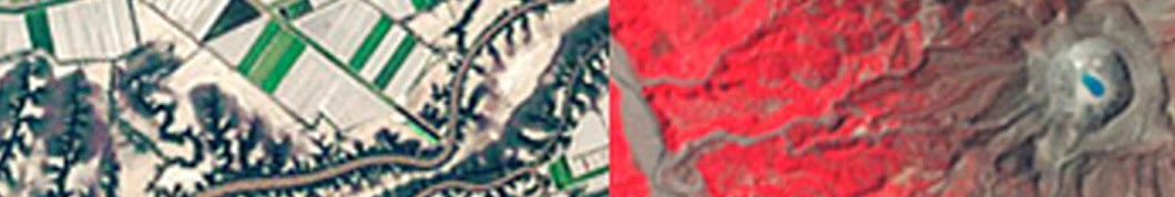
iGETT Remote Sensing Education
เข้าร่วมเมื่อ 17 ธ.ค. 2013
This Channel includes resources for learning or teaching remote sensing concepts created by participant educators in the iGETT project. Integrated Geospatial Education and Technology Training - iGETT- is a U.S. National Science Foundation funded project (DUE 12050069( to support remote sensing education by providing faculty education and teaching resources. Resources include Student Handouts with step-by-step exercises focused on remote sensing using Landsat data. Participants are also creating Concept Modules that can be used by students and the workforce to understand concepts important for using remote sensing.
iGETT Concept Module: Remote Sensing Made Easy
Introduction to resources to help teach remote sensing concepts and imagery use without downloading software or data. Links to resources to teach these concepts easily in one lab and one lecture session.
มุมมอง: 916
วีดีโอ


Introduction to Remote Sensing Concepts for GIS Users
มุมมอง 15K8 ปีที่แล้ว
This presentation introduces GIS users to concepts and techniques to effectively use remote sensing imagery

iGETT Concept Module Photogrammetry and Aerial Imagery
มุมมอง 58K9 ปีที่แล้ว
Introduction to Photogrammetry and Aerial imagery concepts including useful calculations using photogrammetry principles.

iGETT Concept Module Map Design for Color Vision Deficient Users revised
มุมมอง 3429 ปีที่แล้ว
This Concept Module focuses on designing maps for use by or for individuals that have some type of Color Vision Deficiency including explaining the different types of deficiencies.

iGETT Concept Model Remote Sensing and Spatial Thinking
มุมมอง 1.8K9 ปีที่แล้ว
This Concept Module focuses on Spatial Thinking and how it is related to remote sensing.

iGETT Concept Module Ground Truth Remote Sensing Imagery
มุมมอง 2.1K9 ปีที่แล้ว
This Concept Module focuses on the process to ground truth (ground reference) imagery

iGETT Concept Module Why Are Pixels Square and Lenses Round
มุมมอง 7629 ปีที่แล้ว
This Concept Module investigates the reasons why pixels are square and lenses are round. square pixels make up the data in imagery, yet camera lenses that capture that date are round. How do you go from a round lens to a square pixel?

iGETT Concept Module Infrared Radiation
มุมมอง 7299 ปีที่แล้ว
This Concept Module focuses on Infrared radiation - how it is used in remote sensing, and by plants, animals and humans. It covers the band values for infrared radiation and how the information can be used in astronomy and imagery of features on the earth

iGETT Concept Module Landsat 8 Intro to ToA Radiance and Reflectance Part 1 of 2
มุมมอง 2.2K9 ปีที่แล้ว
This is Part 1 of a two part Concept Module that focuses on correcting Landsat 8 OLI and TIRS imagery data for ToA Reflectance for OLI and at Satellite Brightness for TIRS data.
iGETT Concept Module Landsat 8 Intro to ToA Radiance and Reflectance Part 2 of 2
มุมมอง 1.3K9 ปีที่แล้ว
This Concept Module focuses on correcting Landsat 8 OLI and TIRS imagery data when used to compare or anlyze change using data from two different dates or Path and Rows. This Part 2 includes the specific equations that must be used to correct the data.
IGETT Concept Module Introduction to Band Ratios Part 2
มุมมอง 1.9K9 ปีที่แล้ว
Answers to questions from Part 1 of the Concept Module
iGETT Concept Module Introduction to Band Ratios Part 1
มุมมอง 3.4K9 ปีที่แล้ว
This Concept Module focus on band ratios with key ideas about using them including describing applications of band ratios (NDVI, NDBR, NDWI and NDSI). It also briefly compares which bands to use if you are using Landsat 5 or 7 or Landsat 8.
iGETT Concept Module: Remote Sensing for Ocean Assessments
มุมมอง 5639 ปีที่แล้ว
This Concept Module provides an overview of how remote sensing tools and techniques can be used to study the worlds oceans. It provies an overview of resources and tools that can be used to explore the oceans including the Ocean Observing System, Sonar, ROVs, UAVs, and satellite systems.
iGETT Concept Module Object Recognition on Aerial Imagery
มุมมอง 2K9 ปีที่แล้ว
This Concept Module focuses on techniques for Object Recognition using patterns observed in imagery (aerial, Landsat) using examples from forestry.
iGETT Concept Module Map Design for Color Vision Deficient
มุมมอง 2269 ปีที่แล้ว
This concept module focuses on explaining the types of color vision deficiencies and suggests possible map designs using colors and other values for meeting the needs of color visioin deficient individuals. Additional resources are also provided to help design visualizations.
iGETT Concept Module: Imagery Resolution and Landsat Basics
มุมมอง 6K9 ปีที่แล้ว
iGETT Concept Module: Imagery Resolution and Landsat Basics
iGETT Concept Module: Decision Flow Chart for Finding and Download Landsat Scenes
มุมมอง 7059 ปีที่แล้ว
iGETT Concept Module: Decision Flow Chart for Finding and Download Landsat Scenes
iGETT Concept Module for Spectral Signatures
มุมมอง 8K10 ปีที่แล้ว
iGETT Concept Module for Spectral Signatures
iGETT Concept Module Image Analysis Using NDVI Answers Part 2 of 2
มุมมอง 64510 ปีที่แล้ว
iGETT Concept Module Image Analysis Using NDVI Answers Part 2 of 2
iGETT Concept Module: Landsat file names
มุมมอง 49210 ปีที่แล้ว
iGETT Concept Module: Landsat file names
iGETT Concept Module Spectral resolution
มุมมอง 3K10 ปีที่แล้ว
iGETT Concept Module Spectral resolution
iGETT Concept Module Thermal Infrared Remote Sensing - Part 2
มุมมอง 2K10 ปีที่แล้ว
iGETT Concept Module Thermal Infrared Remote Sensing - Part 2
iGETT Concept Module Thermal Infrared Remote Sensing - Part 1of 2
มุมมอง 8K10 ปีที่แล้ว
iGETT Concept Module Thermal Infrared Remote Sensing - Part 1of 2
iGETT Concept Module Spatial Filters - Part 3 of 3
มุมมอง 1.2K10 ปีที่แล้ว
iGETT Concept Module Spatial Filters - Part 3 of 3
iGETT Concept Module Spatial Filters in Remote Sensing - Part 2 of 3
มุมมอง 4.6K10 ปีที่แล้ว
iGETT Concept Module Spatial Filters in Remote Sensing - Part 2 of 3
iGETT Concept Module Spatial Filters in Remote Sensing - Part 1
มุมมอง 4.8K10 ปีที่แล้ว
iGETT Concept Module Spatial Filters in Remote Sensing - Part 1
iGETT Concept Module Supervised Classification using Paint by Number Analogy
มุมมอง 60210 ปีที่แล้ว
iGETT Concept Module Supervised Classification using Paint by Number Analogy
iGETT Concept Module Maximum Likelihood Classification
มุมมอง 6K10 ปีที่แล้ว
iGETT Concept Module Maximum Likelihood Classification
iGETT Concept Module Band Combinations
มุมมอง 2.7K10 ปีที่แล้ว
iGETT Concept Module Band Combinations
iGETT Concept Module Image Analysis using NDVI to Assess Vegetation Greenness
มุมมอง 2K10 ปีที่แล้ว
iGETT Concept Module Image Analysis using NDVI to Assess Vegetation Greenness
Get a better mic
Thank you for the training. The website and materials are not accessible anymore. Is it any problem or my location, Italy, is the problem.
How are the equations when using turntable and fixed camera? Is there a resource that explains the equations for the fixed camera and the rotating object?
Nice Tut mam , I learnt something new and nicer.
Best explanation lecture.. Thank you maam
Thank you
th-cam.com/video/NQd3Lxx0oFE/w-d-xo.html Give a view for advance level i.e., Google Earth Engine, GIS-RS
Why do Protans and Deutans see similar shades of color?
Thank you very much for this video! Could you tell me, please, if detailed table of confidence levels (in %) exists (I mean the table on 4:12)? F.e., to know, which confidence level in % corresponds to Recore/Value 8?
A comprehend introduction which explains concepts clearly.
nice...bt boaring....
TRY this course on Image Processing first its good. www.udemy.com/course/digital-image-processing-made-easy/
Amazing video I never seen like this >> #PakGISRS
Ulala chulada
hi. can i know where can i get the Lλ value after performed DN to radiance?
the whole band is your l lemda after applying first formula ml*qcal+ap
use identify tool to check the pixels values
thanks so much
can you upload video on polarization and interferometry in microwave remote sensing
thanks sir
Can you upload a video on how to extract AOD/AOT from Landsat? I need it for my PhD research.
the formula for NDWI is Green- NIR/Green+NIR. for clear water reflects maximum in green and absorbs maximum in NIR.
Spatial resolution isn't always the same as pixel size.
Thank you for this very nice video, well explained. However I can not get the Power point presentation in your website neither in the link provided by you. Continue doing this great job.
Best band combination explanation, Thank you!
Good job gays , happy to see all these tutorials , they help me a lot.
They gays are happy to get the job done!
Do you have wechat?
very helpful..thanq mam
Many thanks for the great introduction tutorial to remote sensing!!!
Amazing video I never seen like this >> #PakGISRS
hey, awsome videos !! May i ask, do you have a similar one, on Sentinel 2A data ?
That is good idea for a new one! Will look into it today!
very interesting and usefull
I love youtube because of resources like this one!
Hi, on the slide "Other applications" formula for Normalized Difference Birn Ratio is identical to NDMI. Apparently, shortwave-infrared (SWIR) should be used in this formula, and not MIR, which is correctly reflected in the table in the right part of the slide.
this is important helped me to my question before i have on to which landsat for use
A really good introduction for someone who is new to filters in remote sensing! But I found a very little mistake in your explanation: landsat 1 - 7 are 8 Bit sensors, which allows for distinguishing 256 grey values between 0 - 255 (this is right, but:) for landsat 8 - which is a 12 Bit sensor with 4096 grey values, the range is 0 to 4095, NOT 4096.
just to be clear that mean we can change the pixels shape to be more like a circle shape but the industry don't want too because it take a lot of effort and programing???if we could built something like that it would be a game changer.how can I spoke to u guys because I been thinking about this for quiet some time and I believe it will work
Very helpful. Thank you so much
Thank you! This was very helpful for my remote sensing class.
Thanks for uploading.
4800就是sb
where's part 2?